 COUNTY COUNTY
|
|
||||||||
| EXISTING STATIONS | ||||||||
|---|---|---|---|---|---|---|---|---|
| Station Name |
Original Railroad |
Current Location |
Type | Current Use |
Date Built |
Track Status |
Building Material |
More Info |
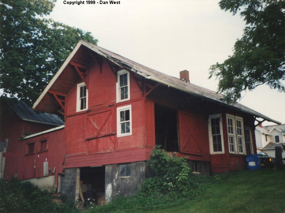
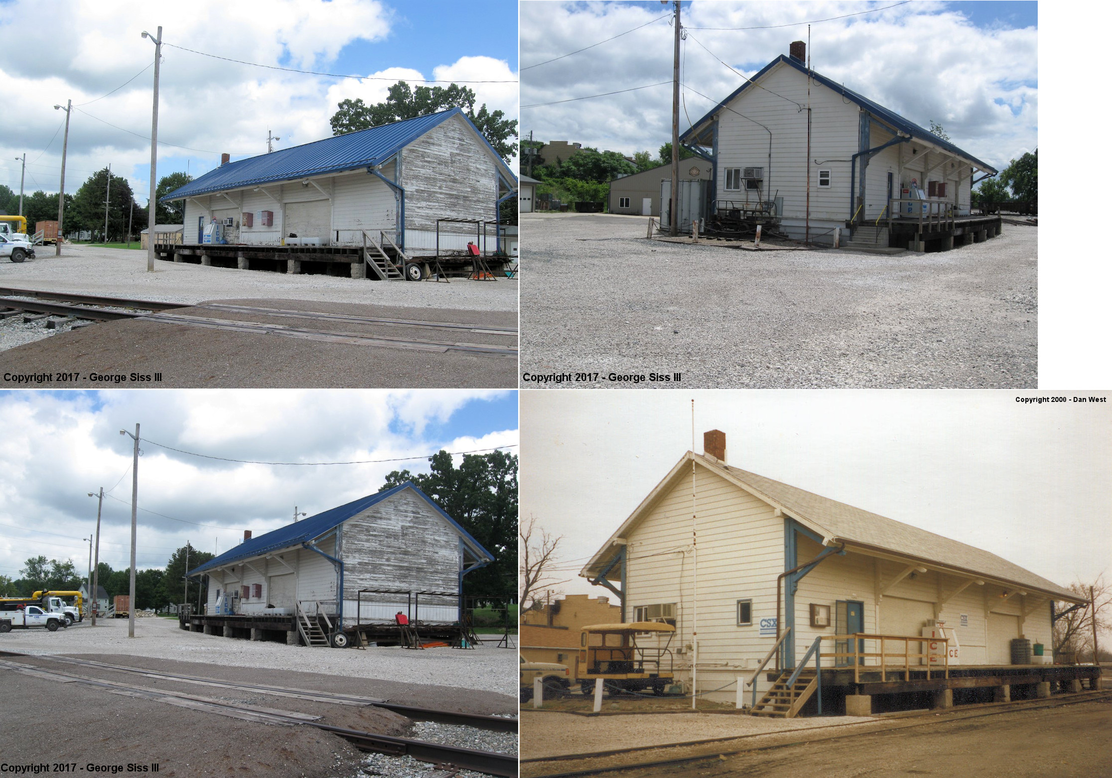
| Homerville (HOMER STA.) |
 |
9418 Zimmerman Road (GPS: 41.017413,-82.126831) |
C | Private | ???? | Gone | Wood |
|
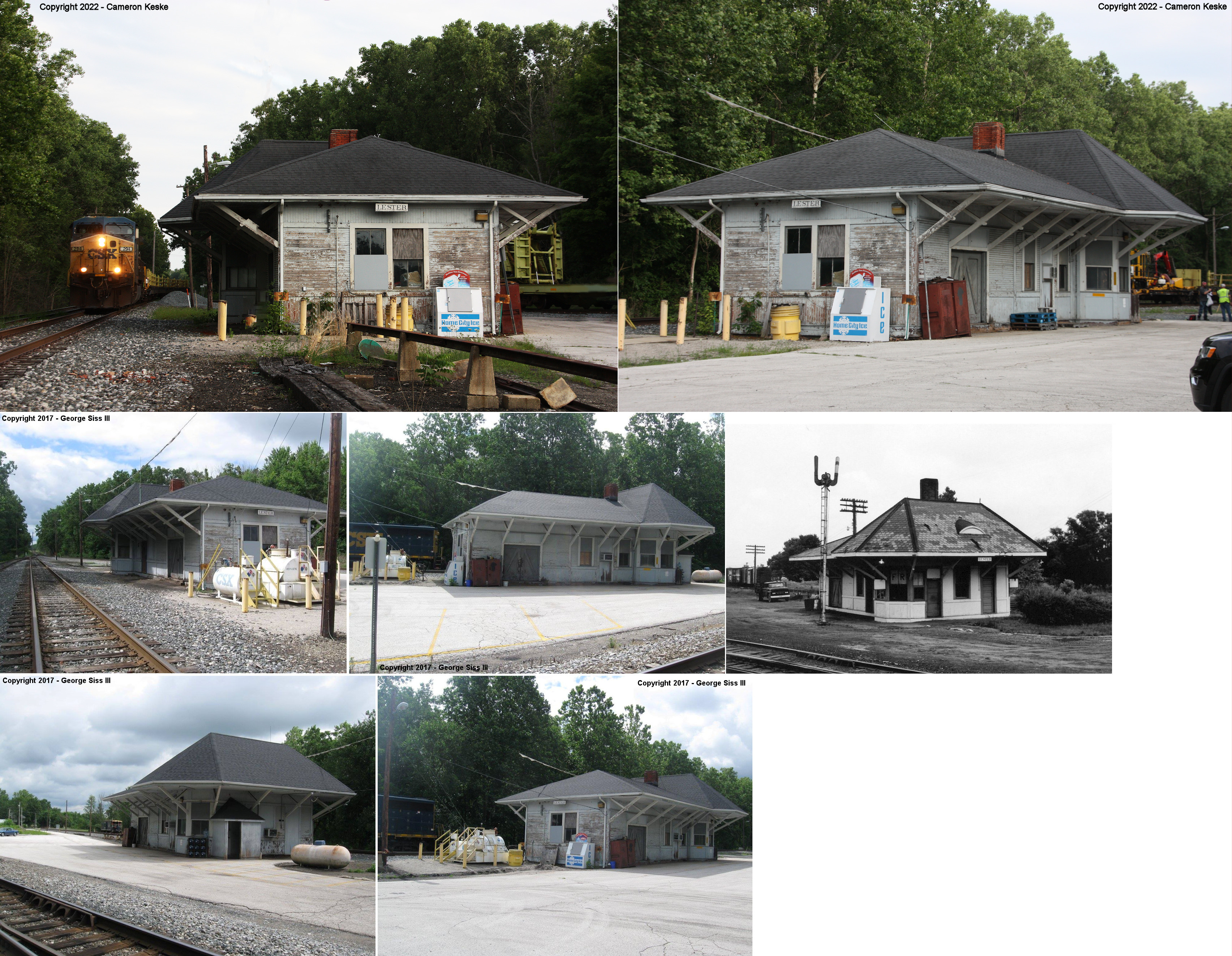
| Lester | |
7024 Speith Road (GPS: 41.179194, -81.942237) |
P | Railroad | ???? | In Use | Wood | |
| Lester |  |
West side of Lester Road between S.R. 18 and Speith
Road (GPS: 41.174281, -81.940389) |
C | Club | 2002 | In Use | Wood |
|
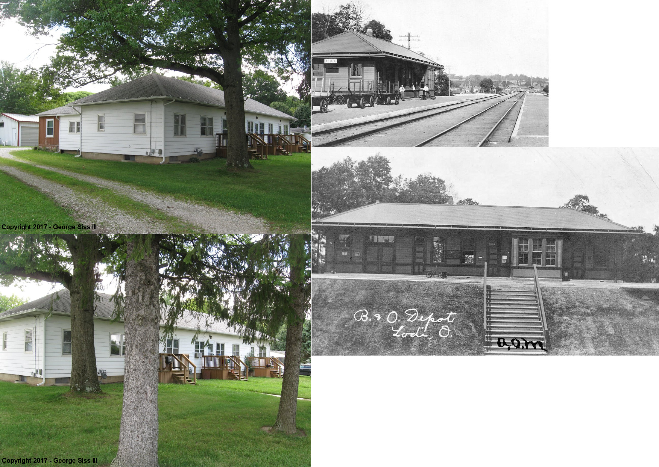
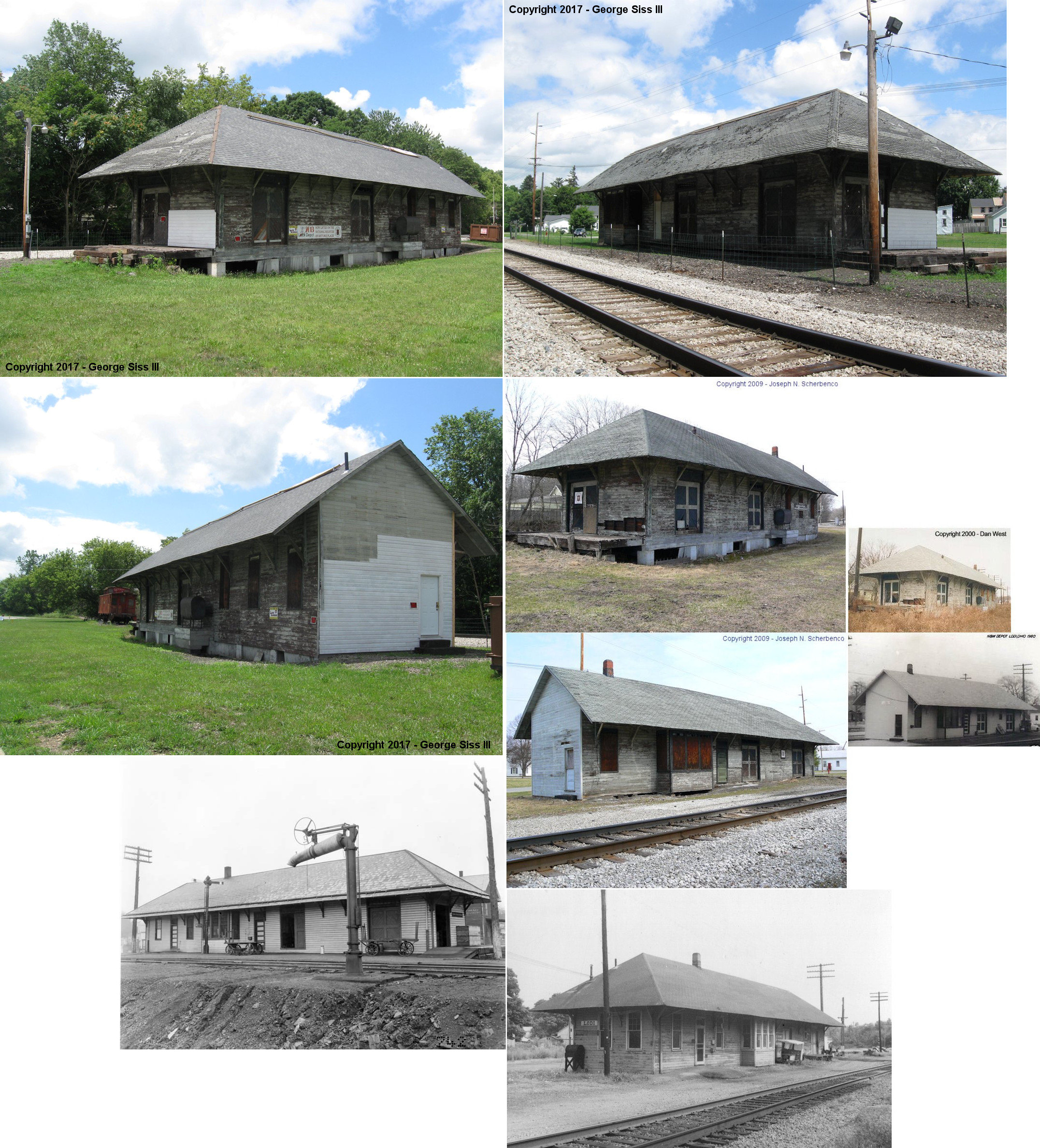
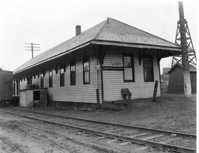
| Lodi | |
East side of Archer Street, just off of
Bank Street (GPS: 41.031491,-82.01964) |
P | Residence | 1907 | In Use | Wood |
|
| Lodi | |
170 South Prospect Street at Cemetery Street (GPS: 41.029569,-82.006242) |
F | Railroad | ???? | In Use | Wood | |
| Lodi |  |
204 Railroad Street at South Broadway (GPS: 41.030659,-82.012905) |
C | Museum | 1882 | In Use | Wood |
|
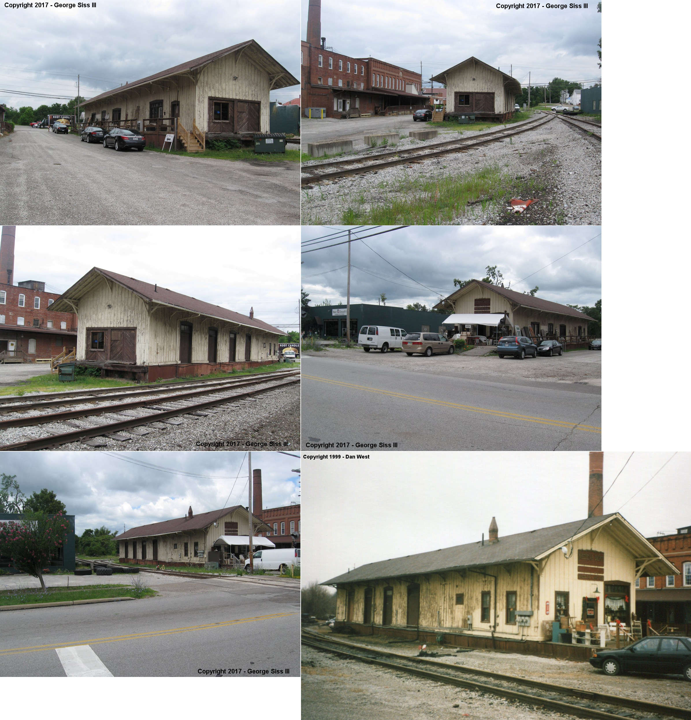
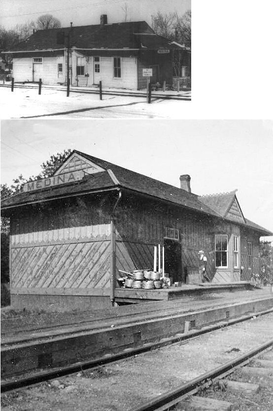
| Medina |  |
602 West Liberty Street (GPS: 41.138886, -81.873185) |
F | Business | 1894 | In Use | Wood |
|
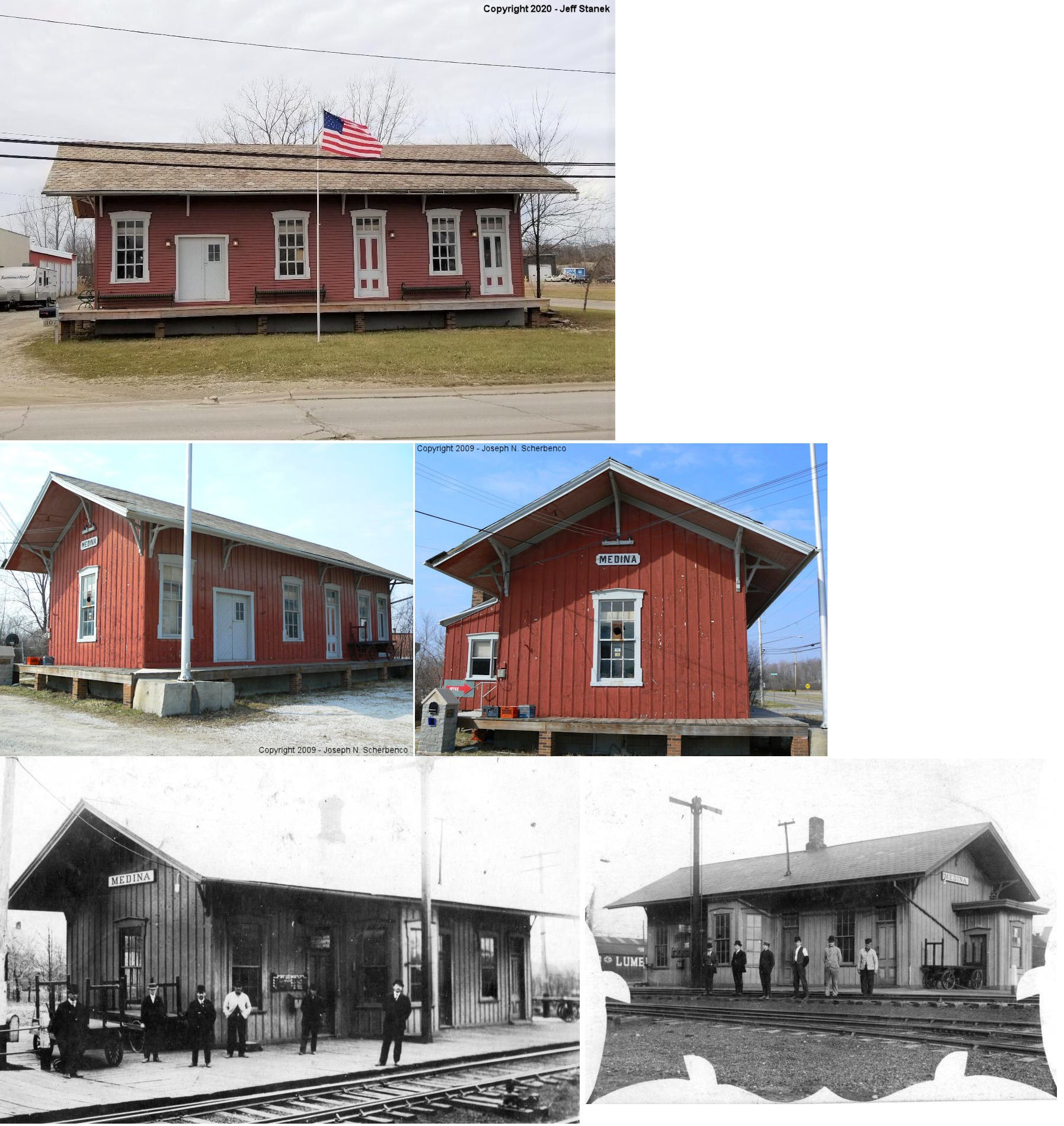
| Medina | |
307 North State Road (GPS: 41.144001, -81.878626) |
P | Business | 1900 | None | Wood |
|
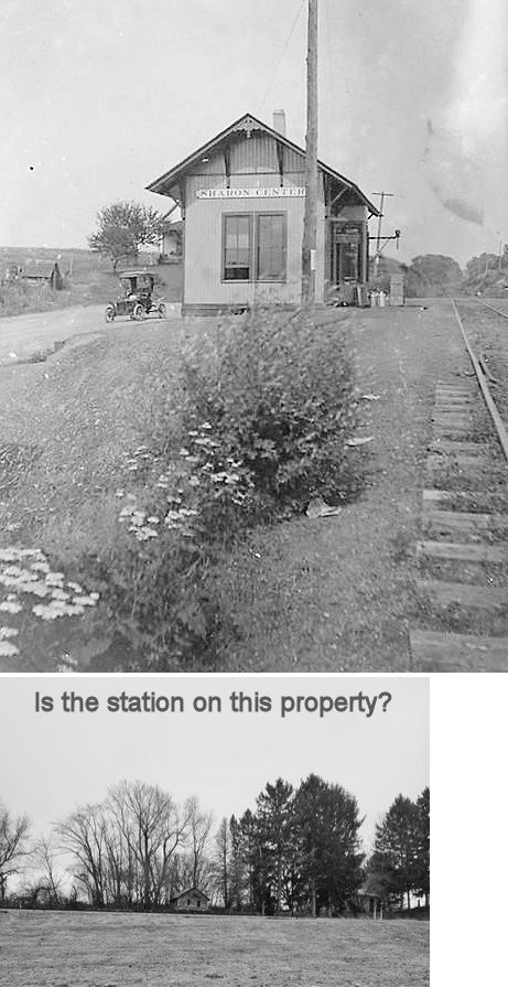
| Sharon Center |
 |
Relocated and used as a residence? Some have speculatated that the depot is in the vicintiy of GPS: 41.089285, -81.737833 past the end of Varney Drive. Need more confirmation and photos though. |
P | Residence | ???? | None | Wood |
|
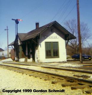
| Spencer |  |
West of SR-301, along tracks next to Spencer Forge (GPS: 41.103035, -82.124853) |
P | Railroad | ???? | In Use | Steel |
|
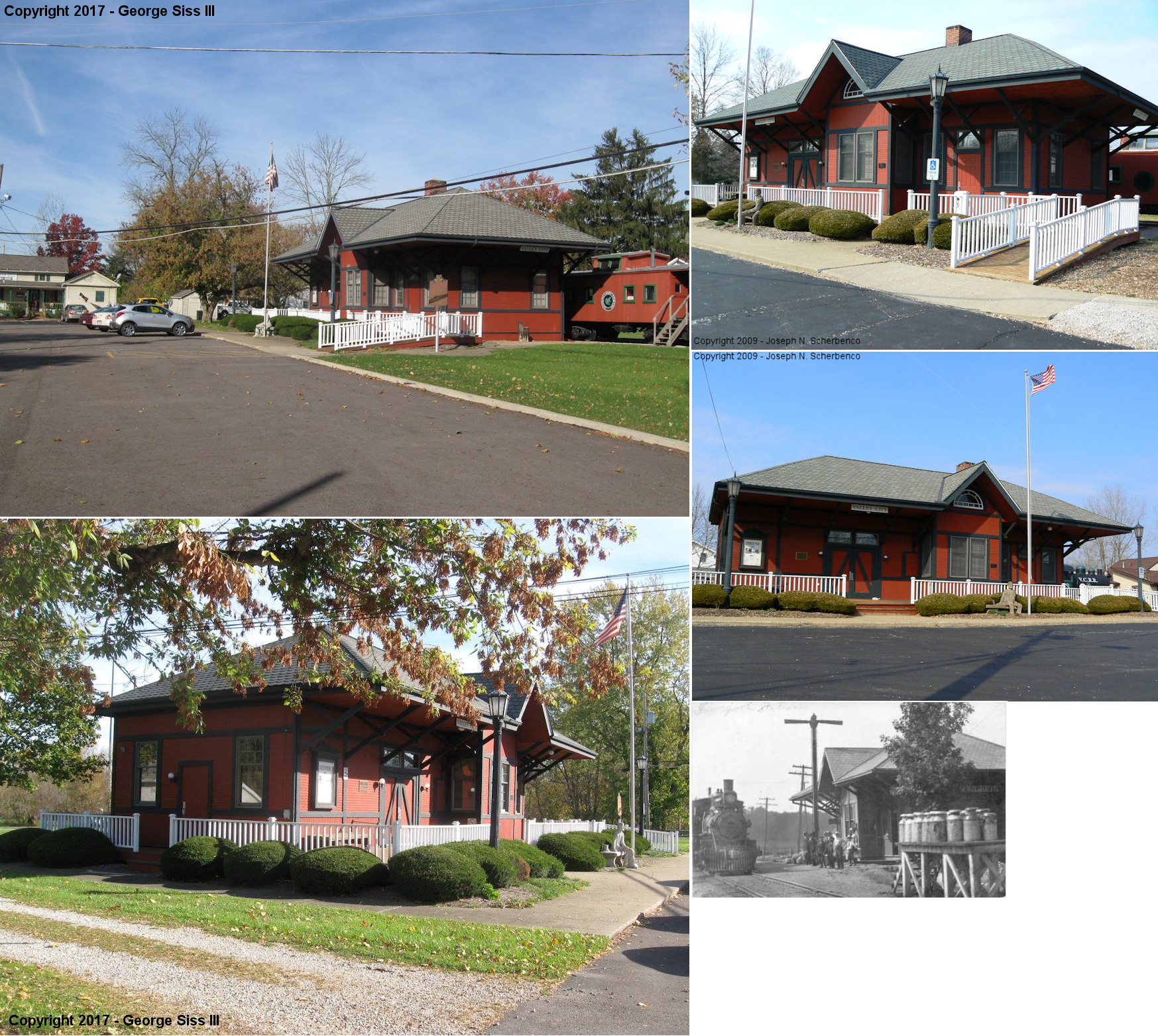
| Valley
City (Liverpool) |
|
6629 Center Road (SR-303) (GPS: 41.238053, -81.925650) |
C | Civic | 1895 | None | Wood |
|
| STATIONS OF THE PAST | ||||||||
| Station Name |
Original Railroad |
Notes | ||||||
| Boneta |
|
This combination store, post office and station was on the south side of Sharon-Copley Road. | ||||||
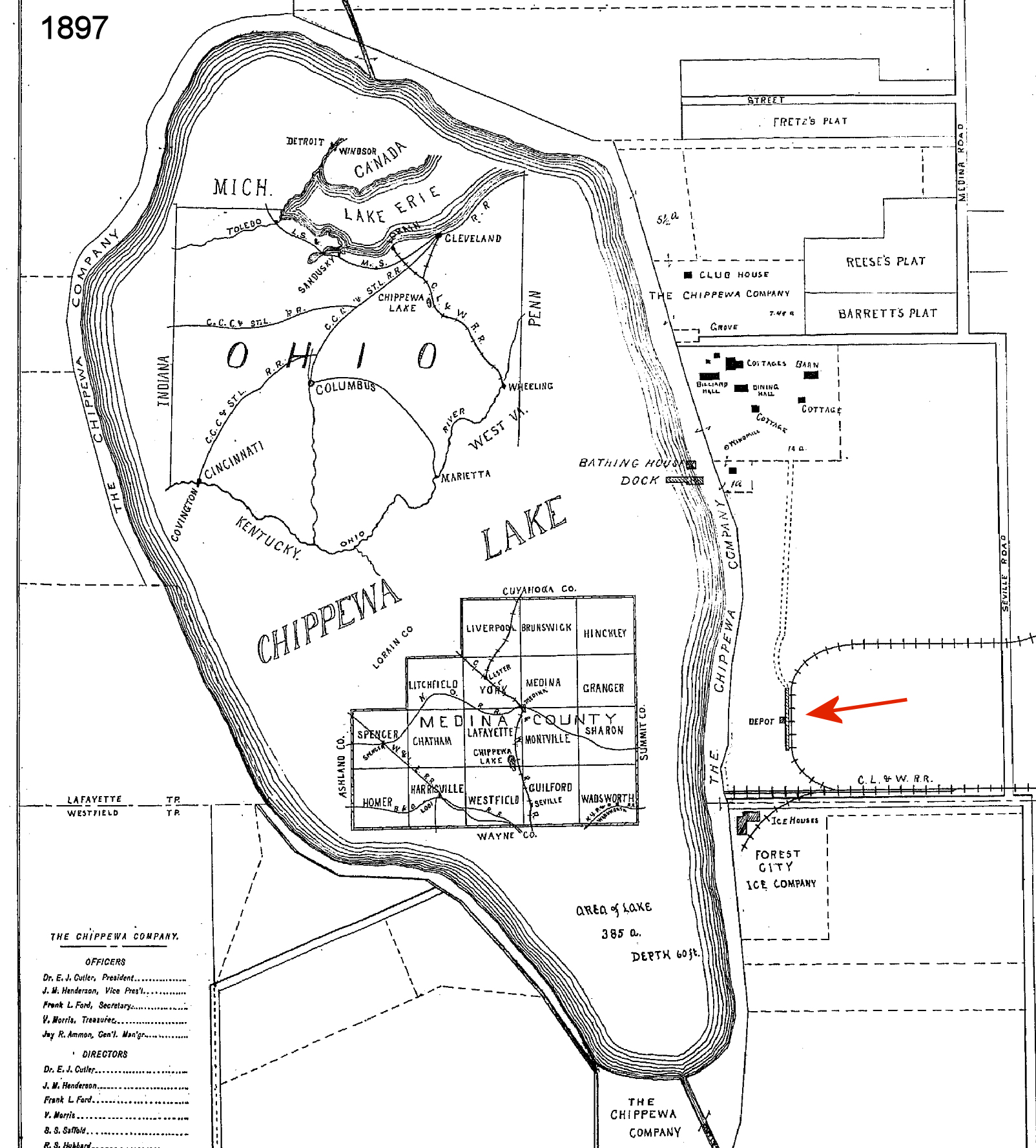
| Chippewa Lake |
|
Before there was a Cleveland & Southwestern trolley station here, the CL&W had a loop track off the mainline and the Chippewa Lake station was on the southeast side of the lake. This can be seen on the 1897 county map. This station was at approximately GPS: 41.064159, -81.901769 (near where the Chippewa Lake Ballroom would later be built). This station served the park in its early days, before it was built up with amusements. | ||||||
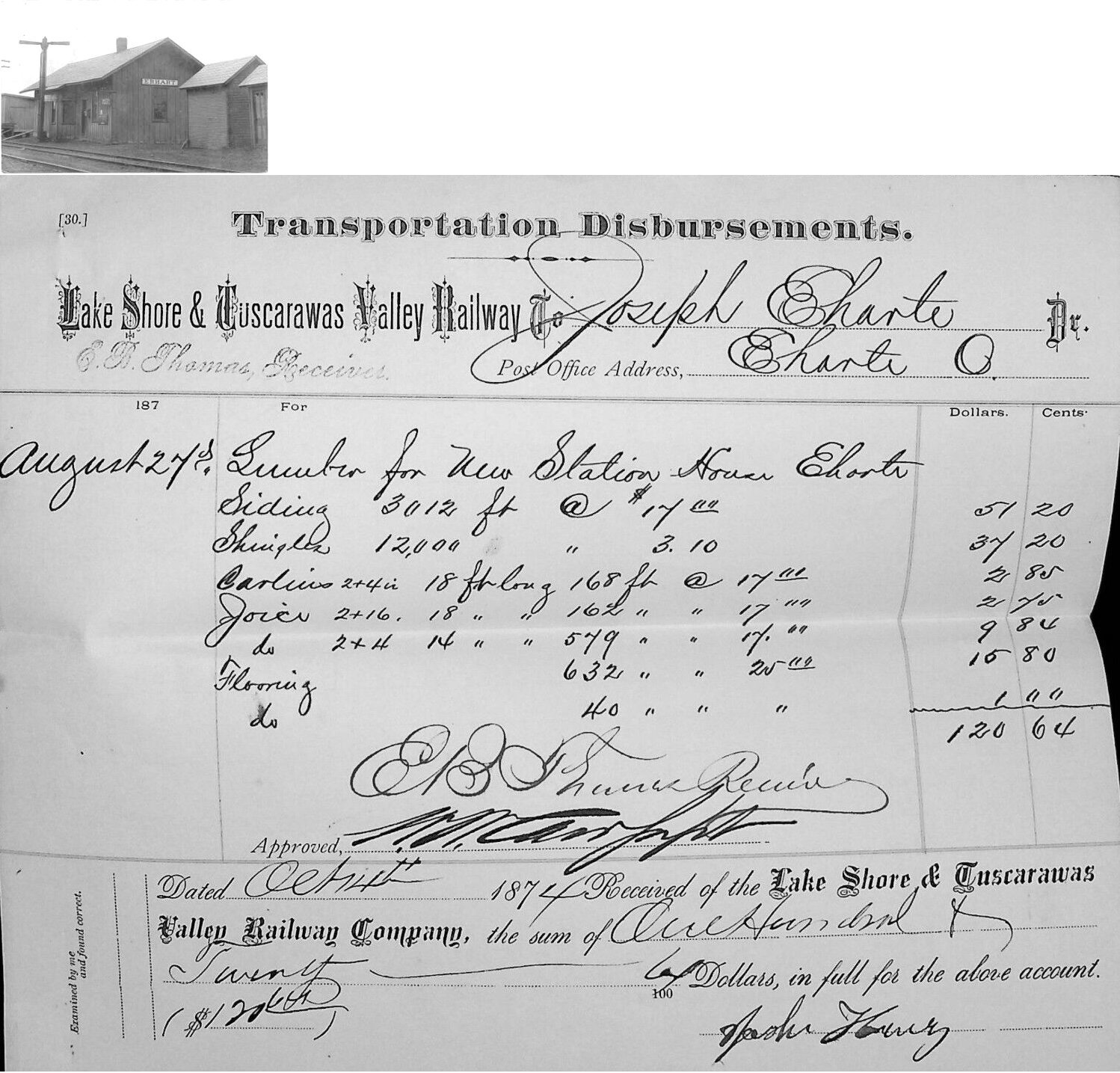
| Erhart | |
A new station was built here in 1874 by the Lake Shore & Tuscarawas Valley Railway. Not sure if this is the same station that's pictured, or if the one that's pictured is a later generation station. | ||||||
| Garden Isle Station | |
This depot was on Garden Isle Road (Township Road 73) about 1/2 mile north of Willow Road (County Highway 90). The depot was on the east side of the tracks. It served the large celery and onion farm there. | ||||||
| Homerville | |
This is the "newer" Homerville station that was built on the mainline when the mainline was rerouted to the north. | ||||||
| Lafayette Sta. (lake Station) |
|
The original CL&W station was on the north side of Chippewa Road (CR-50) on the west side of the tracks at GPS: 41.076938, -81.894260 (shown on the 1897 atlas). The B&O built a new station here in 1905. This location is not to be confused with Lafayette Center. | ||||||
| Litchfield |
|
|||||||
| LODI | |
The original station here was southeast of the Lodi Lumber Company on the old main line just to the west of where it crossed the W&LE (GPS: 41.027337,-82.01001). | ||||||
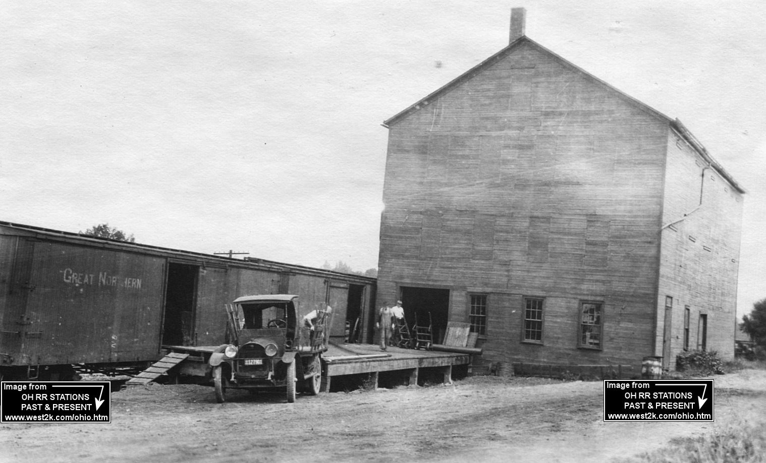
| Lodi |
|
Freight station. | ||||||
| Mallet Creek (York Center) |
|
This station was near SR-18 and Fenn Road. | ||||||
| Medina |
|
This station was off West Smith Road between South Elmwood and South Court Streets. It was just to the SE of the old Medina Electric Light & Power Company which was torn town itself prior to 1932. | ||||||
| Pawnee |
|
|||||||
| Risley |
|
This station was on West Smith Road (County Highway 4). | ||||||
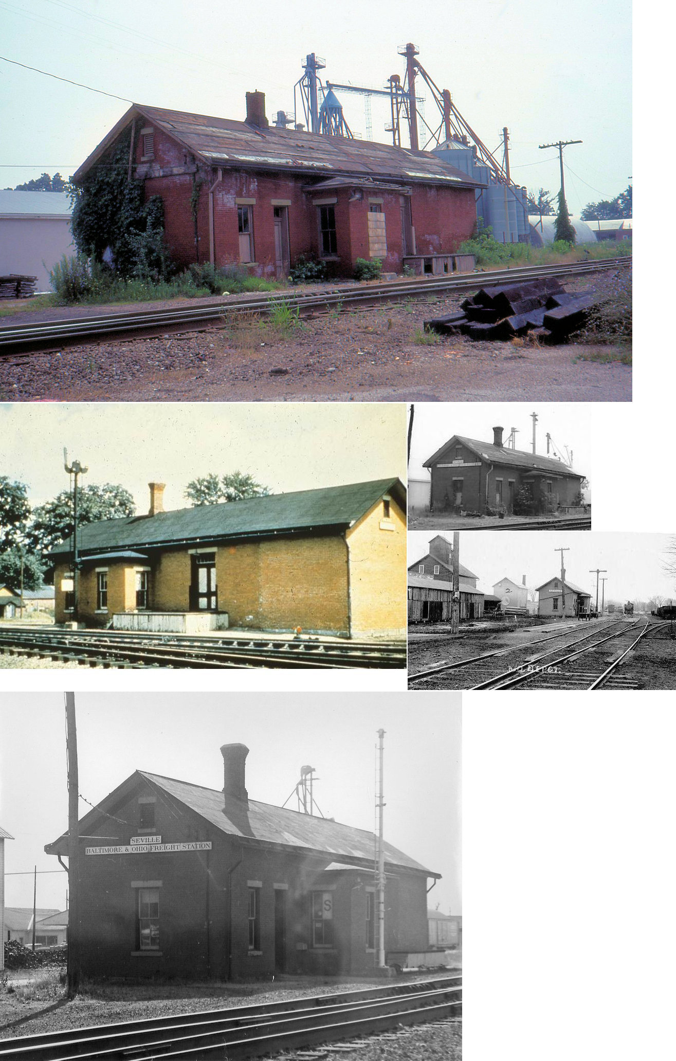
| Seville | |
This station was south of Market Street on the east side of the tracks (GPS: 41.008886,-81.86365). It was built in 1874. There was some effort to move the depot in 1983, but I believe it was eventually torn down soon after. | ||||||
| Silver Creek |
 |
|||||||
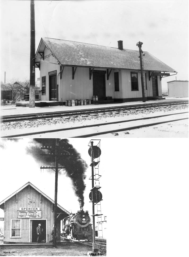
| Spencer | |
|||||||
| Spencer | |
|||||||
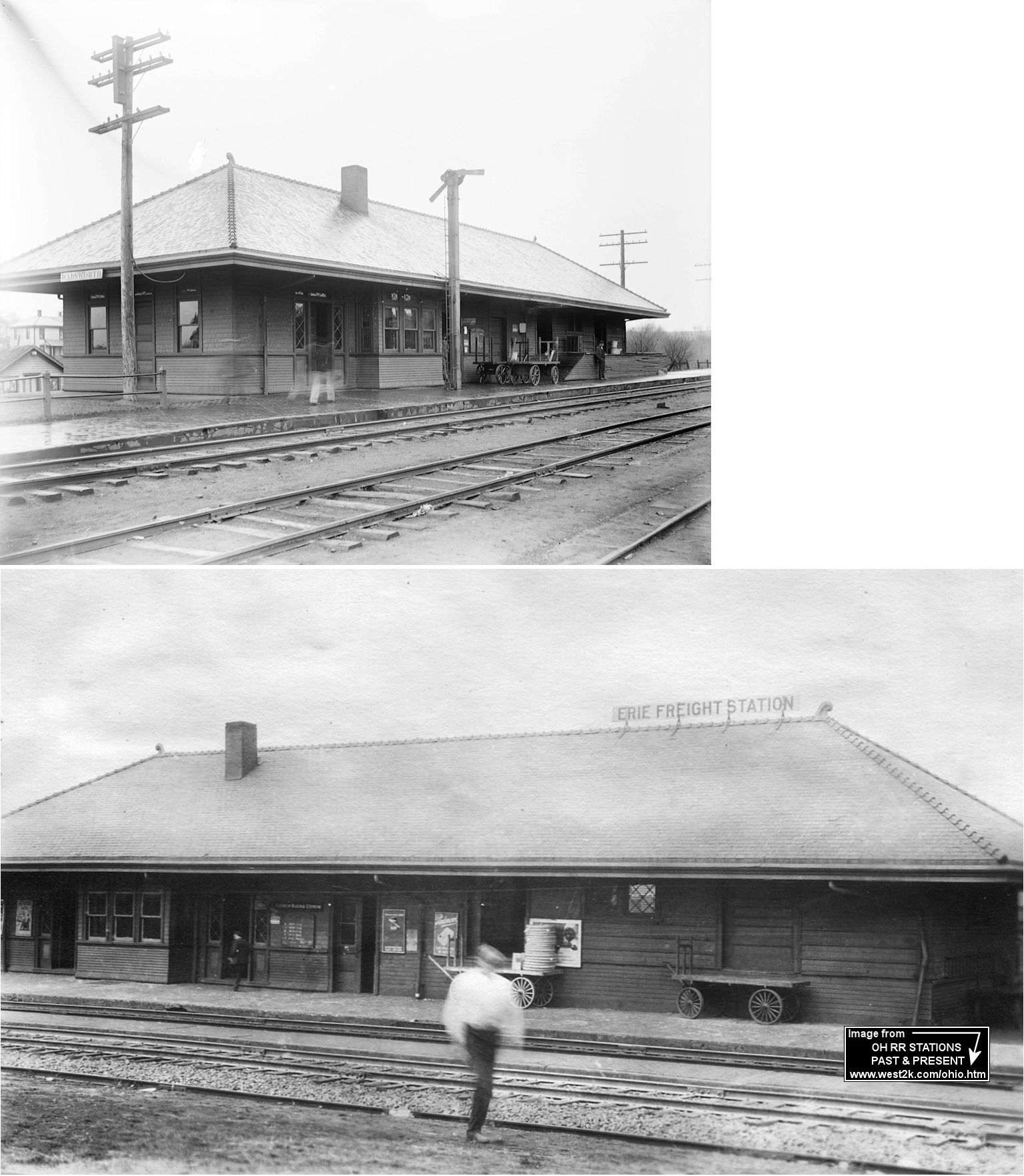
| Wadsworth |
|
An early station here burned down in 1893 (Marion Star, 3-14-1893). | ||||||
| Wadsworth |
|
This combination station was on the east side of Main Street, on the north side of the tracks. According to Erie RR valuation records, the station was built in 1897. It was torn down in the early 1980s. | ||||||
| Wadsworth |
|
There was a three-story freight station here that, according to Erie RR valuation records, was built in 1889. | ||||||
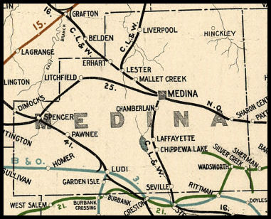
| 1898 MEDINA COUNTY RAILROAD MAP | ||||||||
 |
||||||||
| Notes About Existing
Stations... Homerville (B&O) - Near very old B&O right of way which was subsequently re-routed to the north (the tracks went, the station remained near its original location, but was moved a short distance south to a farm). Lester (Replica) - This is a replica depot built by the Northeastern Ohio Live Steamers, a 7.5" gauge railroad. Depot is full size. Lodi (B&O) - Moved around the corner from original location in the 40s or 50s to become rental housing. Lodi (W&LE) - Built in 1882, it was 48' by 18'-6". The depot was moved 13' closer to the main line, and had a freight section added in 1909, when the B&O rebuilt their main line closer to town. The addition of the freight section made the depot over 90' long. On January 31, 1977, a train/truck accident destroyed nearly 20' of the waiting room. The depot now belongs to the Lodi Railroad Museum, established in December, 2005, and is slated for a complete restoration as soon as grant money is secured. Medina (CL&W Freight) - According to old maps, there was a smaller freight station and earlier passenger station at this location as early as 1885. Medina (CL&W) - Moved in 1978 to the property of Medina Cut Stone from the tracks at West Liberty Street and Medina Street. It used to be across the tracks from the freight station. Spencer (AC&Y) - Used after original station was torn down. Sharon Center (Northern Ohio) - The original location of the station was on Varney Drive (Township Road 204) on the south side of the tracks (GPS: 41.08931,-81.737514). Valley City (CL&W) - Moved 1.5 miles west of original location. Formerly known as Liverpool. |
||||||||