 COUNTY COUNTY
|
|
||||||||
| EXISTING STATIONS | ||||||||
|---|---|---|---|---|---|---|---|---|
| Station Name |
Original Railroad |
Current Location |
Type | Current Use |
Date Built |
Track Status |
Building Material |
More Info |
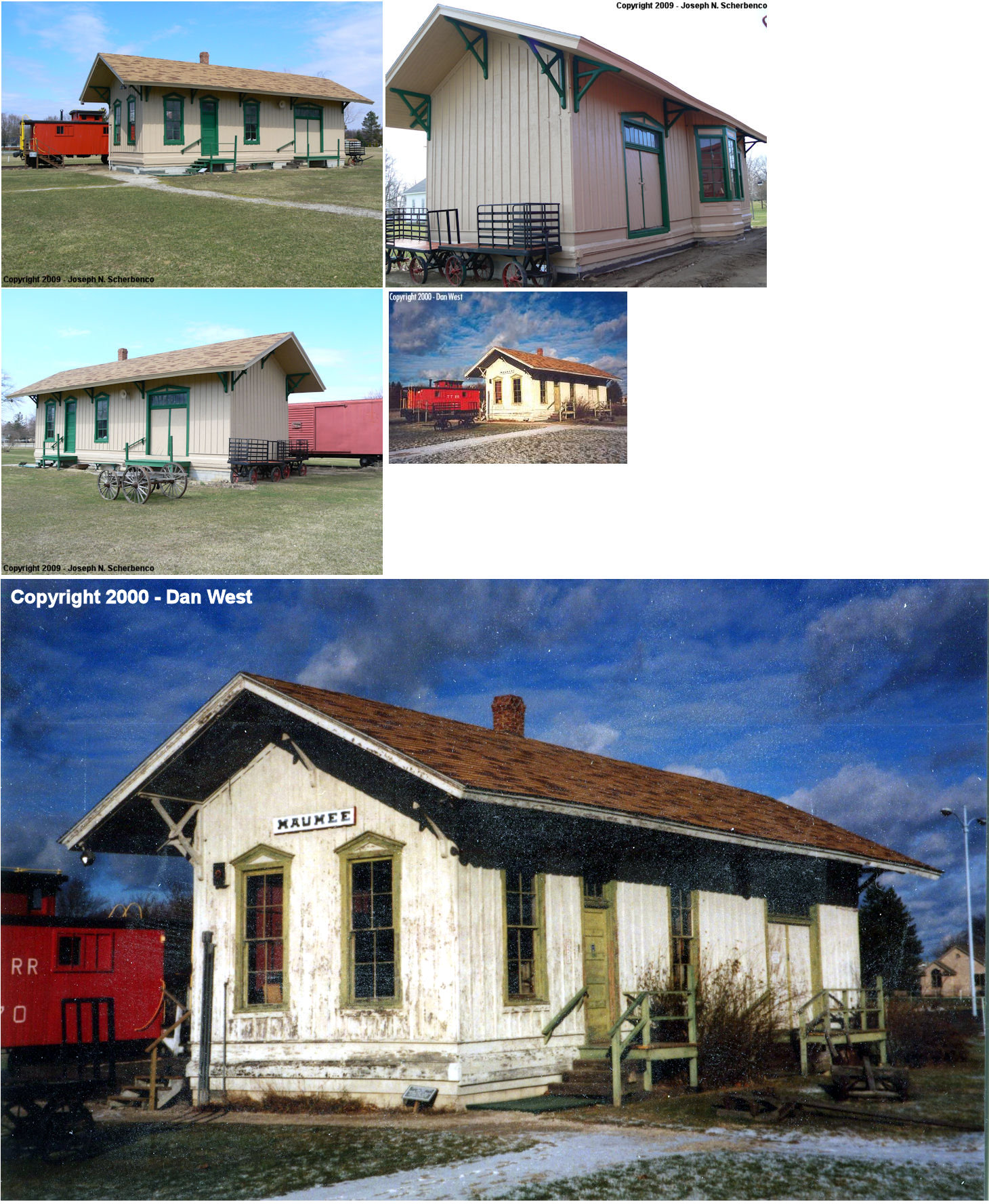
| Maumee |
 |
Wolcott Museum, 1031 River Road (GPS: 41.573296, -83.638475) |
C | Museum | 1880 | None | Wood |
|
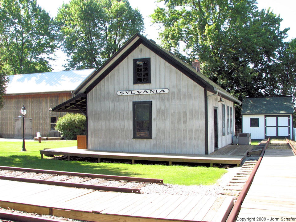
| Sylvania |
 |
5717 North Main Street (Holland-Sylvania Road) (GPS: 41.718134, -83.704742) |
C | Museum | 1869 | In Use | Wood |
|
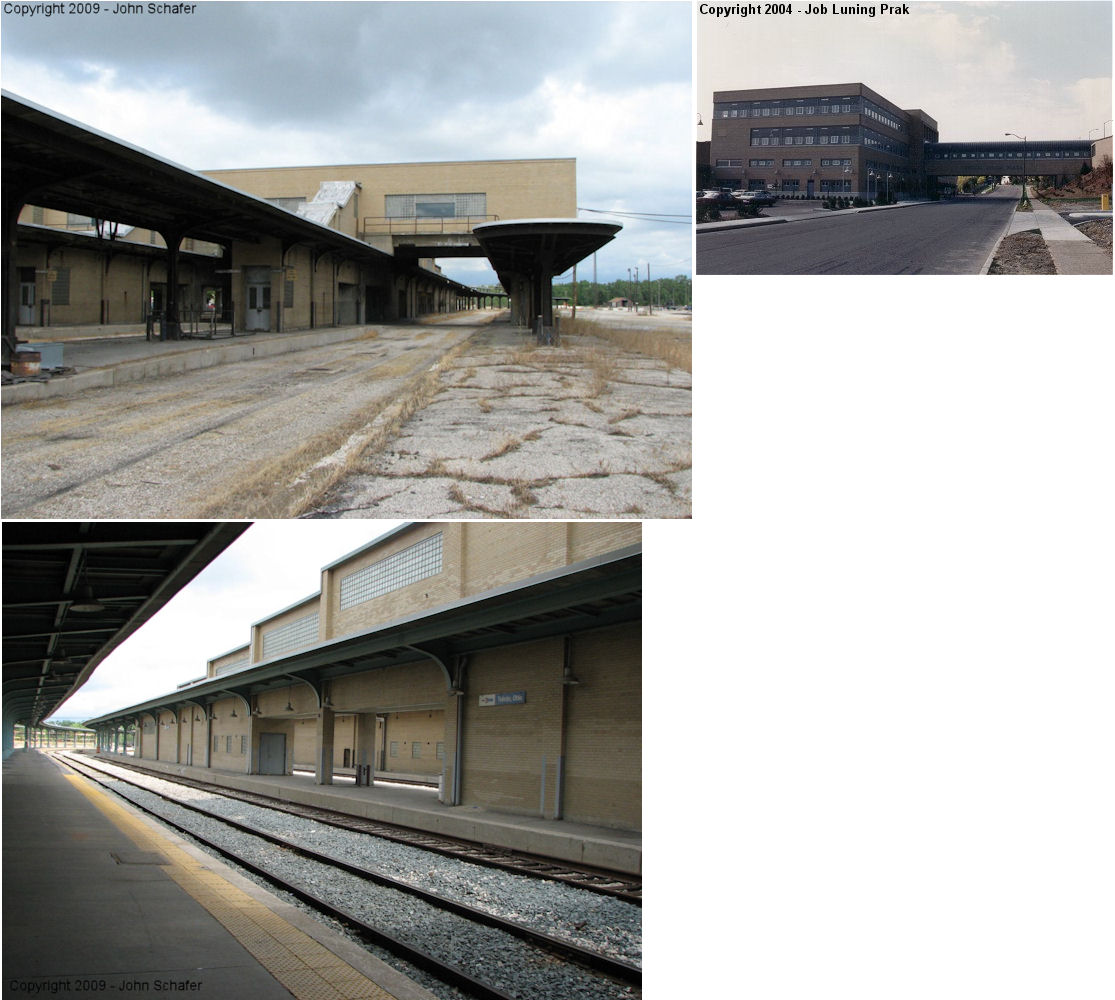
| Toledo |
 |
415 Emerald (GPS: 41.638282,-83.54167) |
P | Multiple | 1950 | In Use | Brick |
|
| Toledo |
 |
606 New York Avenue (GPS: 41.681592, -83.499245) |
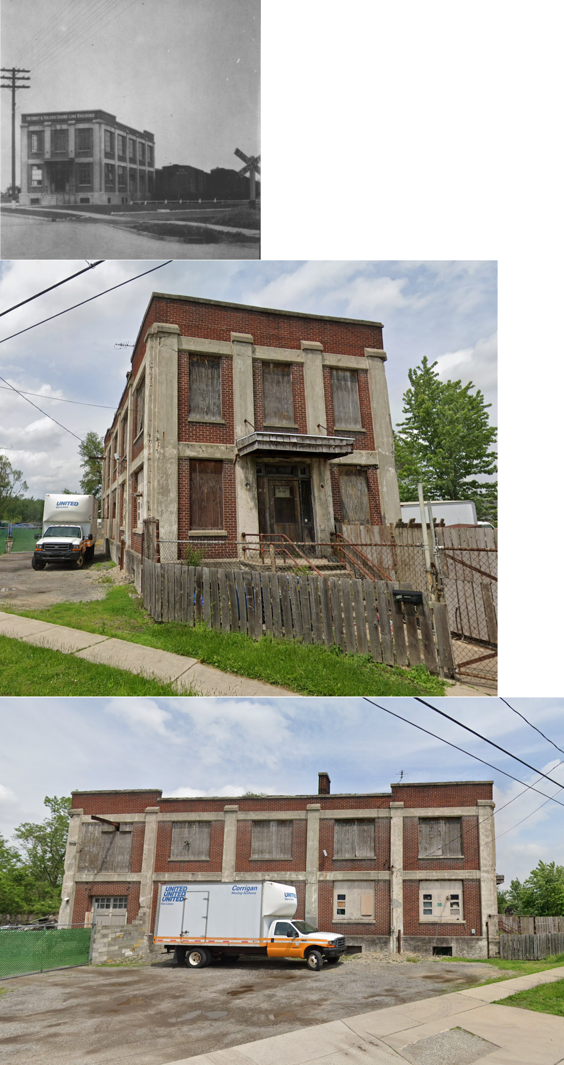
F | Storage | ???? | Gone | Brick | |
| Waterville |
|
West side of Sixth Street at Mechanic Street (GPS: 41.501065, -83.724228) |
C | Railroad | 1885 | In Use | Wood |
|
| STATIONS OF THE PAST | ||||||||
| Station Name |
Original Railroad |
Notes | ||||||
| Airline Junction |
|
This station was at Gibbons Street and Airline Avenue (GPS: 41.638395,-83.578513). | ||||||
| Airline Junction |
|
A freight station is listed at this location on the 1930 NYCRR valuation records with a build date of 1910. | ||||||
| Alexis |
|
Alexis station was near where the LS&MS and Canada Southern crossed in northern Washinton Township. | ||||||
| Alexis |
 |
|||||||
| Auburndale |
|
|||||||
| Bailey |
|
This station was on Railroad Avenue just north of Broadway Avenue. | ||||||
| Booth |
 |
There may have been a station here in the early days of the railroad. | ||||||
| Everett |
 |
This station was on the SW side of South Byrne Road. | ||||||
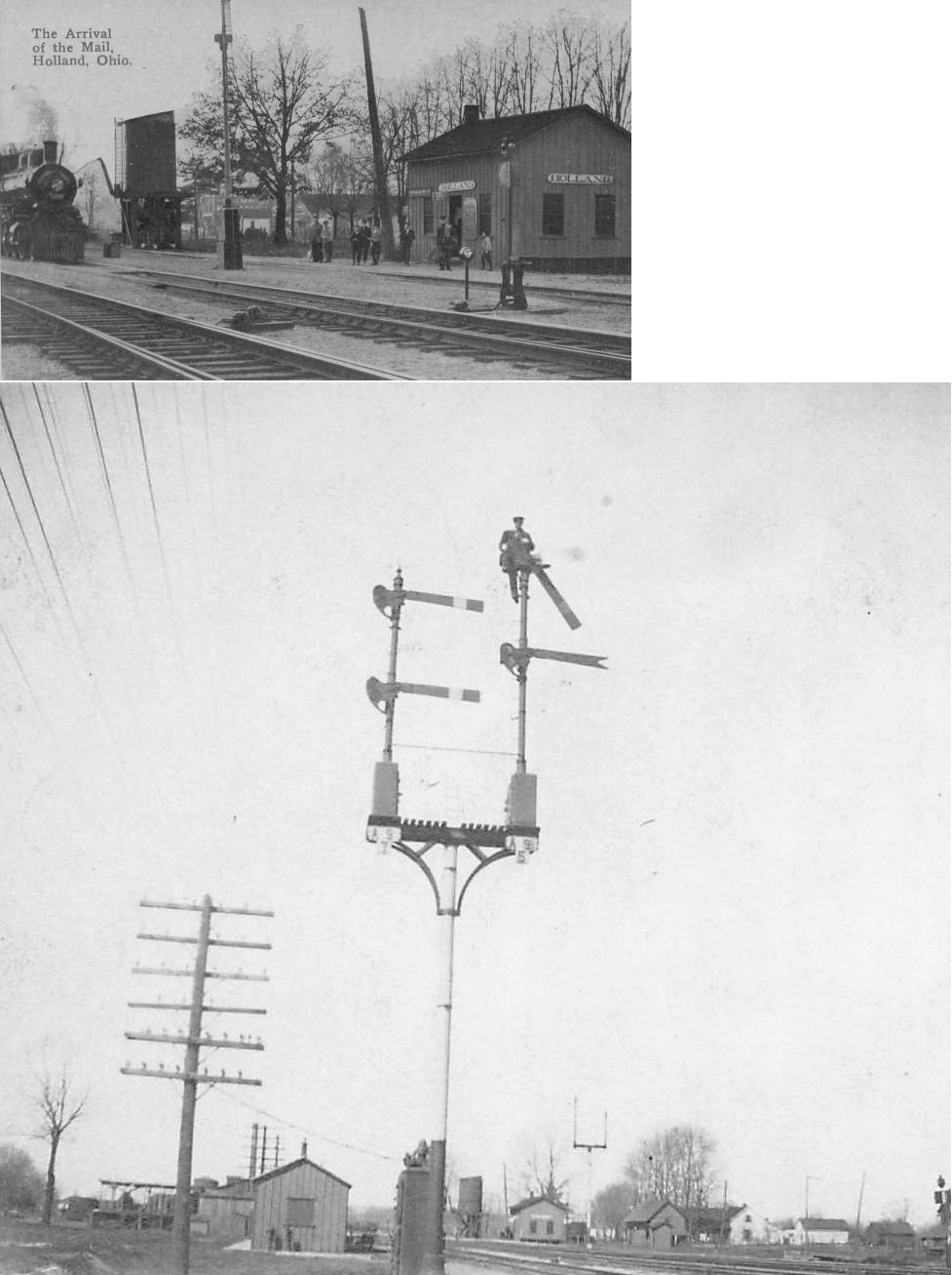
| Holland |
|
This station was on Front Street (at the south end of Erie Street) on the north side of the tracks (GPS: 41.617598,-83.711312). | ||||||
| Homestead |
|
See listing below for Oregon. | ||||||
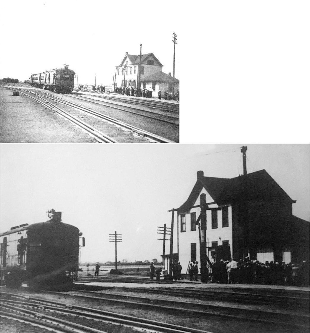
| Ironville |
|
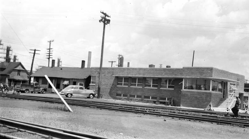
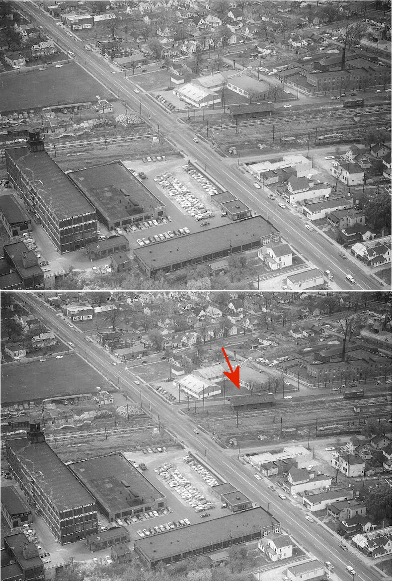
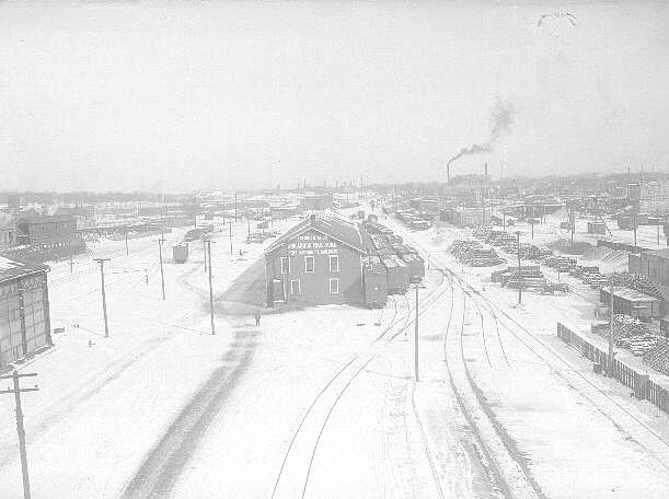
This station was near Front Street. In 1949 it was moved across the tracks and was joined to the Front Street Yard office. The photo shows the station joined to the yard office. | ||||||
| Manhattan Junction |
AND  |
|||||||
| Maumee |
|
This station was on the south side of Illinois Avenue (GPS: 41.567643,-83.662477). It was built in 1855 (The Toledo Blade, 4-4-1971). | ||||||
| MC Junction |
 AND  |
|||||||
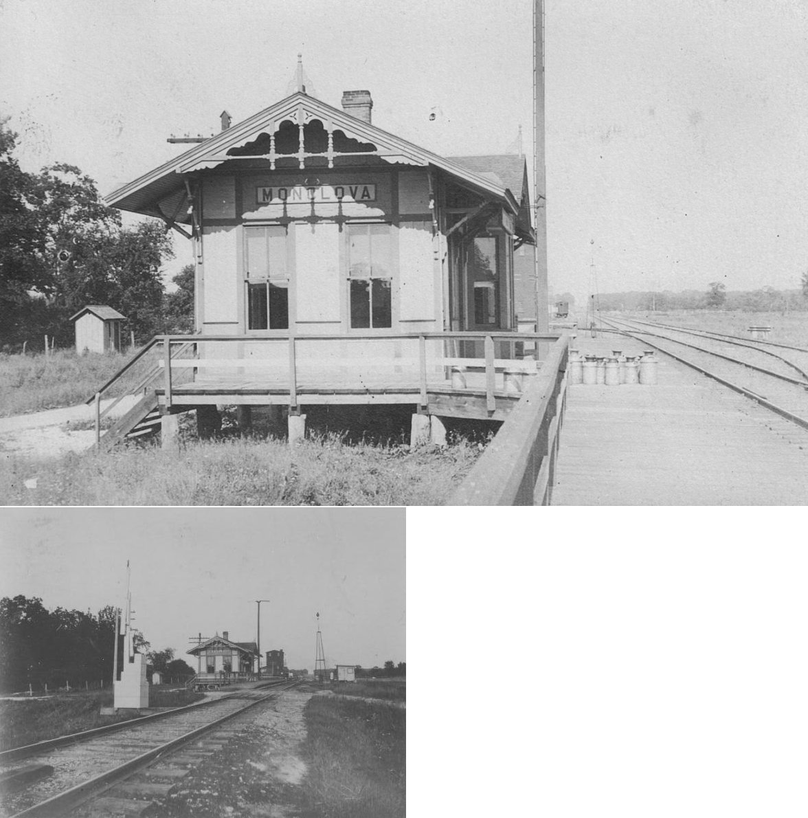
| Monclova |
|
This station was onthe east side of Waterville-Monclova Road (GPS: 41.543007,-83.732761). | ||||||
| Neapolis |
|
This station was on the west side of Main Street on the north side of the tracks. | ||||||
| Oregon (Homestead) |
|
|||||||
| Prentice |
 |
|||||||
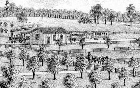
| Richards |
|
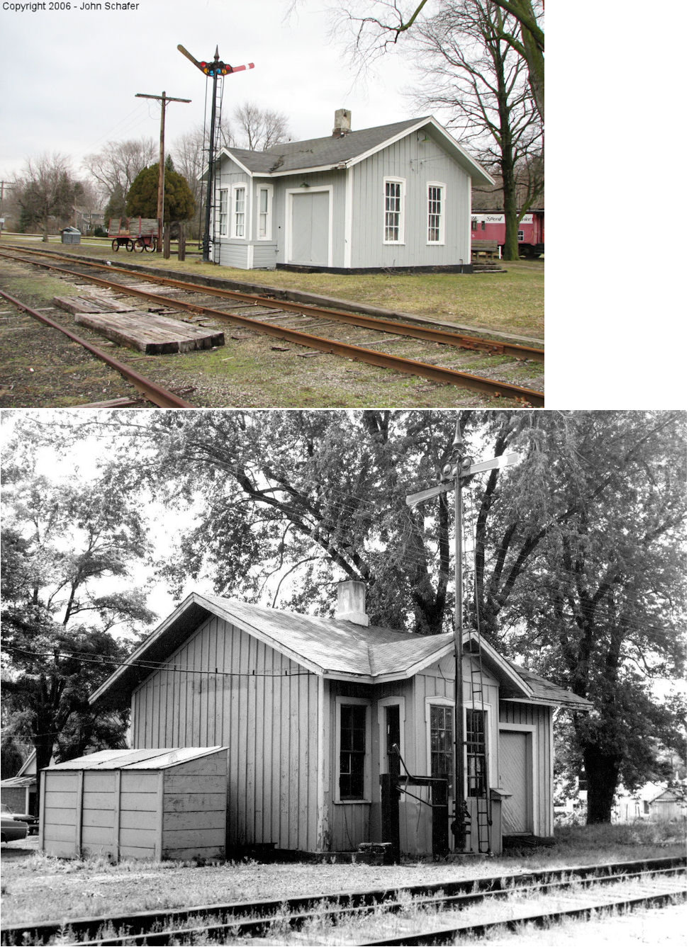
The illustration is of this early station in 1875. This station was on the west side of Richards Road on the north side of the tracks (GPS: 41.66089,-83.641362). | ||||||
| Rockwell |
|
|||||||
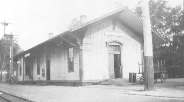
| Sylvania |
|
This was the second LS&MS station built in Sylvania, likely around 1872. | ||||||
| Sylvania |
|
There was a freight station on the west side of the tracks approximately 100 yards north of Convent Boulevard. According to NYCRR valuation records it was built in 1871. | ||||||
| Toledo |
|
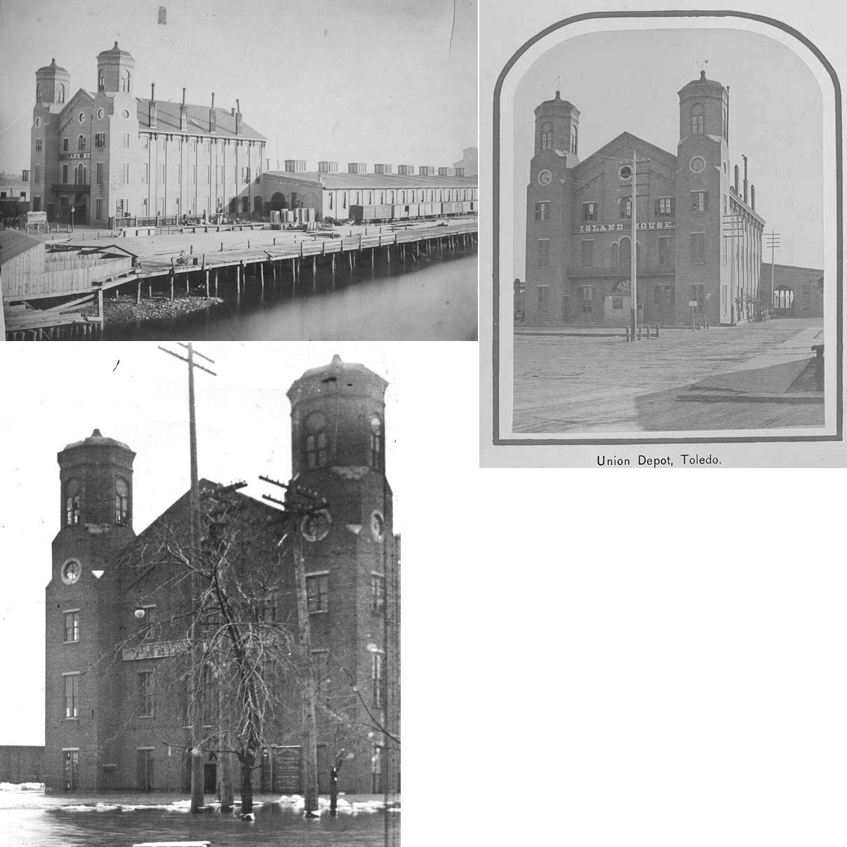
The first union station here was the Island House Hotel, a terminal-type station run by the LS&MS that was located east of the former intersection of Ottawa Street and Lafayette Street at GPS: 41.645413, -83.535334. It is shown on the 1875 map. After the new union station was built in 1886, it continued to serve as a freight house for the LS&MS. It was torn down and replaced with a new freight house sometime around 1904. This location is occupied by Owens Corning now. | ||||||
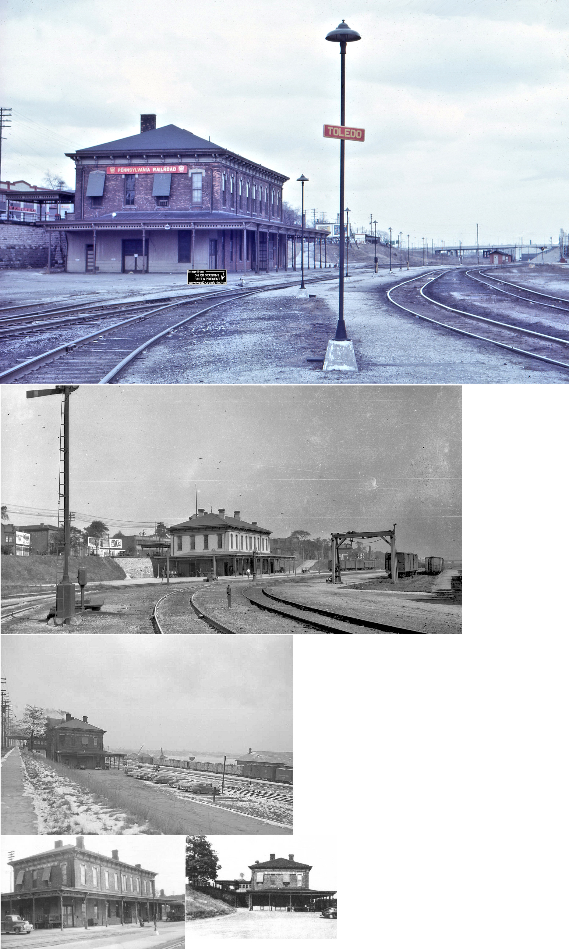
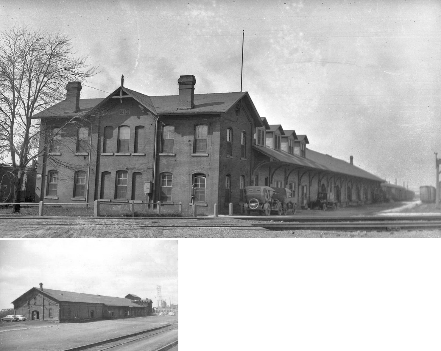
| Toledo |
|
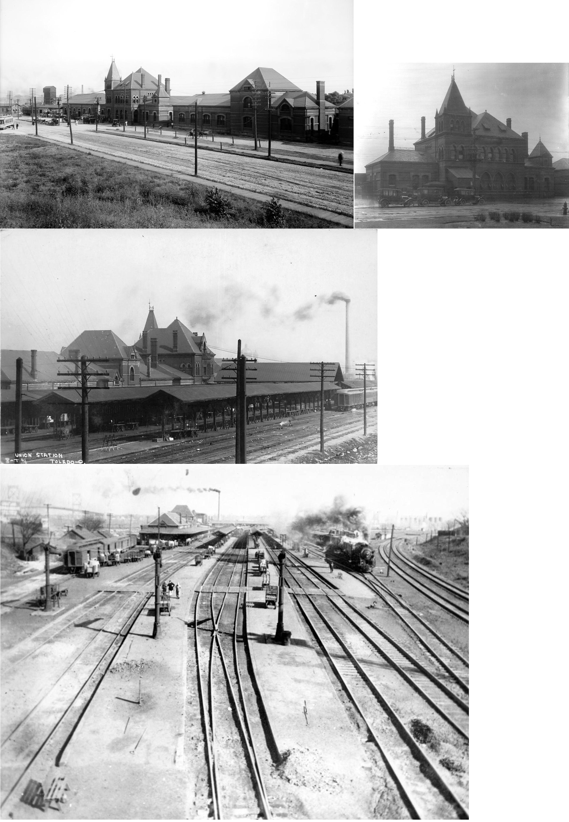
This was the second union station in Toledo. The station was built in 1886 (Stark County Democrat, 12-09-1886 & LS&MS Valuation Records) and opened on November 9 of that year. It sat on Emerald Avenue (formerly North Railroad Avenue) where the current Union Station is located (GPS: 41.638282,-83.54167). The station was significantly damaged by fire in 1930, but wasn't replaced for another 20 years and became an embarassment to the city in its poor condition near the end of its lifespan. According to the 1917 LS&MS Valuation Records, the station measured 125'x40'. | ||||||
| Toledo |
|
The outgoing LS&MS freight house was to the SE of the intersection of Ottawa and Broadway Streets (just across a bayou from the D&M freight house) (GPS: 41.643702,-83.536059). The LS&MS had a complex of freight houses in this area including the "Lake House" and "Island House." According to the 1917 LS&MS Valuation Records, a new inbound freight house was built in 1908, but no date is given for the outbound freight house. | ||||||
| Toledo |
|
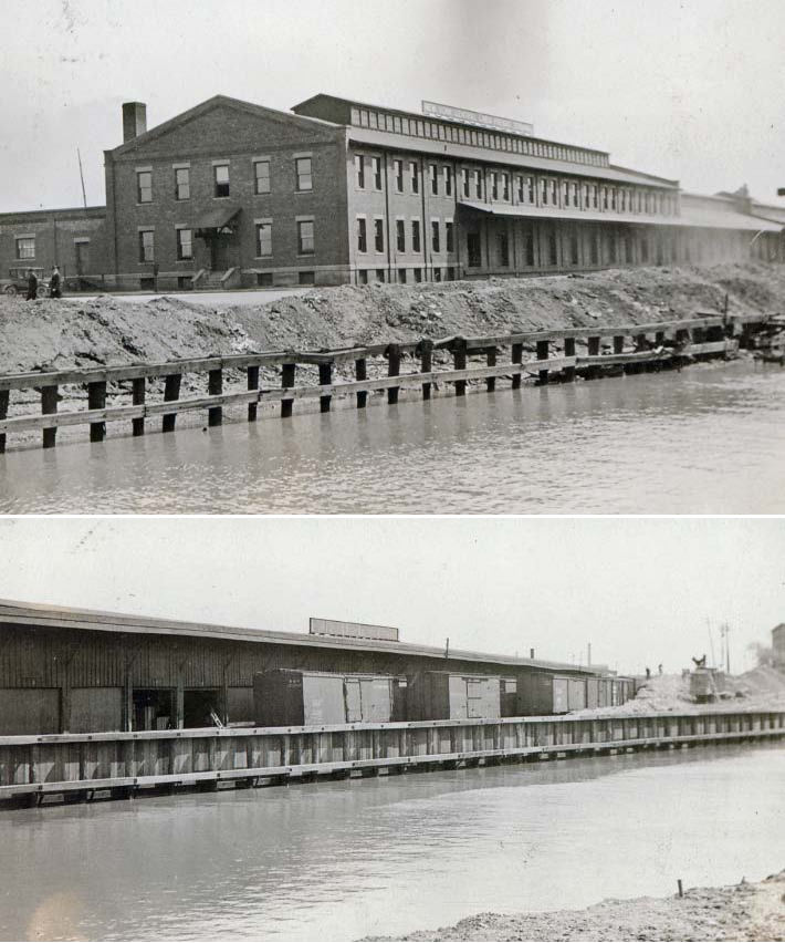
A new freight station was built near the site of the old "Island House" freight station (Toledo's first Union Station) around 1904. It was then referred to as the LS&MS (later NYC) Middle Ground Freight Station and was located at GPS: 41.645259, -83.535341. | ||||||
| Toledo |
|
There was an express passenger station on the north side of Phillips Avenue along Seiss Street (formerly Alexis Street, formerly Lake Shore Avenue) at GPS: 41.690597, -83.556721. This station is shown on the 1895 and 1921 Sanborn maps. On the 1950 map the building is still there, but used for storage. | ||||||
| Toledo (East Toledo) |
|
The 1888 map shows a 2-story depot on the SW side of the tracks on Fassett Street across the tracks from the LS&MS stock yard. | ||||||
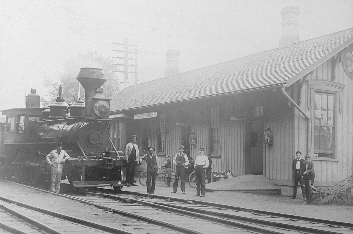
| Toledo (Wagon Works) (Auburndale) |
|
There was a combination passenger/freight station on the NE side of Monroe Street near Milburn Avenue (GPS: 41.667069,-83.574511). It was along Albion Avenue (which is no longer a through street there). This station served the Milburn Wagon Works Company (est. 1848). Later a seperate freight station was built to the NE along Albion Avenue at GPS: 41.668047, -83.573911 and the original combination station was thereafter dedicated only to passengers. On the 1875 map a station is shown here called "Auburndale Station." According to the 1917 LS&MS Valuation Records, the passenger station was built in 1875 and the freight station was built in 1891. | ||||||
| Toledo |
|
The original Canada Southern passenger and freight station was near the intersection of Amherst Drive and Anthony Wayne Trail in the vicinity of GPS: 41.619762, -83.582559 (this is a crude estimate from the 1875 map). | ||||||
| Toledo |
|
There was a station on the north side of Phillips Avenue along Canda Southern Avenue at GPS: 41.690476, -83.556034. The station is shown as an express station on the 1921 Sanborn map. On the 1950 map, it was closed as a station and being used as an office. It was gone by the mid-1950s. This station was essentially across the tracks from the LS&MS Phillips Avenue express station (listed above). | ||||||
| Toledo |
|
There was a freight house on the north side of Monroe Street at Bachelor Lane. This depot probably served the Milburn Wagon Works as it was at the SE side of that complex (GPS: 41.666482,-83.572309). | ||||||
| Toledo |
|
The Wabash freight stations were near the LS&MS freight houses east of Ottawa Street along the river. | ||||||
| Toledo |
AND |
There was a large Wabash/LS&MS freight transfer station east of Ottawa Street along the river. | ||||||
| Toledo |
 |
The passenger station was on Summit between Mulberry and Chestnut Streets (GPS: 41.658684,-83.52191). It was built in 1879, opened in early 1880, and was torn down in 1967. The CHV&T also used this station until 1896 when it moved its passenger trains to the LS&MS station. | ||||||
| Toledo |
|
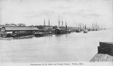
The PRR freight station was on the riverbank just south of the passenger station (GPS: 41.657832,-83.521661). | ||||||
| Toledo |
|
There was a freight station on the SE side of Water Street between Jefferson and Monroe Streets. The head end had frontage on Monroe Street (GPS: 41.648200, -83.535353). On early Sanborn maps, the building was labeled "Manufacturers Railroad Freight Depot." Later maps show it as a PRR freight station. | ||||||
| Toledo |
AND  |
There was a joint freight house near the corner of Olive and Chestnut Streets at GPS: 41.657604, -83.522328. The freight house was one story with a two story head end office on the SW side. This station is shown on the 1905 Sanborn map. | ||||||
| Toledo |
 |
There was a freight station on Ottawa Street at Lafayette (when there was a bridge connecting the streets there) (GPS: 41.645286,-83.537172). There was another freight station east of the intersection of Ottawa and Broadway Streets (GPS: 41.644027,-83.537177). | ||||||
| Toledo |
|
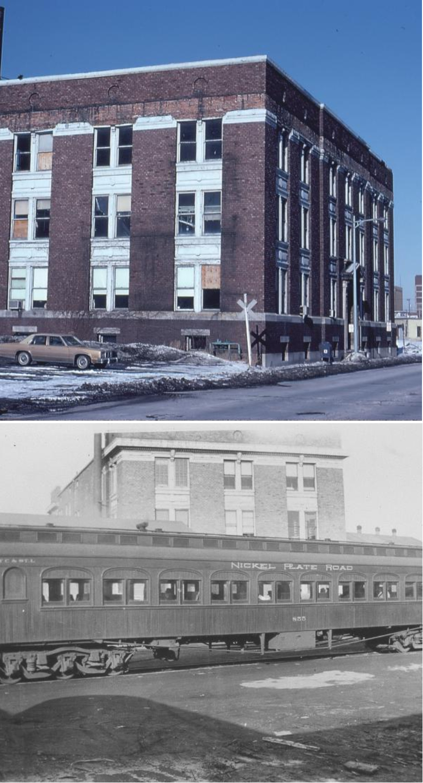
There was a passenger station and freight terminal on the NE side of Lafayette between Ontario and Erie Streets (41.648136,-83.542528). The station last saw a mixed passenger train on the Cloverleaf District in 1941. It had a large waiting room with pink marble wainscoting. The rest rooms had matching pink marble walls and stalls. The waiting room was used for freight sales and auditing personel after passenger service ended. The Cloverleaf used Union Station from about 1900 with a steep ramp to get track up from the Union Station to their track by canal. The ramp and stone wall are still there in overgrown condition. The Cloverleaf was a slow, rough route to St. Louis and value of connecting to other railroads was low, so they went back to their own station to save fees. Their big train was the 1901 Exhibition Flyer to St Louis, which lingered on as the Commercial Traveller in NKP years for decades before becoming a mixed train. It had a 12 section observation car in its best days, one of which was used as Pullman Porter dorm space into 1930's elsewhere. Station had a huge walk in safe behind the old ticket counter full of cancelled NKP predicessor stock certificates. Toledo was the headquarters of Cloverleaf, so they built this fairly eleaborate station in hope of building up business. --Note by William Frisk | ||||||
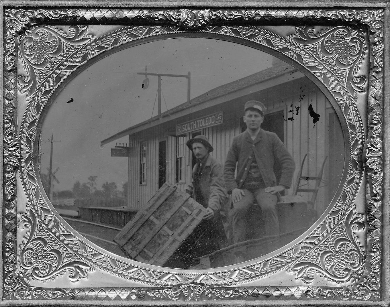
| Toledo (S. Toledo) |
|
Sign board says 9 miles to Toledo and 427 to St. Louis. | Toledo |
|
The NKP's Cloverleaf District freight house was on the NW side of South Erie Street at Kraus Street at GPS: 41.644312, -83.545341. There was a freight office as well as in-bound and out-bound freight houses. There were five tracks between the two freight houses. This freight complex is not on the 1904 map, but does appear on the 1936 map so it was built sometime within that time frame. | |||
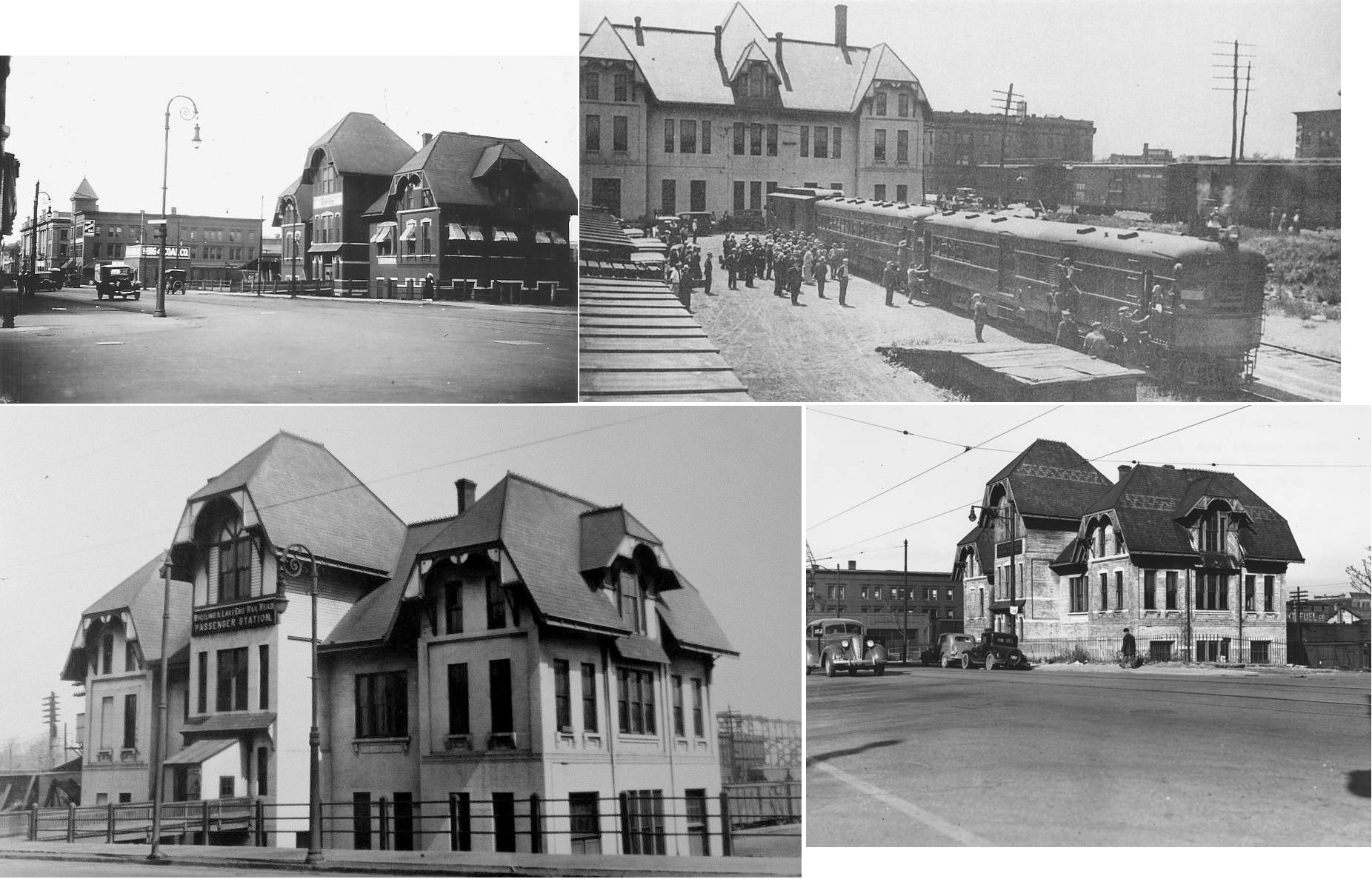
| Toledo |
|
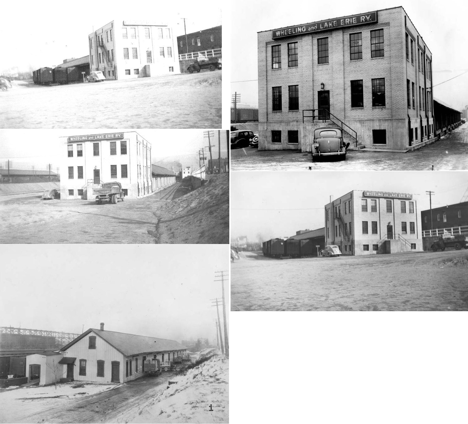
The W&LE passenger terminal was on the north side of the intersection of North Cherry and The Greenbelt Parkway (SR-25) (GPS: 41.661034,-83.534696). The address was 1008 Cherry Street. After it closed it was used as a freight office and was torn down in 1941. | ||||||
| Toledo |
|
The freight station was to the SE of the passenger station along what a section what used to be Champlain Street, but is now the Greenbelt Parkway (GPS: 41.660980, -83.533853). After it went out of service the building became a household appliance warehouse. | ||||||
| Toledo |
|
The passenger station was on the eastern corner of Seneca and Cherry Streets (just to the NW of where the old W&LE station was) (GPS: 41.661659,-83.535511). The station was demolished in 1964. | ||||||
| Toledo |
|
The freight station was on Seneca Street just to the NE of Walnut Street (which no longer intersects Seneca) and to the NE of the passenger station. It was at GPS: 41.662170, -83.534231. The station was also used by the Wabash and Pere Marquette (per the 1905 Sanborn map). | ||||||
| Toledo |
TOLEDO RAILWAY & TERMINAL |
This combination passenger and freight of the Toldeo Railway & Terminal Company station was on the NE side of Cherry Street between Seneca and Oneida Streets at GPS: 41.661034,-83.534696. The station opened in 1902, but only had passenger service for about five years. Plans for the CH&D and the PM to share the station fell through and the station closed as a railroad facility in 1913, although the TR&T kept some offices there. Part of the building bruned in 1927 and the remaining (front) section of the building was torn down in 1971. | ||||||
| Toledo |
 |
The CH&D had a two freight houses near Ottawa and Broadway. | ||||||
| Toledo (East Toledo) |
|
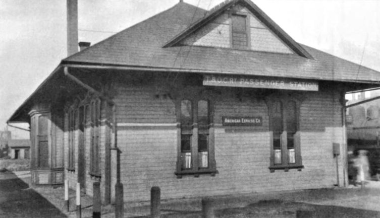
This was the northern terminus of the T&OC. The passenger and freight stations were on the SW side of Main Street (formerly Bridge Street) to the NW of Front Street (GPS: 41.649868,-83.525308). These were stub-end terminal type stations as the tracks ended here. See listing below for freight station. | ||||||
| Toledo (East Toledo) |
|
This freight station was located at approximately GPS: 41.650743, -83.526618. | ||||||
| Toledo (Yondota St.) (Fassett St.) |
AND |
A station is listed at Yondota Street on the Toledo, Columbus & Cincinnati RR (Later T&OC) timetable from 1889. This was the first station south of the main Toledo terminal. Later this station was known as the Fassett Street station on the T&OC. The 1905 Sanborn map shows the station on the south side of Fassett Street between the T&OC and PRR tracks GPS: 41.628746, -83.528039. The station was gone by 1944 as it is not shown on the Sanborn map from that year. | ||||||
| Toledo |
 |
|||||||
| Waterville |
|
This station was on Mechanic Street. | ||||||
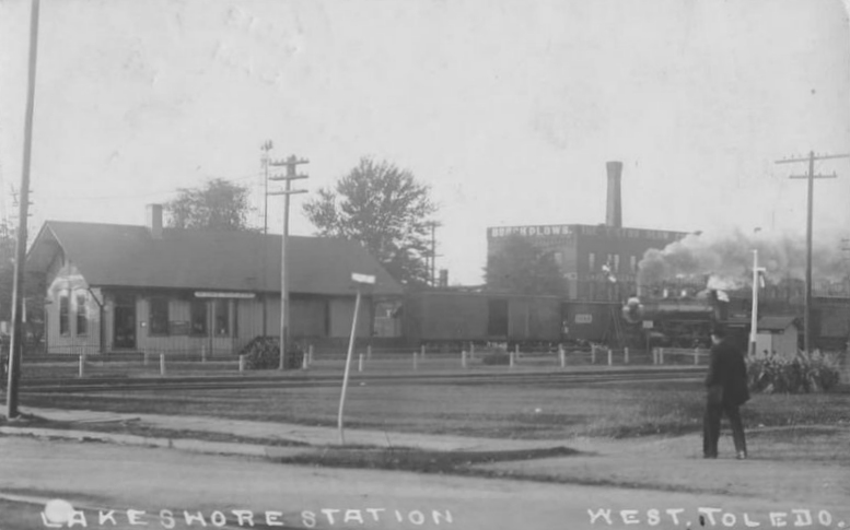
| West Toledo |
|
|||||||
| West Toledo |
|
There was a passenger station on the south side of Dorr Street on the west side of the tracks at GPS: 41.652445, -83.585621. This station is shown on the 1905 Sanborn map. On later maps the building is being used as an office and storage for the nearby lumber company. LS&MS Valuation Records from 1917 list two stations for West Toledo - one that was built in 1891 and one that has no build date listed. | ||||||
| Whitehouse |
|
This replaced an earlier station that burned. It may still exist. Rumor is that the station was dismantled and stored for future reassembly. Does anyone know for sure?? | ||||||
|
Yost Station (TOLEDO) |
|
This station was on the south side of Dorr Street on the NW side of the tracks (GPS: 41.652481,-83.585647). | ||||||
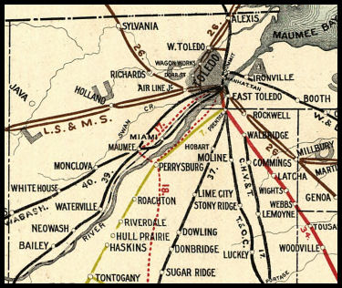
| 1898 LUCAS COUNTY RAILROAD MAP | ||||||||
 |
||||||||
| Notes About Existing
Stations... Maumee (TSt.L&W) - Station moved from downtown Maumee. Its original location was on the north side of Sophia Street between Conant and Allen Streets (GPS: 41.565460, -83.656529). Sylvania (LS&MS) - Moved one mile north of original location. The original location was on the east side of Railroad Street just north of Hawley Street on the NE side of the tracks at GPS: 41.707692, -83.700795 (behind what is now the Southbriar Shopping Center). There was a siding across the main line that ran about a mile to the south of the station. Toledo (Union) - At the time it was built by the New York Central in 1950, it served 110 passenger trains per day. A few years ago, Conrail sold the station to the Lucas County Port Authority for $20,000. The station was renovated using a combination of local, state, and federal money. It was re-dedicated in September, 1996 and the name was changed to Central Union Plaza. The original lobby has been preserved, but the Amtrak station has been re-located downstairs at track level. The remainder of the building is office space, most of which is occupied by the Toledo Metropolitan Area Council of Governments (TMACOG) and Lucas County Educational Services. The remainder of the space is vacant. Amtrak also operates an express facility at the location. Note submitted by Ed D'Amato Waterville (TSt.L&W) - The Toledo, Lake Erie & Western Railway, Inc. (TLE&W) leases the one mile of track on which the depot is located. TLE&W operates an excursion line between Waterville and Grand Rapids. Ohio. TLE&W owns the ten miles of track which was the part of the Nickel Plate Road and formerly once part of the Cloverleaf. |
||||||||