 COUNTY COUNTY
|
|
||||||||
| EXISTING STATIONS | ||||||||
|---|---|---|---|---|---|---|---|---|
| Station Name |
Original Railroad | Current Location |
Type | Current Use |
Date Built |
Track Status |
Building Material |
More Info |
| Belle Center |  |
Off SR 273, near post office (GPS: 40.508279, -83.752440) |
C | Civic | ???? | Gone | Wood |
|
| West Liberty | |
US 68 North of Town (GPS: 40.258059,-83.754846) |
C | Business | 1926 | None | Wood |
|
| STATIONS OF THE PAST | ||||||||
| Station Name |
Original Railroad |
Notes | ||||||
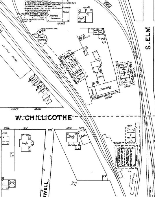
| Bellefontaine |
 |
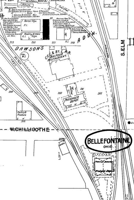
Before the CCC&ST.L owned the IB&W and CC&I, both railroads had stations in Bellefontaine at the site of the latter day CCC&St.L station at W. Chillicothe and Elm St. See this map of the station area from 1887 showing both stations and a shared freight facility. There was also a hotel on the site called Mesamore's Hotel (later known as the Commercial Hotel in the 1890s). There was a CS&C station at this location as early as 1875. Whatever station remained by 1899 was torn down after the new Big 4 station was completed in 1899. | ||||||
| Bellefontaine |
 |
This station was built around 1851 when the line opened through Bellefontaine. Before the CCC&ST.L owned the IB&W (formerly the MR&LE) and CC&I, both railroads had stations in Bellefontaine at the site of the latter day CCC&St.L station at W. Chillicothe and Elm St. See this map of the station area from 1887 showing both stations and a shared freight facility. When the new Big Four station was built in 1899, the original MR&LE depot remained as the Big Four passenger station until the new building was completed. It was torn down in May 1899 (Bellefontaine Republican, 5-19-1899). | ||||||
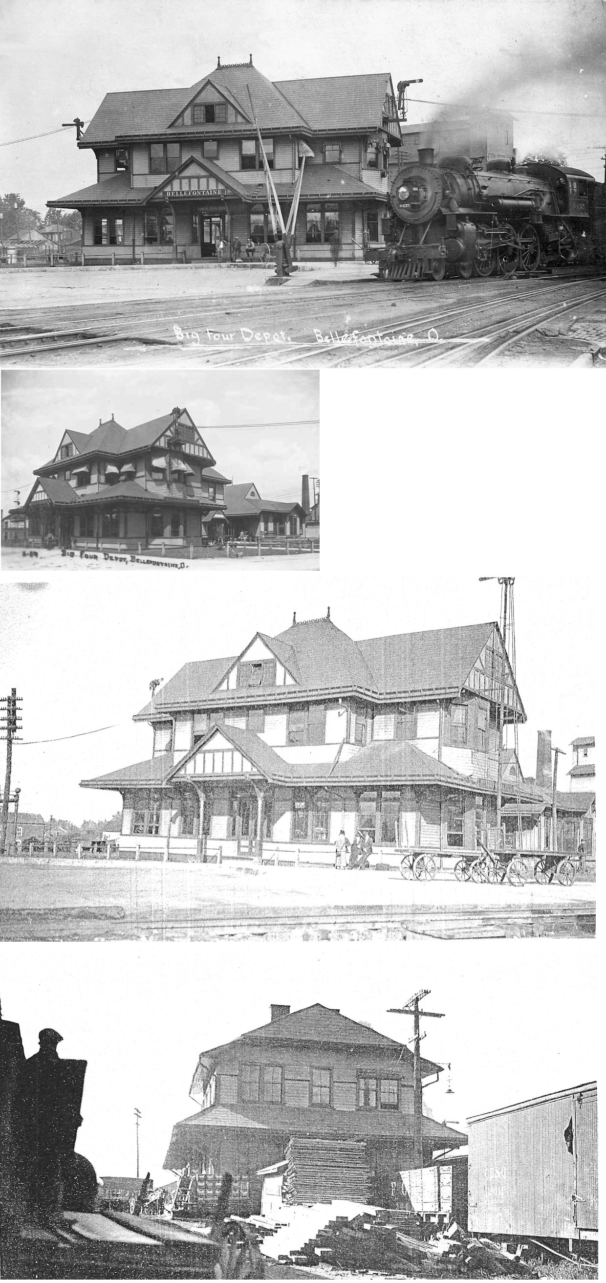
| Bellefontaine | |
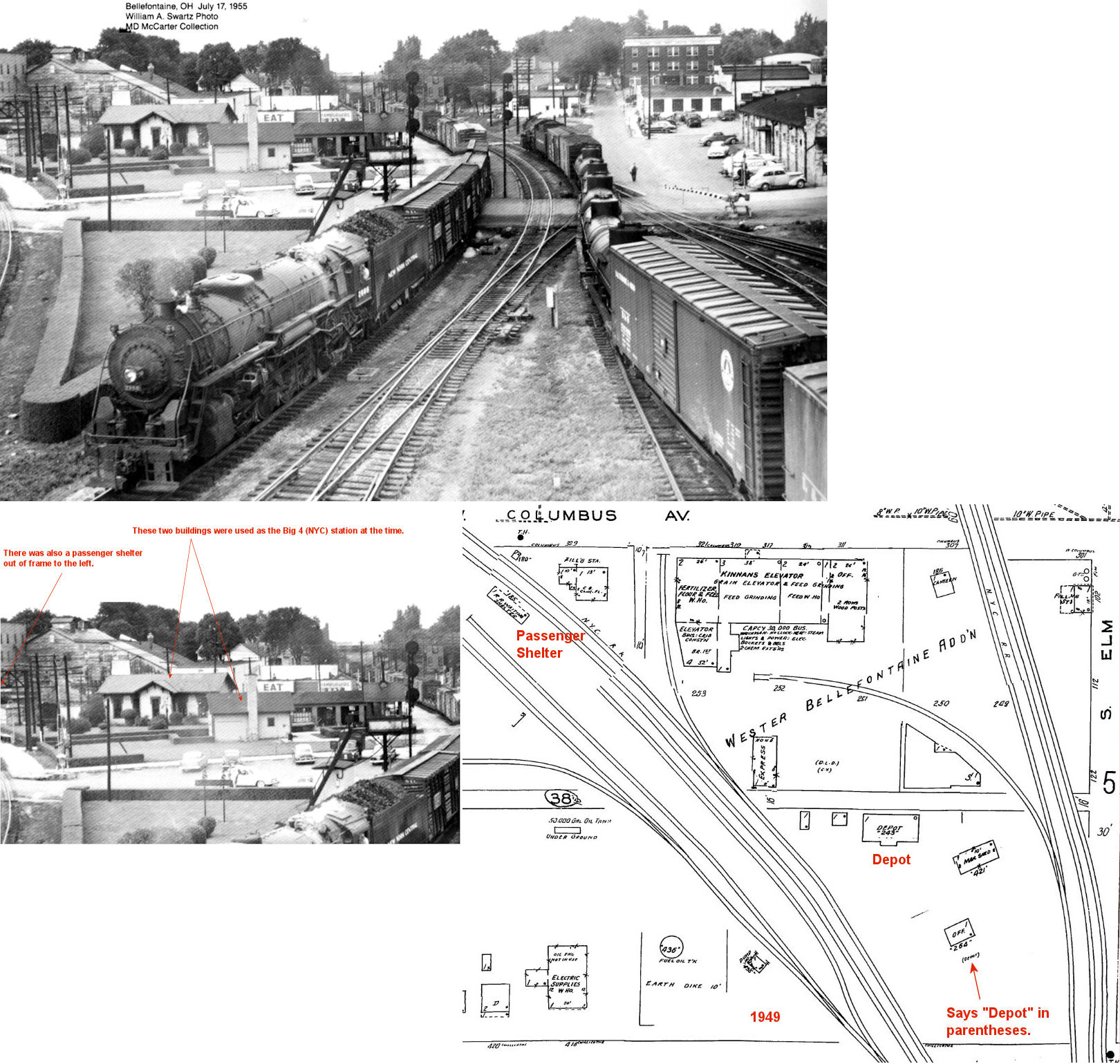
This station, built in 1899, sat on West Chillicothe Avenue. See this map of the station area from 1901. The original shared IB&W and CC&I freight facility was still used for the CCC&St.L at this time. The Big 4 Restaurant was located behind the passenger station. The station burned down on September 30, 1946. | ||||||
| Bellefontaine |
 |
After the station above burned down, the railroad built (or moved in) a traditional depot and used also used a small building with a large chimney (which may have been the boiler room of the old station that survived the fire) on the grounds as stations. | ||||||
| Bellefontaine | |
This freight station sat on West Auburn Street. See a map of its location from 1914. | ||||||
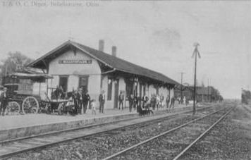
| Bellefontaine |  |
This combination station sat on the corner of Elm Street and Buckingham Avenue. The station below was later added to the area. | ||||||
| Bellefontaine | |
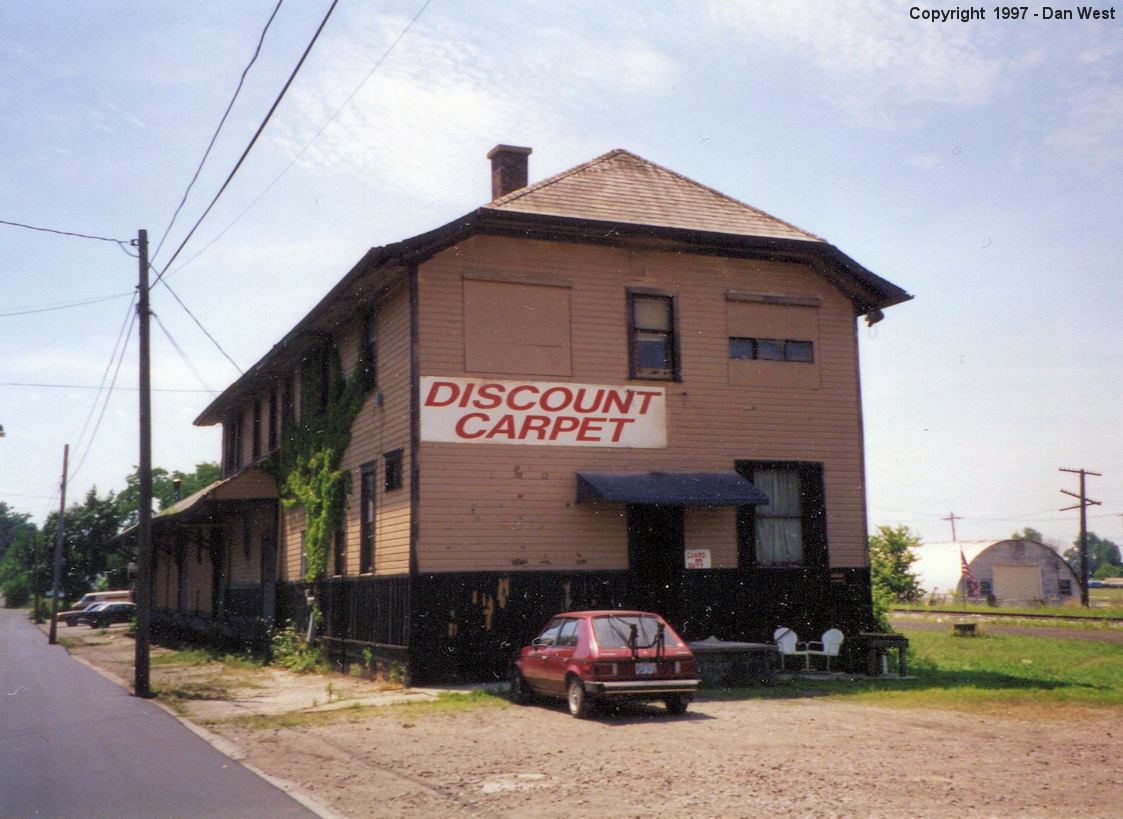
This freight station sat on Elm Street near the original passenger/freight station site and was built in 1899. It burned down on 3/14/1999. | ||||||
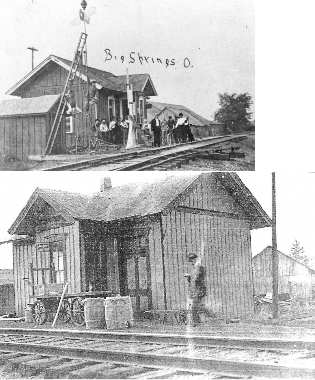
| Big Springs | |
|||||||
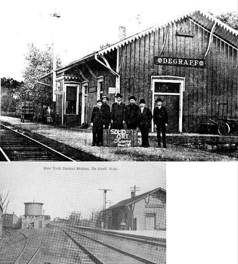
| DeGraff | |
This station was at the south end of Koke St. on the south side of the tracks. In later years this building was used as an express office. | ||||||
| East Liberty | |
This station was on South Main Street at the old grain elevator (GPS: 40.328817, -83.580284). As of June 2023 it appears to have been torn down and the lot cleared. | ||||||
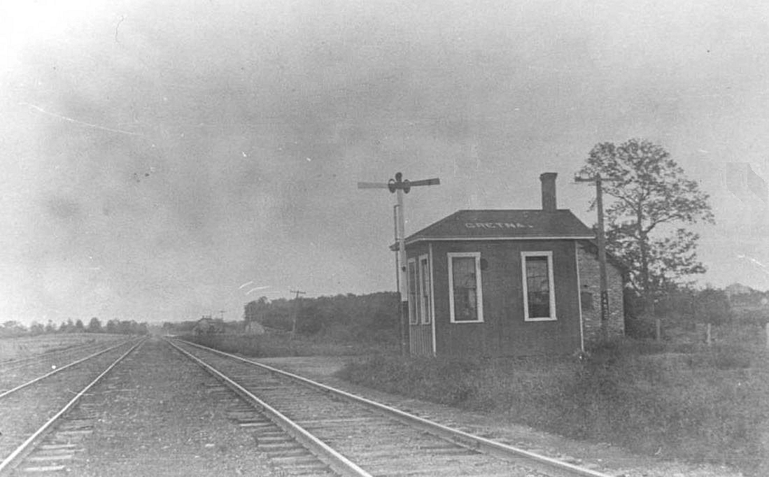
| Gretna | |
|||||||
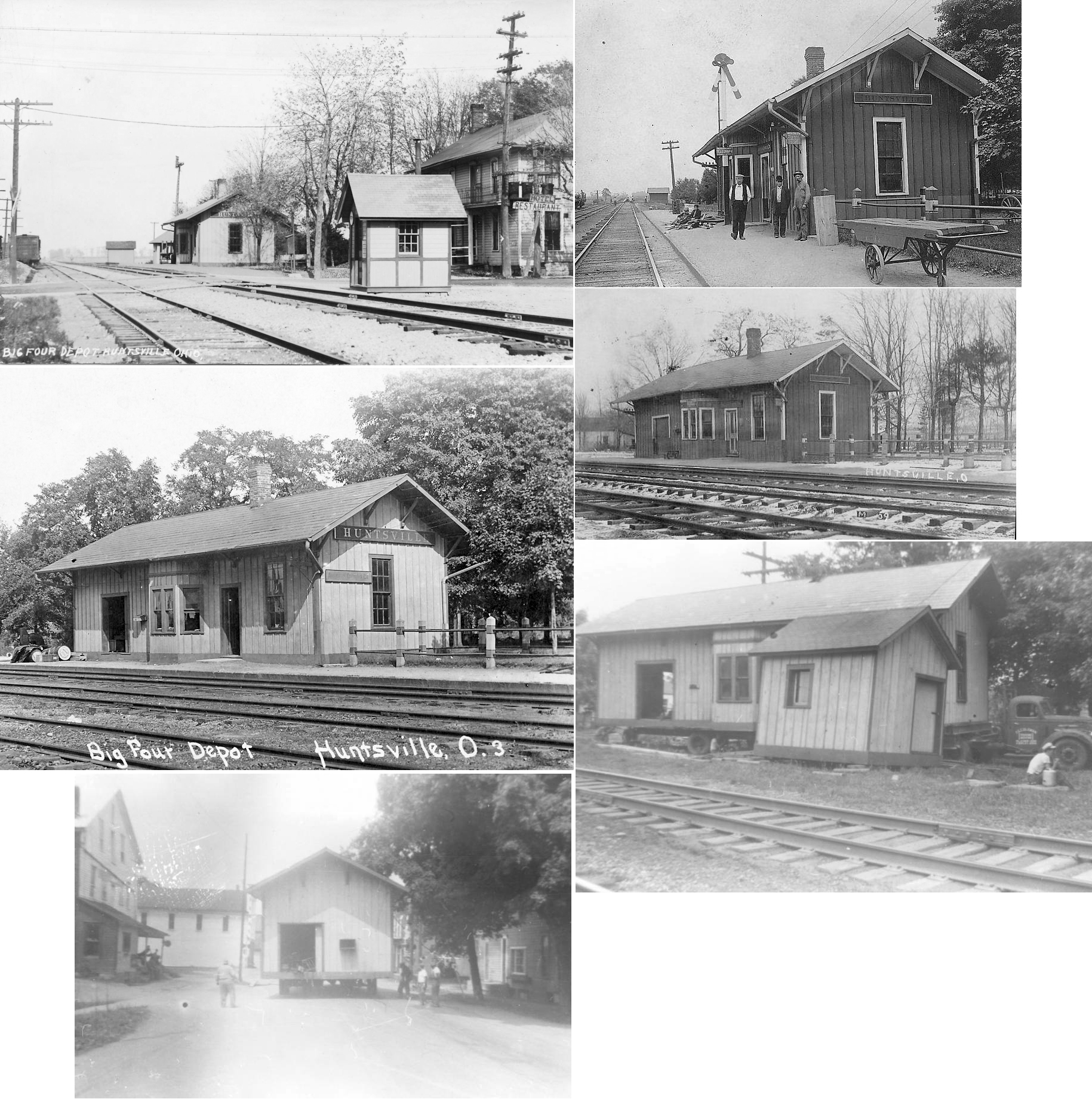
| Huntsville | |
This station was moved in the 1950s next to the school. It became a residence and was then torn down. | ||||||
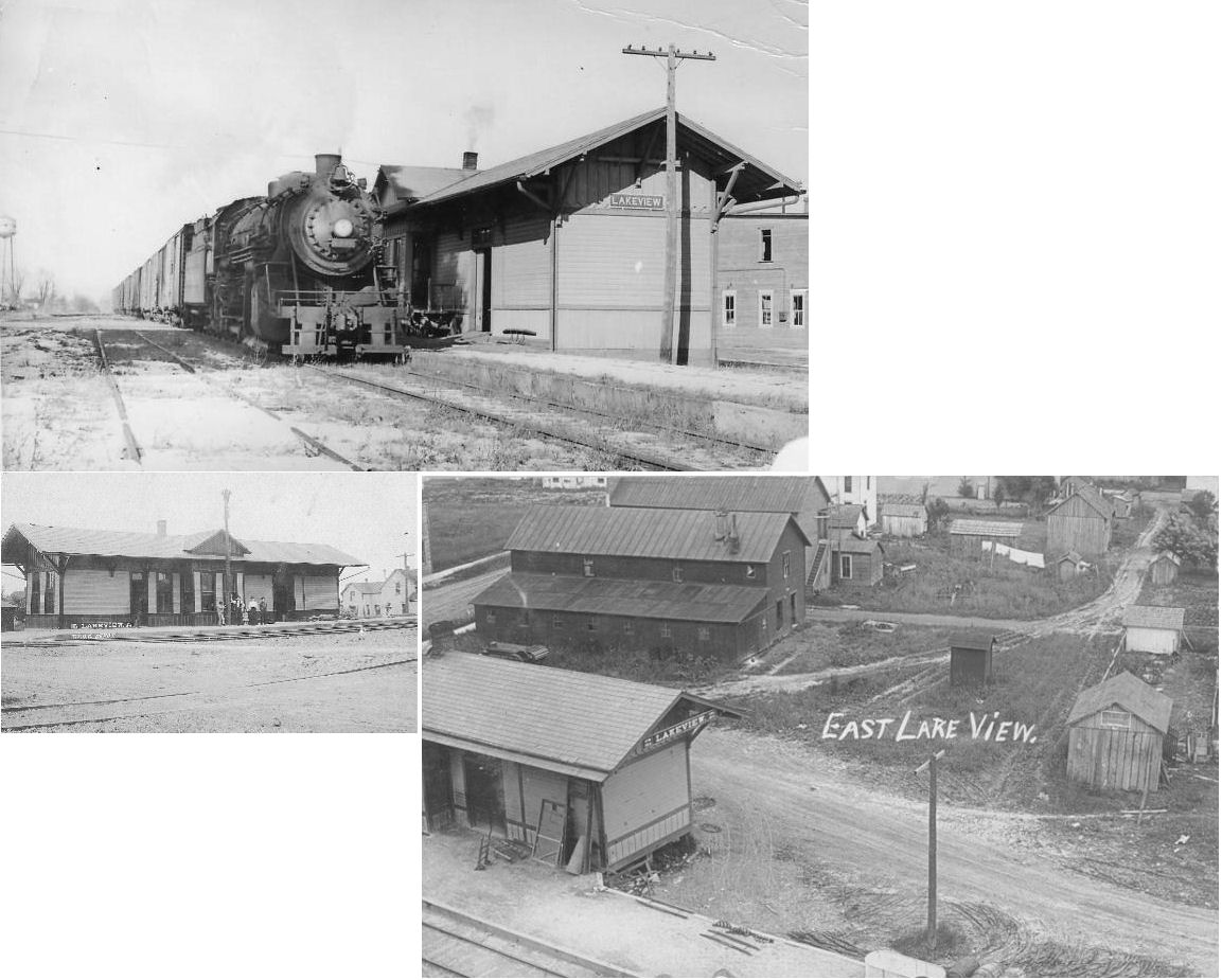
| Lakeview | |
This station was
on the east side of Main Street (SR 235) north of Market Street. In later NYC years it served as a freight station only after passenger service ended. It was torn down in September, 1967. |
||||||
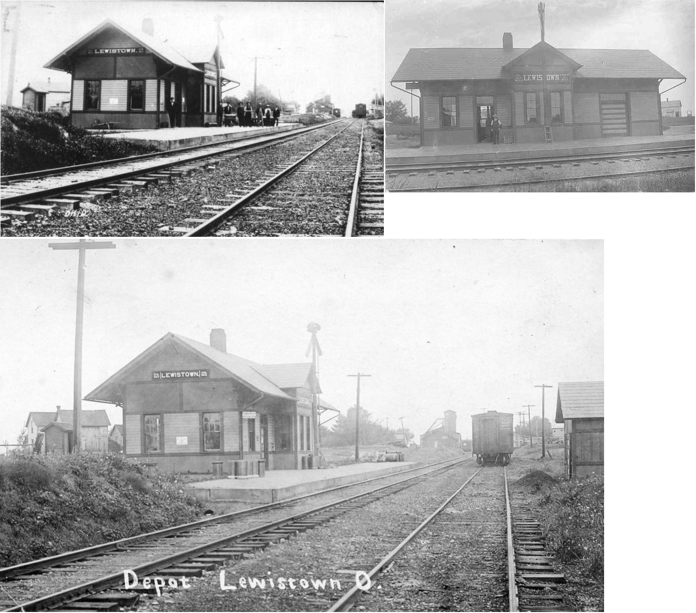
| Lewistown | |
|||||||
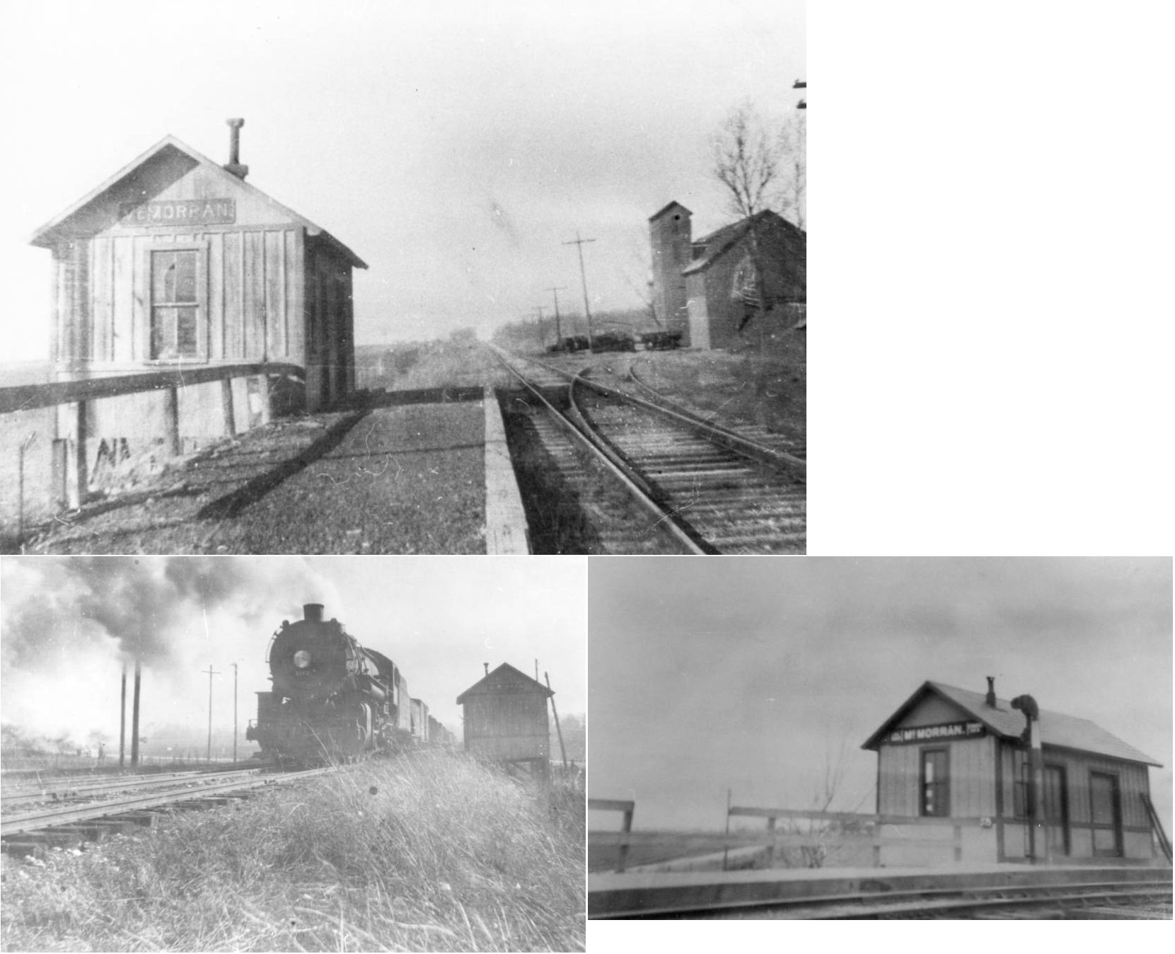
| McMorran | |
|||||||
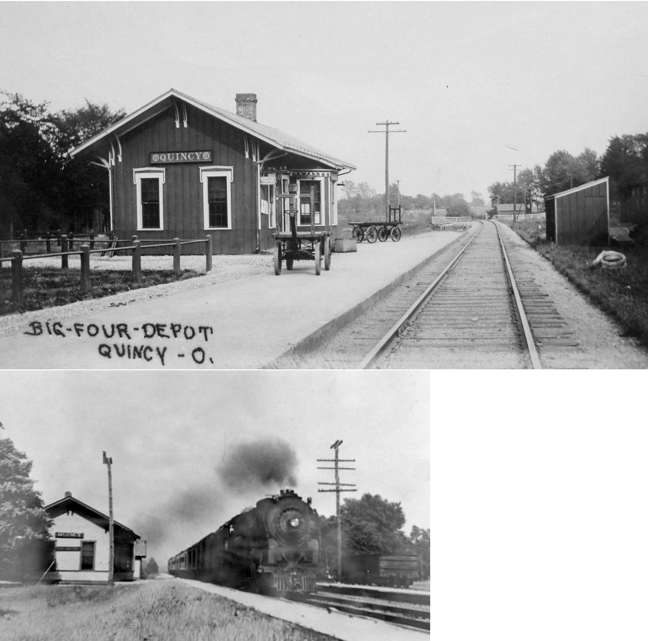
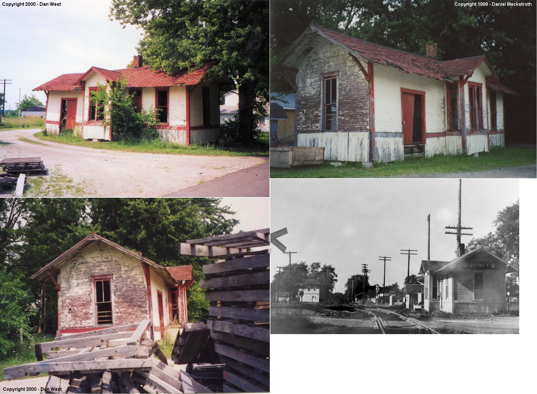
| Quincy | |
This station was on the east side of Miami Street on the north side of the tracks. | ||||||
| Quincy |
 |
This station was built in 1873. It was on Yost Street Next to Quincy Lumber, but was torn down (or moved?) in the late 2000s. | ||||||
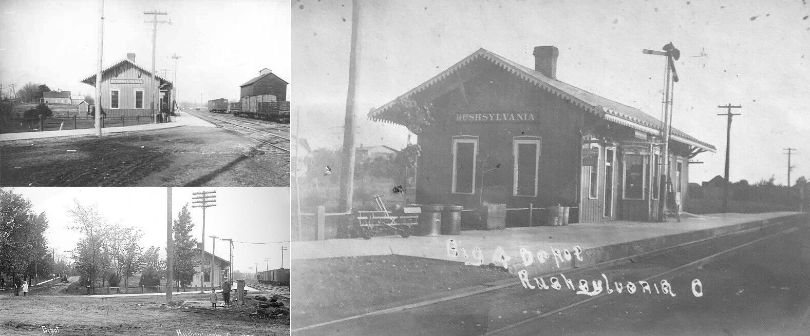
| Rushsylvania | |
|||||||
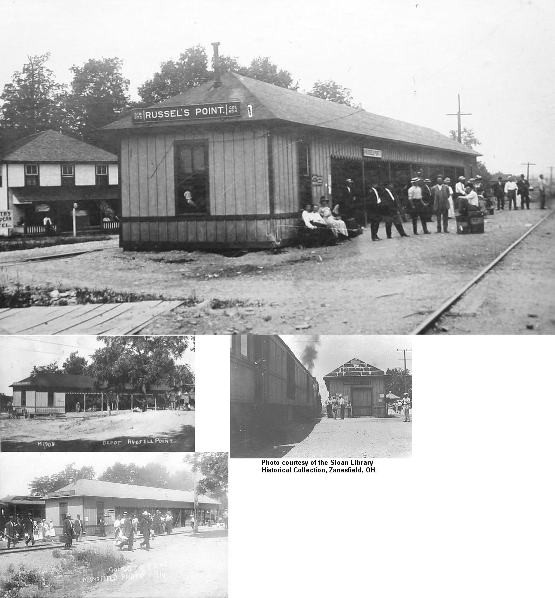
| Russells Point | |
|||||||
| Russells Point | |
Freight station. | ||||||
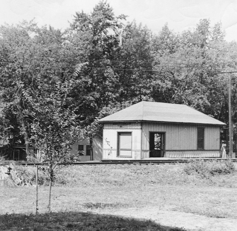
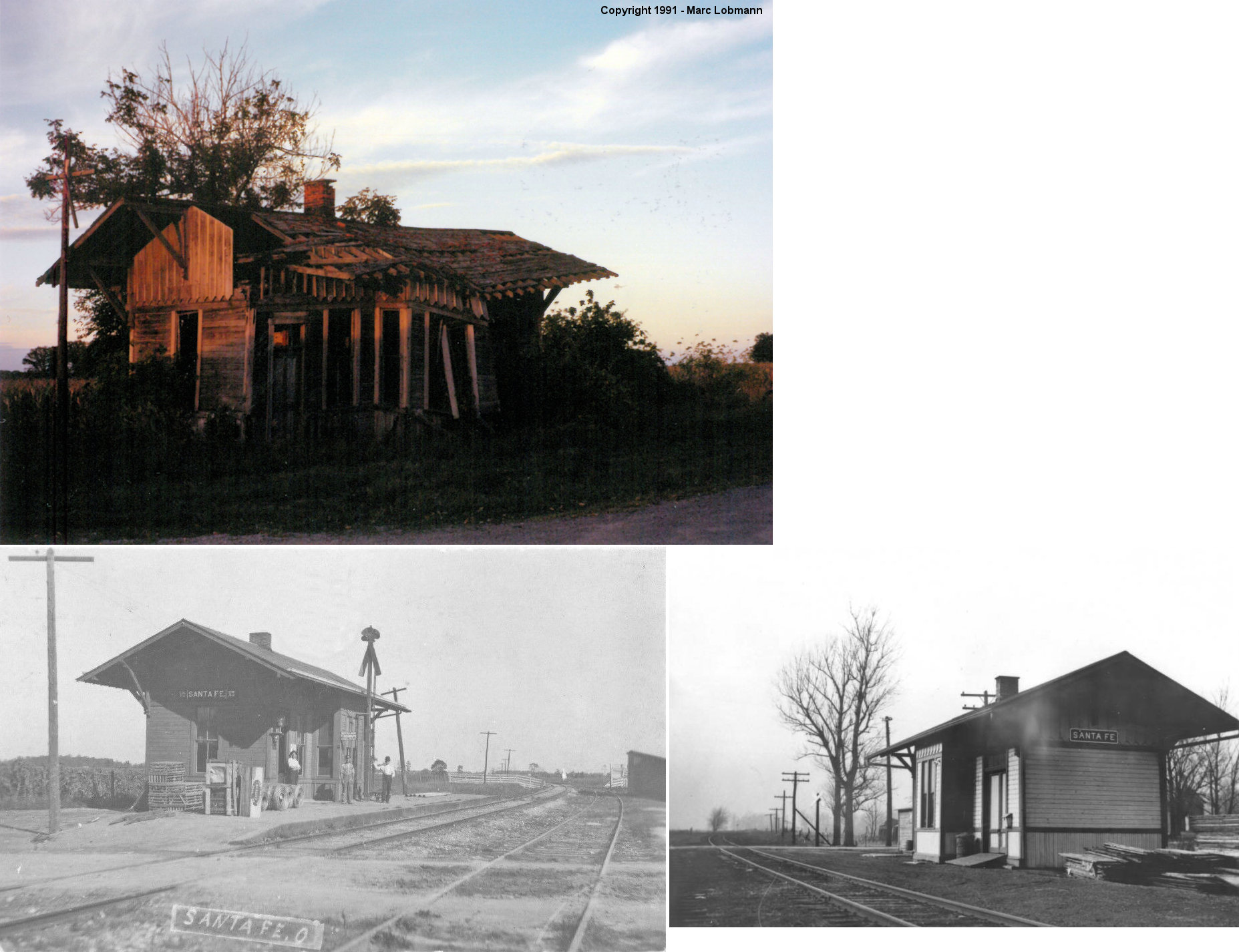
| Santa Fe | |
This station was located east of Santa Fe Line Road just north of the still existing grain elevator and north of the former tracks. It was a small wooden single-story bay station, standing derelict in the fall of 1991. As of spring 1992 the structure was gone and the plot returned to trucking/storage usage, a local said it was burned to the ground. | ||||||
| Silver Lake | |
There was a station here as early as 1875 on the CS&C. There was a spur off the main track and the station was on the NE side of the lake. | ||||||
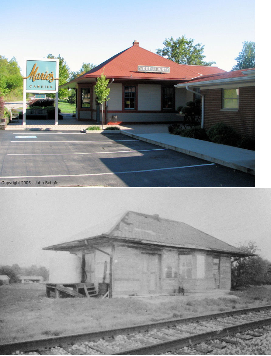
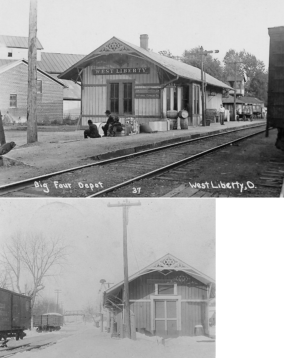
| West Liberty |
|
The first station here was built by the MR&LE. | ||||||
| West Liberty | |
This was the second station at West Liberty. It was located on Baird Street at Miller Street (GPS: 40.252194,-83.761445). | ||||||
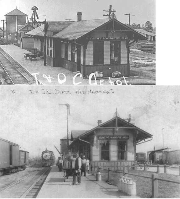
| West Mansfield | |
This station was at the NE end of State Street on the west side of the tracks (GPS: 40.401552,-83.539465). | ||||||
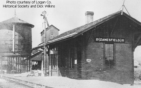
| Zanesfield | |
|||||||
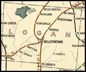
| 1898 LOGAN COUNTY RAILROAD MAP | ||||||||
 |
||||||||
|
Notes About Existing Stations... Belle Center (CCC&St.L) - Depot is currently under restoration and owned by the village. The exterior has been restored and work is now underway on the interior as of 2014. The signals have been returned and a new street has been created to run in front of the depot. West Liberty (CCC&St.L) - Moved. Now Marie's Candy Store. This station was built in 1926 when the West Liberty Cut-off was constructed by the Big 4. It was originally located on Township Highway 193 at Runkle Avenue (GPS: 40.251396,-83.77102). All prior stations were located on the old main line about one mile east of the current main line on Baird Street. |
||||||||