 COUNTY COUNTY
|
|
||||||||
| EXISTING STATIONS | ||||||||
|---|---|---|---|---|---|---|---|---|
| Station Name |
Original Railroad | Current Location |
Type | Current Use |
Date Built |
Track Status |
Building Material |
More Info |
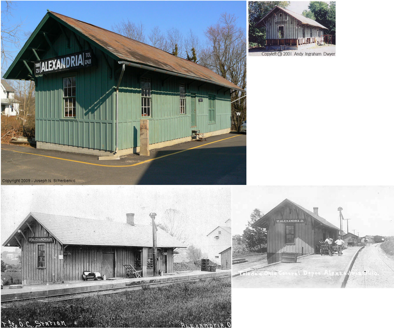
| Alexandria |  |
West corner of Liberty Street & Main Street (SR-37) (GPS: 40.088778,-82.612504) |
C | Vacant | ???? | None | Wood |
|
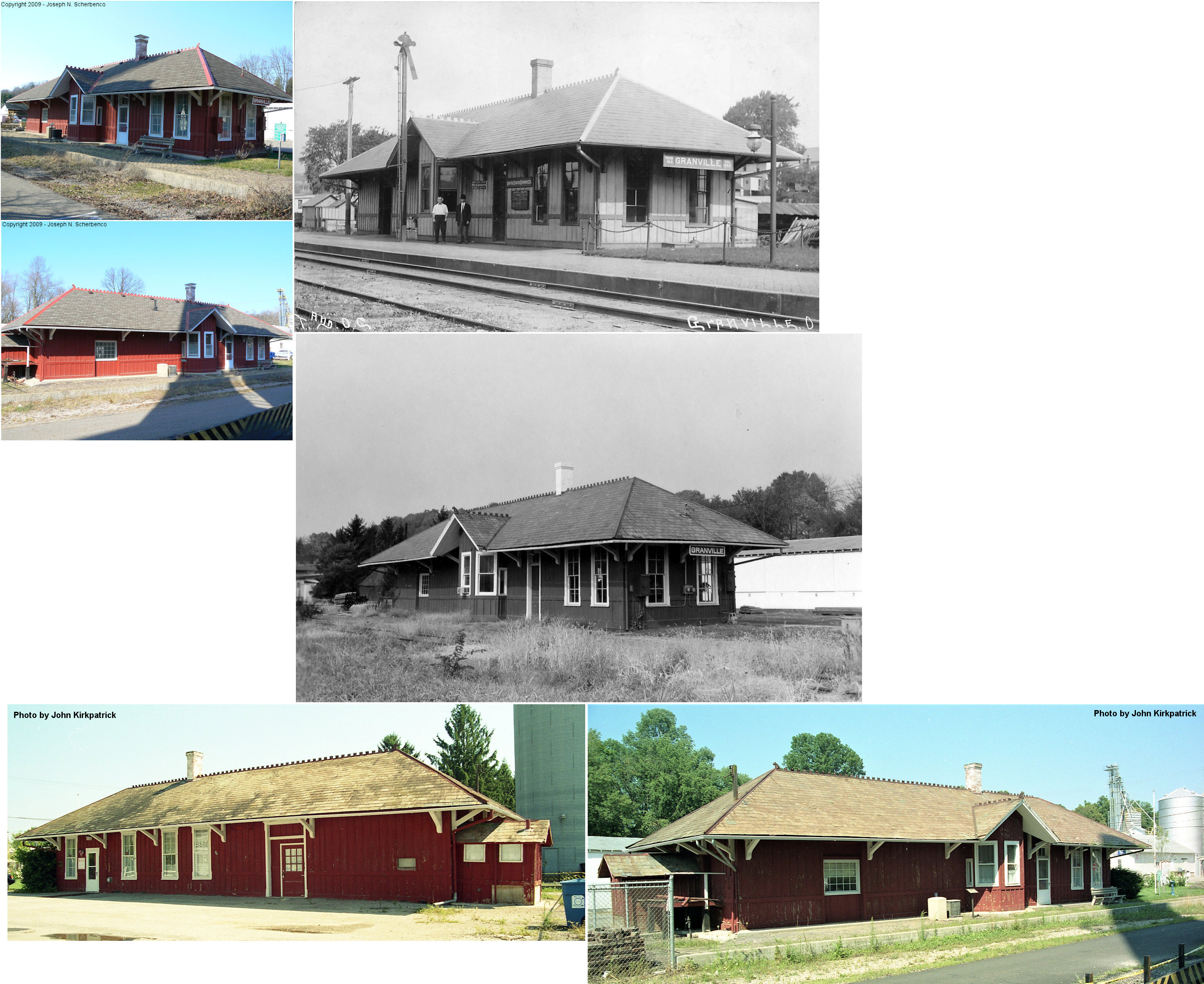
| Granville | |
425 South Main (GPS: 40.064467,-82.520883) |
C | Business | 1880 | Gone | Wood | |
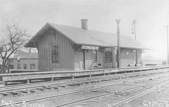
| Croton (Hartford) |
|
13104 Mitchell Road (GPS: 40.239057, -82.672247) |
C | House | ???? | None | Wood |
|
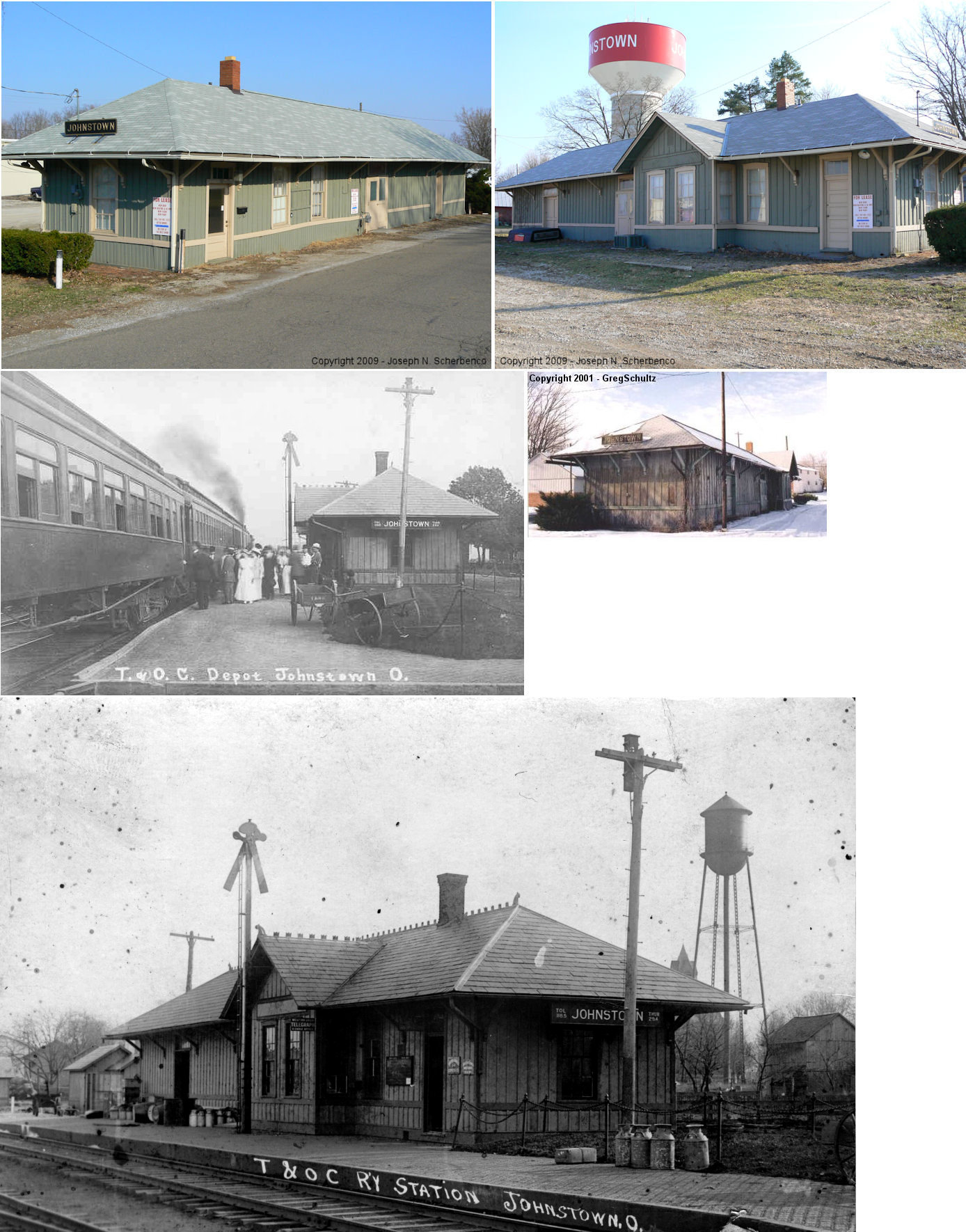
| Johnstown | |
110 Track Street. (GPS: 40.153642,-82.681005) |
C | Business | ???? | Gone | Wood | |
| National Road |  |
5475 US 40 at CR-327 (Lancers Road) (GPS: 39.960494,-82.43747) |
C | Railroad | 1885 | In Use | Wood |
|
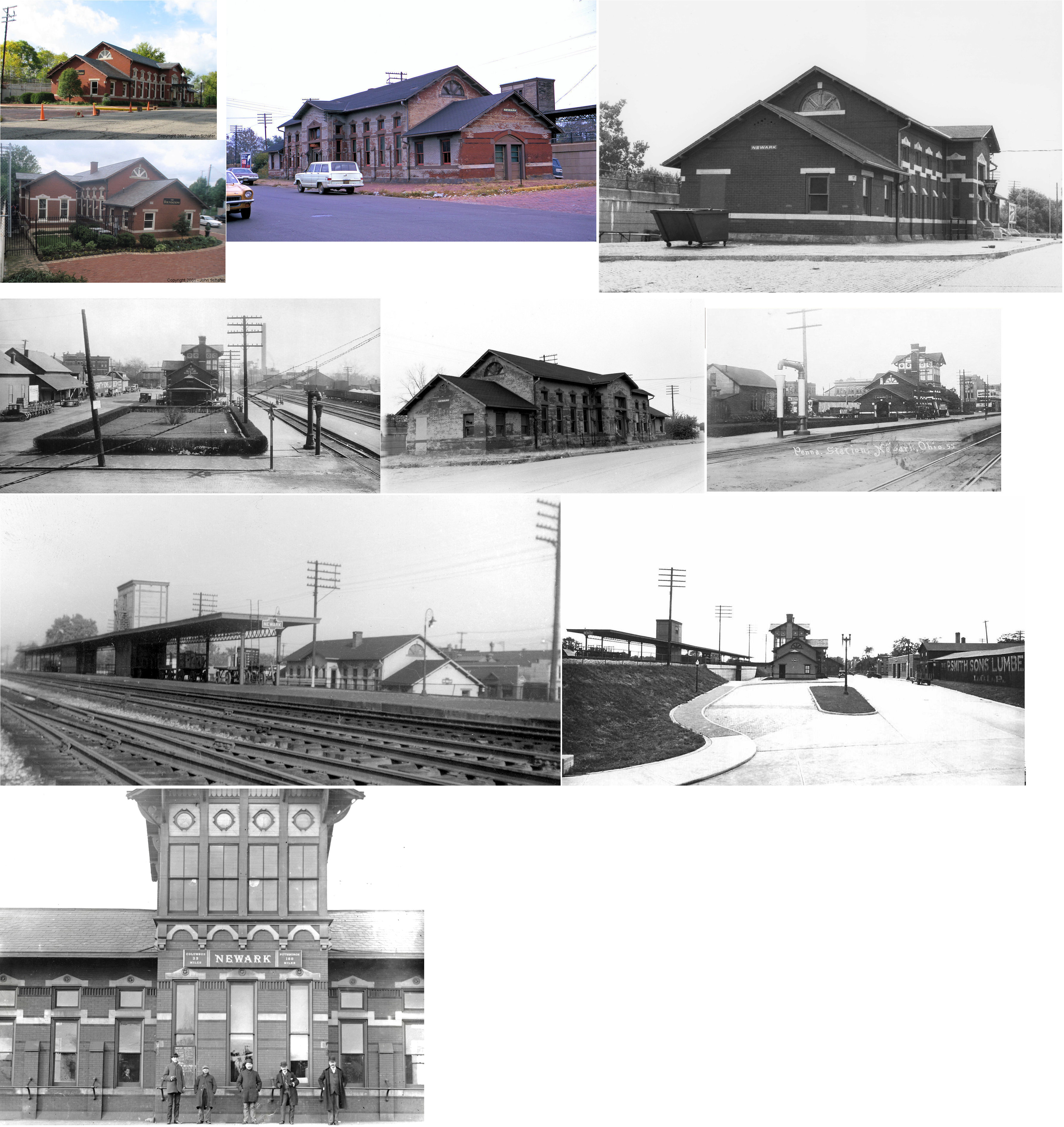
| Newark |  |
25 East Walnut Street (GPS: 40.05543,-82.400503) |
P | Civic | 1880 | In Use | Brick |
|
| Outville (Kirkersville Station) |
 |
6750 Outville Rd. SW.,
Pataskala (GPS: 39.994178,-82.598498) |
C | ???? | ???? | In Use | Wood |
|
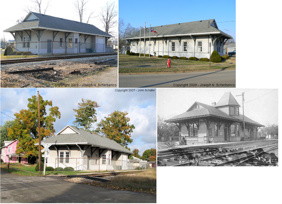
| Utica | |
NE corner of Church & Central Streets (GPS: 40.23677,-82.450748) |
C | Civic | ???? | In Use | Wood | |
| STATIONS OF THE PAST | ||||||||
| Station Name |
Original Railroad |
Notes | ||||||
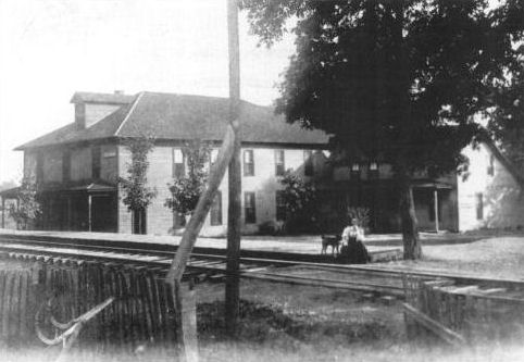
| Avondale | |
The Avondale Hotel served as the station here. The first station (which may have been the hotel) is shown on maps from 1875 when the line was the Newark, Somerset & Straitsville RR. | ||||||
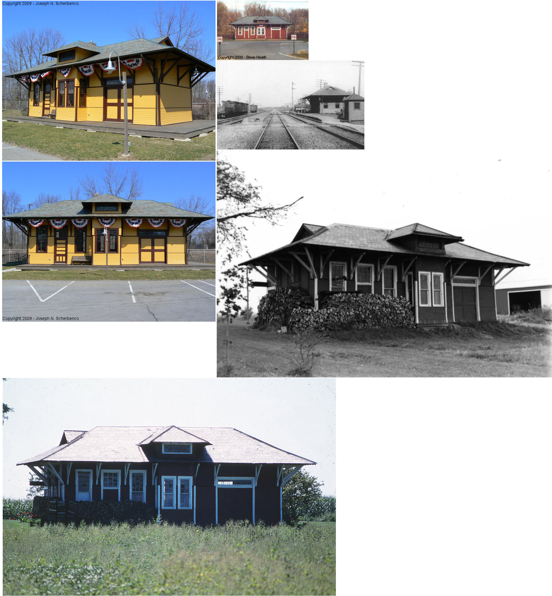
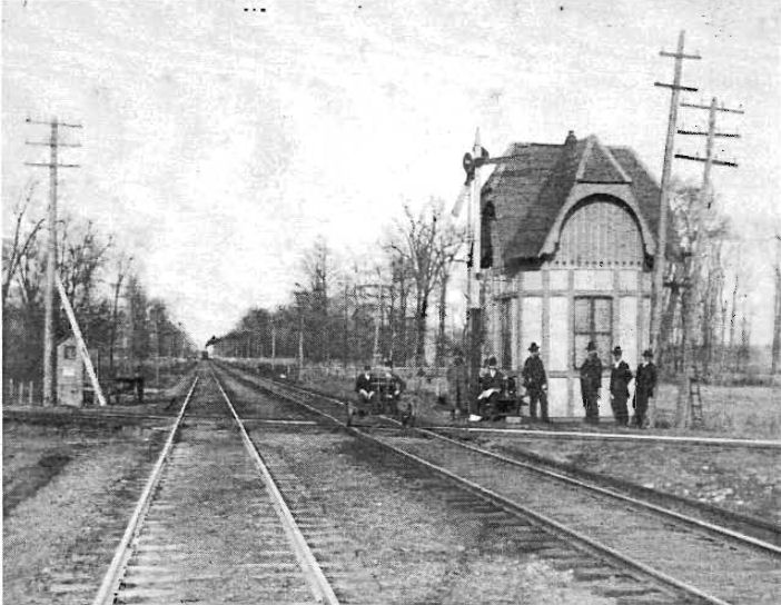
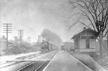
| Central City (Heath) |
AND |
This was the original combination tower and station that served until 1897 when the station listed below replaced it. | ||||||
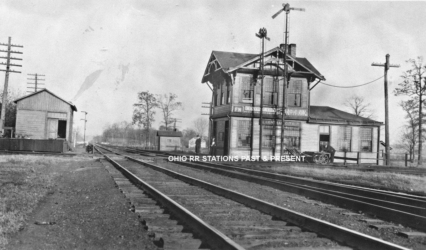
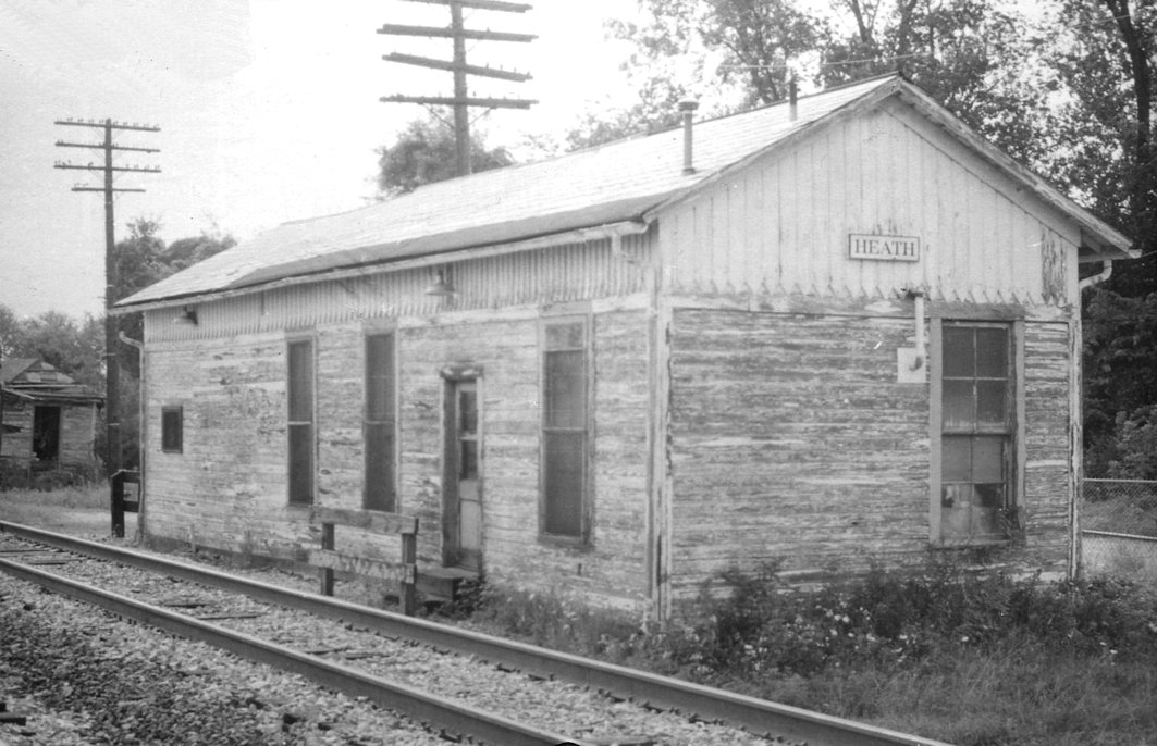
| Central City (Heath) |
AND |
A one-story station was moved here from elsewhere (does anyone know where it came from) in 1897. Upon arrival, the second story was added on for the tower. The freight station, also pictured, was built in 1890. The station was at GPS: 40.034328, -82.471522. | ||||||
| Claylick | |
This station was on the east side of Brownsville Road SE (SR668)at approximately GPS: 40.059608, -82.287771. Judging from the look of the station, it likely served another purpose as well as being a station. | ||||||
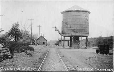
| Clemons | |
This station was two miles east of Alexandria. | ||||||
| Columbia Center |
|
The original B&O station was at the south end of Railroad Street SW where it used to end at the tracks (GPS: 39.996705,-82.695288). | ||||||
| Columbia Center |
|
Only a platform is listed here on the 1923 PRR List of Stations & Sidings. | ||||||
| Croton (Hartford) |
|
This was likely an earlier station. | ||||||
| Hanover | |
According to PRR vaulation records, this station was built in 1893. "VI" telegraph tower was .6 mile from the station. | ||||||
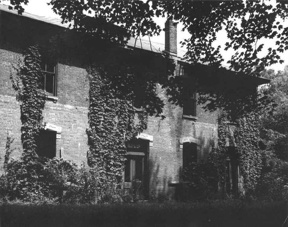
| Heath | |
Demolished 1999 | ||||||
| Heath |
|
|||||||
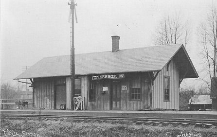
| Hebron | |
This station was located at the intersection of North and West Streets. | ||||||
| Marne (MontgomerY) |
|
|||||||
| National Pike (National Road) |
|
There was an earlier station here that predated the one that is still standing. Maps from 1875 show a station at the same location (on the east side of the tracks on the north side of National Road). Either that, or the existing station is older than originally thought. | ||||||
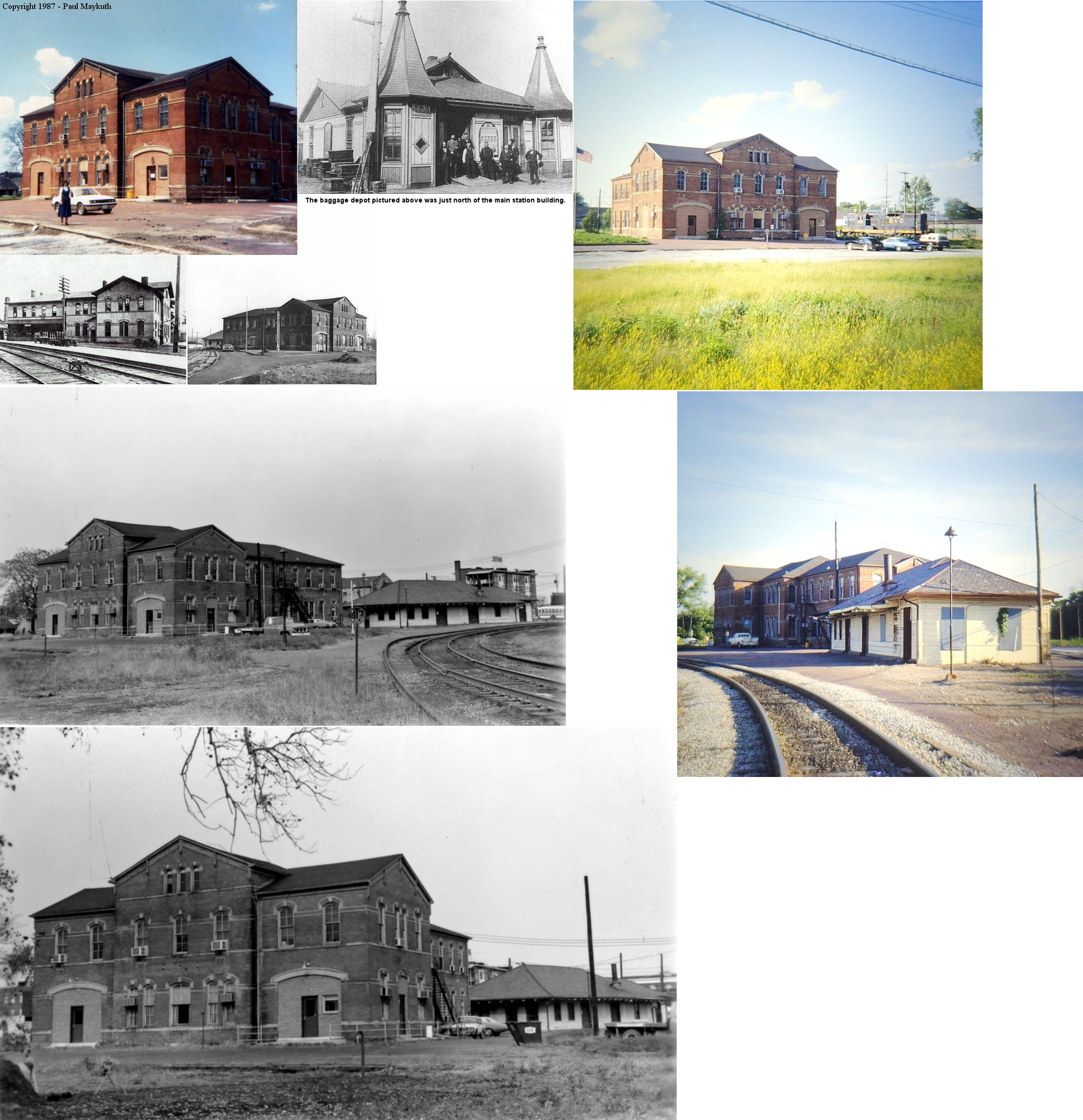
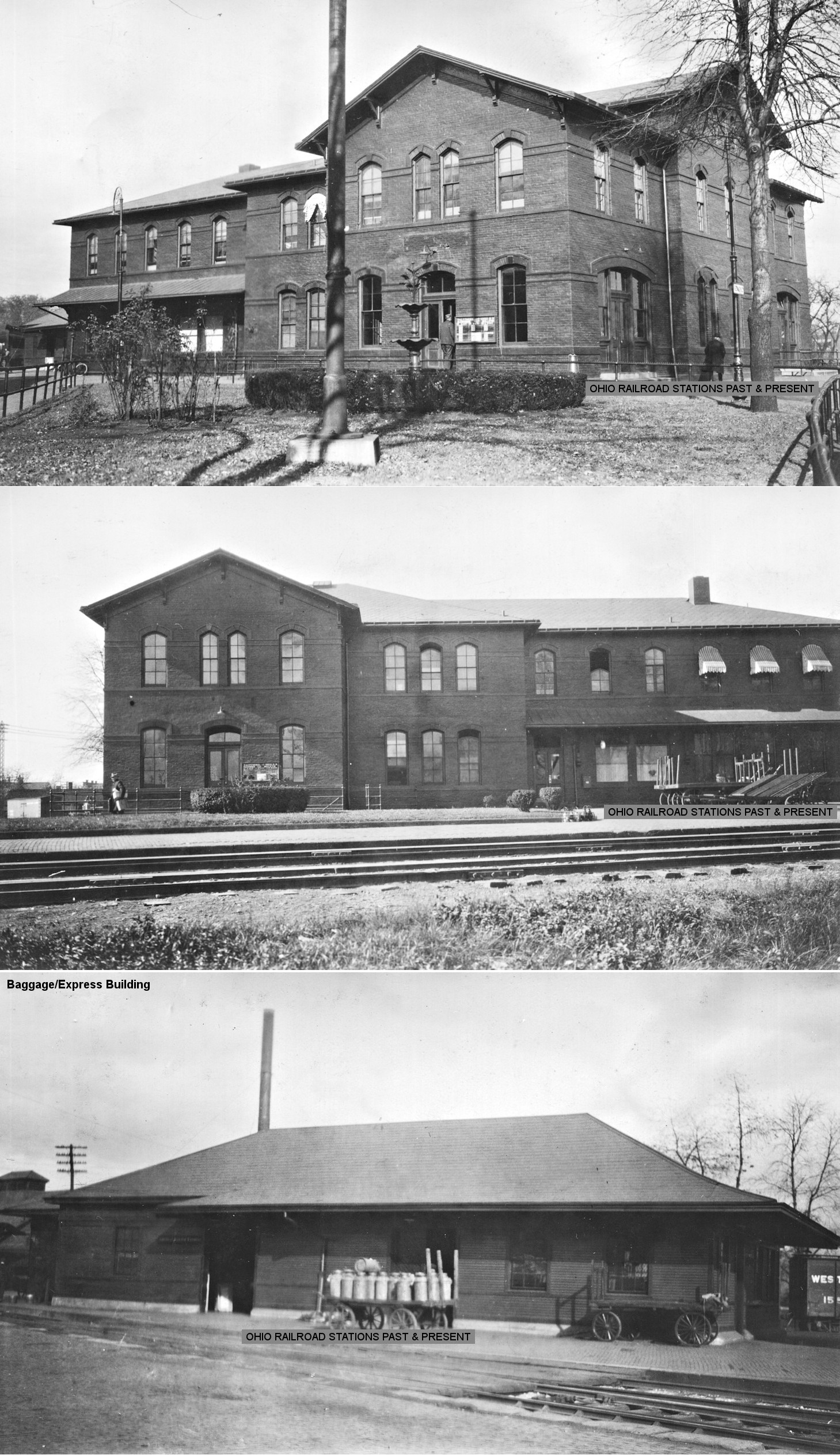
| Newark | |
This station was just to the NE of the corner of South 1st Street and Yearly Street (formerly Franklin Street) between the tracks (GPS: 40.05712,-82.397126). It was built in 1878 and demolished 1989. According to the B&O 1888 Annual Report the waiting room was enlarged that year and a freight transfer shed was added. Here are some more photos from the 1919 B&O valuation report. | ||||||
| Newark | |
This freight station was on the corner of North Canal Street (now Market) and South 1st Street (GPS: 40.057416,-82.398775). Although it went out of service decades prior, it was torn down in 1967 and the newspaper article that announced its destruction claimed that it was likely over 100 years old at the time (Newark Advocate, 7-27-1967). It is likely that it was built in the early 1880s. | ||||||
| Newark | |
This station was a replacement for the station listed above and was likely built in the 1920s or 1930s. It was along the east side of Cinton Street near Wyoming Street at GPS: 40.062688, -82.403118. | ||||||
| Newark |
|
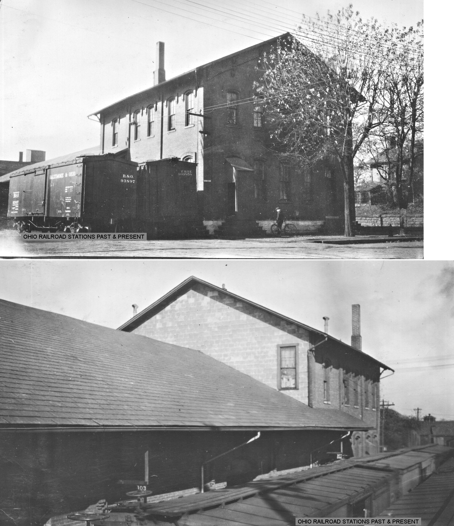
The freight station was just west of the passenger station on Walnut Street across 3rd Street (GPS: 40.055094,-82.401621). It was built in 1882 and torn down in 1944 (Newark Advocate, 5-6-1944). | ||||||
| Newark |
|
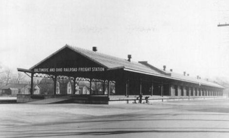
A new freight station opened here on May 11, 1929. It was between 5th and 6th Streets. | ||||||
| Newark |
|
The first station here was a house owned by Lucius Smith, a wealthy pioneer citizen of Newark. This house was located on South 3rd Street on the south side of the tracks (according to "Centennial History of the City of Newark and Licking County, Ohio" by Edwin M. P. Brister published in 1909). | ||||||
|
Outville (Kirkersville Station) |
|
|||||||
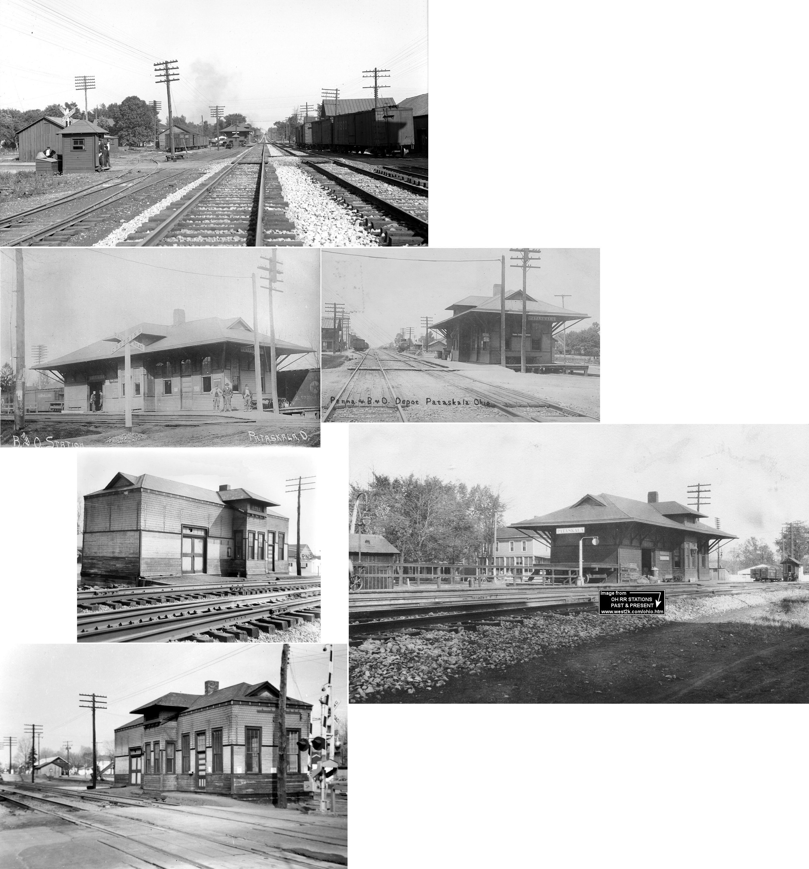
| Pataskala | |
The original B&O station here was on the east side of Main Street, on the north side of the tracks. (GPS: 39.9962,-82.674968) | ||||||
| Pataskala | |
According to PRR valuation records, this station was built in 1890. | ||||||
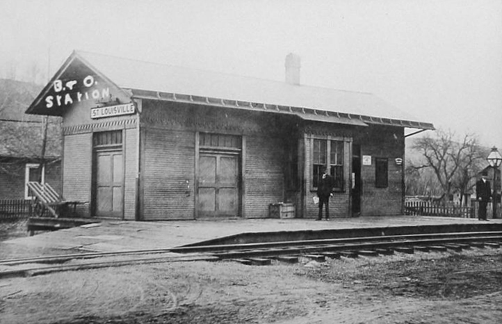
| St. Louisville |
|
|||||||
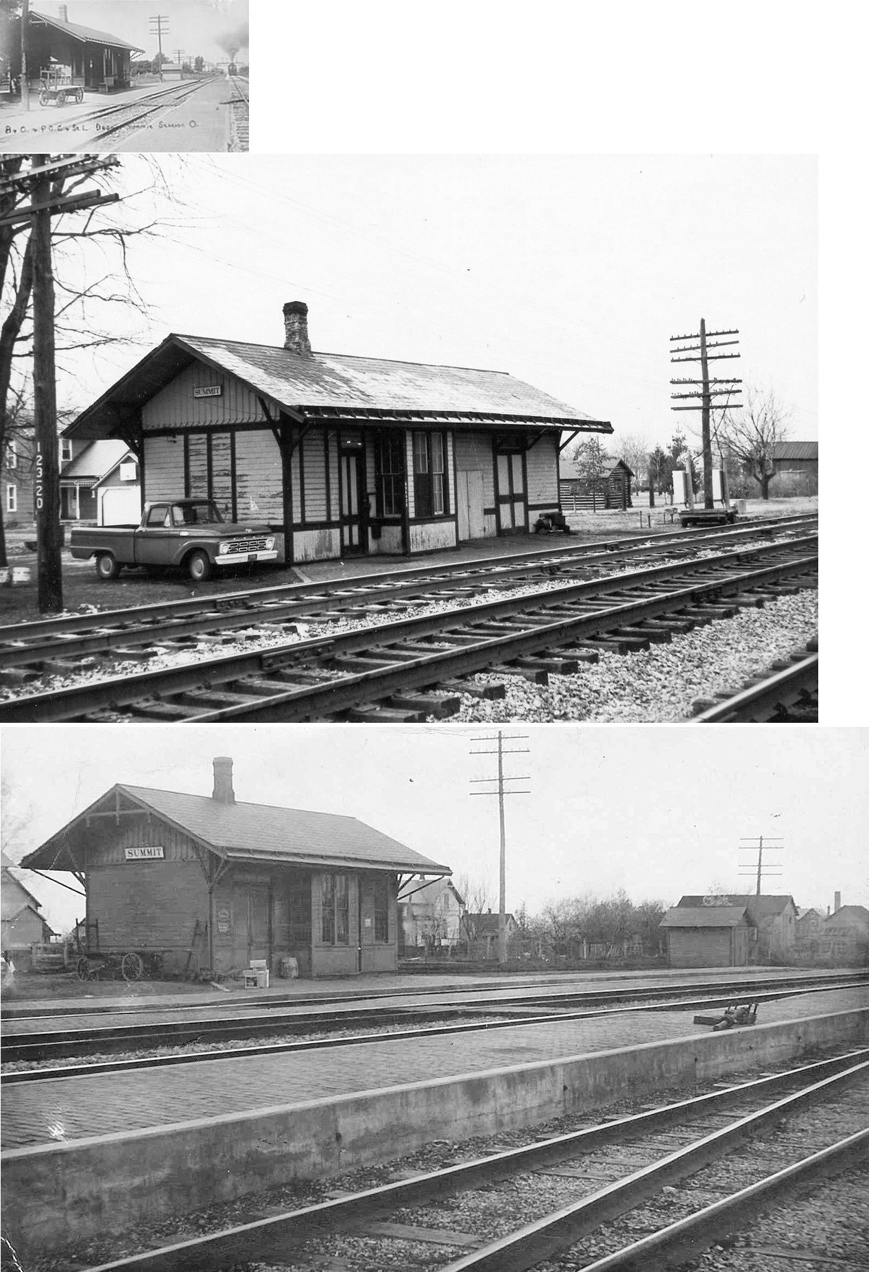
| Summit
Station (Hawkeye) |
|
This joint station was located on the west side of Main Street on the south side of the tracks. It was burned by vandals in the early 1970s. | ||||||
| Swans | |
|||||||
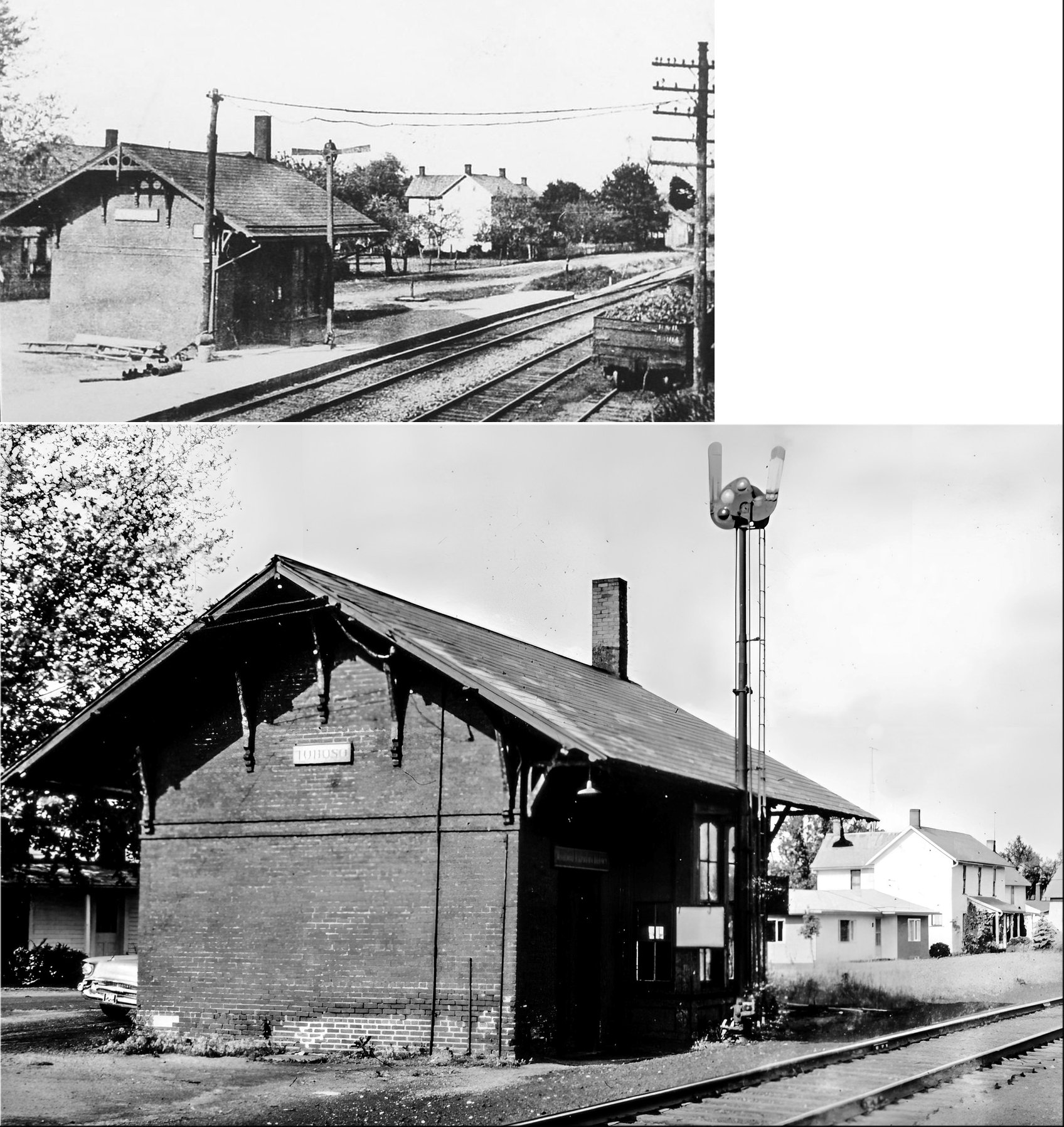
| Toboso | |
|||||||
| Union |
|
|||||||
| Utica |
|
The first B&O station here, according to maps from 1875, was a combination depot/warehouse that was near the corner of Maple Street and North Main Street. (GPS: 40.238875,-82.451888) | ||||||
| Vanatta |
|
Town was originally called "Vanattasburg." | ||||||
| Weiant |
 |
There was a station that served the workers at the Weiant Greenhouses near Newark. I am unsure whether it was a RR station or an interurban line. Does anyone know for sure? | ||||||
| York Street |
|
A station is listed here on the 1923 PRR List of Stations & Sidings. It was at milepost 170.7 while Pataskala was at 173.4. | ||||||
| 1898 LICKING COUNTY RAILROAD MAP | ||||||||
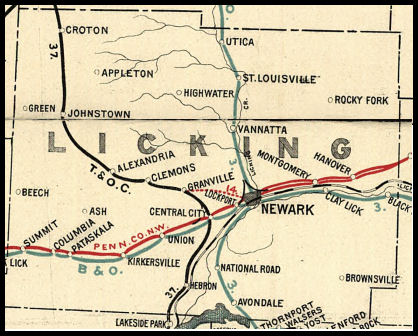 |
||||||||
|
Notes About Existing Stations... Alexandria (T&OC) - Moved from original location into town. Croton (T&OC) - Moved from town in 1940s. National Road (NS&S) - The Newark, Somerset & Shawnee eventually became part of the B&O. Newark (PRR) - On National Register of Historic Places. Owned by a non-profit organization. According to PRR valuation records, the station was built in 1888. According to the NRHP application, it was built in 1880 and newspaper articles confirm that as the correct date. Outville (B&O) - he B&O Outville station has been moved approximately 1/4 mile west of it's original location (on the east side of Main Street on the south side of the tracks) and is now inside the Harrison Township Maintenance complex. It was moved in 1963. It was restored in 2005. It is behind locked gate, best to visit during the week when the gate is open. |
||||||||