 COUNTY COUNTY
|
|
||||||||
| EXISTING STATIONS | ||||||||
|---|---|---|---|---|---|---|---|---|
| Station Name |
Original Railroad | Current Location |
Type | Current Use |
Date Built |
Track Status |
Building Material |
More Info |
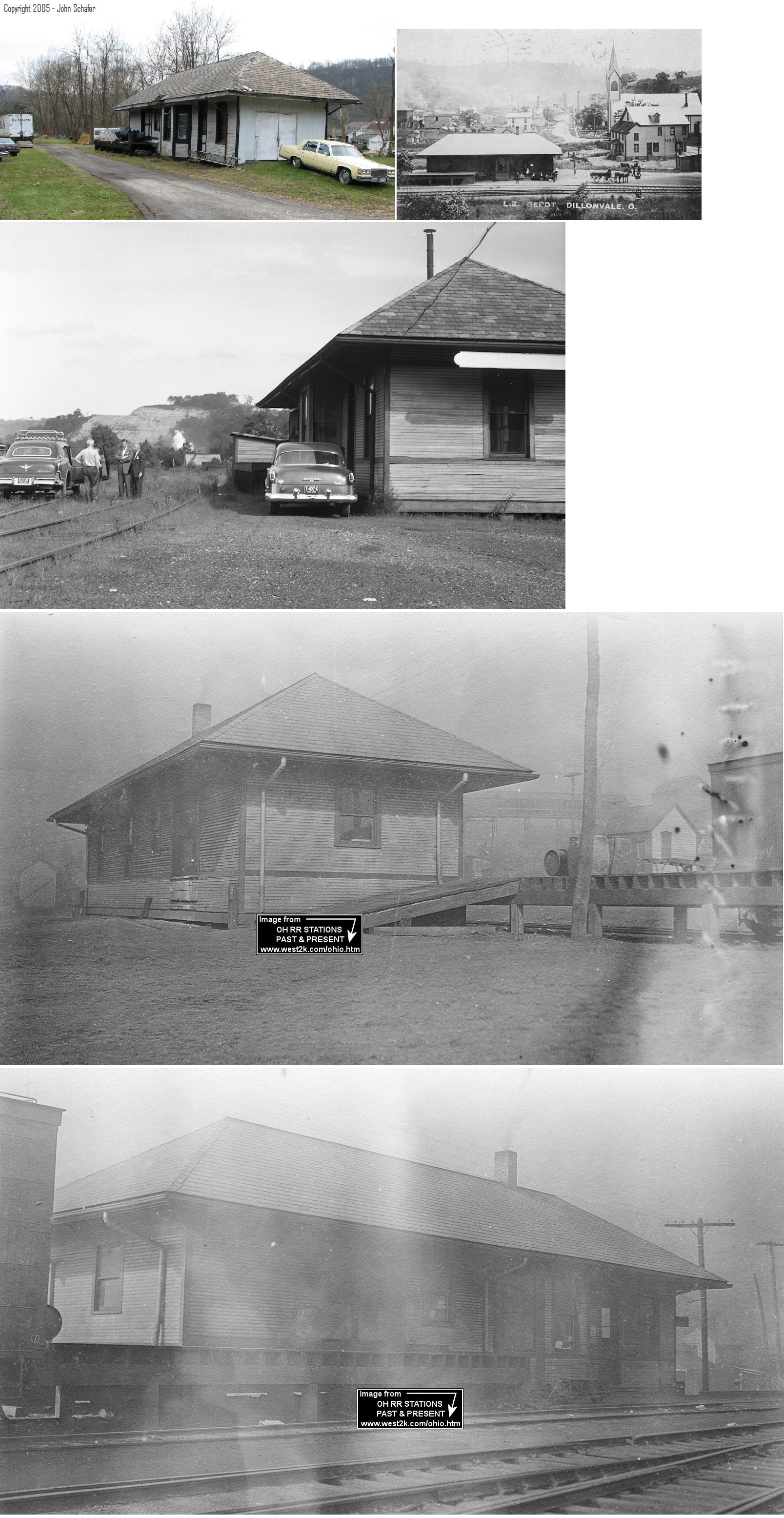
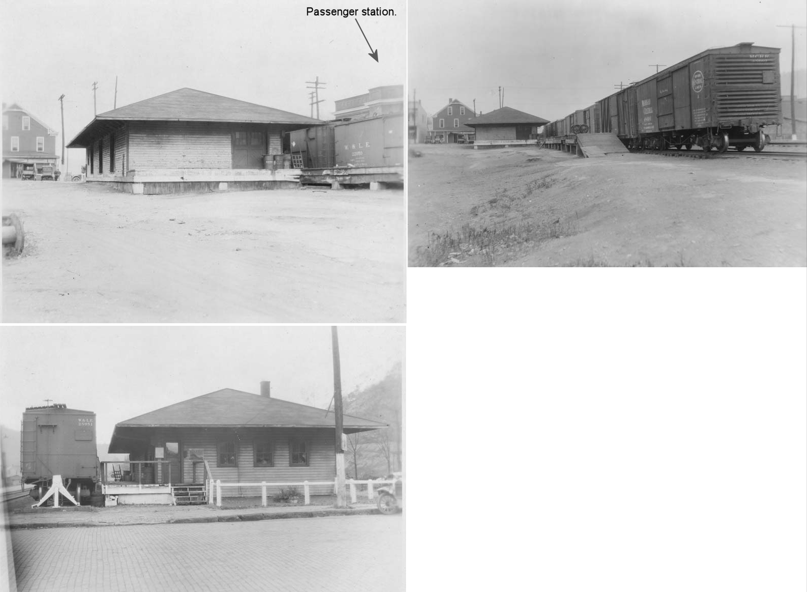
| Dillonvale |  |
York Street (Township Road 1201) (GPS: 40.203749,-80.772142) |
P | Storage | 1907 | Aband. | Wood |
|
| STATIONS OF THE PAST | ||||||||
| Station Name |
Original Railroad |
Notes | ||||||
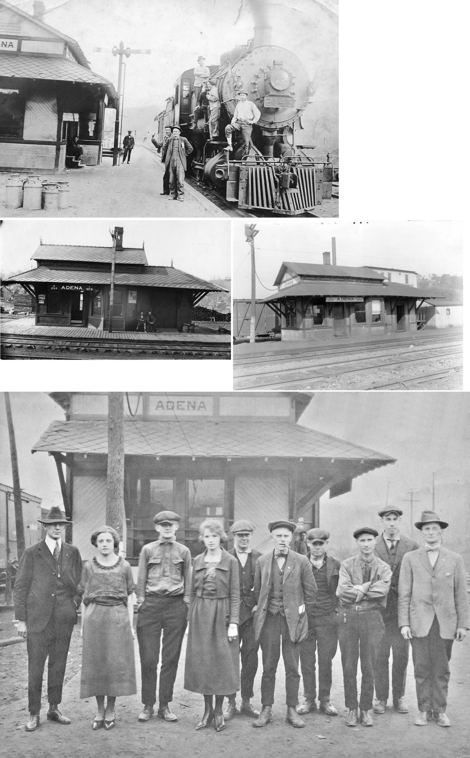
| Adena |  |
The W&LE had a freight station and passenger station off Mill Street. Adena Mills was nearby just to the southwest. | ||||||
| Adena | |
A collection of old boxcars made up the freight station here. | ||||||
| Amsterdam | |
This station was on the north side of Ridgewood Drive on the west side of the tracks at GPS: 40.470342, -80.923485. LEA&W = Lake Erie, Alliance & Wheeling. Was privately owned from 1958-2002. The station was torn down after the roof collapsed in November 2002. According to NYC valuation records, the station was built in 1902 and measured 16'x80'. A 20' extension was added in 1914. | ||||||
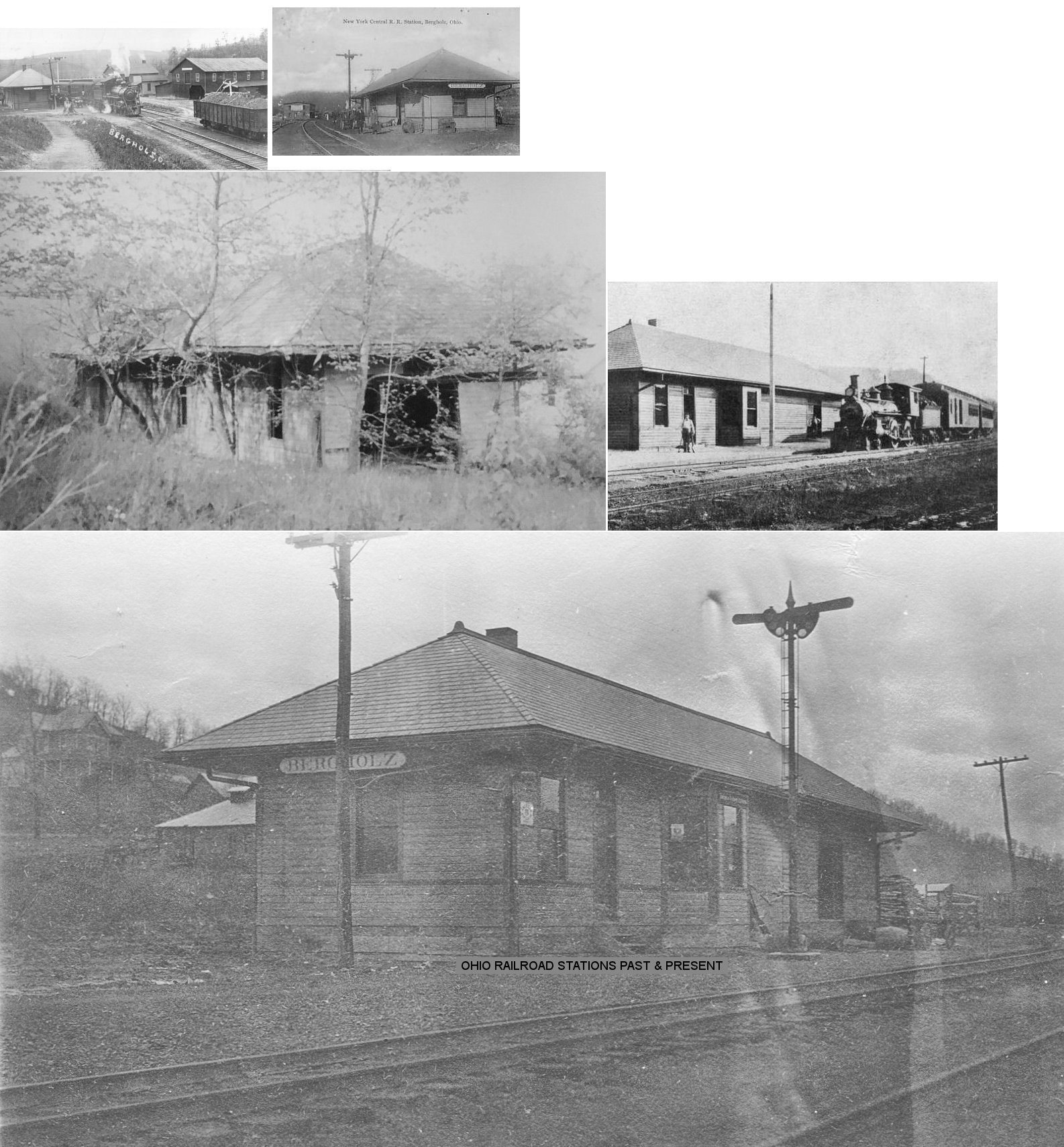
| Bergholz | |
This station was located on 2nd Street. It was torn down in summer of 2000 to make way for a mini-mart. When NYC closed it in 1958, a local resident and businessman produced a deed which his grandfather executed with railroad in 1882 which said, that when passenger service ends, property reverts to the family. As passenger service ended in 1941, the family did not exercise ownership rights until depot finally closed for freight service in 1958. The family was successful in it's efforts with the NYC and took possession of property and depot in 1959. Soon after, the new owners gutted the depot, removing all wall partitions and ceiling and used the shell of depot for their company's (Allen Box Co.) storage of pallets. This was discontinued in late 60's or early 70's and the depot laid idle into the 80s and 90s when the depot/property was purchased by new mini mart being constructed nearby. The new mini-mart needed the property for septic tank installation. Thus, depot/lot was sold for several thousand dollars in 2000 and the depot was torn down (with some of the lumber being salvaged). --Note by Tom Barnett (2002). According to NYC valuation records, the station was built in 1908 and measured 18'x78'. | ||||||
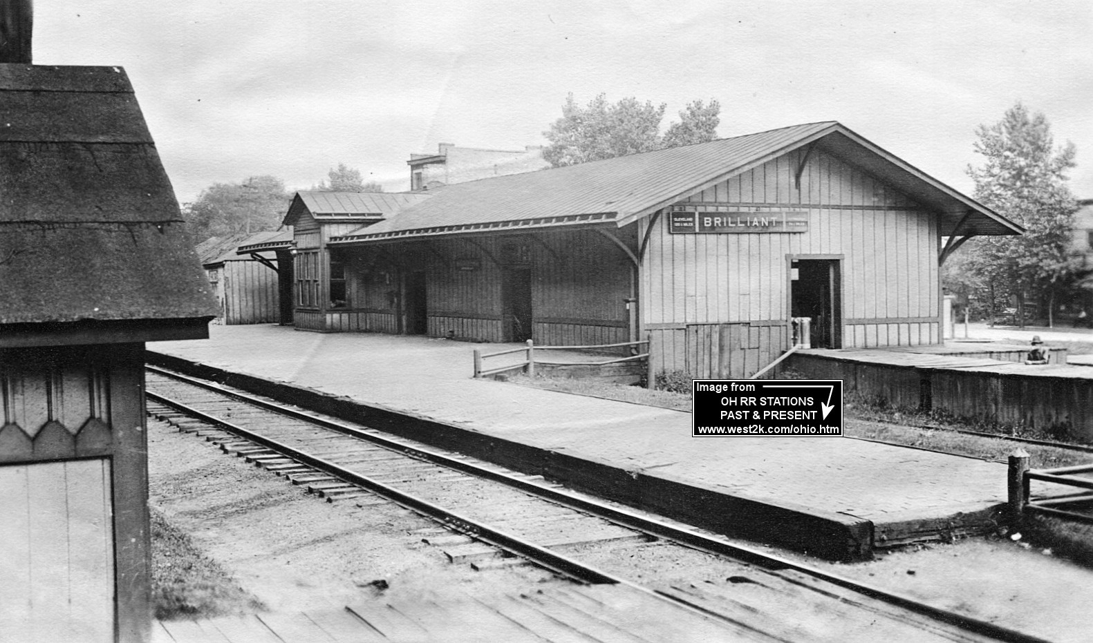
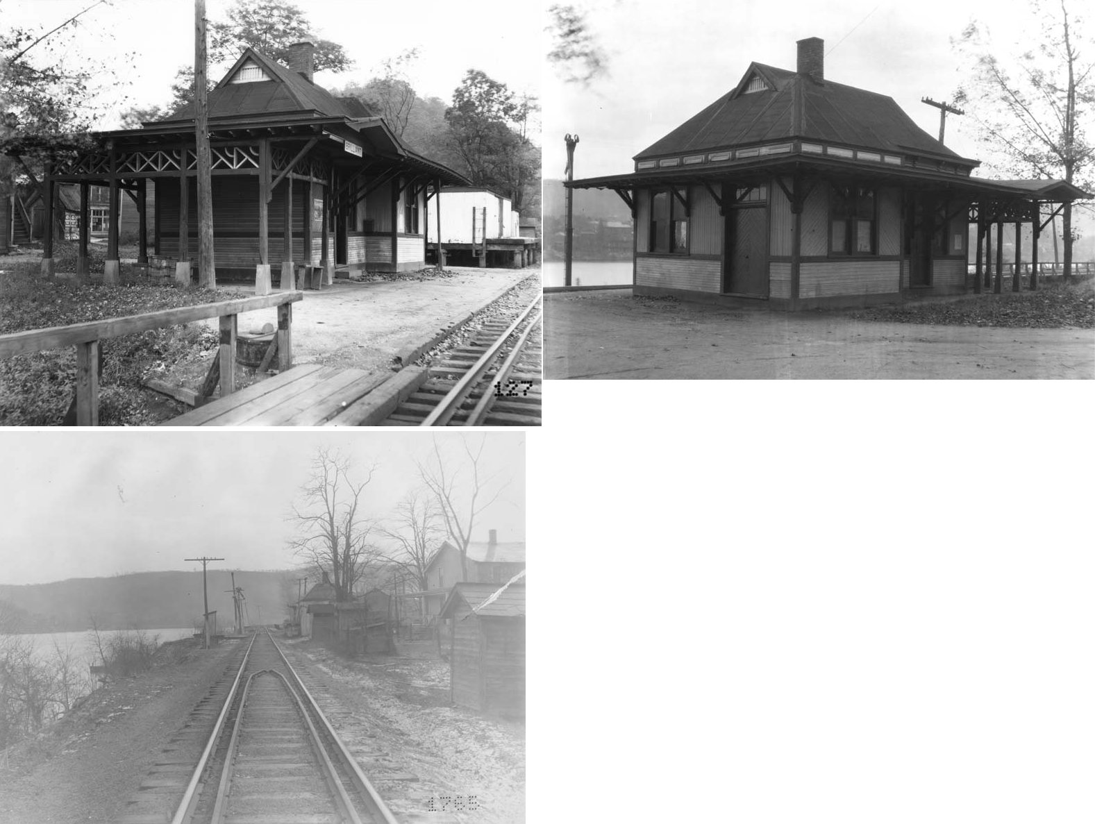
| Brilliant (LaGrange) |
 |
This station sat about 250' north of where Ross Street crossed the tracks (GPS: 40.270964,-80.61995). The town was formerly known as LaGrange and Philipsburg. According to PRR valuation records, this station was built in 1855. | ||||||
| Brilliant (Lagrange) |
|
The W&LE passenger and freight stations were about 300 yards to the east of the PRR station (across market St.) and sat down by the river. (GPS: 40.270693,-80.618432) | ||||||
| Brilliant | |
In later years this old boxcar was used as a station. | ||||||
| Broadacre |
 |
According to PRR valuation records, this station was built in 1870. There was also a stock pen and section foreman's dwelling here. A station is shown here on the 1923 PRR List of Stations & Sidings. | ||||||
| Carman (Carmen) |
|
According to PRR valuation records, a passenger shelter was built here in 1913. This was likely near where Carman Road crossed the tracks at approximately GPS: 40.359881, -80.871545. | ||||||
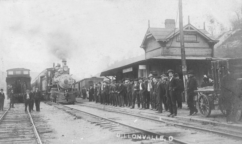
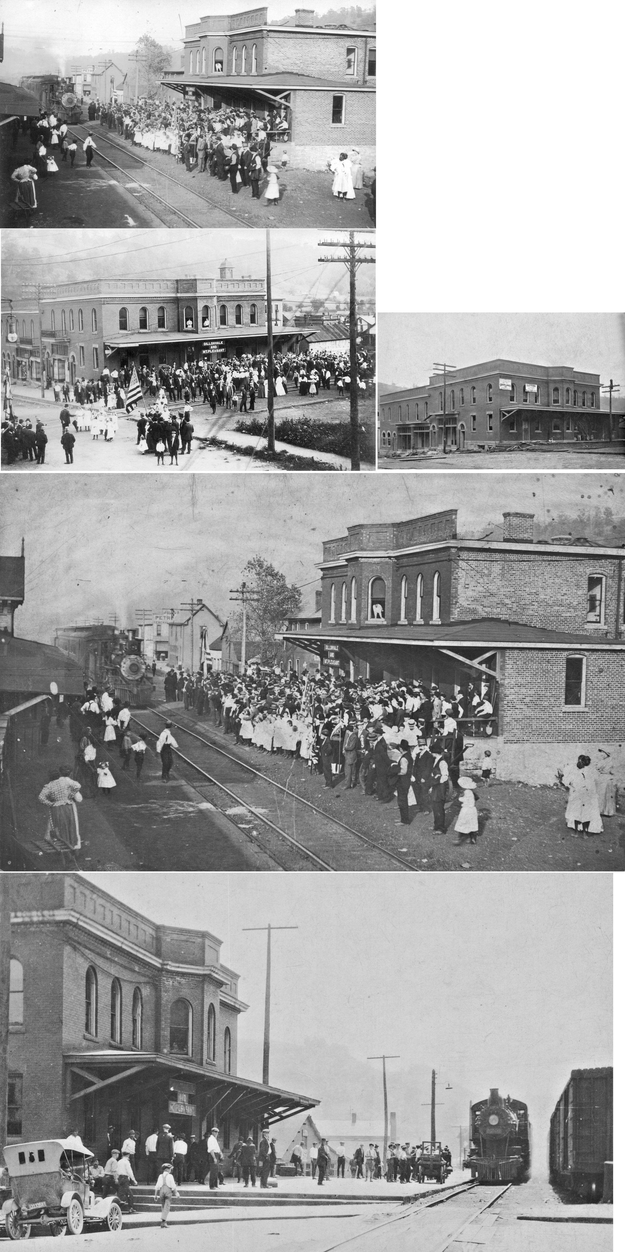
| Dillonvale | |
This was the original station on the Wheeling & Lake Erie and sat on the northwest corner of where Main Street crossed the tracks. The "newer" Dillonvale station (see below) was built in 1905. They were located across the tracks from each other. The two story wood station was torn down around 1910 and replaced with a large one story freight station. | ||||||
| Dillonvale | |
Built in 1905, this building served as offices and passenger station for the W&LE and the W&LE Coal Company. It was torn down in 1985. It sat on the southwest corner of where Main Street crossed the tracks at GPS: 40.196523, -80.776117. The station served both Dillonvale and Mt. Pleasant. | ||||||
| Dillonvale | |
This freight station was on the site of the original passenger station. It was built in 1910 on the NW side of the tracks on the SWside of Main Street at GPS: 40.196634, -80.776254. | ||||||
| Elliotsville | |
This location was 1.25 miles north of Toronto, between Toronto and Freemans Station. There may have been a depot here to serve the American Sewer Pipe Company. | ||||||
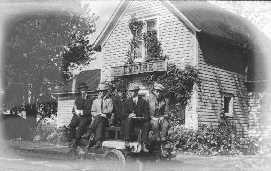
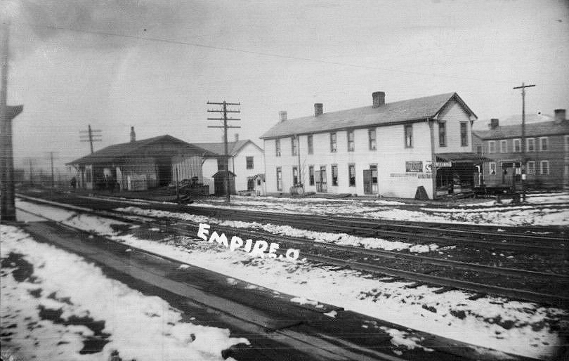
| Empire (McCoys Sta.) |
|
The first station here was on the west side of Wheatley Street, just north of Main Street. The town was known as McCoy's Station in the early years (GPS: 40.508203,-80.62465). | ||||||
| Empire | |
The second station was built just to the north of the original station. It was on Wheatley Street just north of Market Street on the west side of the tracks (GPS: 40.508473,-80.624939). According to PRR valuation records from 1917, this station was built in 1856. Not sure how that date can be correct if this was the second station here. | ||||||
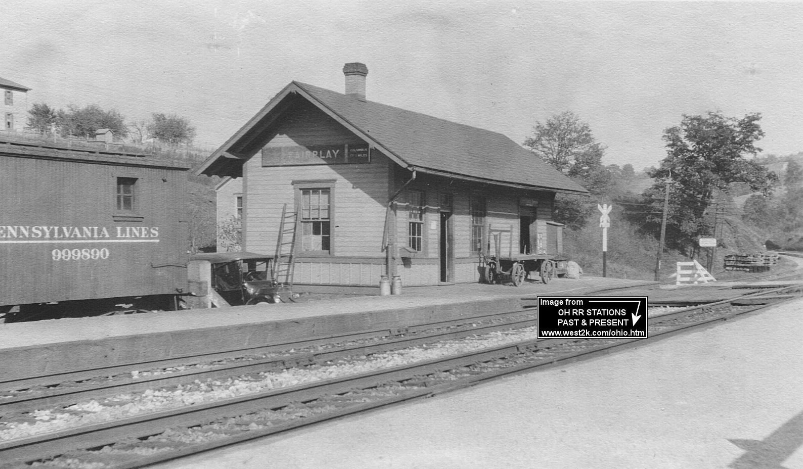
| Fairplay |
|
According to PRR valuation records, this station was built in 1898. There was also a railroad bunkhouse here. | ||||||
| Fernwood |
|
According to PRR valuation records, this station was built in 1880. A station is shown here on the 1923 PRR List of Stations & Sidings. | ||||||
| Freemans Station |
|
This station was 1.75 miles north of Toronto on the west side of the county road (7-F). It was just south of the Freeman Fire Clay Company and was most likely primarily used for employees of that operation. This station is shown on Sanborn maps of Toronto as late as 1903. | ||||||
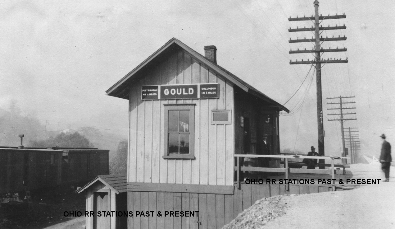
| Gould |
|
According to PRR valuation records, this station was built in 1870. | ||||||
| Hammondsville | |
The station was about where Main Street crosses the tracks. It sat on the east side of the tracks. The station may have been demolished when Main Street was straightened (it used to jog a bit more to the north on the west side of the bridge over the creek). The station was either in, or next to, W.H. Wallace & Sons Dry Goods, which served as the ticket agent and post office in the 1870s. (GPS: 40.5573,-80.70658) | ||||||
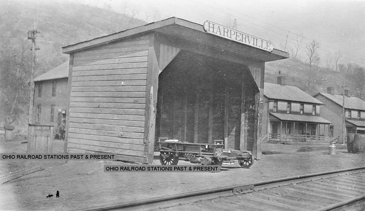
| Harperville | |
There was an 18'x60 one-story station here similar to the one at Bergholz. It was built in 1907 by J.C. Devine for the LEA&W. | ||||||
| Harperville | |
This three-sided passenger shelter was built by the Harris Lumber Company in 1915. It measured 10'x15'. The shelter was likely a replacement for the station above for some reason. | ||||||
| Herrick |
|
This station was between Amsterdam and Germano. A station is shown here on the 1913 LEA&W timetable. Not sure if there was a station building here or just a shelter or platform. | ||||||
| Irondale | |
According to PRR valuation records from 1917, this station was built in 1872. | ||||||
| Jeddo | |
|||||||
| Jeffersonville | AND |
Not sure if this town had two stations originally or a shared station. This town is now the southern part of Steubenville. | ||||||
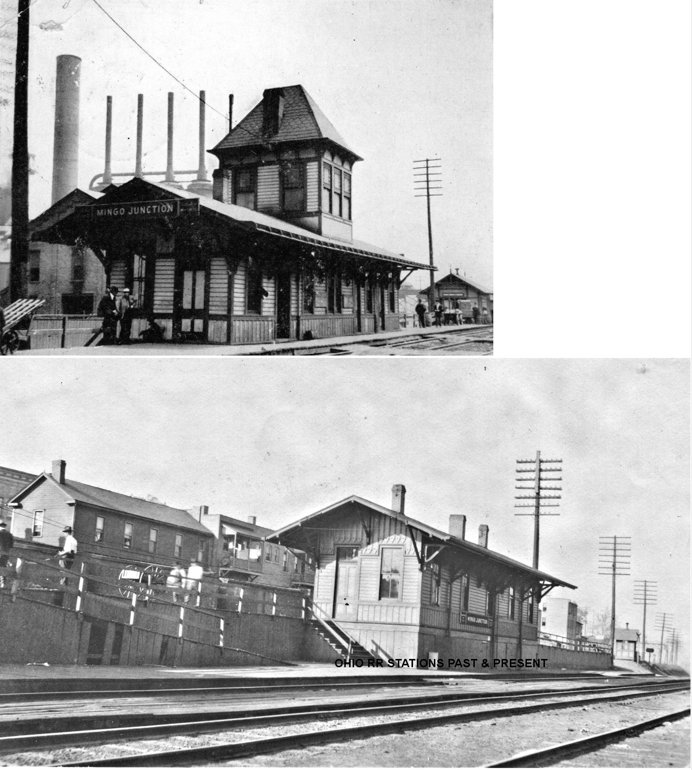
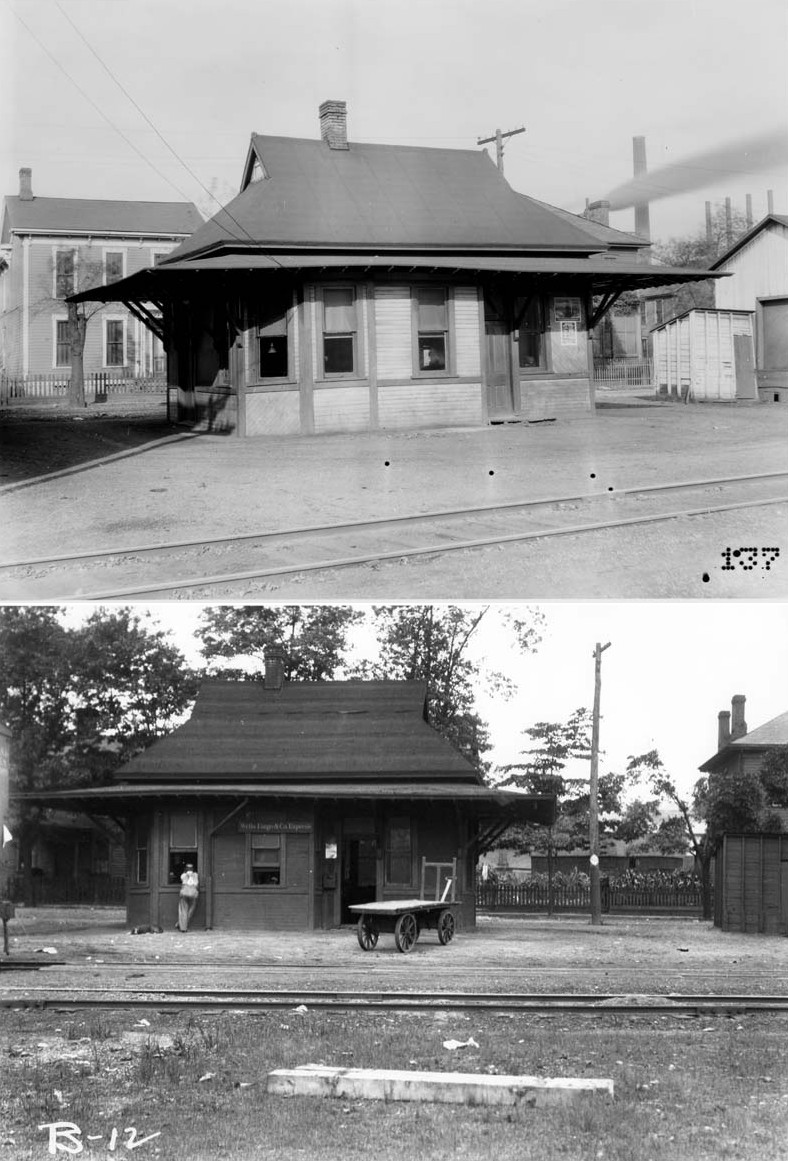
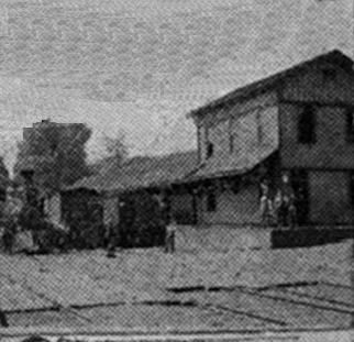
| Mingo Junction | AND |
This station, built in 1888, sat between the C&P and PCC&St.L tracks directly behind 618 Commercial Avenue near the McLister Avenue intersection at GPS: 40.320887, -80.605872. The freight station/baggage house was just to the south as shown in the photo. At some point the tower was removed and the freight station/baggage house was torn down or moved (it's not shown near the passenger station on the 1946 map, see below). | ||||||
| Mingo Junction | |
There was a small freight station with a concrete platform on a stub track behind 750 Commercial Street at GPS: 40.318686, -80.607021. | ||||||
| Mingo Junction | |
The W&LE passenger station sat at 447 Cleveland Avenue near the intersection with Carbon Avenue just south of Wheeling Steel. | ||||||
| Mingo junction | |
The freight station was at 446 Cleveland Avenue next to the passenger station. | ||||||
| Mingo Junction | |
There was a Pittsburgh & West Virginia RR station was near the east portal of Coen Tunnel on the south side of the tracks at GPS: 40.313495, -80.617098. It was similar in design to the station at Hopedale (Harrison County). | ||||||
| New Alexandria |
|
According to PRR valuation records, a shelter was built here in 1885. It's not clear if this was used for passengers or something else. There was also an interlocking tower here. A station is shown here on the 1923 PRR List of Stations & Sidings. | ||||||
| Panhandle | |
There was a passenger shed here as it served as a flagstop only. This was located where the LEA&W crossed the PCC&St.L around GPS: 40.359287, -80.868684 west of Unionport near the Harrison County line. | ||||||
| Phillips | |
According to NYC records, there was only a freight station here. It measured 10'x12' and was property of the Wolf Run Coal Company. However, a passenger station is shown here on the 1913 LEA&W timetable. | ||||||
| Pine Valley | |
|||||||
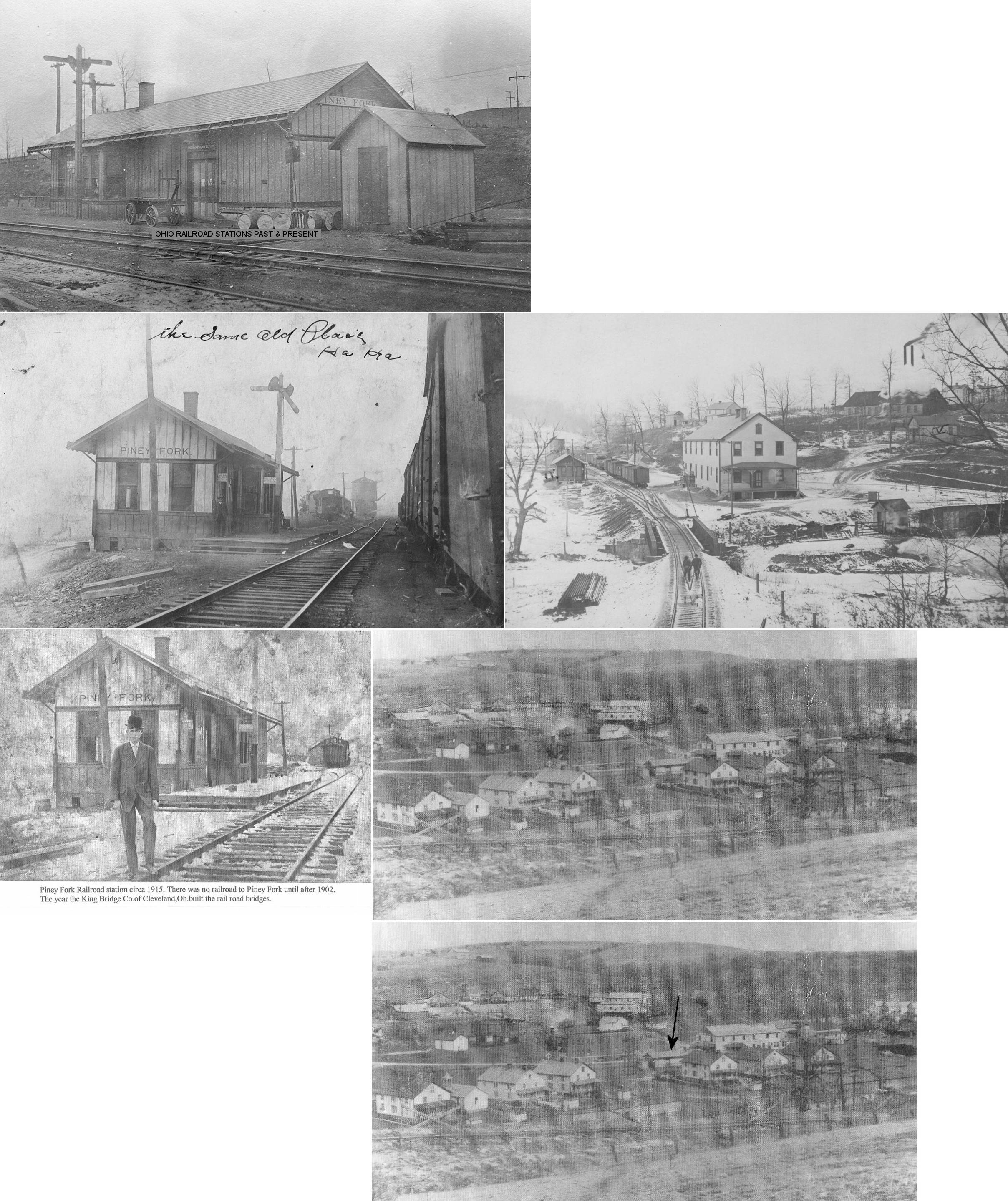
| Piney Fork | |
According to NYC valuation records, this combination station was built in 1902 and measured 16'x60'. | ||||||
| Port Homer | |
A station is shown at this location in 1871. A station is also shown here on the 1923 PRR List of Stations & Sidings. | ||||||
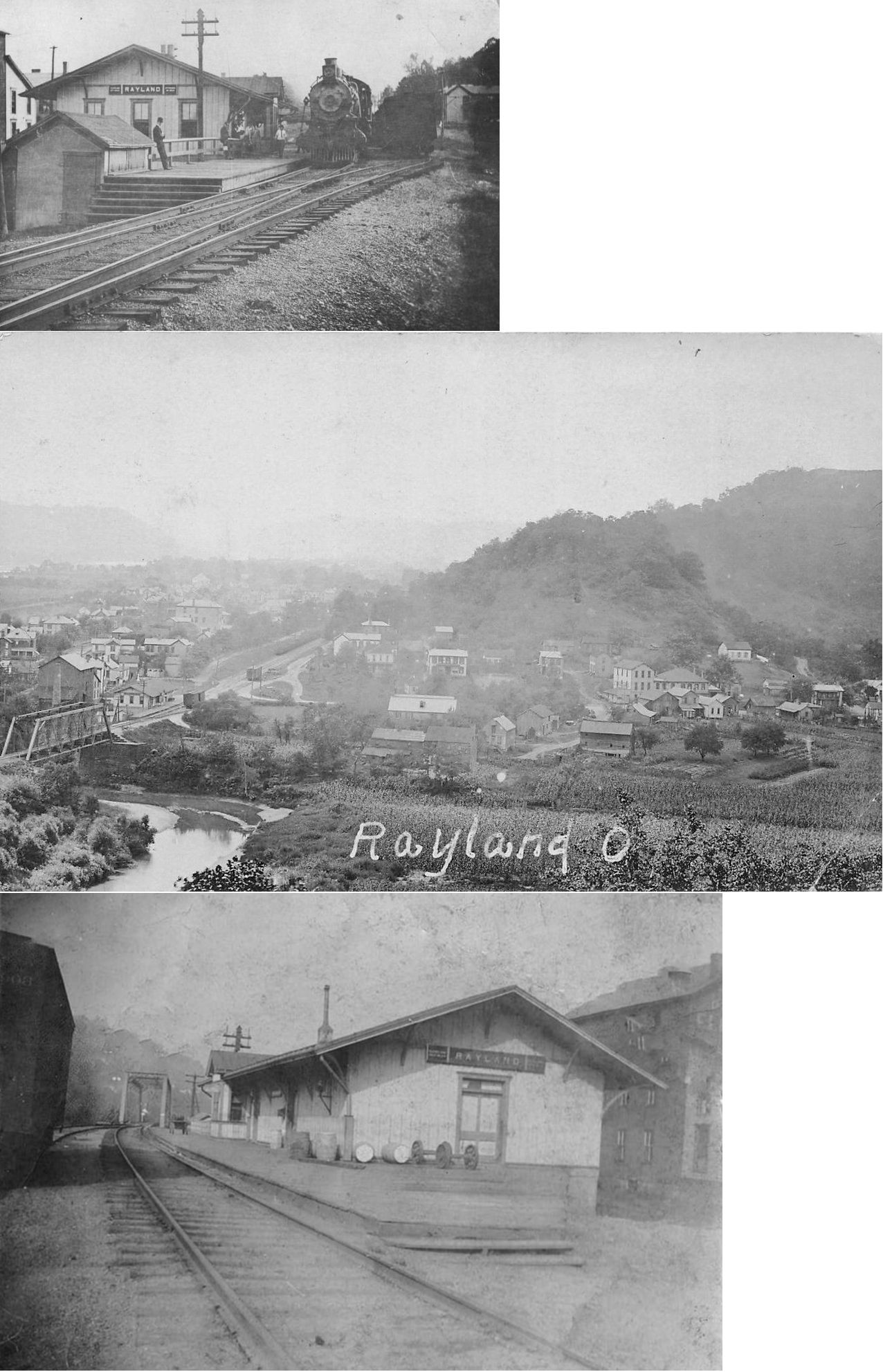
| Rayland (Portland Depot) |
|
The first station here was on the SE corner of Main (SR-150) and Church Street. This station is shown on maps from 1871 when the town was known as Portland Depot (GPS: 40.187769,-80.689637). The PRR changed the name of the station from "Portland" to "Rayland" in 1905. | ||||||
| Rayland | |
The second generation station was on the NE corner of Cleveland Avenue/Church Street and SR-150 (GPS: 40.188101,-80.68947). According to PRR valuation records of 1917, this station was built in 1856, so this may have been the original station moved to a new location. | ||||||
| Rayland (Portland Depot) |
|
The W&LE reached Rayland in 1890. | ||||||
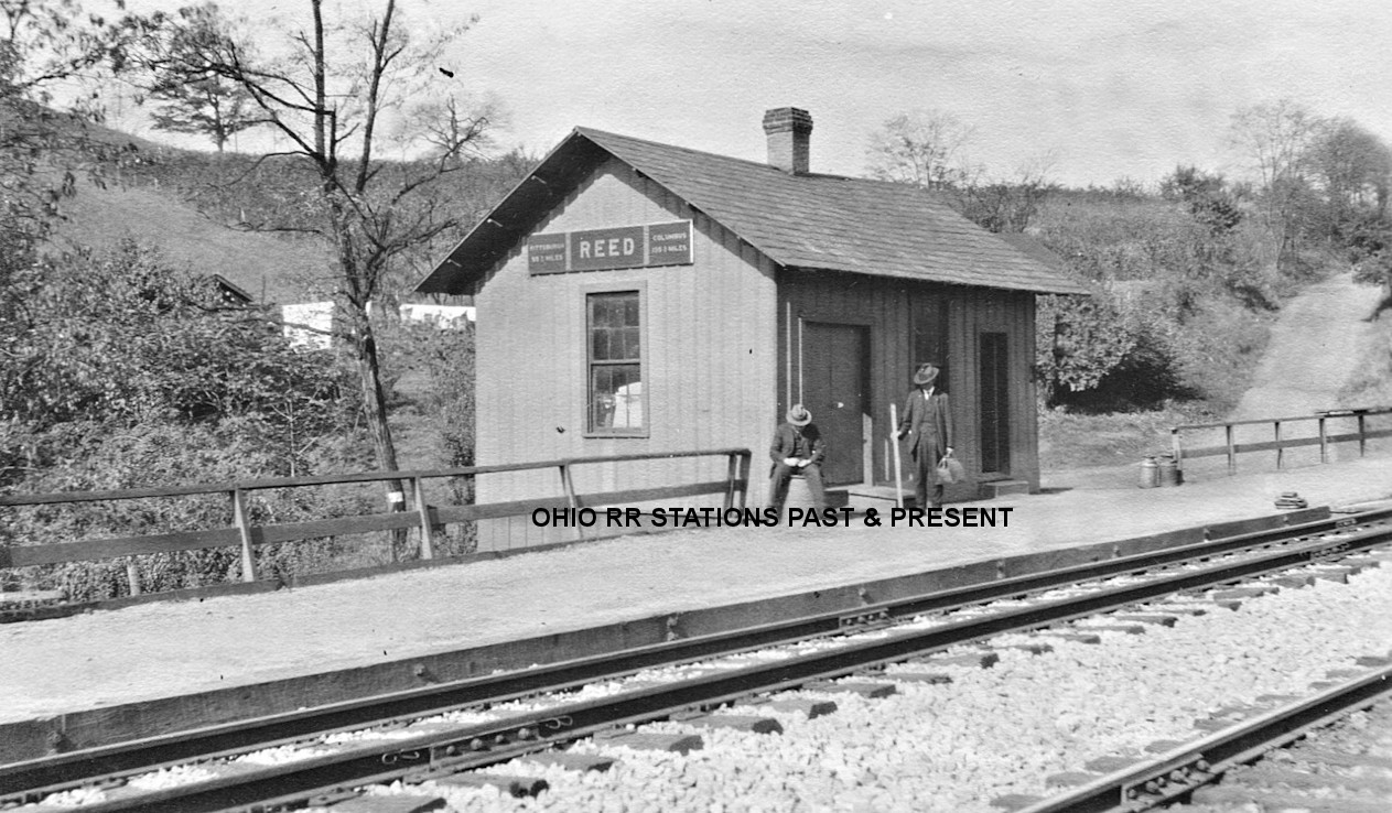
| Reeds Mill (Reed) |
|
According to PRR valuation records, this station was built in 1883. A station is shown here on the 1923 PRR List of Stations & Sidings (listed as "Reed"). | ||||||
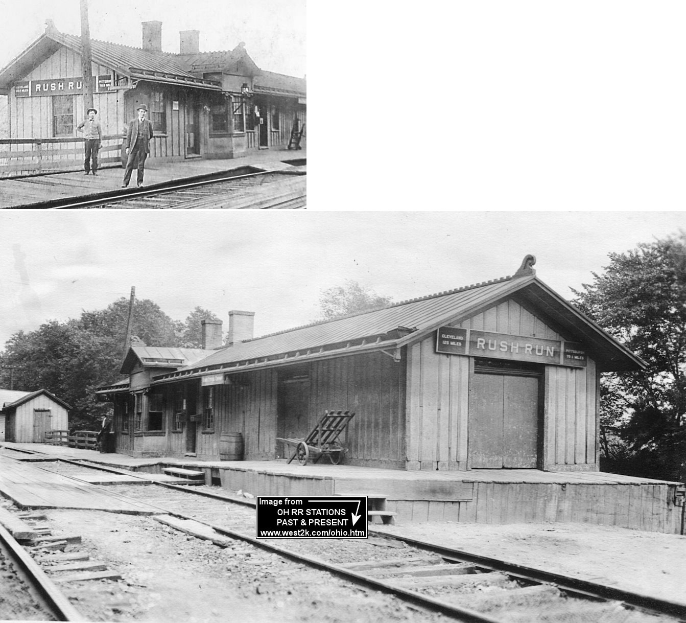
| Rush Run | |
According to PRR valuation records from 1917, this station was built in 1873. The station was 1/2 mile from the junction with the Rush Run Branch which had no stations and only served collieries and a sand company. | ||||||
| Salt Run | |
According to PRR valuation records, this passenger station was built in 1885. It was in the vicinity of GPS: 40.245595, -80.657475. A station is shown here on the 1923 PRR List of Stations & Sidings. | ||||||
| Skellys Station (CResswell) |
|
|||||||
| SloanEs Station (Toronto) |
|
This town was on the southern border of Knox Township. It is now part of Toronto. In 1853 the pioneer pottery of Carlyle & McFadden was founded. And in 1856 the Cleveland & Pittsburg Railroad came to the village which was originally known as Newberg. Because the railroad already had a station called Newburg on its line near Cleveland, this one was given the name Sloane's Station after William Sloane who was liberal in granting a right of way for the railroad. In 1880 there were still only 500 people in the village but it had already spread beyond its original boundaries. The first C&P station here was on the south side of Henry Street, on the west side of the tracks at GPS: 40.463564,-80.602167. It is shown on maps from 1871 when the town was known as Sloane's Station. The PRR officially changed the name of the station to Toronto in 1881. According to PRR valuation records from 1917, a new station was built here in 1887. | ||||||
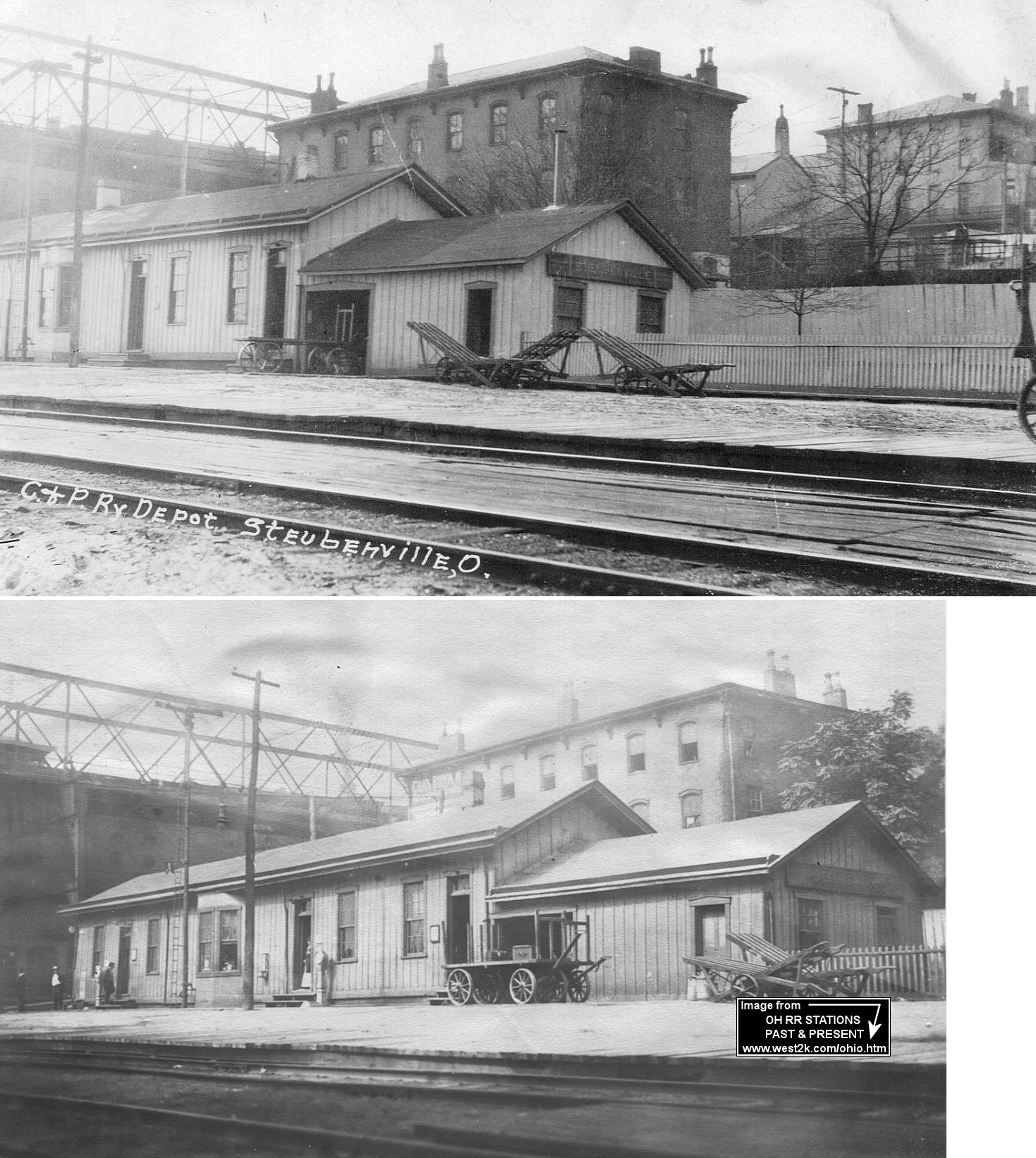
| Steubenville | |
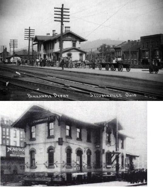
The first passenger station was the second building south of the SW corner of Washington and 6th Streets. It was most likely a converted store or house as the building sat perpendicular to the tracks with frontage on North 6th Street with a platform in the rear of the building along the tracks. This station is shown on maps from 1871 and was demolished when the new station was built in 1879 and maps then show a park area there on the site of the new station. (GPS: 40.362283,-80.617021) | ||||||
| Steubenville | |
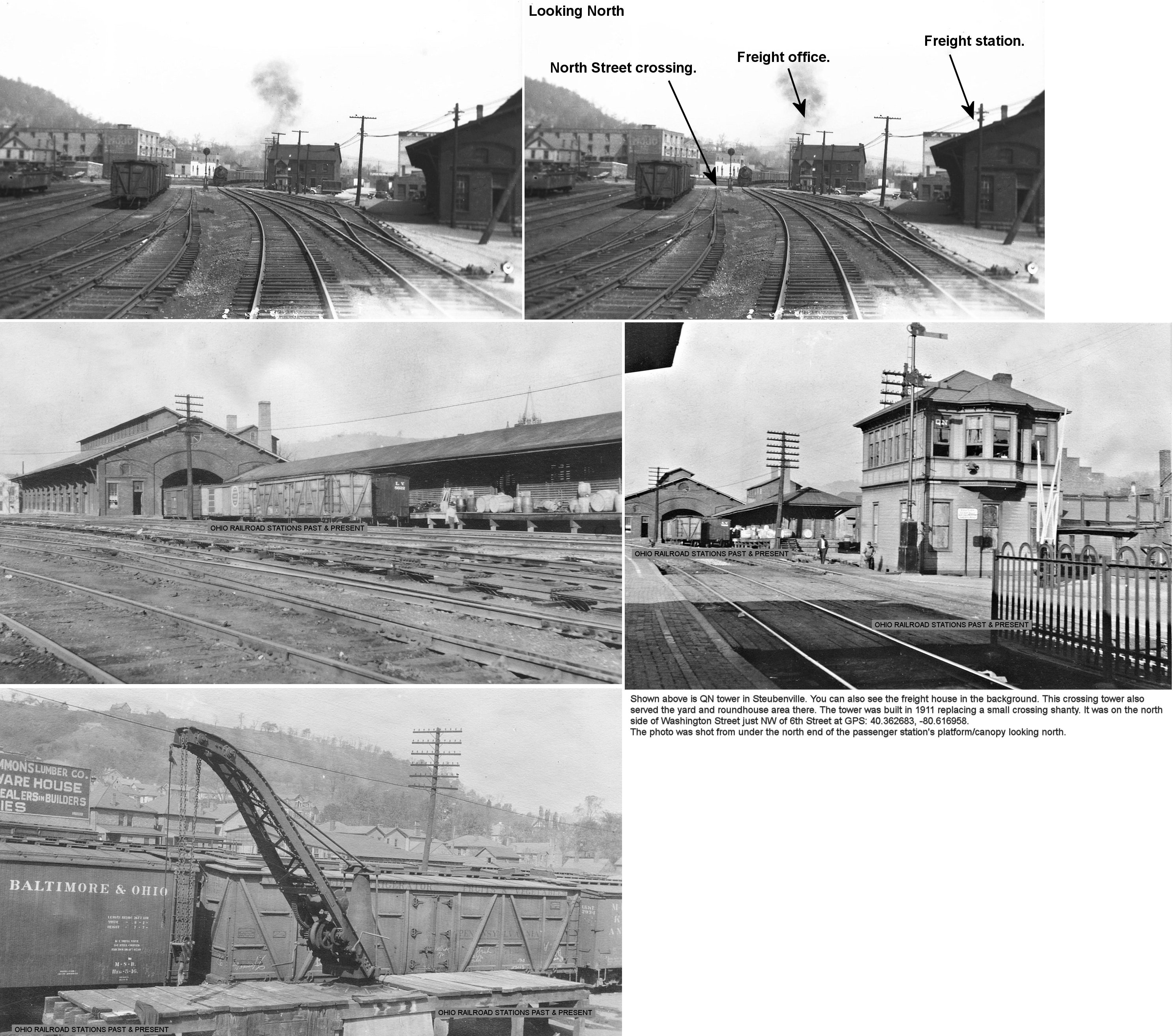
The first PCC&St.L freight house was north of the passenger station. It was on the north side of Washington Street, on the east side of the tracks (across from the roundhouse and repair shops). This freight station is shown on maps from 1871. (GPS: 40.362798,-80.616893) | ||||||
| Steubenville | |
This second generation passenger station was built in 1879. According to Sanborn Fire Insurance maps, this station sat on North 6th Street between Market and Washington Streets. Surprisingly this station was moved (around 1911) to a new location nearby when the newer station (listed below) was built by the PRR. The photos show the station in its original location and being moved. (GPS: 40.36185,-80.617343) | ||||||
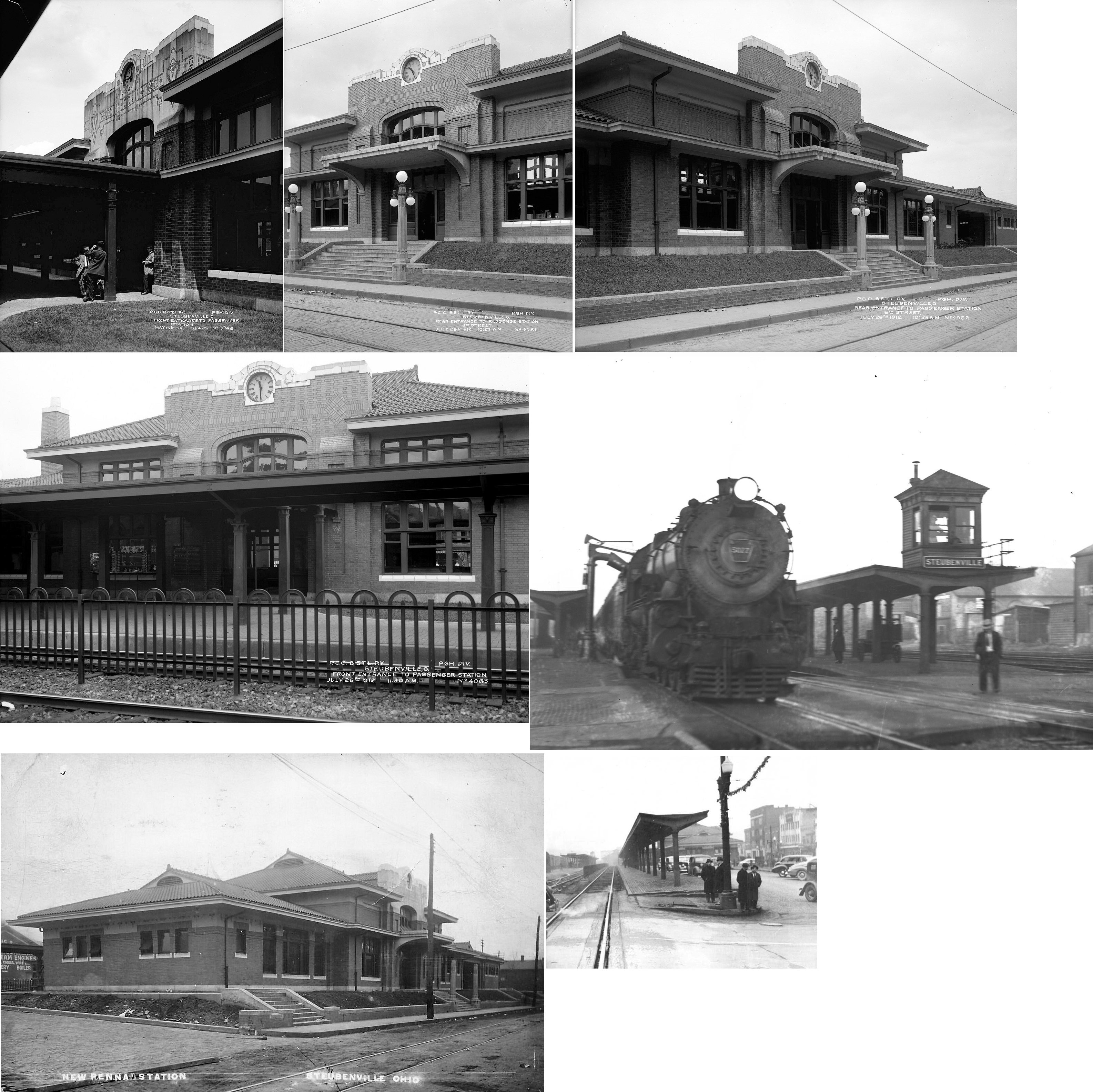
| Steubenville |  |
The third generation station on the PCC&St.L line was constructed by the PRR which built a larger station at the same location as the station listed above. Sanborn maps show a larger station building there with the date built as 1911 listed (PRR valuation records confirm that date). This new station included a tunnel under the tracks with stairs or an elevator to a platform with a canopy between the tracks. (GPS: 40.36185,-80.617343). | ||||||
| Steubenville | |
A second generation freight house was constructed just north of the original freight house at the corner of 6th and North Streets in 1881 (according to PRR valuation records). (GPS: 40.363542,-80.616603) | ||||||
| Steubenville |  |
The Pittsburgh Wheeling & Kentucky Railroad was merged into the PCC&St.L in 1917. Does anyone know where this station was located? The photo of the station is from 1897. | ||||||
| Steubenville | |
The first C&P River Division passenger station was next to Brinkman's Hotel in a grain mill at the corner of Market and North Water Streets. The station opened in the grain mill in October 1856, but burned down in December 1856. An old railroad car was used as a temporary station until a new depot was built (see listing below). | ||||||
| Steubenville | |
The second C&P station was built in 1857 below South Street. | ||||||
| Steubenville | |
The third generation station was built in 1864 just below the Market Street bridge on Water Street at GPS: 40.359023, -80.611460. PRR valuation records say that the station was built in 1867. | ||||||
| Steubenville | |
An early C&P freight house was east of the corner of Slack and High Streets (east of the curve in Dean Martin Boulevard). It was on the east side of the tracks (GPS: 40.354058,-80.61318). The C&P freighthouse here burned down on September 12, 1888. A new freight house was built to replace it soon after. That second freight house had a two-story head end on the south side of High Street at GPS: 40.355362, -80.613110. | ||||||
|
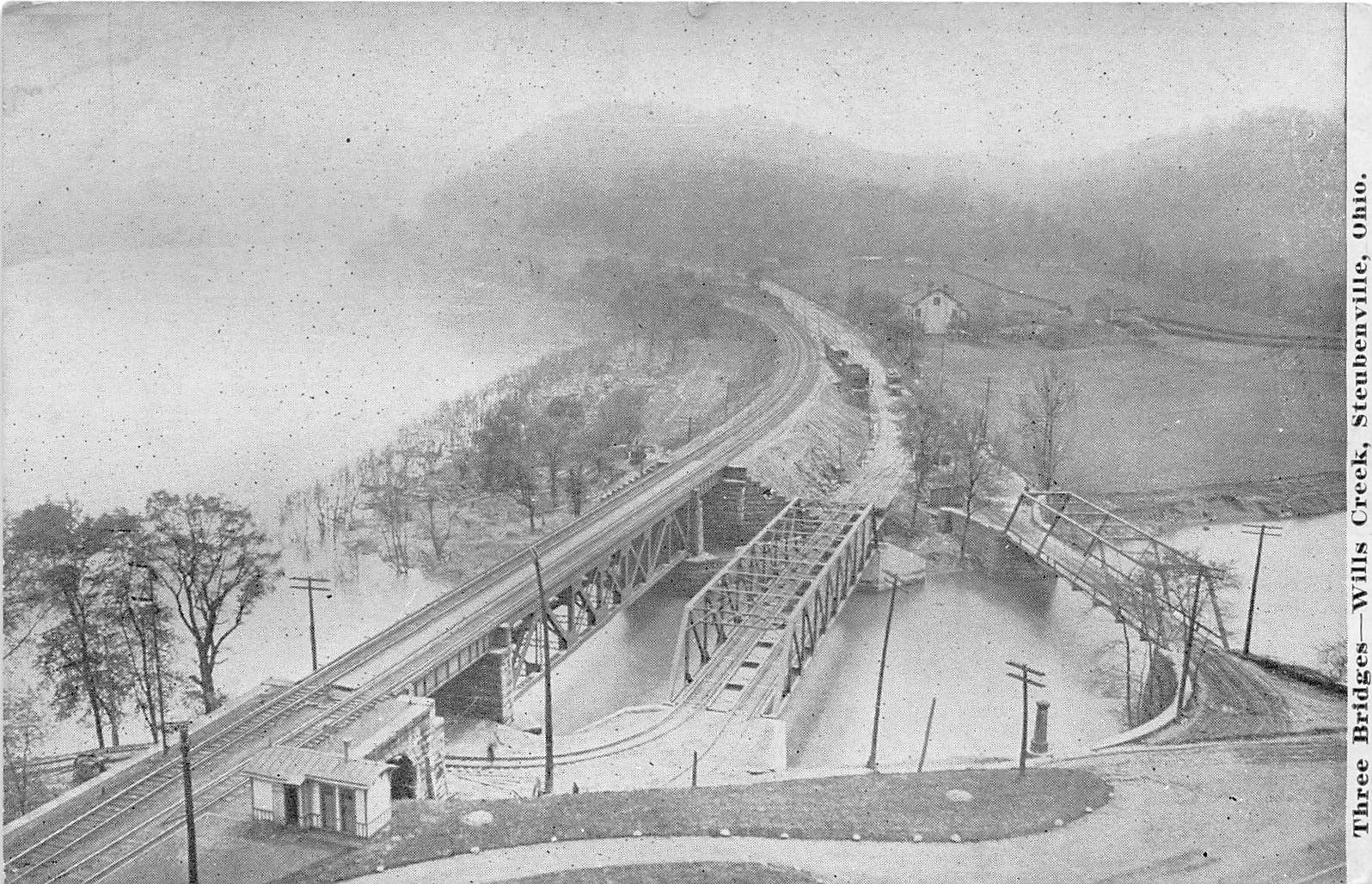
Steubenville (WIlls Creek) |
|
This station was on the north bank of Wills Creek near the Ohio River. | ||||||
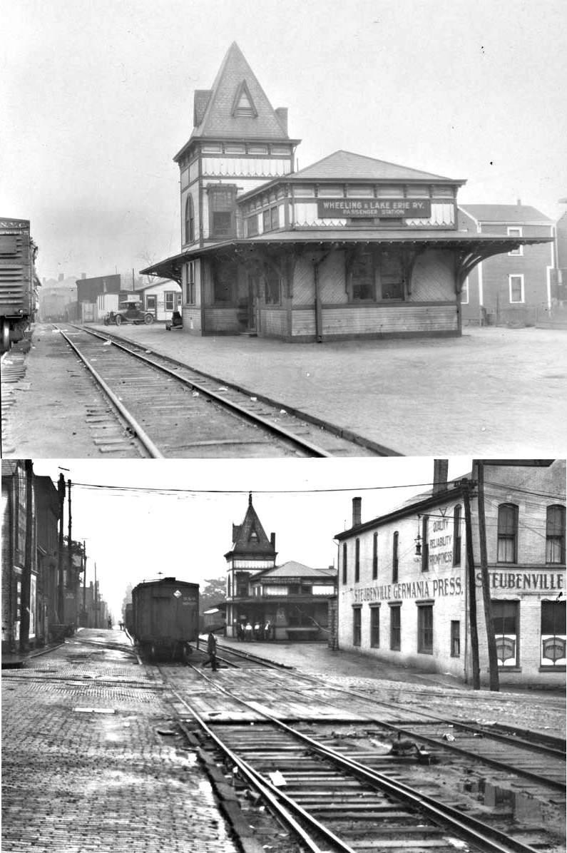
| Steubenville | |
The W&LE passenger station sat behind Mosgrove's New U.S. Hotel which was at the corner of Market and North High Streets (now Dean Martin Boulevard). The station was at GPS: 40.359904,-80.612419. | ||||||
| Steubenville | |
The W&LE freight house was on South Lake Erie Avenue between Adams and Market Streets right where the Historic Fort Steuben Museum is today at GPS: 40.358478, -80.613199. | ||||||
| Tiltonville | |
PRR valuation records of 1917 list only a platform here that was built in 1910. There was no mention of a carbody station in the records for that year, so the carbody may have been removed by then. | ||||||
| Toronto (SloanEs Station) |
|
See entry for Sloanes Station above. | ||||||
| Toronto | |
According to the 1903 Sanborn Fire Insurance map, the second generation station sat on the north side of Clark Street just east of 5th Street on the west side of the tracks. It was across the street from the Toronto Steam Laundry and diagonally northwest of the Hotel Windsor. The station was a combination station with passenger and freight buildings joined together. (GPS: 40.466735,-80.601931) | ||||||
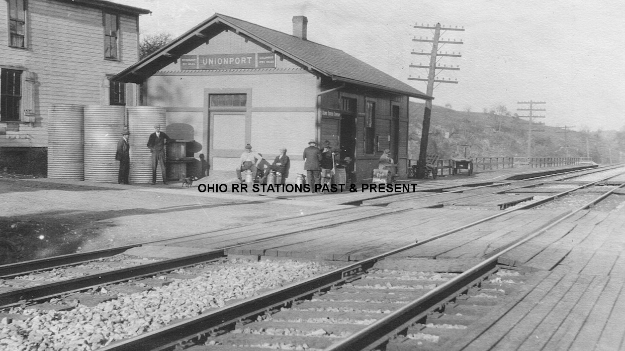
| Unionport |
|
The first station here was a combination depot/post office on the east side of SR-39, on the north side of the tracks (GPS: 40.358301,-80.84936). This station is shown on maps from 1871. A new station was built here in 1899 according to PRR valuation records. | ||||||
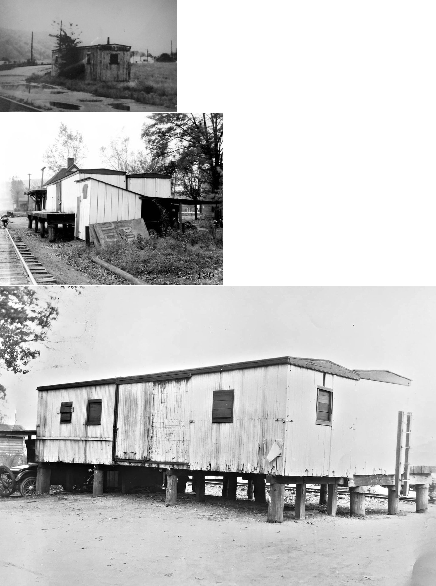
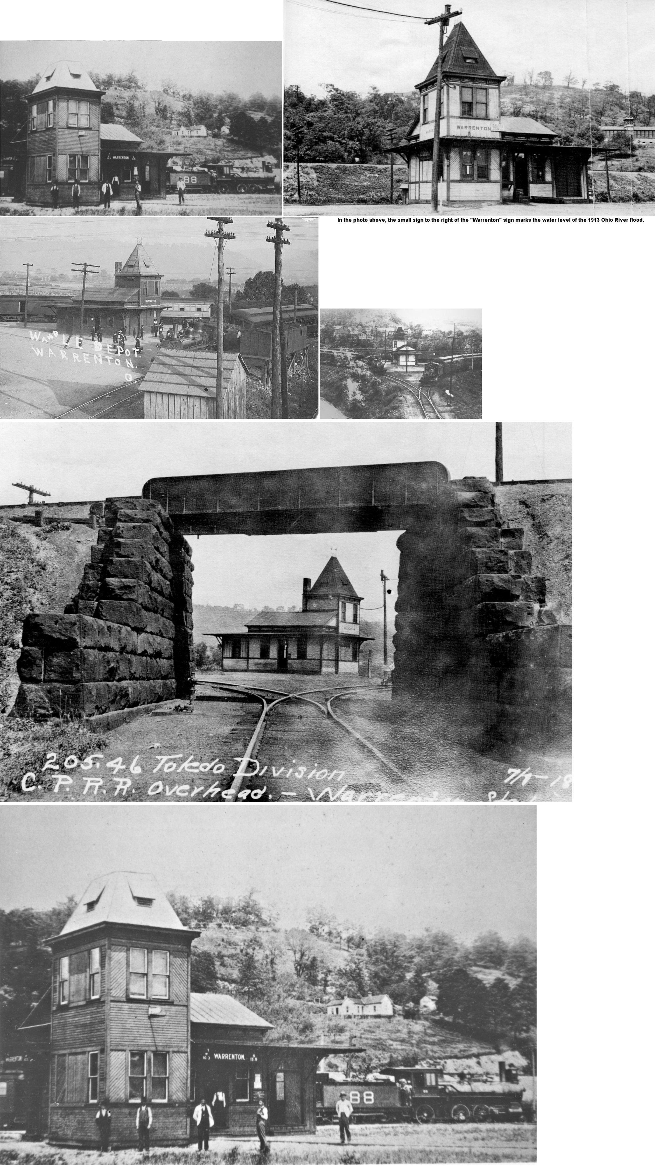
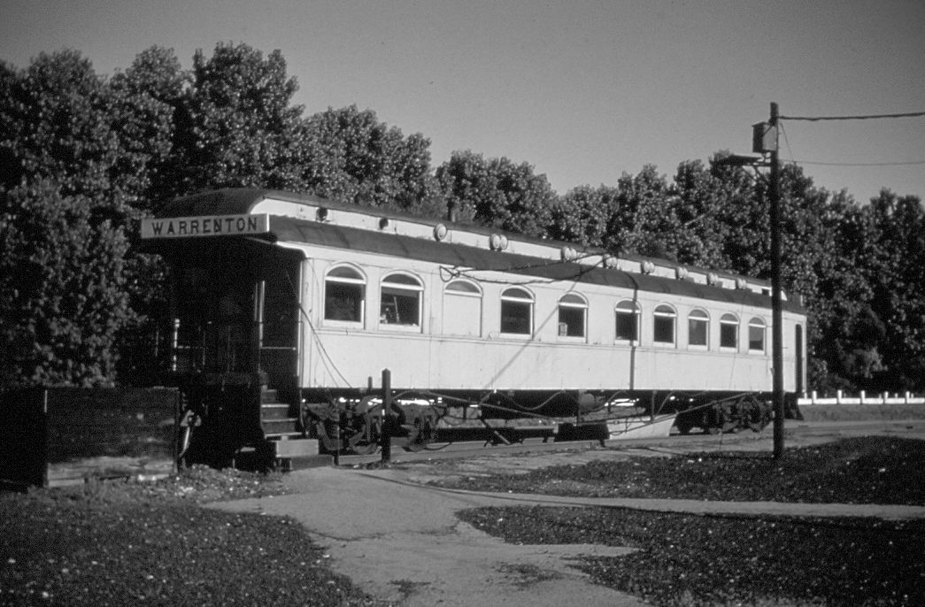
| Warrenton | |
This station was located just to the SW of the exit off SR-7 onto Old SR-7. The Rayland C&P station can be seen in the background (to the right of the foreground station) of this photo as it was located just across Short Creek to the south. (GPS: 40.190291,-80.686314) | ||||||
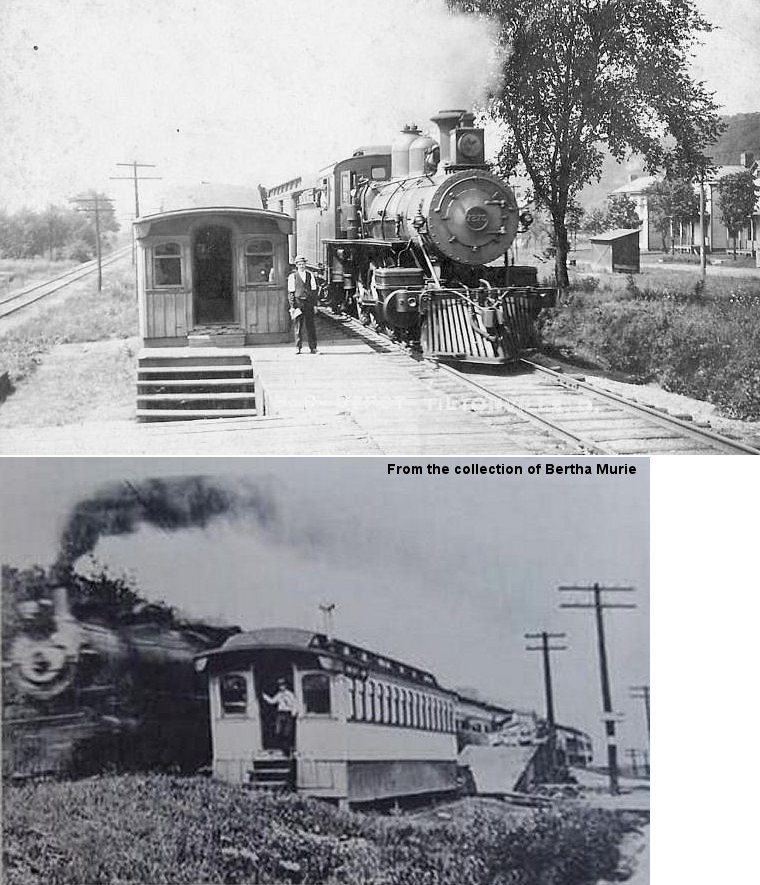
| Warrenton | |
In later years, after the station was gone, an old W&LE business car served as the station here. | ||||||
| Weems (Smithfield Station) |
|
This station was on CR 25 (Weems Road) at GPS: 40.286896,-80.753701. It was torn down in 2015. Also known as Smithfield Station and Holmes Mills prior to that. | ||||||
|
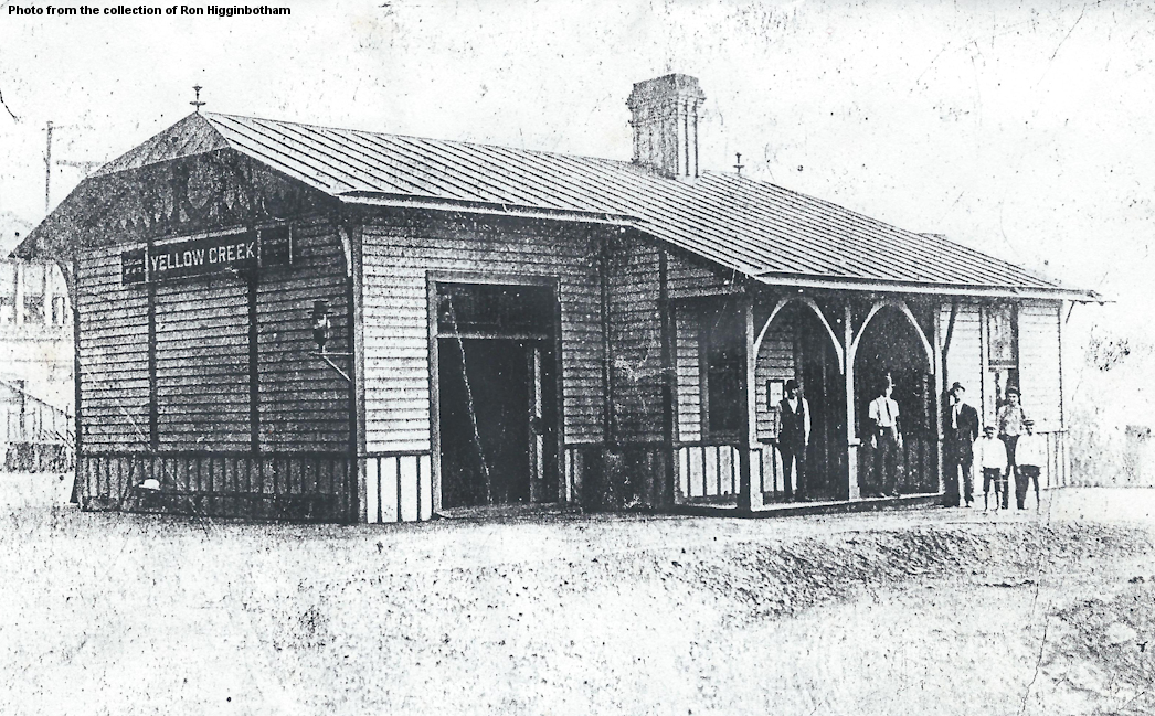
Yellow Creek (Linton) |
|
This station was south of the Yellow Creek Bridge. The Jefferson County Children's Home can be seen in the background of the photo. This is now where the Route 7 rest area stands. According to PRR valuation records from 1917, this station was built in 1886. | ||||||
| Yorkville | |
|||||||
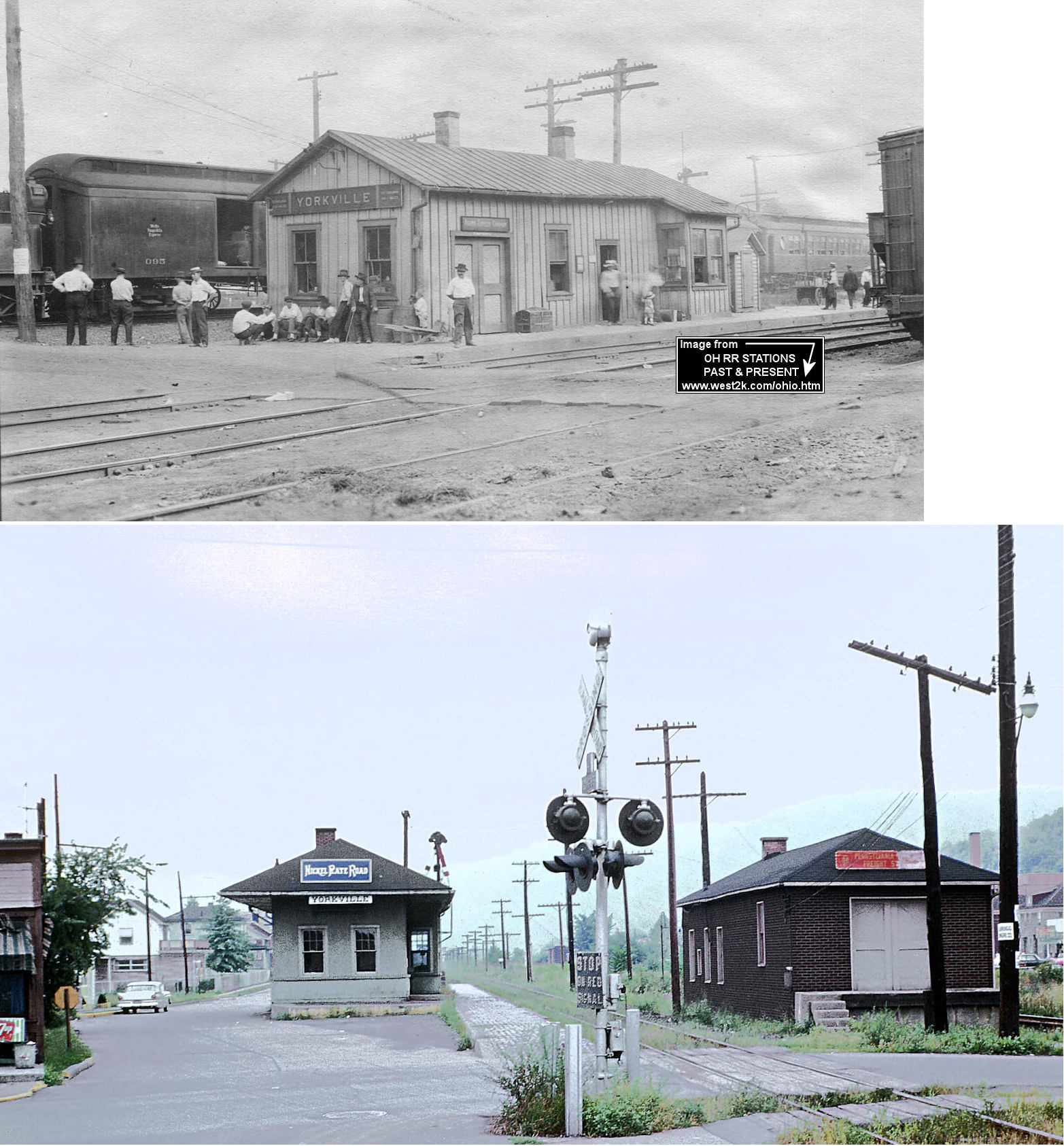
| Yorkville | |
This second generation station, built in 1916, sat along 4th Street between Garden Avenue and County Road 2. It was two blocks north of the Belmont County line. It was torn down in the mid-1970s. | ||||||
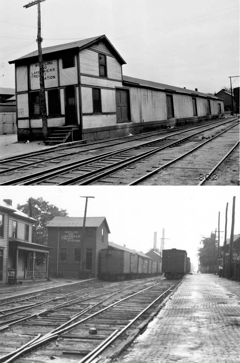
| Yorkville | |
This station was across the tracks from the W&LE station along the C&P. PRR valuation records say that the station was built in 1870. In later years the station was stripped of its distinguishing features and covered with Insul-brick like many others in the system in Ohio. This modification, and its location next to the W&LE station, is shown in the second photo. | ||||||
| Yorkville | |
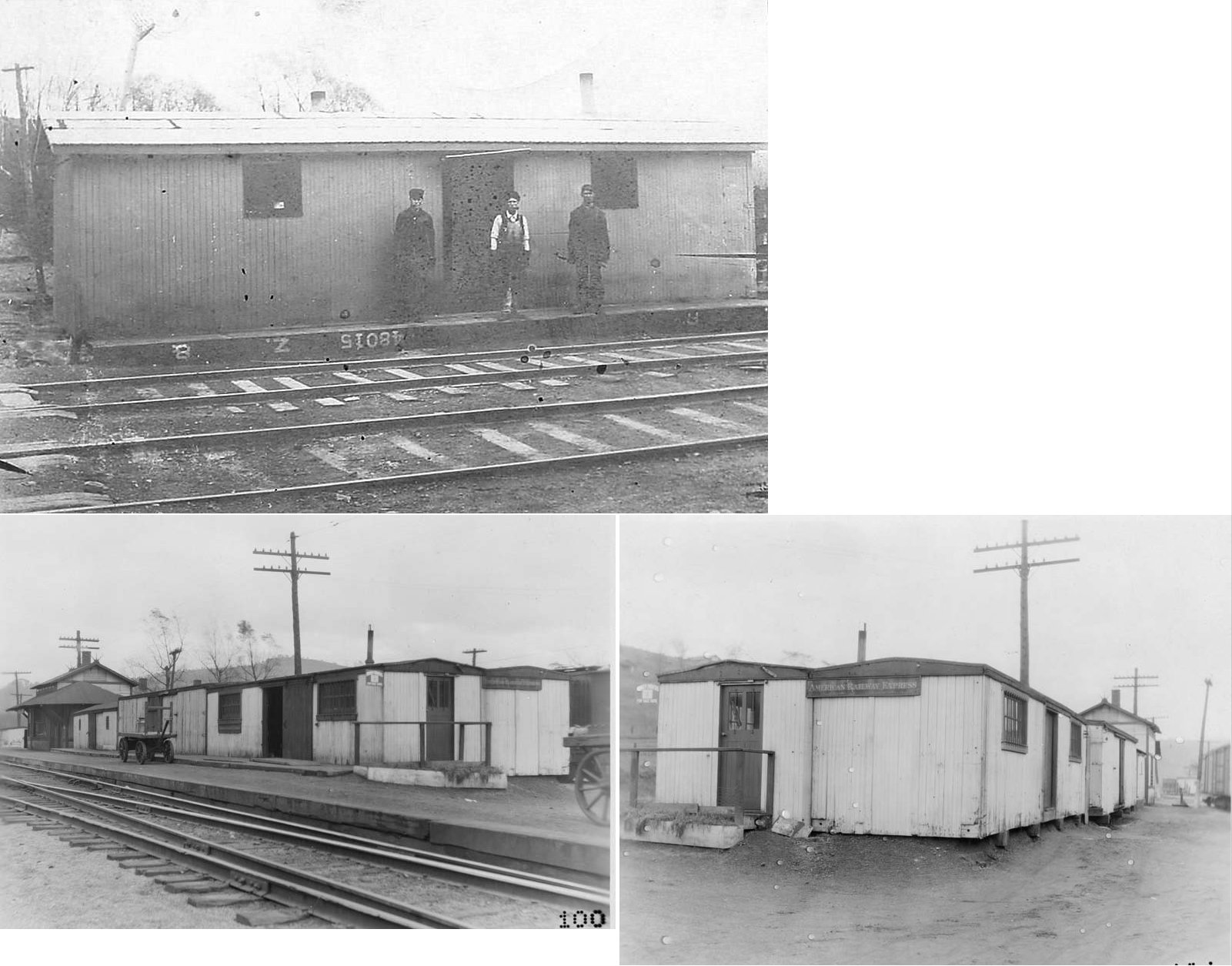
PRR valuation records from 1917 list a freight station at Yorkville made of four old boxcar bodies that were placed here around 1913-1916. | ||||||
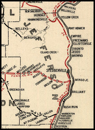
| 1898 JEFFERSON COUNTY RAILROAD MAP | ||||||||
 |
||||||||
|
Notes About Existing Stations... Dillonvale (LEA&W) - This Lake Erie, Alliance & Wheeling (later LS&MS then NYC) station has been under private ownership since the late 1950s. According to NYC valuation records, the station was built in 1907 and measures 18'x60'. This was the terminus of the LEA&W. |
||||||||