 COUNTY COUNTY
|
|
||||||||
| EXISTING STATIONS | ||||||||
|---|---|---|---|---|---|---|---|---|
| Station Name |
Original Railroad | Current Location |
Type | Current Use |
Date Built |
Track Status |
Building Material |
More Info |
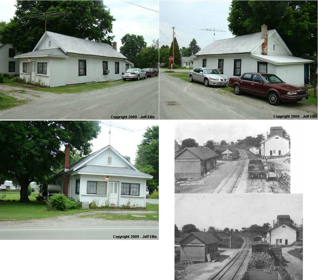
| East Monroe |  |
10812 SR-28. Corner of SR-28 and Highland Street. (GPS: 39.358711,-83.498012) | P | Residence | ???? | In Use | Wood |
|
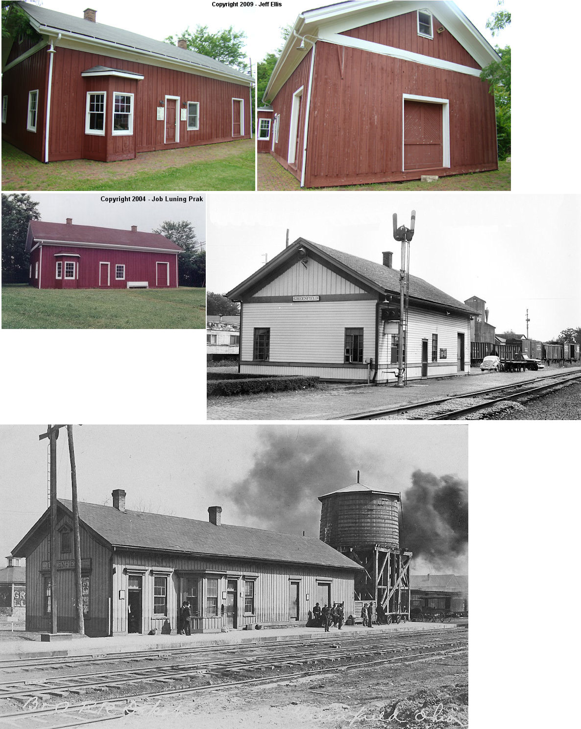
| Greenfield |
 |
211 North McArthur Way (GPS: 39.353783,-83.379329) |
C | Business | 1878 | None | Wood |
|
| Greenfield |
 |
North McArthur Way, next to the station above. (GPS: 39.353329,-83.37905) | C | Society | 1854 | None | Wood |
|
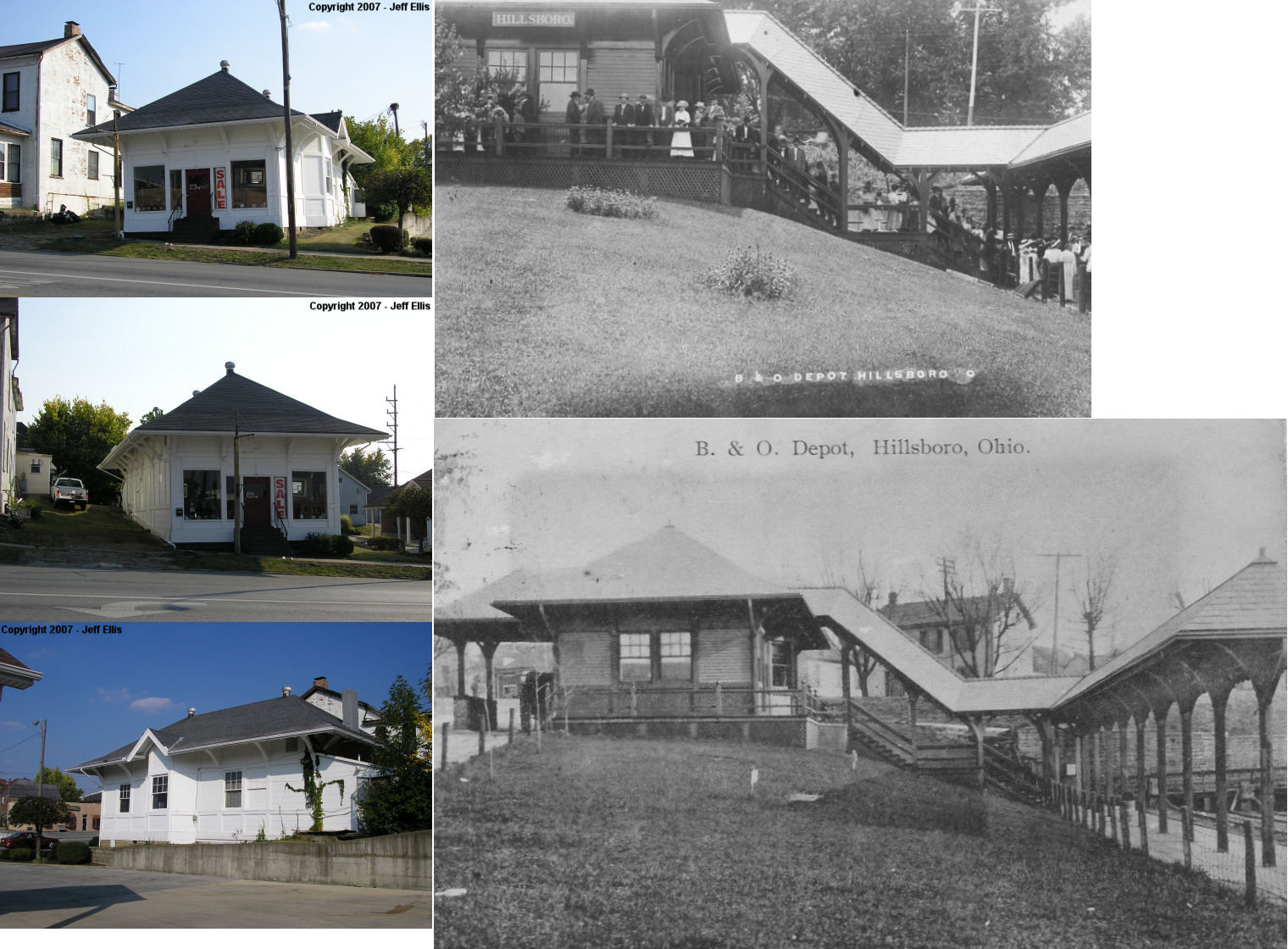
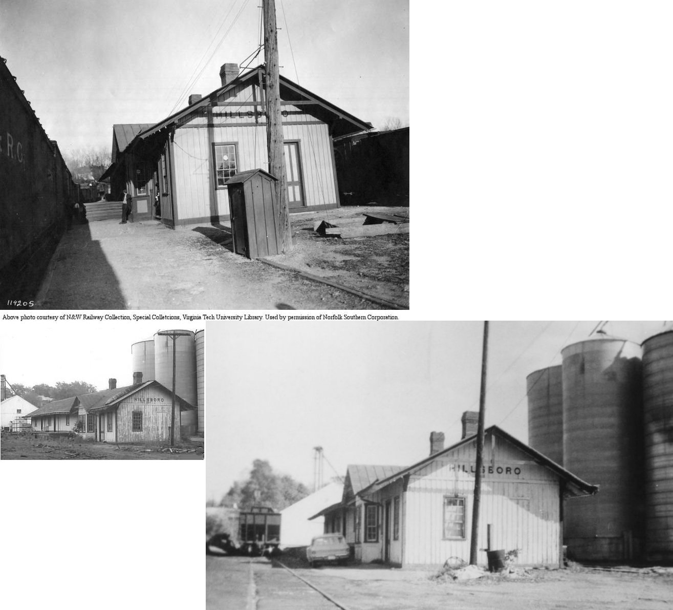
| Hillsboro | |
211 West Main (GPS: 39.202427,-83.614427) |
P | Business | 1892 | Gone | Wood |
|
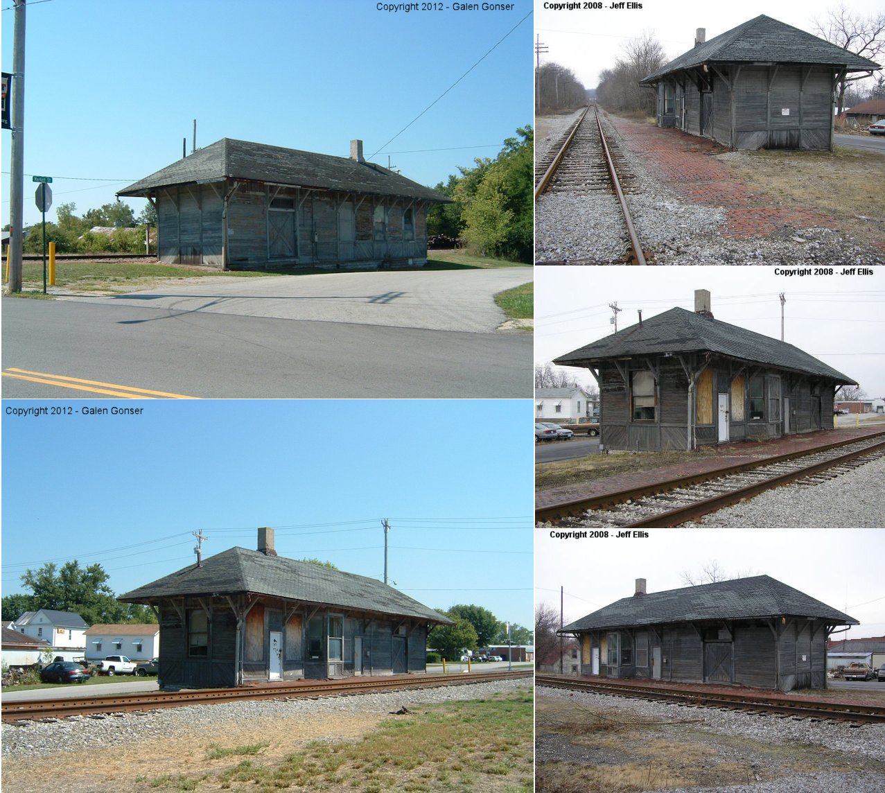
| Leesburg | |
West side of South Fairfield Street at Market Street (GPS: 39.343458,-83.554314) |
C | Railroad | 1899 | In Use | Wood |
|
| STATIONS OF THE PAST | ||||||||
| Station Name |
Original Railroad |
Notes | ||||||
| East Danville (Straight Out) |
 |
Prior to being called East Danville, this town was called Straight Out Station. | ||||||
| East Monroe |
 |
The first station here was on the west side of Monroe Street, on the south side of the tracks. (GPS: 39.357504,-83.499449) | ||||||
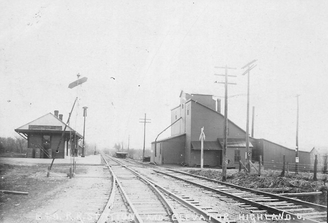
| Highland |
|
Formerly known as New Lexington Station, a new station was built here in 1901 (Hillsboro News Hearld, 4-4-1901). | ||||||
| Hillsboro |
|
The original M&C station was a combination station built in 1880 (The Highland Weekly News, 3-25-1880). It was on the NE side of the tracks between Main and Beech Streets at GPS: 39.203505, -83.615421. After the new passenger station was built, it served as the freight station. It burned down on April 23, 1896 (Marietta Daily Leader, 4-24-1896). | ||||||
| Hillsboro | |
In 1892 a new freight station was built on the west side of the tracks on the north side of Main Street at GPS: 39.203170, -83.615583. Both the new and old freight stations were still standing when the old one burned down. | ||||||
| Hillsboro |
 |
A new station was built here in 1880 (The Highland Weekly News, 2-19-1880). It was on the west side of North West Street at GPS: 39.207103, -83.613211. | ||||||
| Hillsboro | |
This station was on the east side of North West Street at GPS: 39.207156, -83.612417. It was built in 1907 to replace the station listed above (Hillsboro News Herald, 10-10-1907). | ||||||
| Leesburg |
|
The original passenger station was on the east side of Fairfield Street. It was replaced by the existing station in 1899 (Hillsboro News Herald, 6-29-1899). The 1899 map shows both stations standing, one on each side of Fairfield Street with the one on the east labeled as "Old Passenger Depot." (GPS: 39.3435,-83.553734) | ||||||
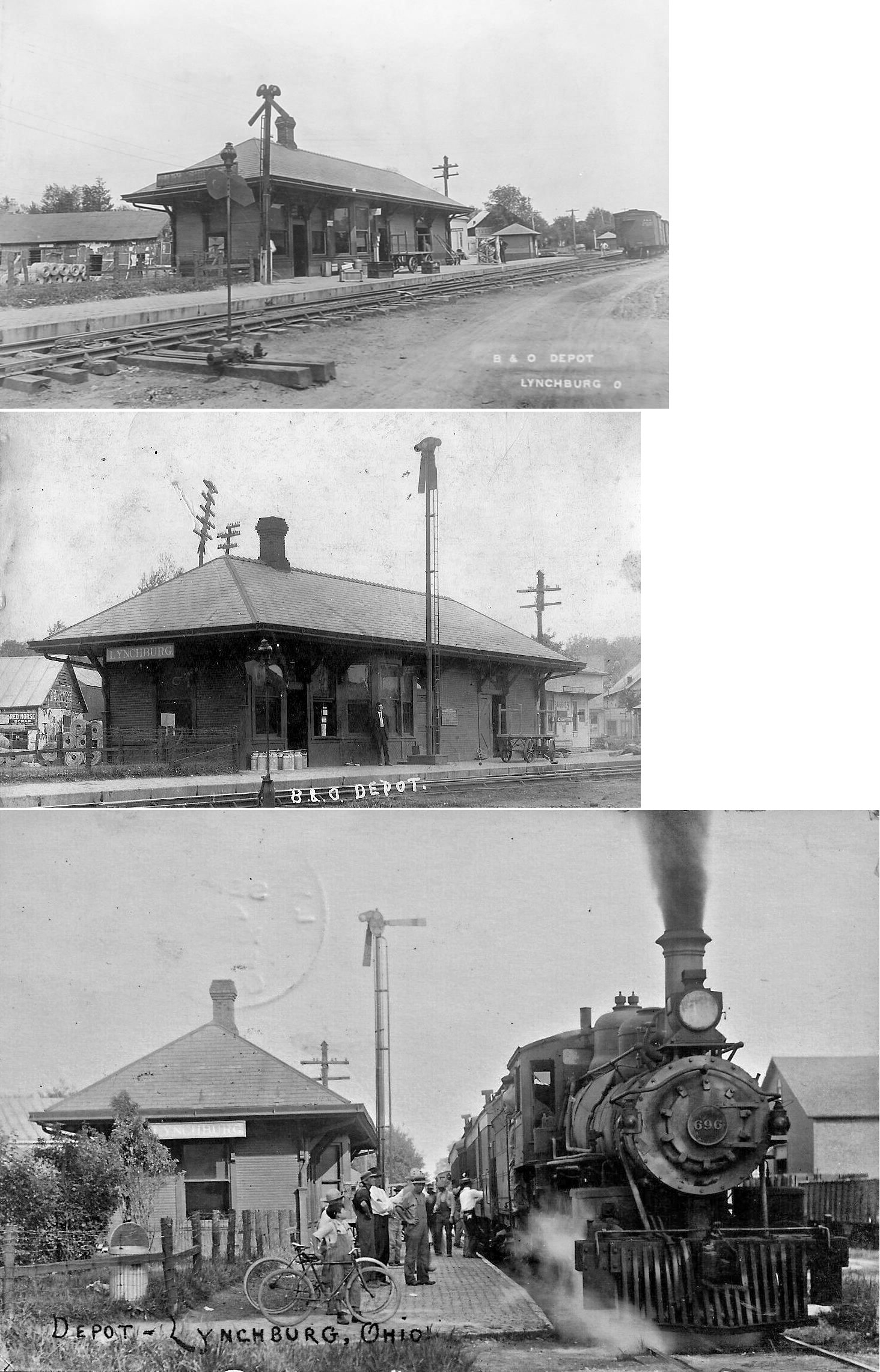
| Lynchburg |
|
There was a CW&B station here prior to 1895. It was at the SE corner of Washington and Main Streets, on the north side of the tracks. (GPS: 39.241955,-83.792183) | ||||||
| Lynchburg | |
This station was on the corner of Washington and Main Streets. It was built in 1899 (Hillsboro News Herald, 8-10-1899). Before that there was an original CW&B station (see above) at this same site (but the older station was a few feet closer to Main Street). | ||||||
| Mowrystown |
|
A new depot was built here in 1878 (The Highland Weekly News, 12-12-1878). | ||||||
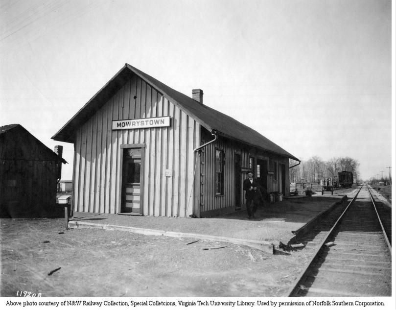
| Mowrystown | |
This station was on the north side of Main Street (SR-321) and on the west side of the tracks. (GPS: 39.042313,-83.758159). According to N&W valuation records, it was built in 1901. | ||||||
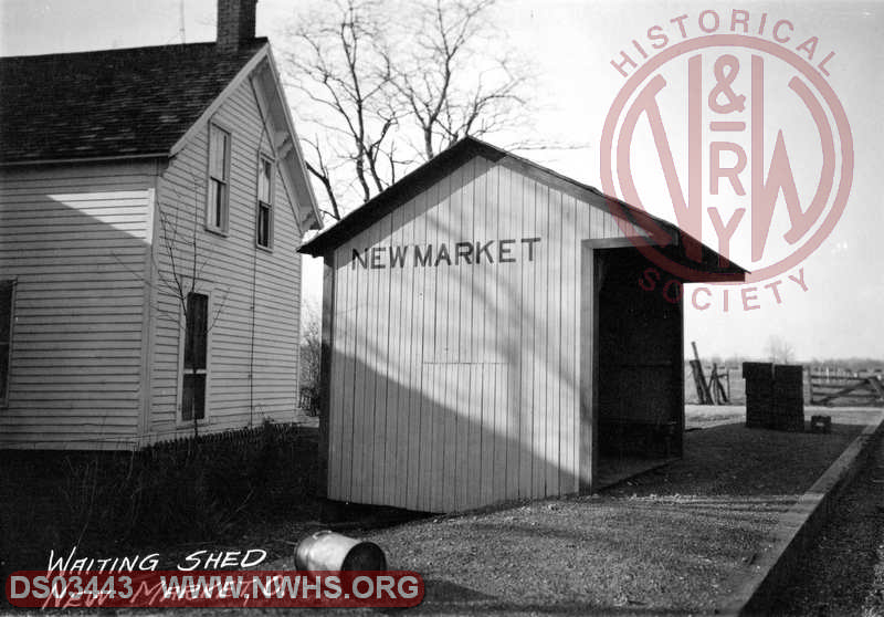
| New Market | |
There was a shelter-type passenger waiting shed here. According to N&W valuation records, it was built in 1911. | ||||||
| Russell |
|
This frame combination station was on the north side of South Street, on the south side of the tracks (GPS: 39.219354,-83.727834). It was built in 1888 (Hillsboro News Herald, 3-8-1888). | ||||||
| Shackleton | |
|||||||
| Taylorsville |
|
A new depot was built here in 1878 (The Highland Weekly News, 12-12-1878). | ||||||
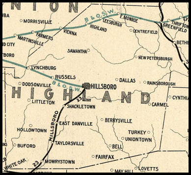
| 1898 HIGHLAND COUNTY RAILROAD MAP | ||||||||
 |
||||||||
|
Notes About Existing Stations... East Monroe (B&O) - The station was moved about 50 years ago and was used as a restaurant and gas station owned and operated by the railroad section gang chief William Ramsey. It is now used as a residence. Greenfield (Ohio Southern & CWB Stations) - Both buildings are now adjacent to each other. The Ohio Southern station is used as an animal hospital - the CWB station is believed to be unused but owned by the historical society. The Ohio Southern (DT&I) station has been moved from its original location. The station once stood along the tracks right at the north end of the Paint Creek bridge, but was moved approx 200 yards west to the top of the high bluff where it currently stands. It is a vintage Springfield, Jackson & Pomeroy station having been built prior to the renaming of the line to Ohio Southern. The M&C (B&O) building has been moved a couple of blocks from its former trackside location which was originally on on the north side of tracks, between Washington and Depot (now Short) Streets. The original portion of the M&C (B&O) station was built in 1854 when the line known as the Belpre & Cincinatti. It closed in 1973 (Greenfield Daily Times, 6-15-1973). Hillsboro (B&O) - This station was built sometime between 1887-1893 as appears on maps beginning in 1893. The station's original location was on the NE side of the tracks on the north side of Main Street at GPS: 39.203061, -83.615258. The tracks for the Hillsboro Branch terminated here. There was a a walkway leading NW from the passenger station to a long platform along the tracks. It was moved across Main Street to the south side and a bit to the east of its original location soon after service ended in the 1940s. Leesburg (B&O) - The Leesburg Depot was purchased in 2019 by the Leesburg Area Historical Society. Through local fundraising and an Ohio Facilities Construction Commission appropriation the LAHS has begun restoration efforts. The intention is to re-create the 1899 era exterior (while adding modern safety and handicapped accessibility modifications) and to turn the interior, eventually, into a community museum and gathering place. Follow the progress at: www.leesburghistory.org. |
||||||||