 COUNTY COUNTY
|
|
||||||||
| EXISTING STATIONS | ||||||||
|---|---|---|---|---|---|---|---|---|
| Station Name |
Original Railroad | Current Location |
Type | Current Use |
Date Built |
Track Status |
Building Material |
More Info |
| Liberty Center |  |
Corner of Wabash and Dasmascus Streets (GPS: 41.443786,-84.009013) |
C | Society | 1891 | In Use | Wood |
|
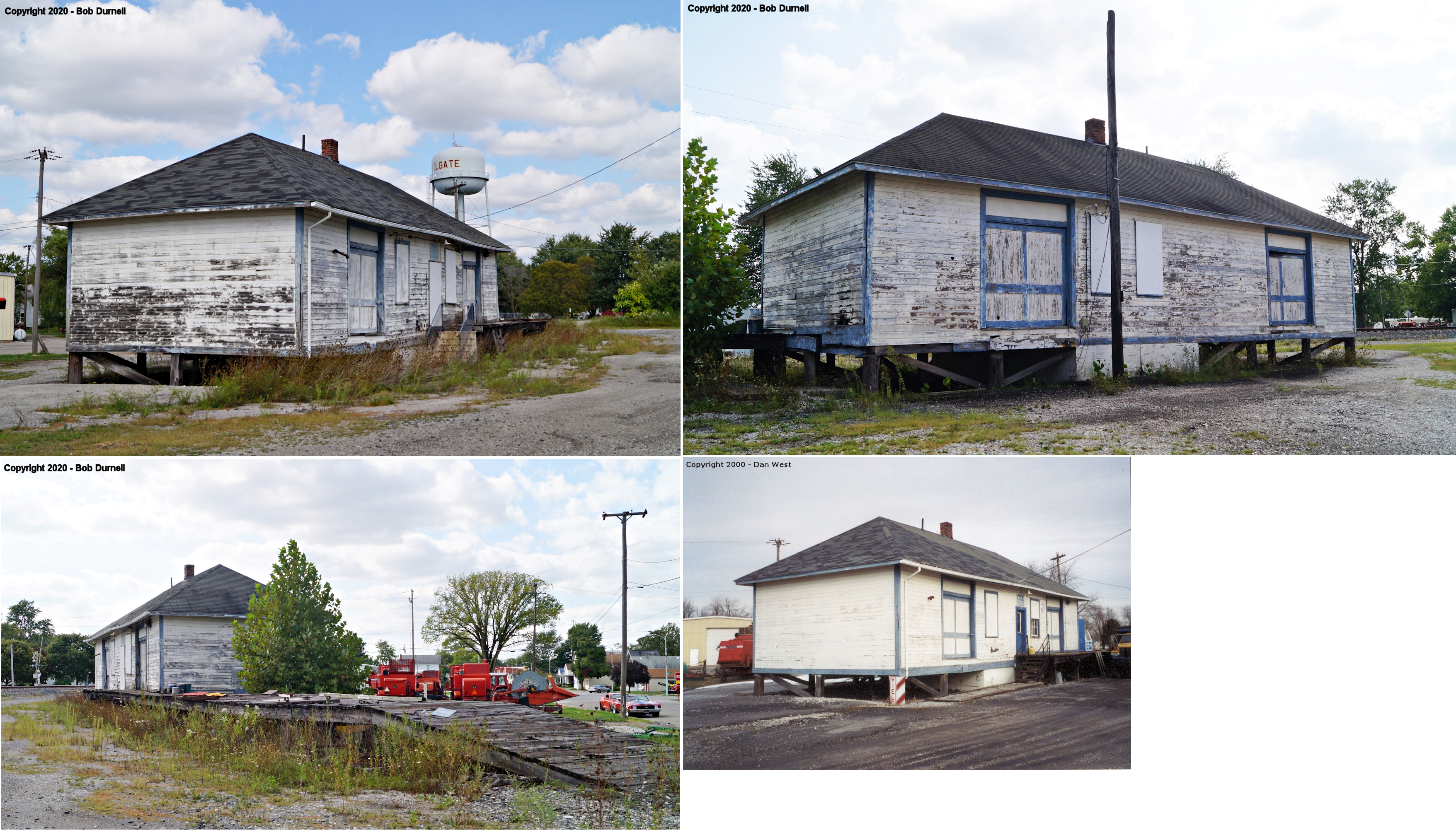
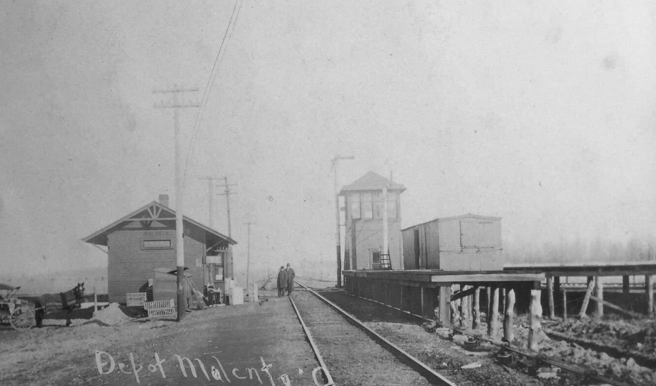
| Malinta |  |
112 Henry Street (GPS: 41.322016, -84.036161) |
P | Museum | ???? | Aband. | Wood | |
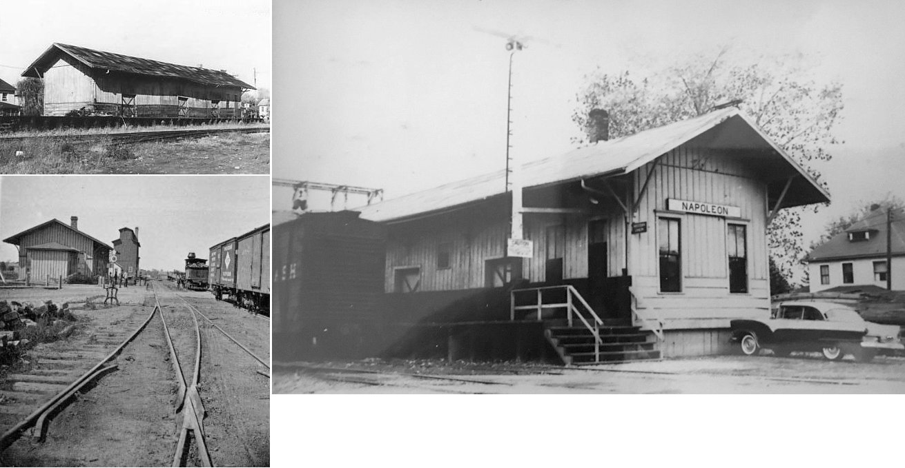
| Napoleon |  |
Henry County Fairgrounds South Perry Street (GPS: 41.378638, -84.120844) |
F | Museum | ???? | None | Wood | |
| STATIONS OF THE PAST | ||||||||
| Station Name |
Original Railroad |
Notes | ||||||
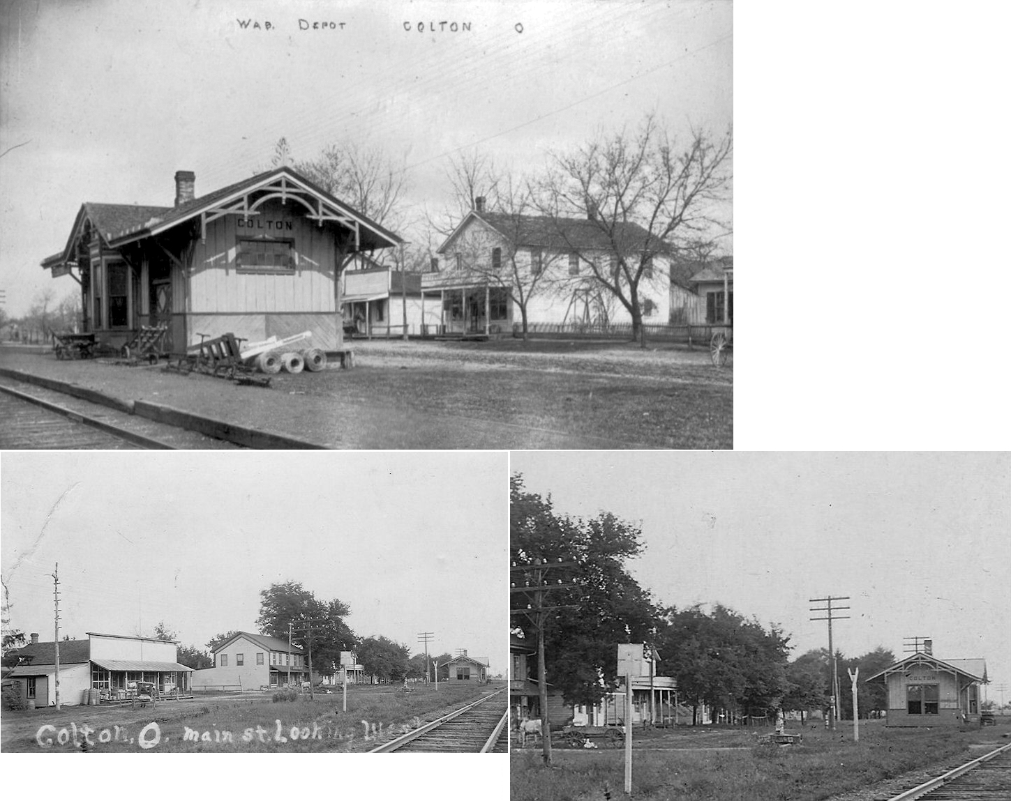
| Colton | |
This station was on South Street at Waqshington Street on the SE side of the tracks at GPS: 41.464699, -83.951531. The grade through here is now the south fork of the Wabash Cannonball Trail. | ||||||
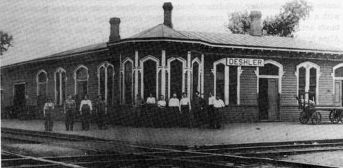
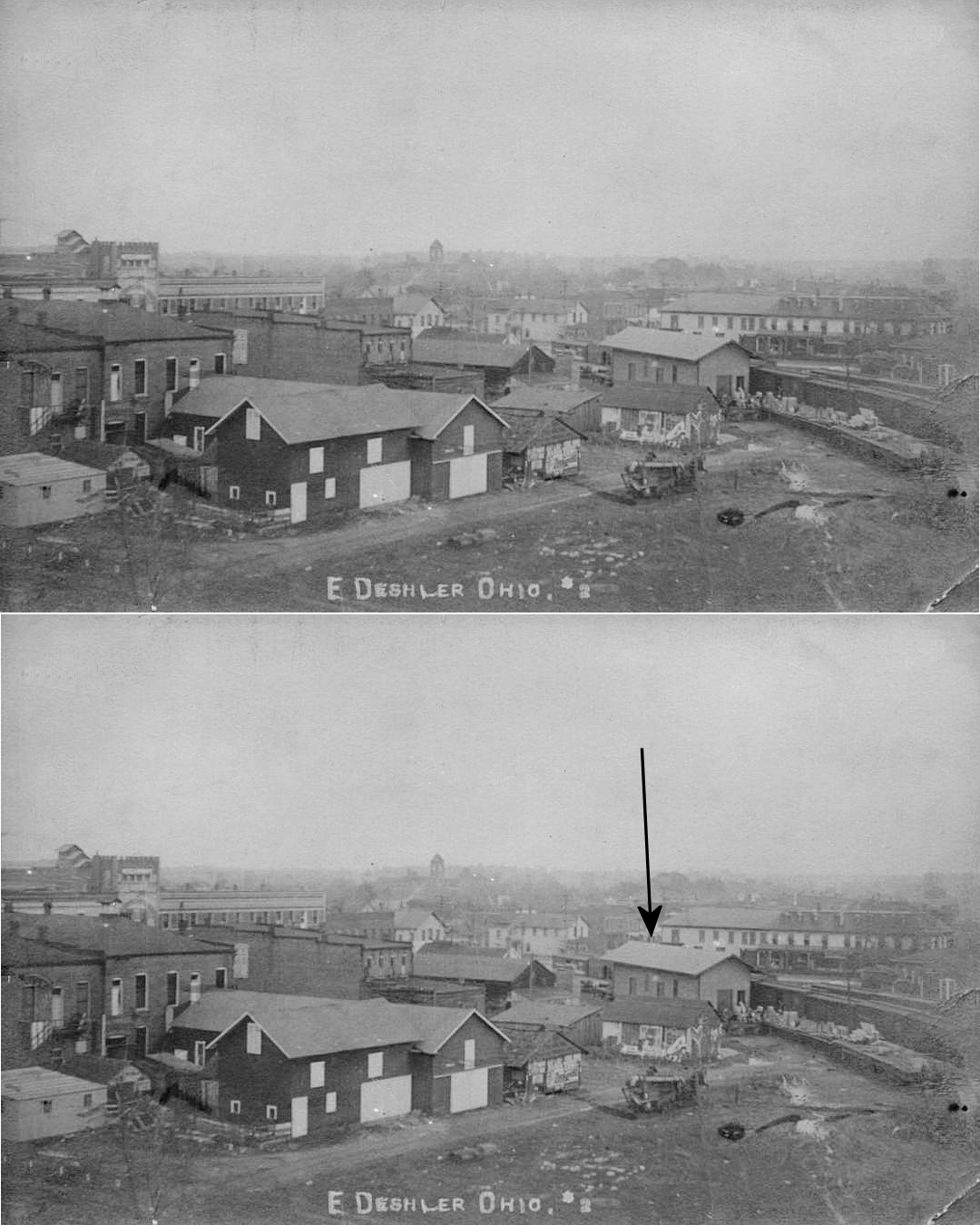
| Deshler |  AND  |
This is the first depot at Deshler predating the one listed above. The freight station was on a transfer track behind the passenger station. This station last appears on Sanborn maps in 1915 and the new station is shown on the 1923 map in the same location. | ||||||
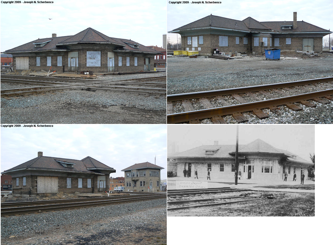
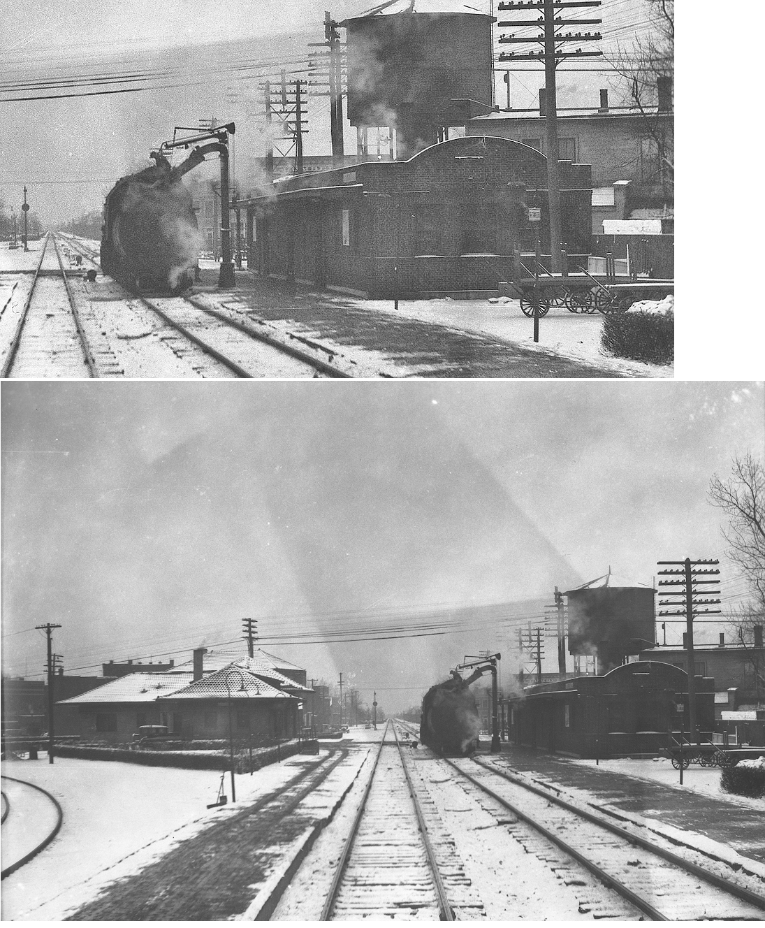
| Deshler | |
This second-generation station was on Main Street in the north quadrant of the diamond at GPS: 41.206521, -83.901949. It was torn down August 11, 2022. | ||||||
| Deshler | |
The freight station was across the tracks to the north of the passenger station. It was at GPS: 41.206811, -83.902145. | ||||||
| Deshler |
 |
|||||||
| Elery | |
|||||||
| Gallup |
|
|||||||
| Gerald |
|
|||||||
| Grelton | |
|||||||
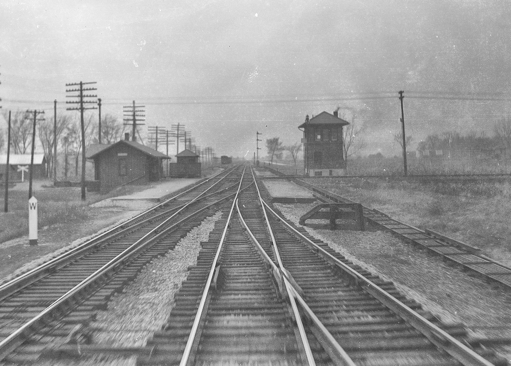
| Hamler | AND |
This union station sat on Randolph Street in the southwest quadrant of the diamond with platforms extending along each line. The original interlocking tower was in the southeast quadrant, but was replaced by a newer tower that was built in the northeast quadrant. | ||||||
| Holgate | |
The Cloverleaf depot can be seen behind the B&O depot in this old shot of the crossing of the B&O and Cloverleaf. The B&O station was in the southwest corner of the crossing and the Cloverleaf station was in the southeast quadrant. Later photos and maps indicate that passenger traffic for both railroads may have been consolidated at the B&O station after the Cloverleaf station was torn down. These stations were east of Keyser Street at was once called Quincy Street (which ran parallel to the Cloverleaf tracks). The B&O and Cloverleaf had a shared freight house on a transfer track that crossed over the northwest quadrant of the diamond. I am not sure if this is the same freight station that is still standing (but it probably is). | ||||||
| Holgate | |
This freight station was East of the SR-108 crossing. | ||||||
| Malinta |
|
|||||||
| Malinta |
|
The freight station here was a converted boxcar on a platform. | ||||||
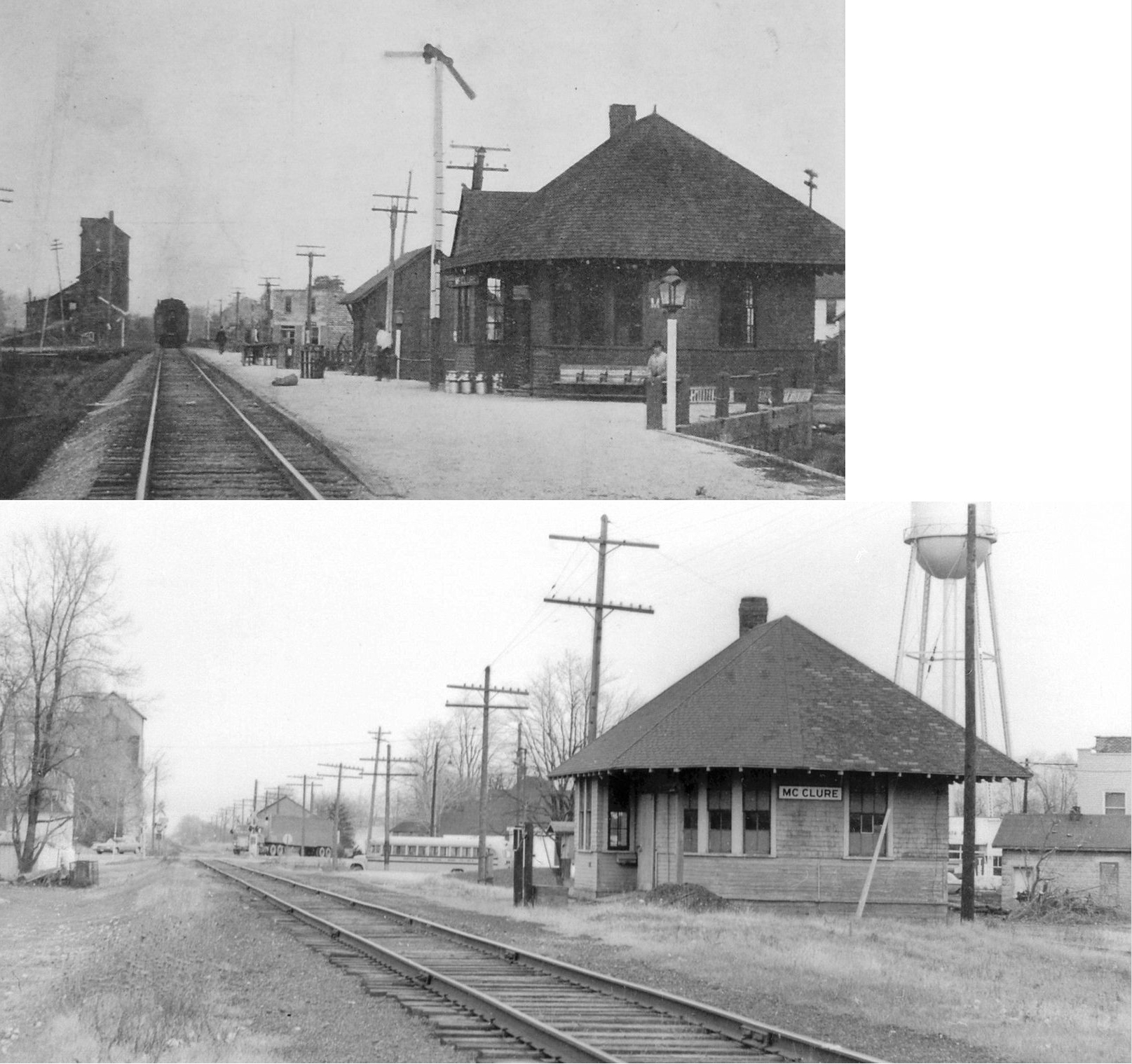
| McClure |
|
|||||||
| Napoleon |
|
The passenger station was on the east side of Oakwood Avenue and on the south side of the tracks. The freight station (existing, now at the fairgrounds) was just to the east of the passenger station. | ||||||
| Napoleon |
|
The passenger station was located on the south side of the tracks on the triangle created by the intersection of Depot, Hobson and Oakwood streets. Both the passenger and freight stations were torn down in the 1970s. | ||||||
| Napoleon |
|
The freight station was on the north side of the tracks on the west side of Oakwood Avenue (across the street and across the tracks from the passenger station). | ||||||
| New Bavaria |
|
|||||||
| Okolona |
|
|||||||
| Pleasant Bend |
|
|||||||
| Standley |
|
|||||||
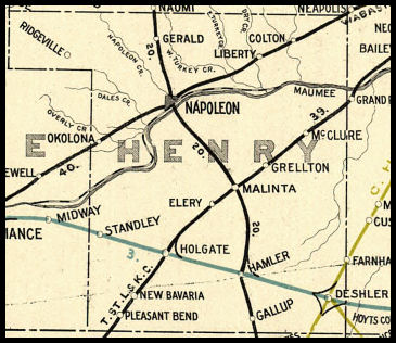
| 1898 HENRY COUNTY RAILROAD MAP | ||||||||
 |
||||||||
|
Notes About Existing Stations... Liberty Center (Wabash) - The original location was 100 feet east and 100 feet north. Norfolk Southern required removal of building from site in 1986. The station was built in 1891 and remodeled in 1904. This building is being restored by The Liberty Center Historical Society, a non-profit organization dedicated to the preservation of history in the Liberty Center school district. |
||||||||