 COUNTY COUNTY
|
|
||||||||
| EXISTING STATIONS | ||||||||
|---|---|---|---|---|---|---|---|---|
| Station Name |
Original Railroad | Current Location |
Type | Current Use |
Date Built |
Track Status |
Building Material |
More Info |
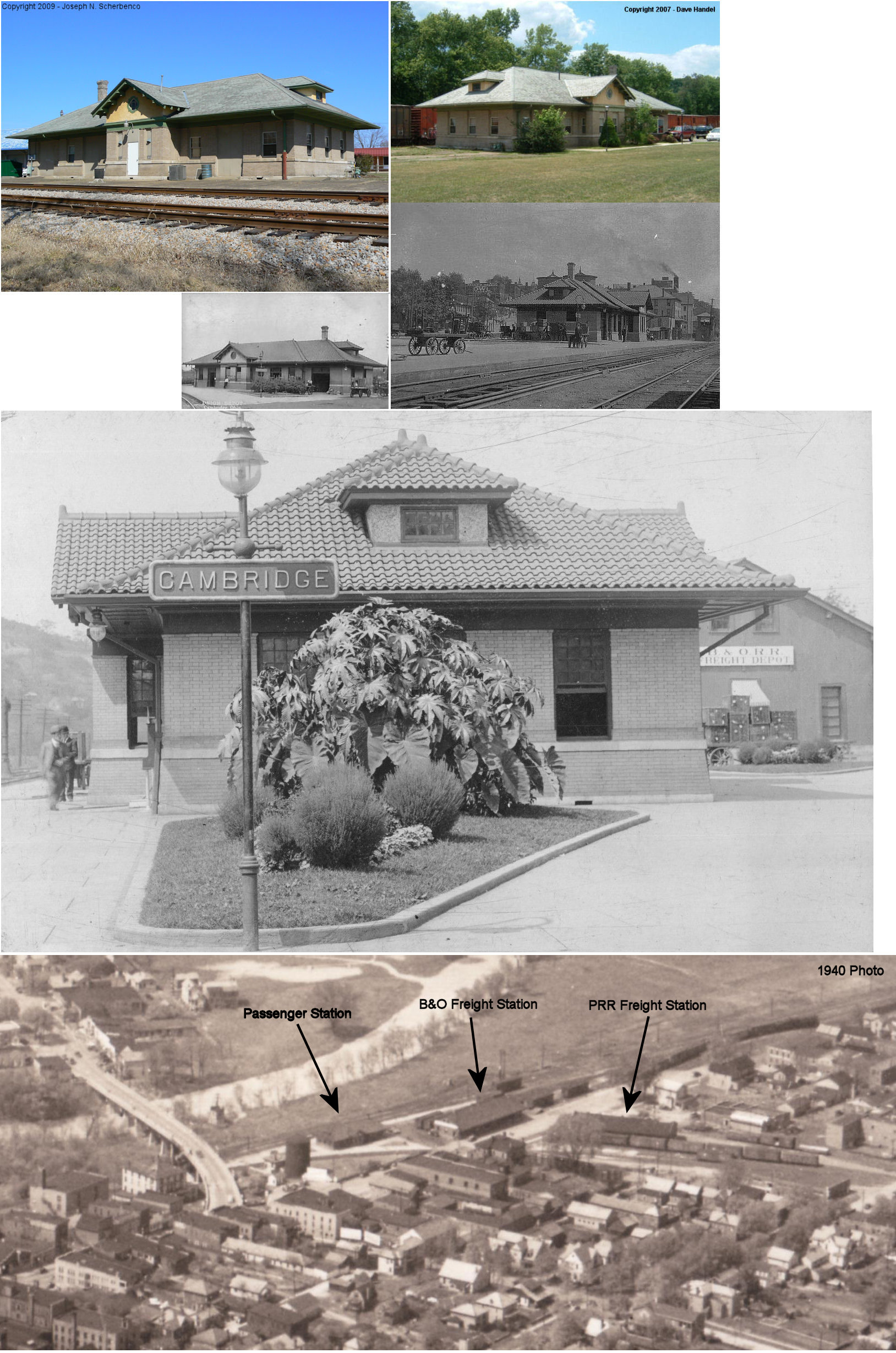
| Cambridge |
 AND  |
Wheeling Avenue & SR 209 | P | Business | ???? | In Use | Stucco |
|
| Cambridge |
|
Wheeling Avenue & SR 209 | F | Business | ???? | In Use | Wood | |
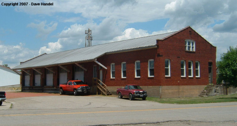
| Cambridge |
|
Wheeling Avenue & 4th Street | F | Storage | ???? | Gone | Brick | |
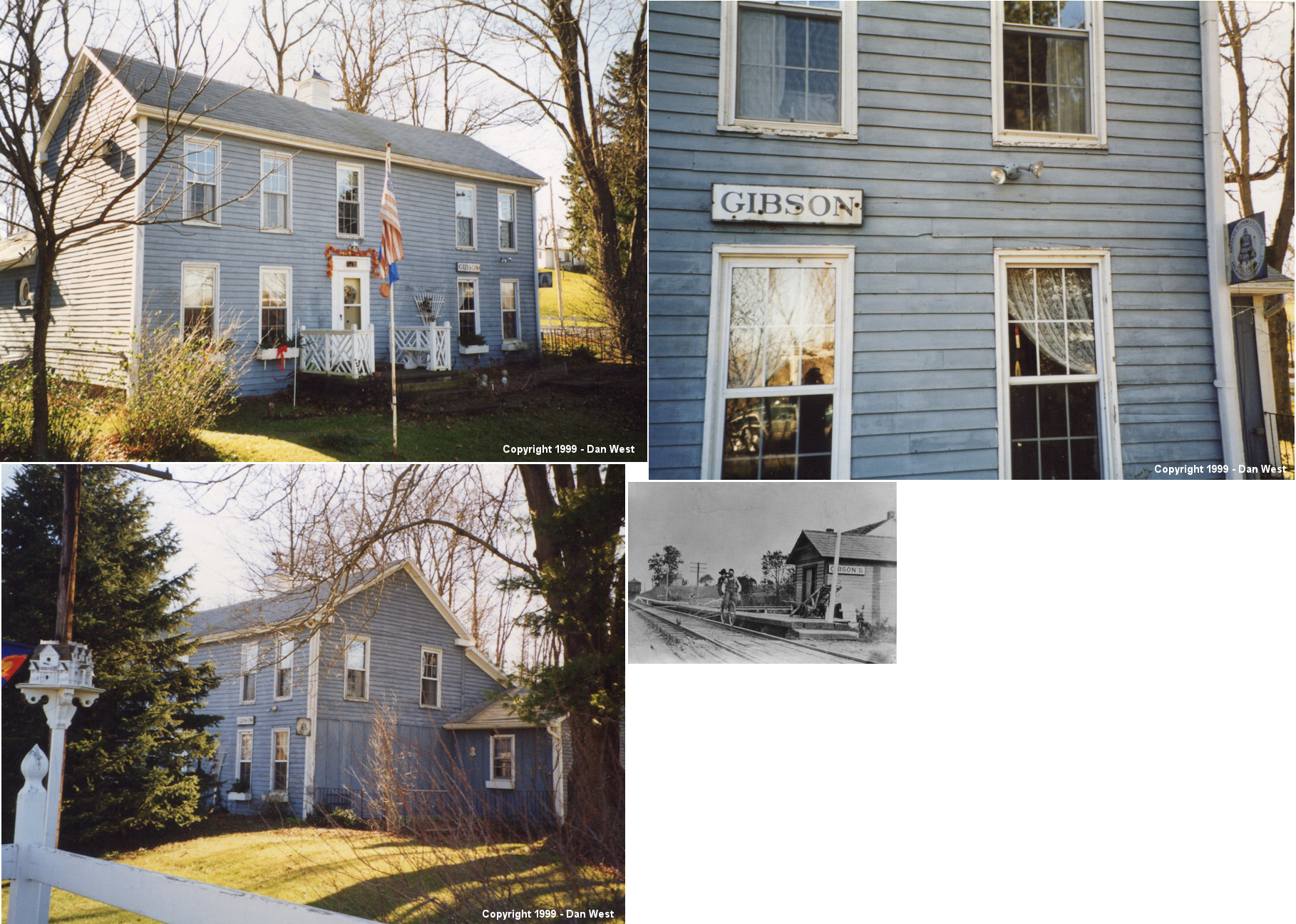
| Gibson |
|
60704 Salem Road | C | House | 1853 | Gone | Wood |
|
| Guernsey (Wheeling) |
 |
South side of Guernsey Valley Road just west of 8th Street Road (GPS: 40.181895, -81.593700) |
C | House | ???? | Gone | Wood |
|
| STATIONS OF THE PAST | ||||||||
| Station Name |
Original Railroad |
Notes | ||||||
| Akron Switch |
|
This station is shown on the 1881 C&M timetable. | ||||||
| Birds Run (Bridgeville) (Guernsey) |
|
At some point after 1910 the C&M line was rerouted between Guernsey and Kimbolton. The old line followed what is today Guernsey Valley Road (CR-86) into Birds Run (formerly called Bridgeville). The line then followed Wills Creek back east to Kimbolton. The PRR officially changed the name of this station to Guernsey in 1881. A station is shown here on the 1923 PRR List of Stations & Sidings. "BN" cabin was near the station. | ||||||
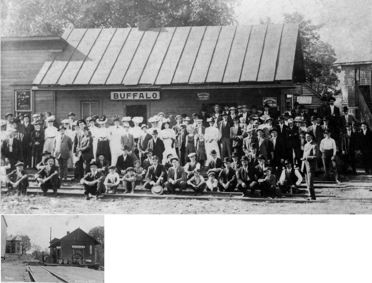
| Buffalo (Hartford) |
|
Formerly known as Hartford. | ||||||
| Blue Bell |
|
|||||||
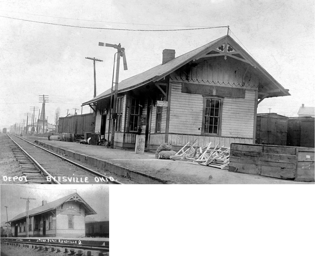
| Byesville |
|
This combination station was on the north side of Main Street at Glass Avenue at GPS: 39.970419, -81.539237. It was likely built in 1902 as a newspaper report mentions that the original depot was being moved to a new site to serve as a freight station while a new depot would built at the original site (Cambridge Jeffersonian, 9-4-1902). | ||||||
| Campbells |
|
|||||||
| Cambridge |
|
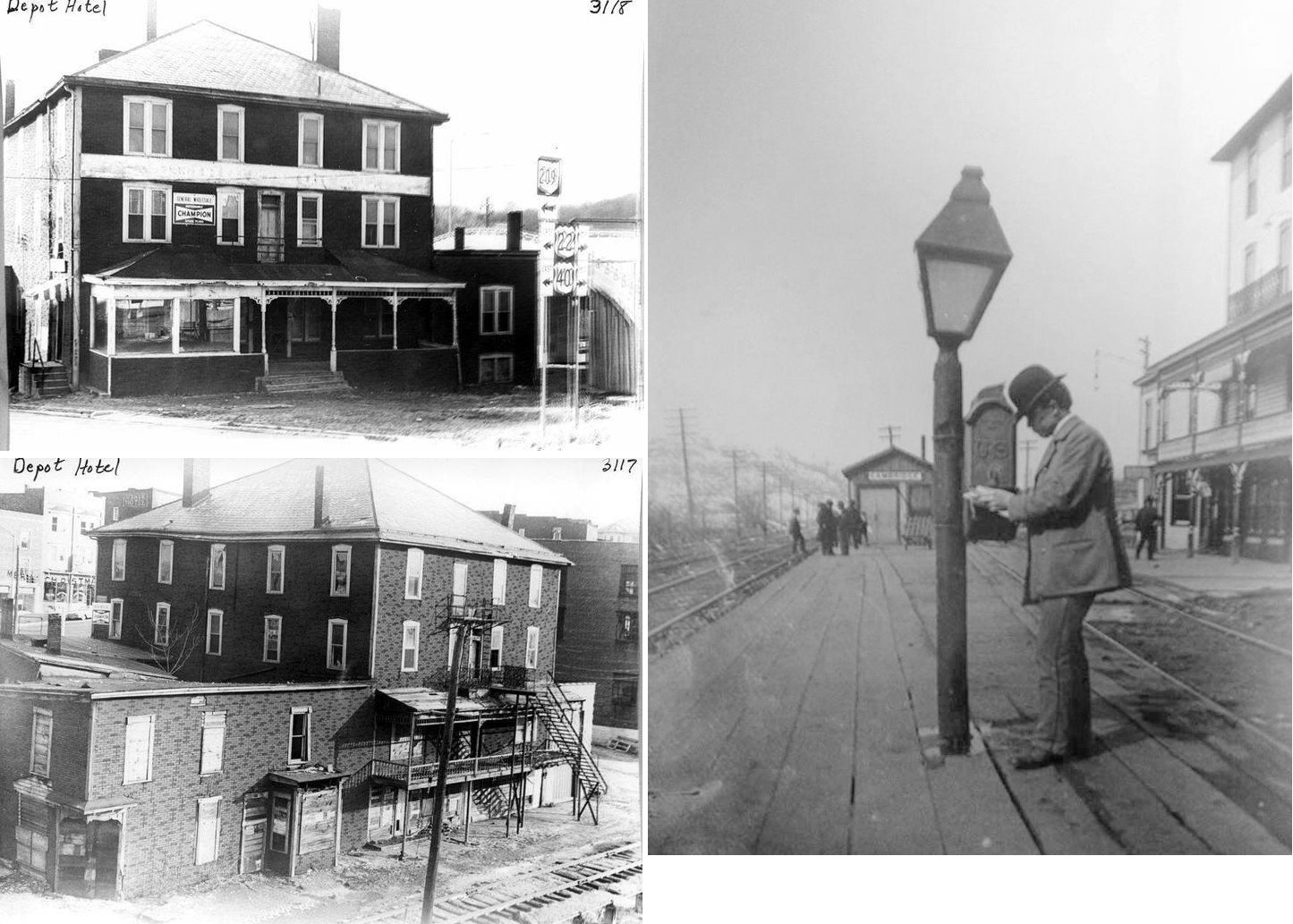
According to an 1886 map, the original B&O station was on the track side of a triangular block at the intersection of 5th Street, Main Street and National Road (Dewey Ave.). On a 1892 map, the depot is shown on the first floor of this same building referred to as the "Depot Hotel." Its address was listed as 444 Wheeling Avenue. | ||||||
| Cambridge |
|
The original C&M depot was on the northwest corner of 4th Avenue and Wheeling (on the opposite side of Wheeling from where the Union Station would be built). In later years this original station would serve as offices for the C&M railroad. According to an article in the Marion Star (4-25-1901), the C&M depot (and a B&O train) was demolished in a derailment on April 25, 1901. (Note however that the report of the accident in the Cambridge Jeffersonian of May 2, 1901, reports that it was a B&O telegraph office that was demolished and not the C&M depot so it's not clear what happened). This building would have sat directly east of the current PRR freight station. There was an earlier C&M freight station which was at the corner of N. 4th and Stuebenville. In later years (circa 1910) that freight station was demolished and location was empty until the Farm Bureau Warehouse was built on that site in the 1920s. | ||||||
| Cassell |
|
This station was on the east side of Banty lane (TWP-1473), on the north side of the tracks. (GPS: 40.007915,-81.659655) | ||||||
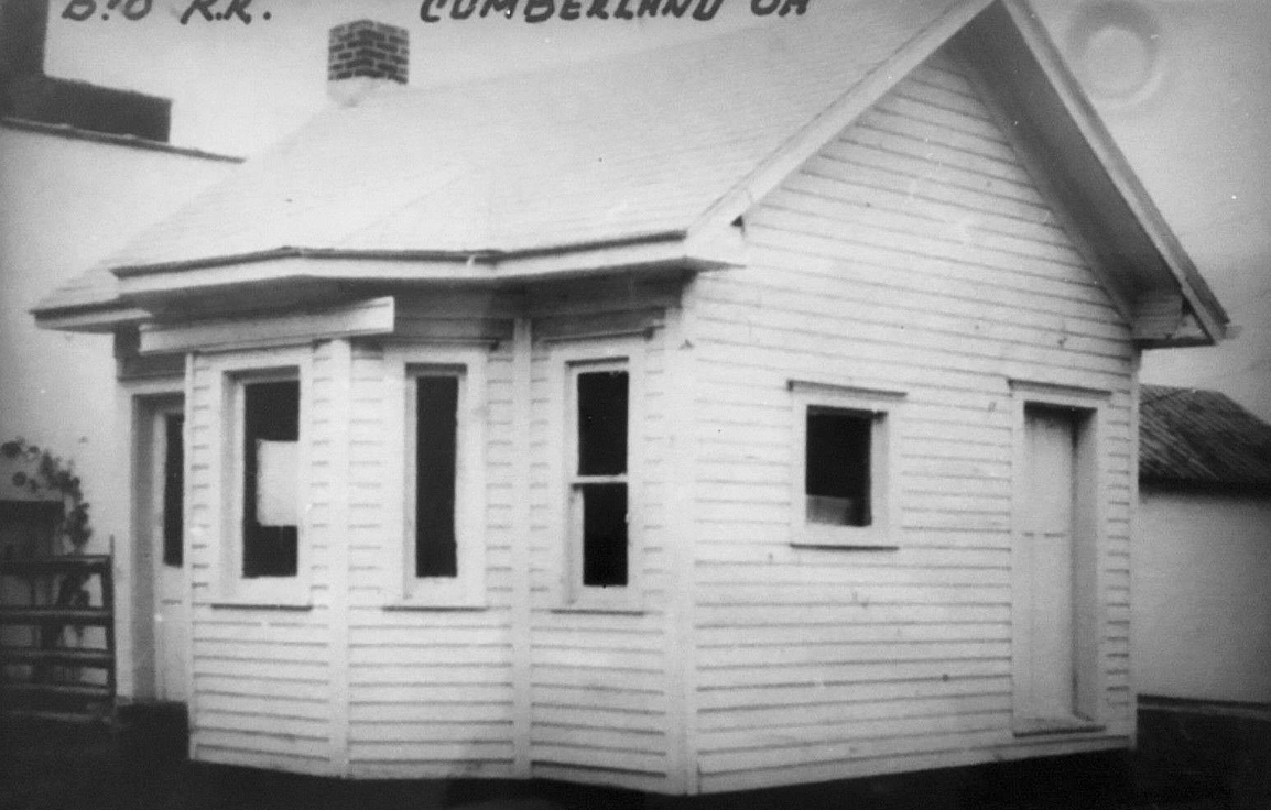
| Cumberland |
|
This station was located between Main and Water streets. It later served as a freight station only. | ||||||
| Cumberland |
 |
This station, built in 1886, was located on Mill Street between Bank Street and Broad Street at GPS: 39.850682, -81.658072. | ||||||
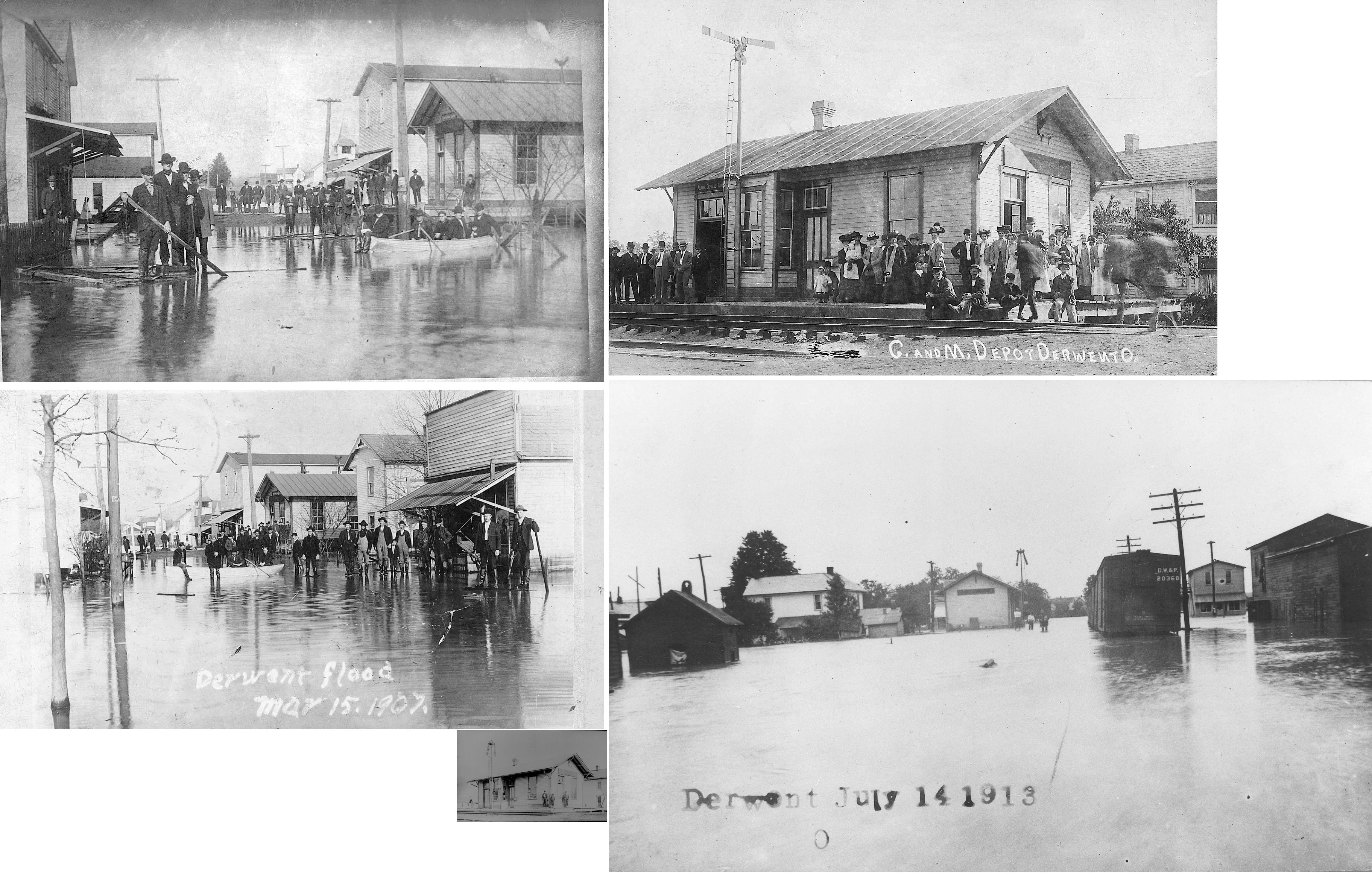
| Derwent |
|
|||||||
| Farmers |
|
This station is shown on the 1881 C&M timetable between Byesville and Akron Switch, but there are no trains listed as stopping there on the schedule. | ||||||
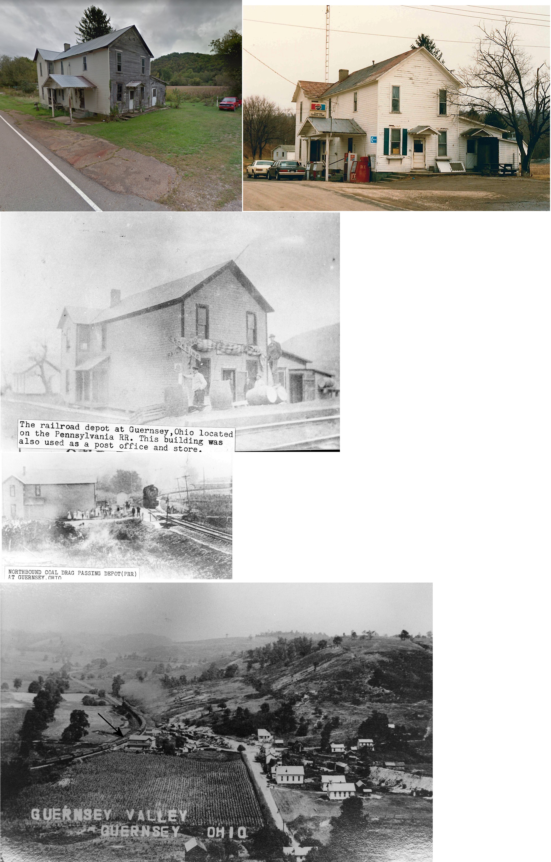
| Guernsey |
|
See listing above for Bird Run. | ||||||
| Hartford (Dyson) |
|
This station is shown on the 1881 C&M timetable. | ||||||
| Kimbolton |
|
The first station at Kimbolton was a couple of converted boxcars. | ||||||
| Kimbolton |
|
The second station here was near what is now the corner of Cemetery Street and Holbrook Street at approximately GPS: 40.154165, -81.573032. | ||||||
| Kings Mine |
|
A freight station was built here in 1905. | ||||||
| Lore City |
|
This station may have also served the short-lived Marietta & Lake Railroad. It is not clear if the M&L had any stations of its own. A Zanesville Times Recorder article from Oct. 1, 1910 indicated that the B&O connected with the M&L at Lore City for taking passengers to the fairgrounds in (Old) Washington. | ||||||
| Millers |
|
This station is shown on the 1881 timetable between Kimbolton and Oldham. | ||||||
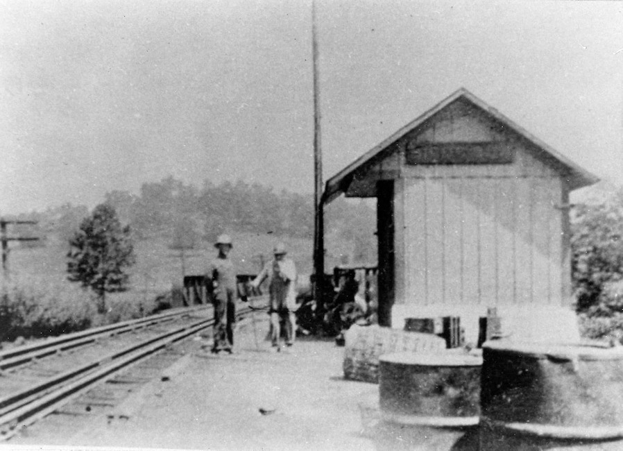
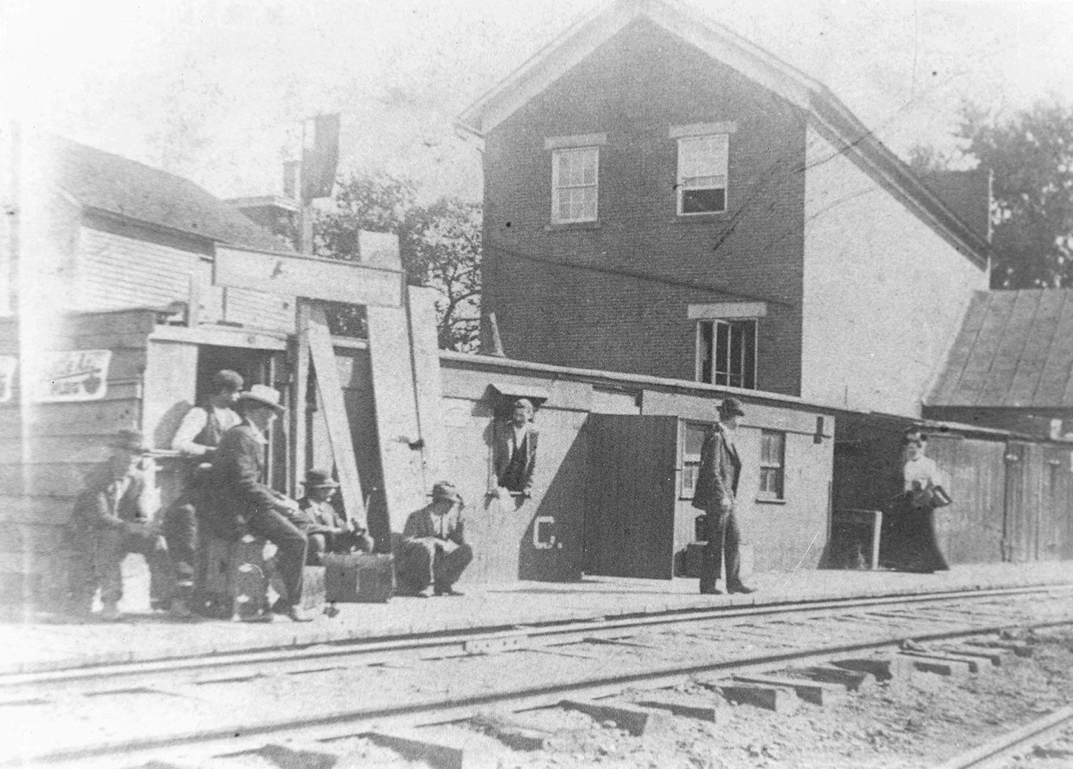
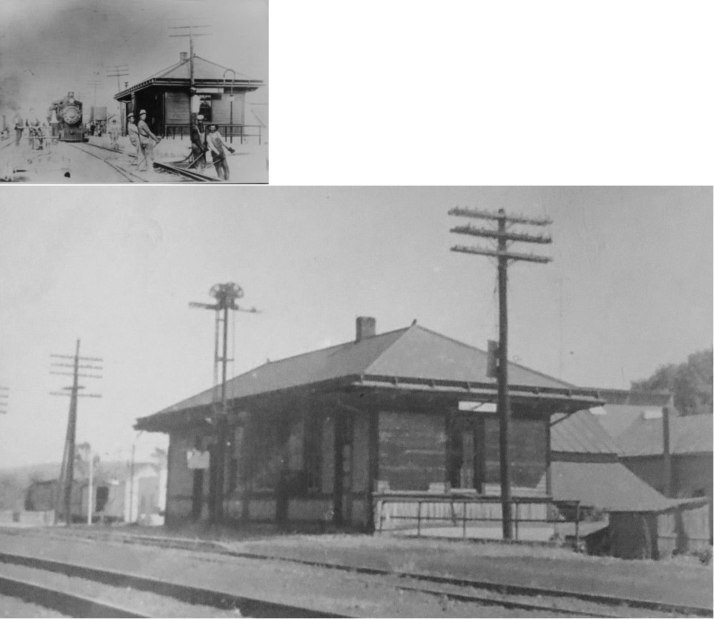
| Morgan's Junction |
|
The photo is very old as this station was closed in 1892. | ||||||
| Nicholsons |
|
This station is shown on the 1881 C&M timetable between Cambridge and Byesville. | ||||||
| Oldham |
|
A station is shown here on the 1923 PRR List of Stations & Sidings. | ||||||
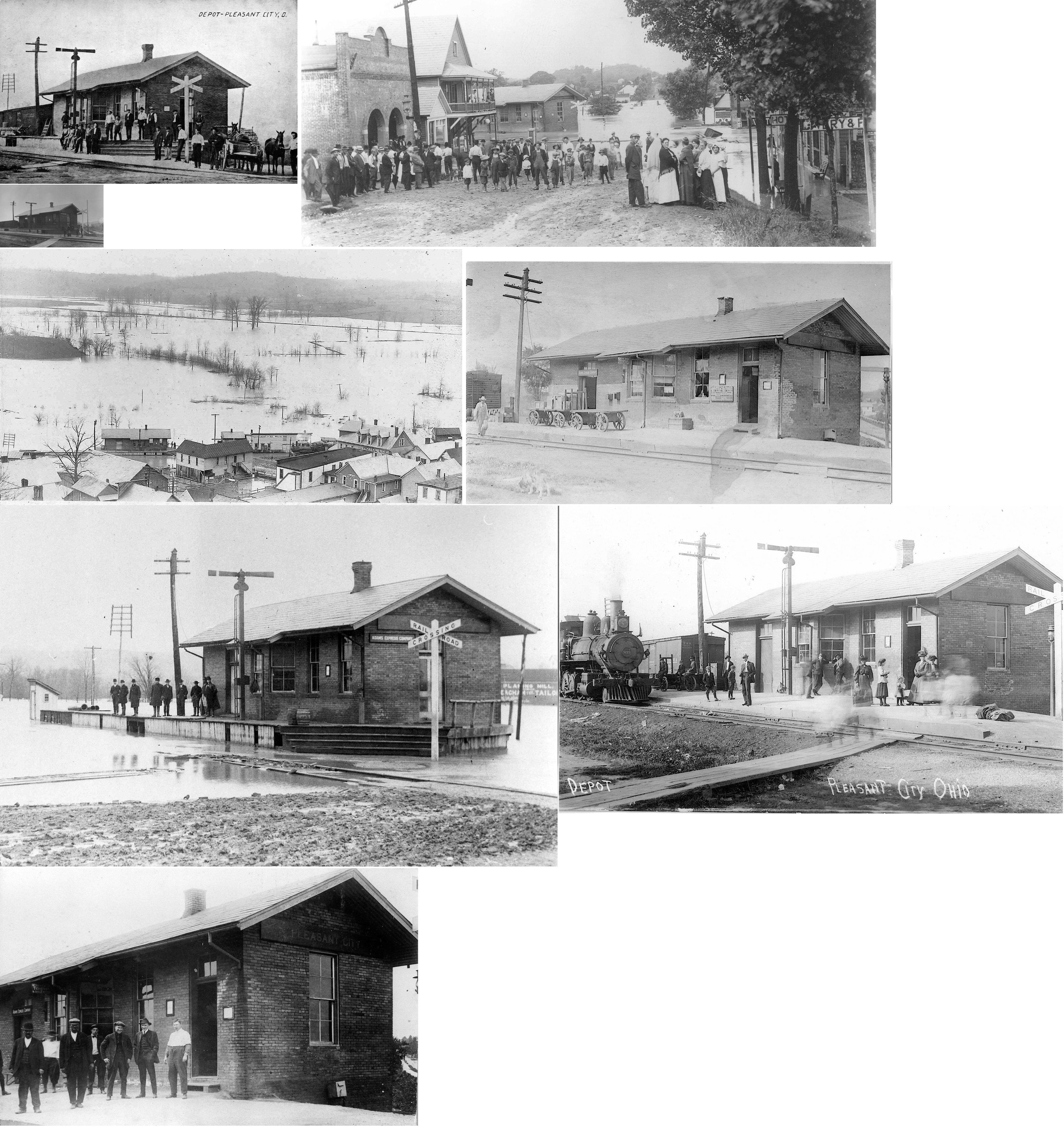
| Pleasant City |
|
This station was on the south side of Main Street west of Caldwell Street. It was on the west side of the tracks. In later years it served as a freight station after passenger service was discontinued. Prior to 1898 this station was known as Point Pleasant. | ||||||
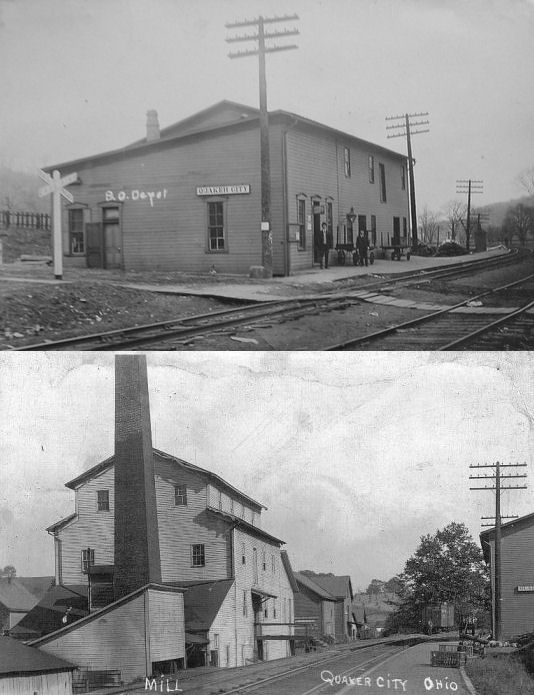
| Quaker
City (Millwood) |
|
The town was formerly called Millwood and the name appears on the B&O timetable from 1867. The depot was on the west side of SR-513 at GPS: 39.968195, -81.301041. After it was torn down it was replaced with a metal structure. | ||||||
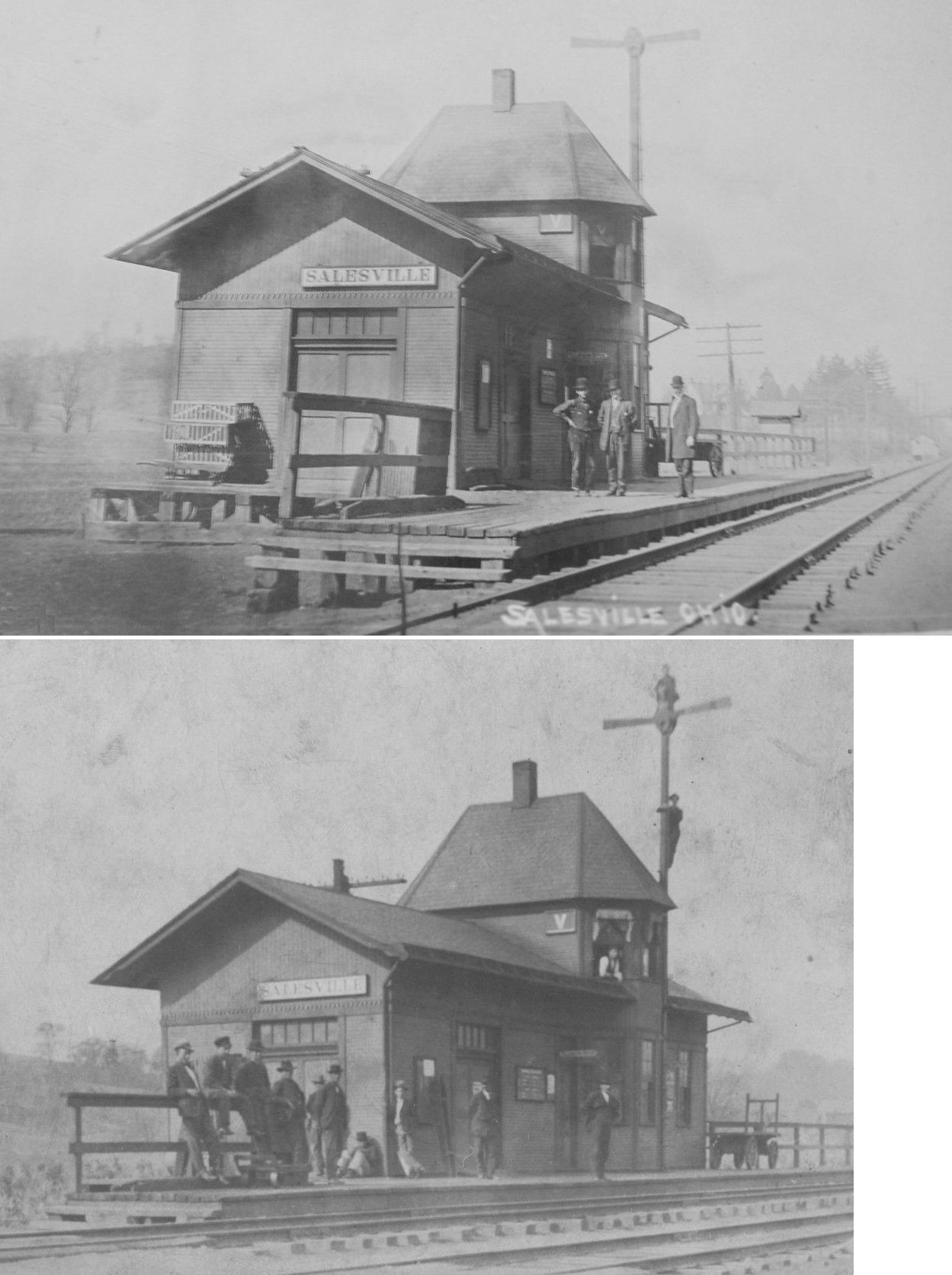
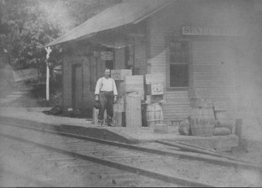
| Salesville |
|
|||||||
| Seneca |
|
This station is shown on the 1881 C&M timetable. | ||||||
| Senecaville |
|
|||||||
| Spencer Station |
|
|||||||
| Tyner Station |
|
A station is shown here on the 1923 PRR List of Stations & Sidings. There may have been a telegraph station here as well. | ||||||
| Old Washington |
Marietta & Lake |
It is not clear if the M&L had any stations of its own. A Zanesville Times Recorder article from Oct. 1, 1910 indicated that the B&O connected with the M&L at Lore City for taking passengers to the fairgrounds in (Old) Washington. The M&L was chartered in 1909, but only lasted a few years. The original plan was for the RR to connect Lore City with Freeport (Harrison County), but it appears that it only made it to (Old) Washington. | ||||||
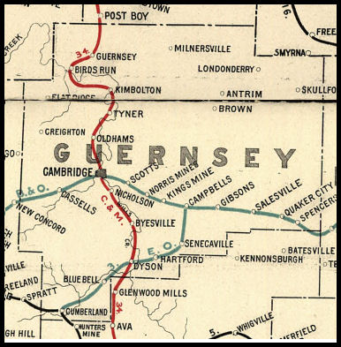
| 1898 GUERNSEY COUNTY RAILROAD MAP | ||||||||
 |
||||||||
|
Notes About Existing Stations... Cambridge (B&O/PRR) - Union depot. See below for description of the original B&O and C&M passenger stations. Gibson (B&O) - This station also served as a post office and general store. The current owner bought the run down station in the late 1960s and restored it into a beautiful home. Guernsey (C&M) - This station also served as a post office and general store. The station is shown here on the 1923 PRR List of Stations & Sidings. |
||||||||