 COUNTY COUNTY
|
|
||||||||
| EXISTING STATIONS | ||||||||
|---|---|---|---|---|---|---|---|---|
| Station Name |
Original Railroad | Current Location |
Type | Current Use |
Date Built |
Track Status |
Building Material |
More Info |
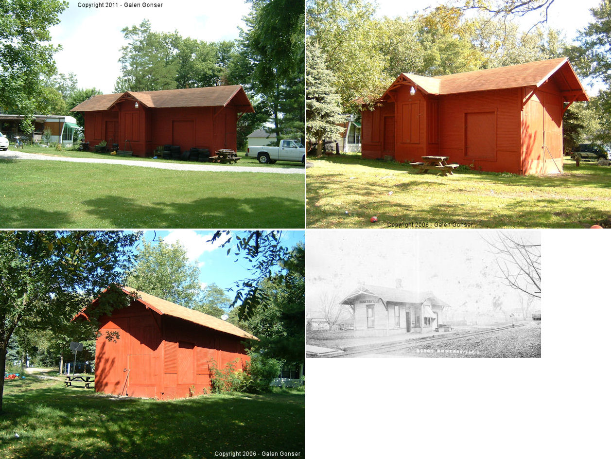
| Bowersville |
 |
Just NE of the north end of Long Street (GPS: 39.579421, -83.722849) |
C | Storage | ???? | None | Wood |
|
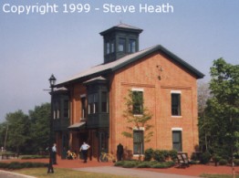
| Xenia |  |
150 South Miami Avenue (GPS: 39.680245,-83.931347) |
R | Civic | 1998 | Gone | Brick |
|
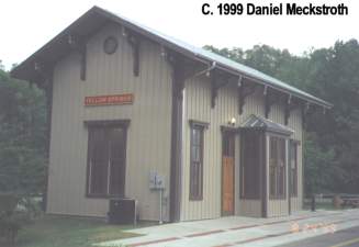
| Yellow Springs | |
101 Dayton Street (GPS: 39.807241, -83.887779) |
R | Civic | ???? | Gone | Wood |
|
| STATIONS OF THE PAST | ||||||||
| Station Name |
Original Railroad |
Notes | ||||||
| Alpha |
 |
Tod Pidgeon writes (2/06/99): I went to Alpha and so far I can't find a building that convinces me that it's a station. There is a building that is next to the RR on Alpha rd in Alpha. The building is on the property of the Alpha Seed & Grain looks abandoned. The building in question looks like it was the office for the grain elevator. It has a scale on the side away from the RR and it doesn't have platform or anything. This building has a sign on the front that says "Alpha Museum" sponsored by the E.J. Nutter foundation. There no address on the building but the building to the south has the St # of 745 and the zip code for Alpha 45301. I'm not convinced this is not the station or that Alpha never had a station because when I was a kid I remember the sign on route 35 used to say Alpha Station Rd. Now it just says Alpha. Tod Pidgeon writes (2/18/99): The Greene county historical museum has a picture of the station. It was a small building and has a sign on the side of it which simply said "AL". It was located on the south side of the tracks. The story is that the station was moved to the back of one of the houses in Alpha as some kind of out building and then was demolished a few years ago. In the photo, one of the smaller buildings on the right may have been the station with the mill on the left in the foreground. |
||||||
| Bowersville |
 |
This was a station on the original route of the Cincinnati, Columbus & Hocking Valley Railway. The CC&HV was subsequently purchased by the Ohio Southern RR (DT&I). | ||||||
| Bryson |
|
This station was one mile south of Old Town, between Old Town and Xenia. | ||||||
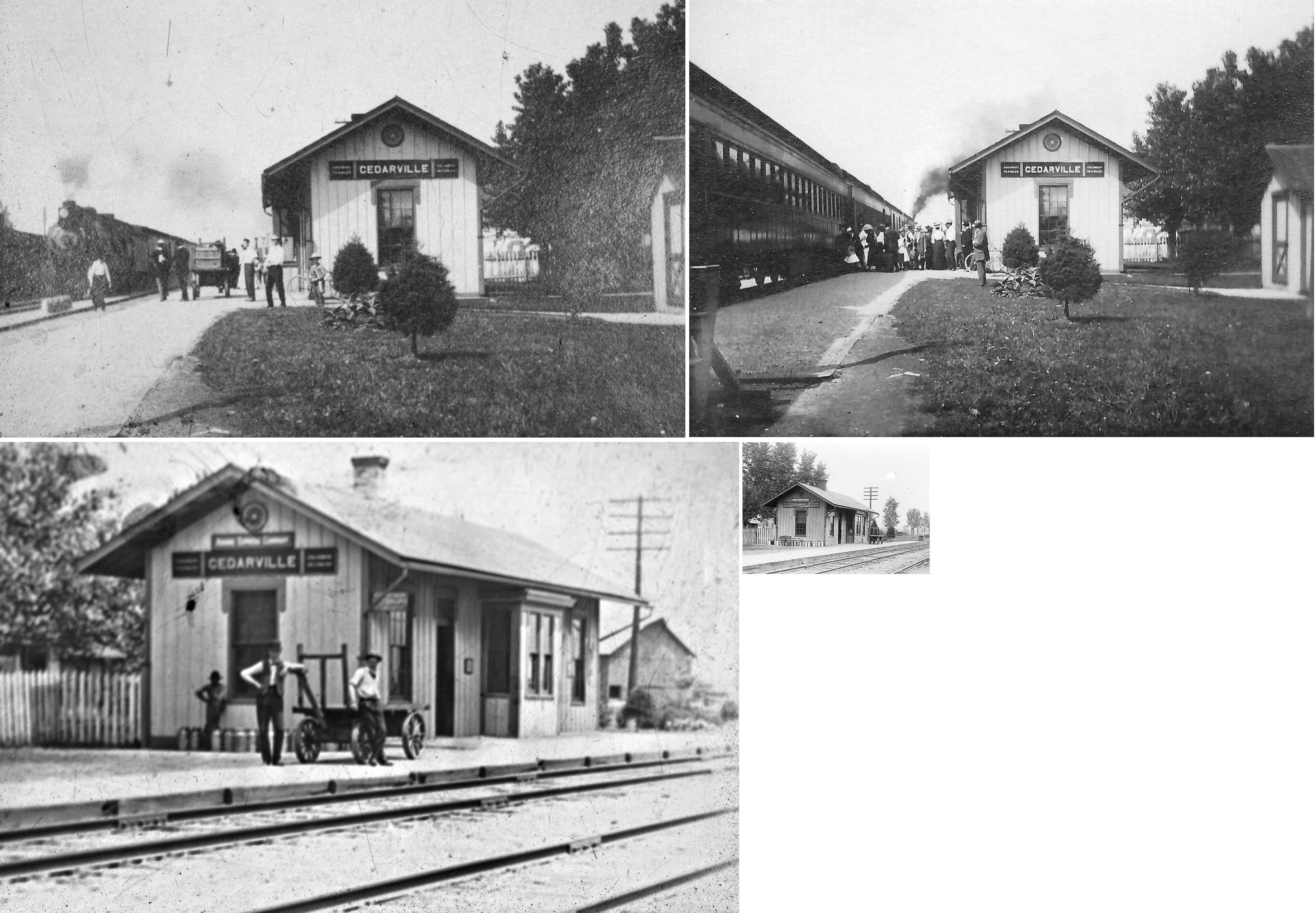
| Cedarville | |
This station sat at the bend on East Street on the north side of the tracks. There was also a freight house on the west side of Main Street where a parking lot exists today (2008). | ||||||
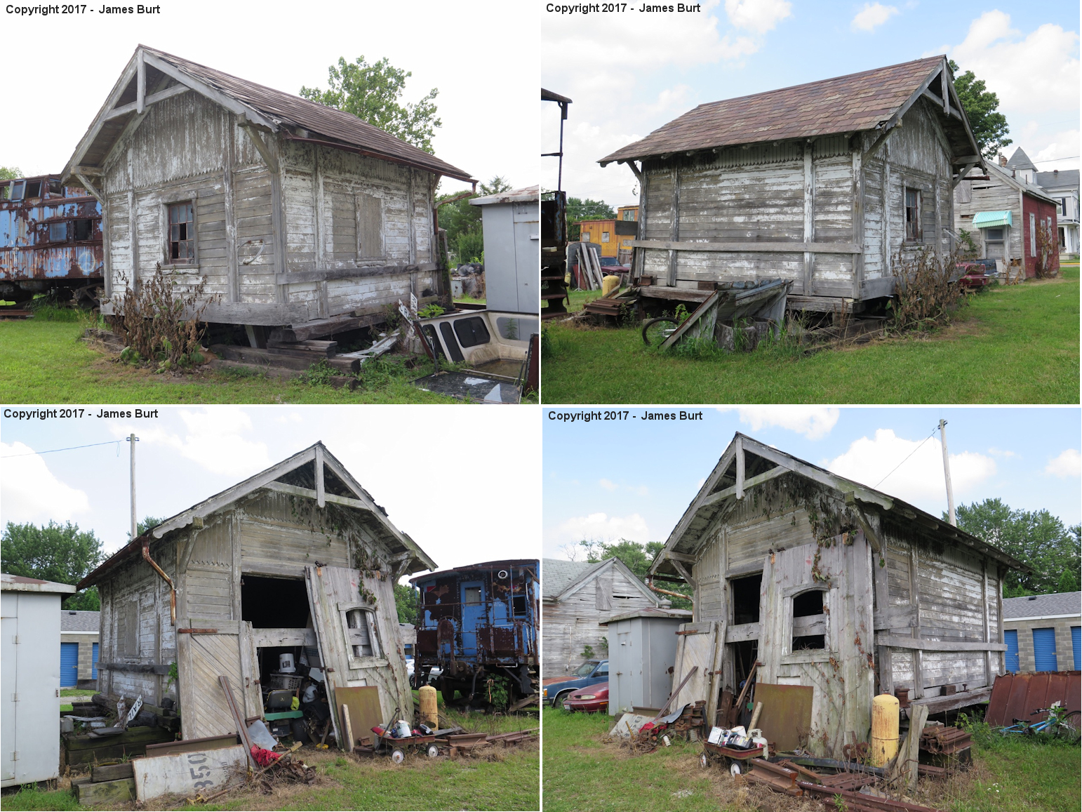
| Cedarville |  |
This station was near Cedarville Self-Storage at 31 South Miller Street (GPS: 39.738300, -83.806860). There were also three cabooses and another possible railroad-related building on the property. It's unknown where the station building came from (if you know, please email). As of summer 2024 the buildings had been torn down and the cabooses were sold and moved. | ||||||
| Claysville Junction |
 |
This station was at the junction of the Little Miami RR and the narrow-gague Waynesville, Port William & Jeffersonville RR. It was between Waynesville and Roxanna. There are no roads to this area anymore. It was in the vicinity of GPS: 39.562943, -84.020847. | ||||||
| Goes Station |
|
This station was built in 1862 and was destroyed by a explosion in 1933. 75% of the factory here was also destroyed in the blast. There were several eplosions at the powder mill here over the years (with a minor and major one within months in 1886). | ||||||
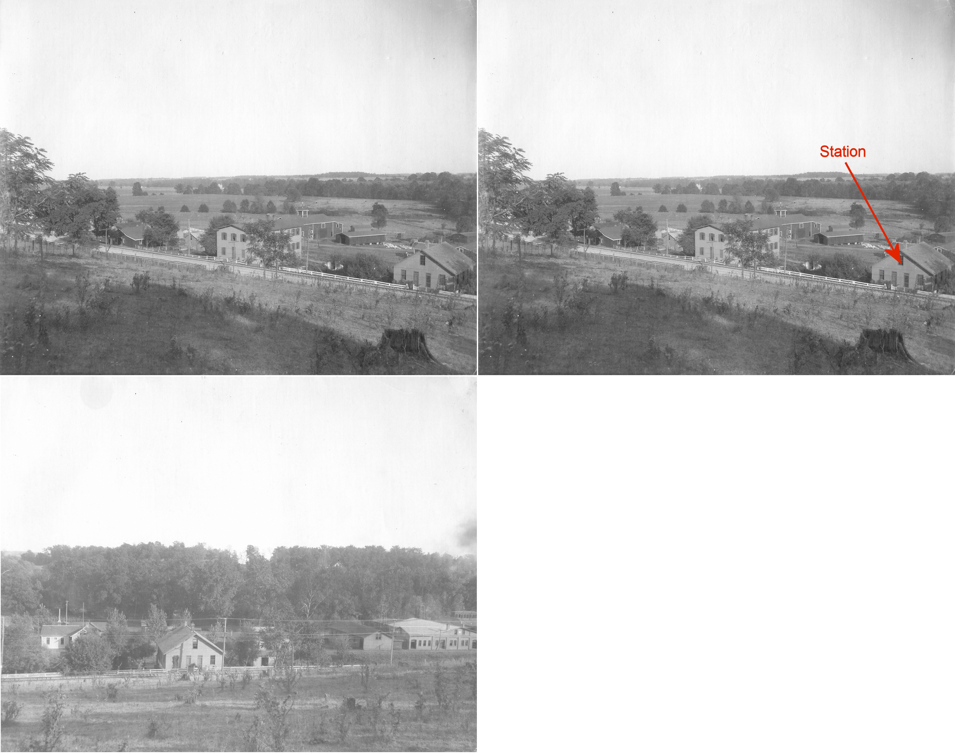
| Harbines |  |
|||||||
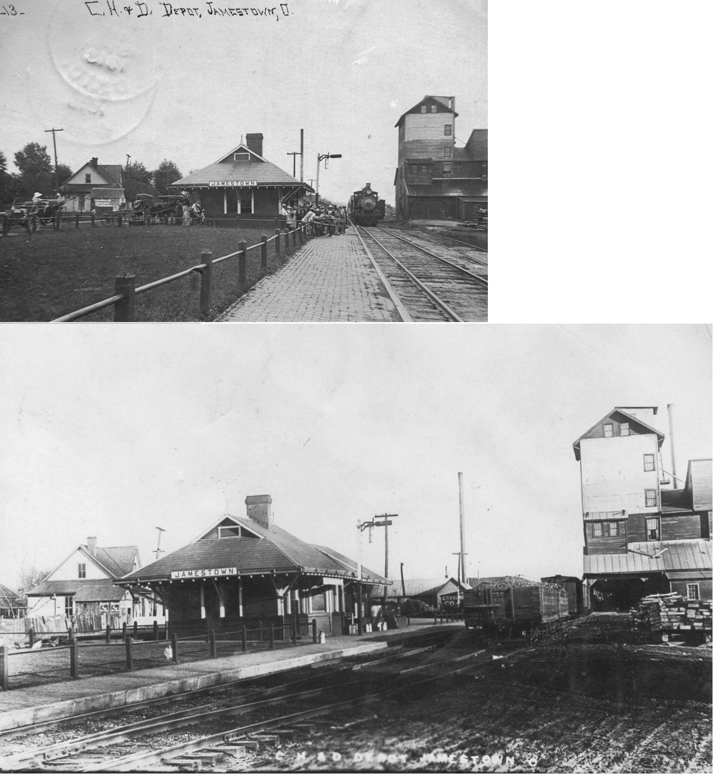
| Jamestown | |
This station was built sometime between 1894 and 1899 and sat on Railroad Street (now Verity Street) between S. Church and Sycamore. Prior to that there was an older Dayton & Southeastern RR station on this site, but a bit to the west. The B&O put a trailer next to the station in 1970 because it was so dilapdated (Gazette News-Current, 4-29-1970). It was torn down sometime soon after and the station (now in the trailer) was closed by the B&O in 1975. | ||||||
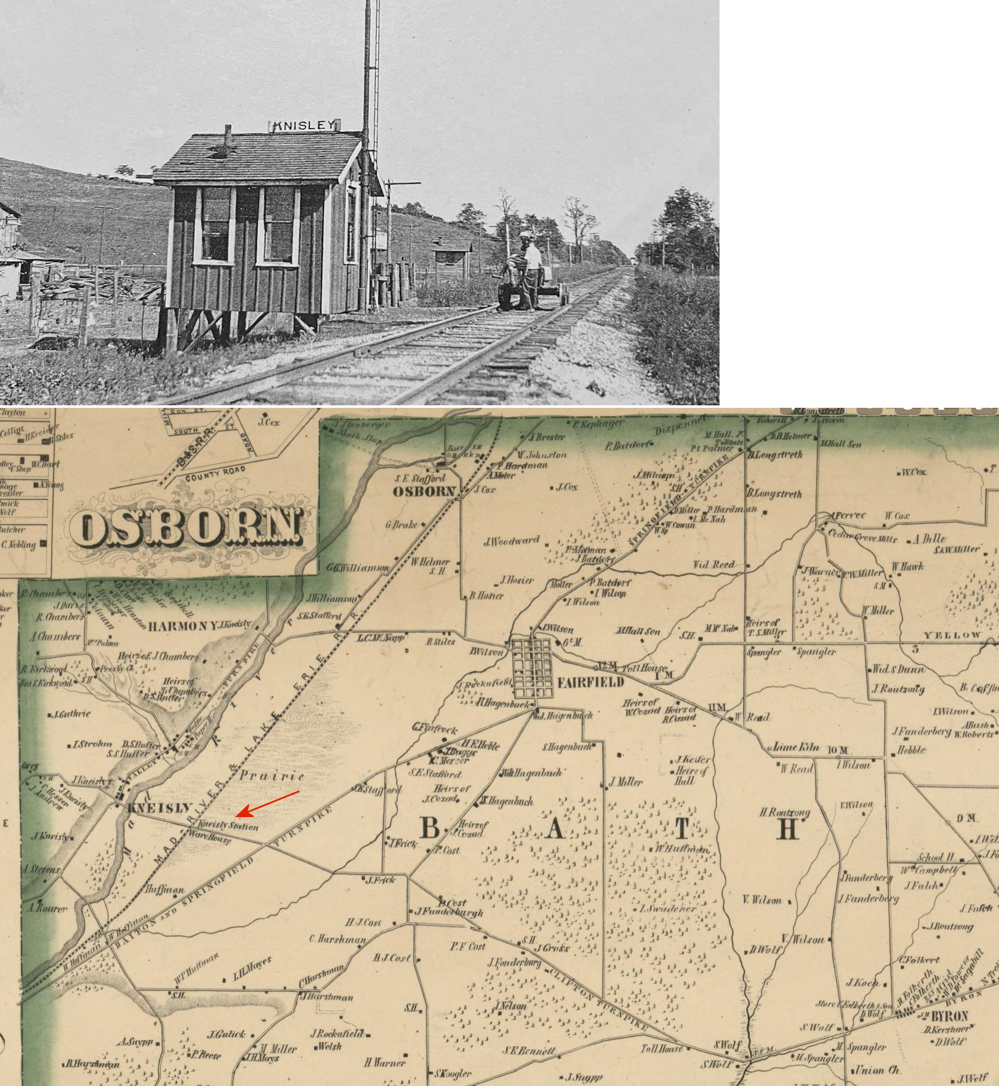
| Knisley (Kneisly) |
 |
This was telegraph station “KI” in Greene County SW of Osborn. The 1855 Greene County atlas shows it as a RR station on the MR&LE. It was an early station on the line, but reduced to a telegraph station in later years. | ||||||
| Monroe | |
|||||||
| New Jasper | |
The depot was last known located in a grain elevator on New Jasper Station Road. Passenger platform was built between elevator building and tracks. Line was operated as the Ironton branch of the B&O. CSX abandoned the line in 1983. Building was in extremely poor condition and probably razed in the 2000s. | ||||||
| Old Town |
|
|||||||
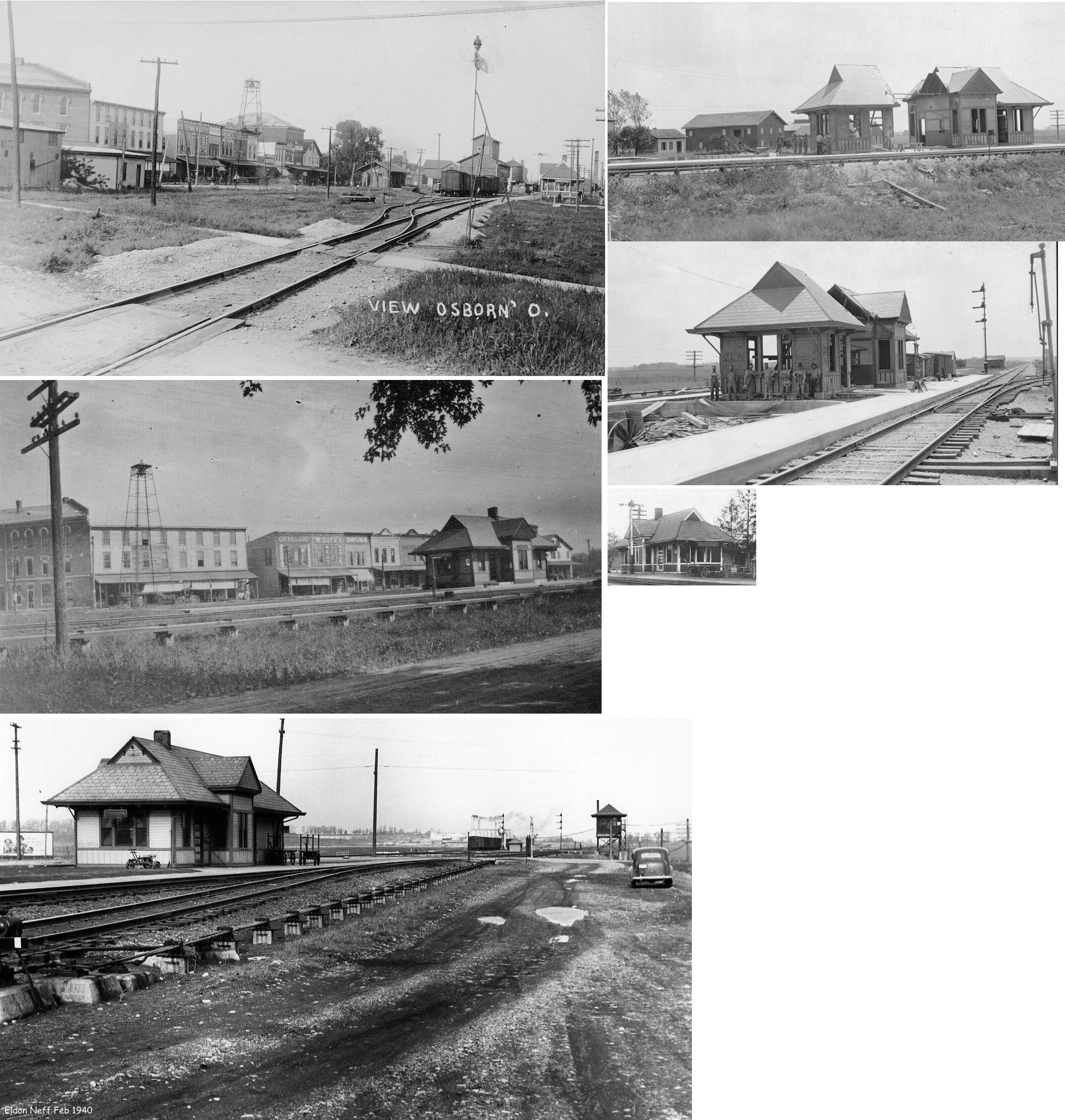
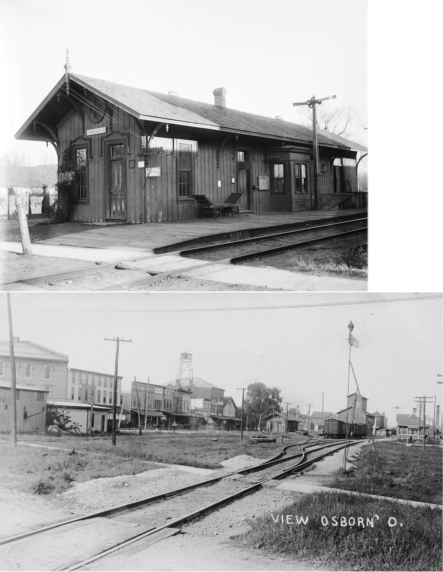
| Osborn |  |
This town was located in what is now the flood basin of the Huffman Dam. The town was relocated several miles away in 1921 during construction of the dam to a site near Fairfield. The depot was cut in two and moved to the new location. In 1950, Fairfield and Osborn were merged as Fairborn. This station was on South Railroad Street. | ||||||
| Osborn |  |
See note above. This station was on North Railroad Street. The building between the tracks was the Tranchant & Finnell Elevator. | ||||||
|
Roxanna (Claysville) |
|
|||||||
|
Shoups Station |
|
This was an early Dayton & Xenia RR station that was south of Zimmermansville (now part of Beavercreek). The station was located in the vicinity of North Fairfield Road and Old Mill Lane just north of US-35. The old Schantz Mill was located just to the SE of the station. | ||||||
| Simms |
 |
The Big 4 stations that were here date from the CCC&I years as they are shown on maps from 1874. They were located in the SW quadrant of Section 2 of Bath Township. They were on an east/west raod just west of a tollhouse on the old Dayton-Springfield Pike. The passenger station was on the north side of the road and on the east side of the tracks. The freight station was on the south side of the road on the west side of the tracks. | ||||||
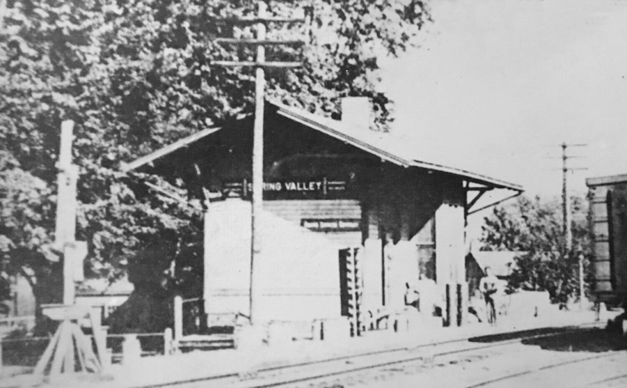
| Spring Valley |
 |
|||||||
| Trebein | AND |
This was a joint station and also served as a general store. It was on the SW side of the old Dayton & Xenia Pike on the NE side of the tracks. This location is now where Shaw Road (CR-142) crosses the tracks (GPS: 39.70561,-83.985844). It was located next to the old Miami Fertilizer Company (formerly a tobacco warehouse). It is shown on the 1910 map. It is also shown on the 1931 map, but appears to have been out of service but still used as a store. On that map there is a filling station built just to the north of the station building. | ||||||
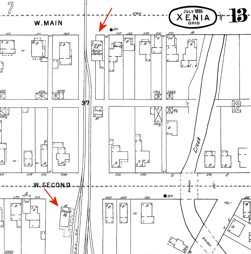
| Xenia | |
The first CH&D passenger station here was on the south side of West Main Street on the east side of the tracks at approximately GPS: 39.683868, -83.938662. | ||||||
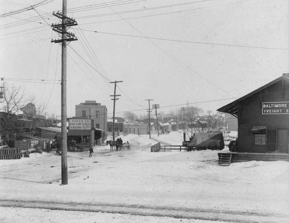
| Xenia | |
The first CH&D freight station here was on the south side of West Second Street on the west side of the tracks at approximately GPS: 39.682752, -83.938771. | ||||||
| Xenia | |
This later-generation passenger station was on the NE corner of Home Avenue and South Detroit Street (GPS: 39.679729,-83.929324). An article in the Gazette News-Current from July 13, 1896 reports that CH&D trains will stop using its depot on Main Street and instead stop at the new Detroit Street depot which will be known as "Xenia Junction." The station was closed by the B&O in 1975. | ||||||
| Xenia | |
The freight station was just to the north of the passenger station closer to Hill Street (GPS: 39.68003,-83.929147). | ||||||
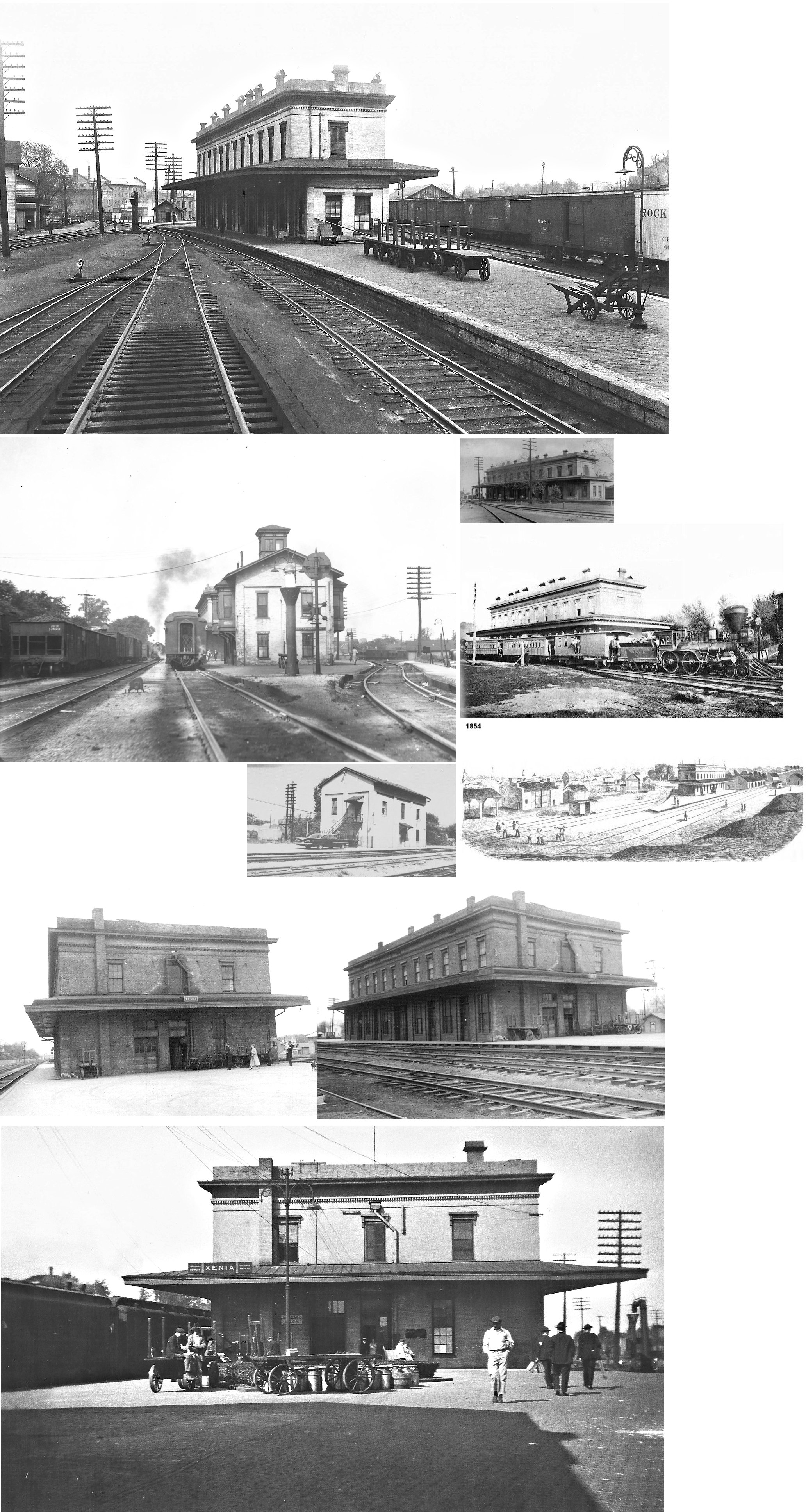
| Xenia |
|
Built in 1850, this passenger station was located right in front of where the
replica station is today on Miami Street
between South Detroit Street and South West Street (GPS:
39.680245,-83.931347) The freight station was at the corner of Miami
Street and Detroit Street (GPS: 39.680018,-83.929785). These stations are
both shown on maps from 1874 and the passenger station is shown in
illustrations from 1854. In the early years, the station served the Little
Miami RR, the Dayton, Xenia & Belpre RR, and Xenia & Columbus RR.
The building also housed a hotel. The freight station was built some time around 1880, it was used as the Panhandle (PRR after April 1920) freight station on the ground floor, XG tower controlling divergent tracks to Cincinnati, Dayton and Springfield on the second floor, until the passenger station just west (built in 1850 for the Little Miami RR) was demolished in 1955 at which time it assumed duties as a passenger station too. It housed the passenger station on the ground floor from 1955 to the end of Amtrak passenger service on Oct. 10, 1979. From 1979 to 1986 it housed a Conrail office. This original structure was demolished during the summer of 1988 and the replica of it was constructed ten years later. - Tom Vondruska |
||||||
| Xenia |
|
The Little Miami tracks ran through town down the center of Detroit Street. James Gowdy donated a building on the east side of Detroit Street between 2nd and 3rd Streets (north of the alley in the middle of the block) to be used as a station in 1844 (GPS: 39.683564,-83.928895). The station was known as the "Uptown Station" and later as the "Detroit Street Passenger Station." This station is shown on maps from the late 1800s through 1910. In 1919, the building appears on maps as just a dwelling and by 1931 the building is gone. | ||||||
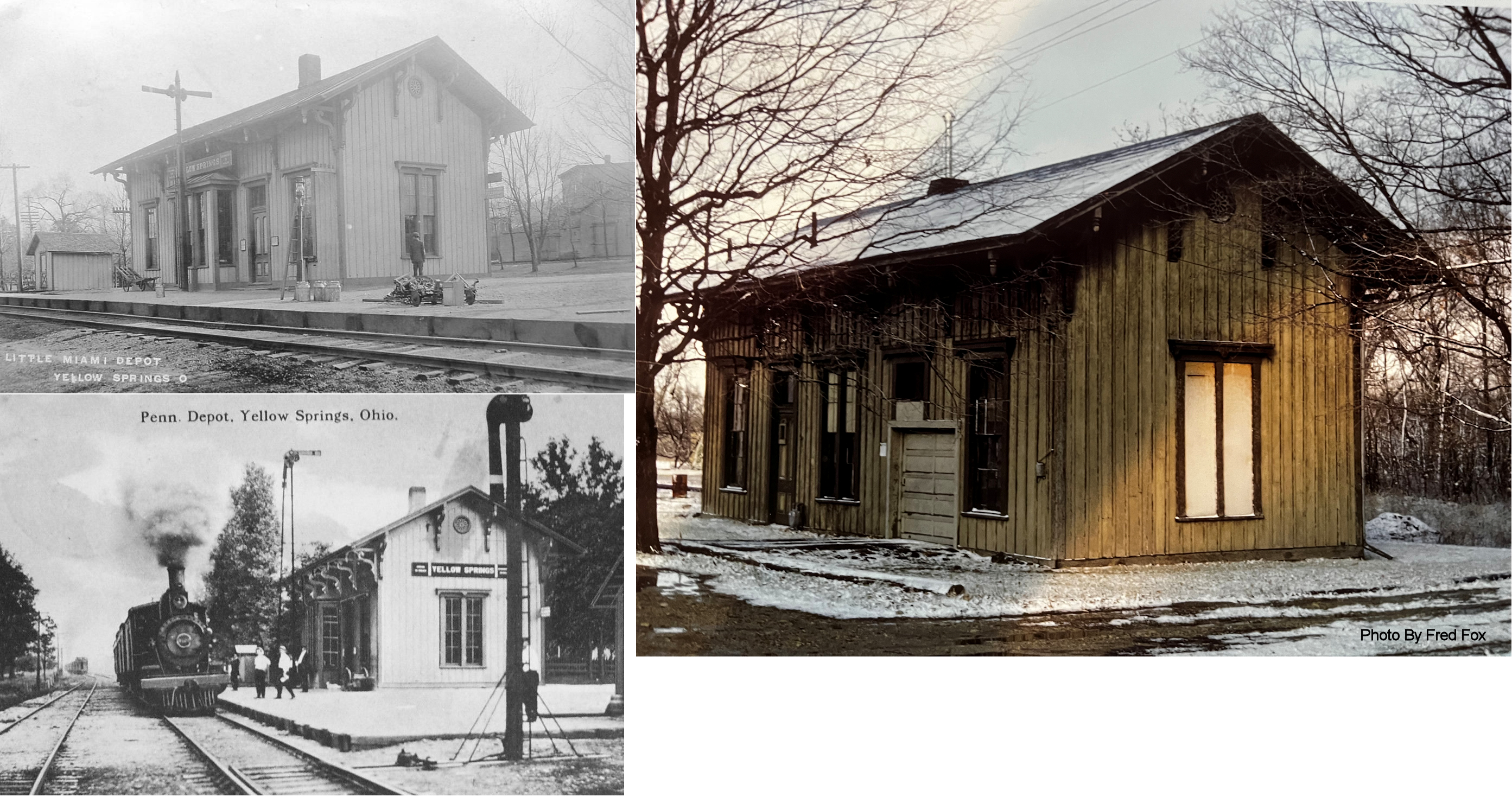
| Yellow Springs |
|
Station was off Corry Street (formerly Grove Street) just south of Xenia Avenue (GPS: 39.806443,-83.887771). The Little Miami RR was later part of the PRR. | ||||||
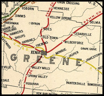
| 1898 GREENE COUNTY RAILROAD MAP | ||||||||
 |
||||||||
|
Notes About Existing Stations... Bowersville (DT&I) - Station was built in the late 1800s along a line begun by the DT&I to run from Jeffersonville in Fayette County to Waynesville in Warren County. The line was completed as far south as Bowersville were the wooden passenger station was built. The line, known locally as "The Grasshopper," was slated to be abandoned in September 1932, but the actual date was pushed back a month to allow local farmers to get their crops shipped out. Xenia (Replica) - This replica of the Panhandle (PRR) freight house and GW tower was dedicated May 1998. The original structure stood about 150 feet east of the current building where the parking lot is now. Yellow Springs (Replica) - When the railroad was first put in Yellow Springs it was a resort town people used to come there for the healing powers of the springs. It was suppose to go through Clifton originally but was rerouted as a reward to William "Judge" Mills for securing loans for the penniless Little Miami RR and was completed to Springfield by August of 1846. Brigitta Valey writes: In 1967 my parents recovered the station from certain destruction before the village of Yellow Springs could demolish it. In short, the village considered the station an eyesore in 1967 and the fire department was going to burn it as practice but all pieces of the structure were saved. The walls of the station were stolen and used for horse shelters. However, all of the architectural elements were stored and some pieces were restored. I know this because I grew up with them in my parents house until my father transferred them to a friend who then transferred them to another friend. Now, 32 years later, the "Gothic Multi-use Pennsylvania RR Station" has been rebuilt as close to historical dimensions, including as much as the original architecture as possible. It was dedicated 5/8/99 not far from where it originally stood. The station was originally just off Corry St. very close to the center of the village. The replica station now serves the community as the chamber of commerce office and public restrooms. The replica includes the original station's windows and ticket counter that separated the office from the freight storage. The brackets are also original and were restored and used on the superstructure. Original vents have been incorporated into the modern heating and cooling system making it as the original station looked in 1870. Because of the age of the wood some window frames and cornice pieces could not be used. |
||||||||