 COUNTY COUNTY
|
|
||||||||
| EXISTING STATIONS | ||||||||
|---|---|---|---|---|---|---|---|---|
| Station Name |
Original Railroad | Current Location |
Type | Current Use |
Date Built |
Track Status |
Building Material |
More Info |
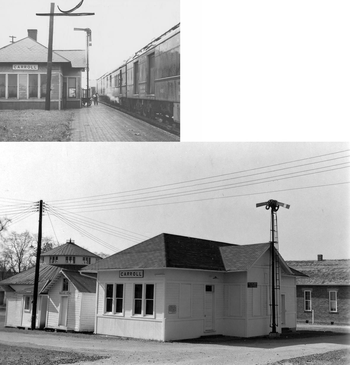
| Carroll |
 |
Fairfield Co. Fairgrounds, Lancaster (GPS: 39.724943, -82.600052) |
C | Civic | 1905 | In Use | Wood |
|
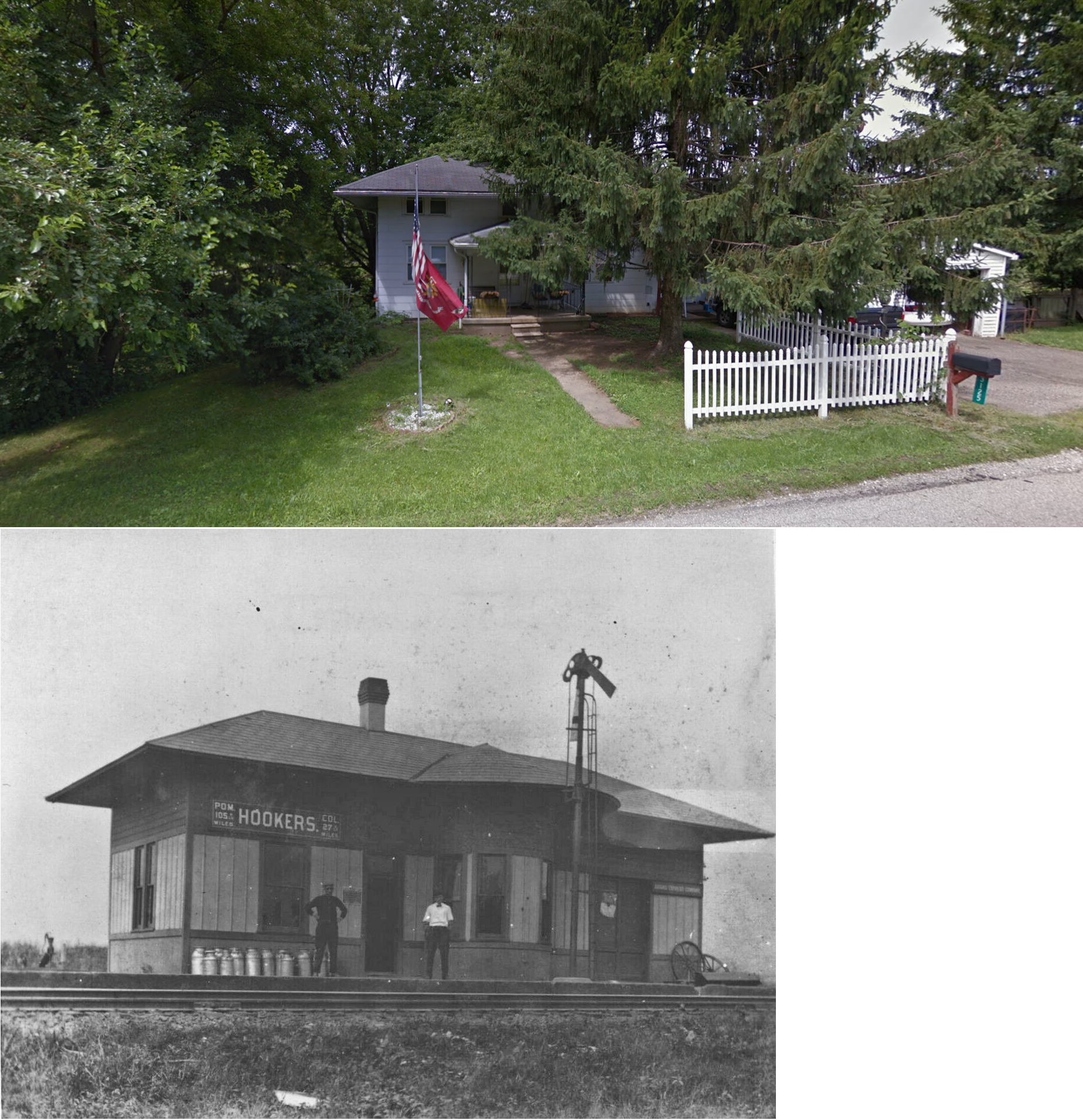
| Hooker |
|
3125 Old Columbus Road near US 33 (GPS: 39.747960, -82.660593) |
C | Residence | 1898 | In Use | Wood |
|
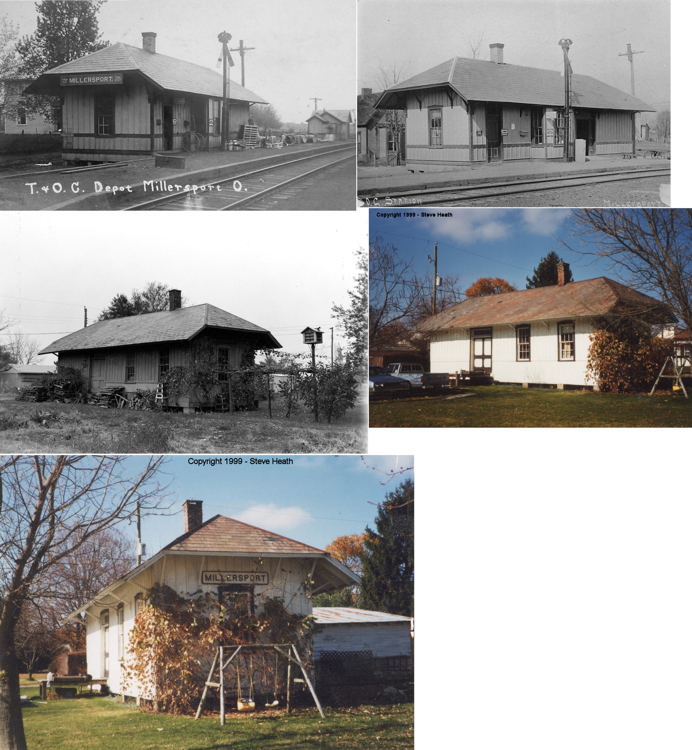
| Millersport |
 |
20750 River Road, Guysville (Athens County) (GPS: 39.300705, -81.900079) |
C | Rental | 1870s | Gone | Wood |
|
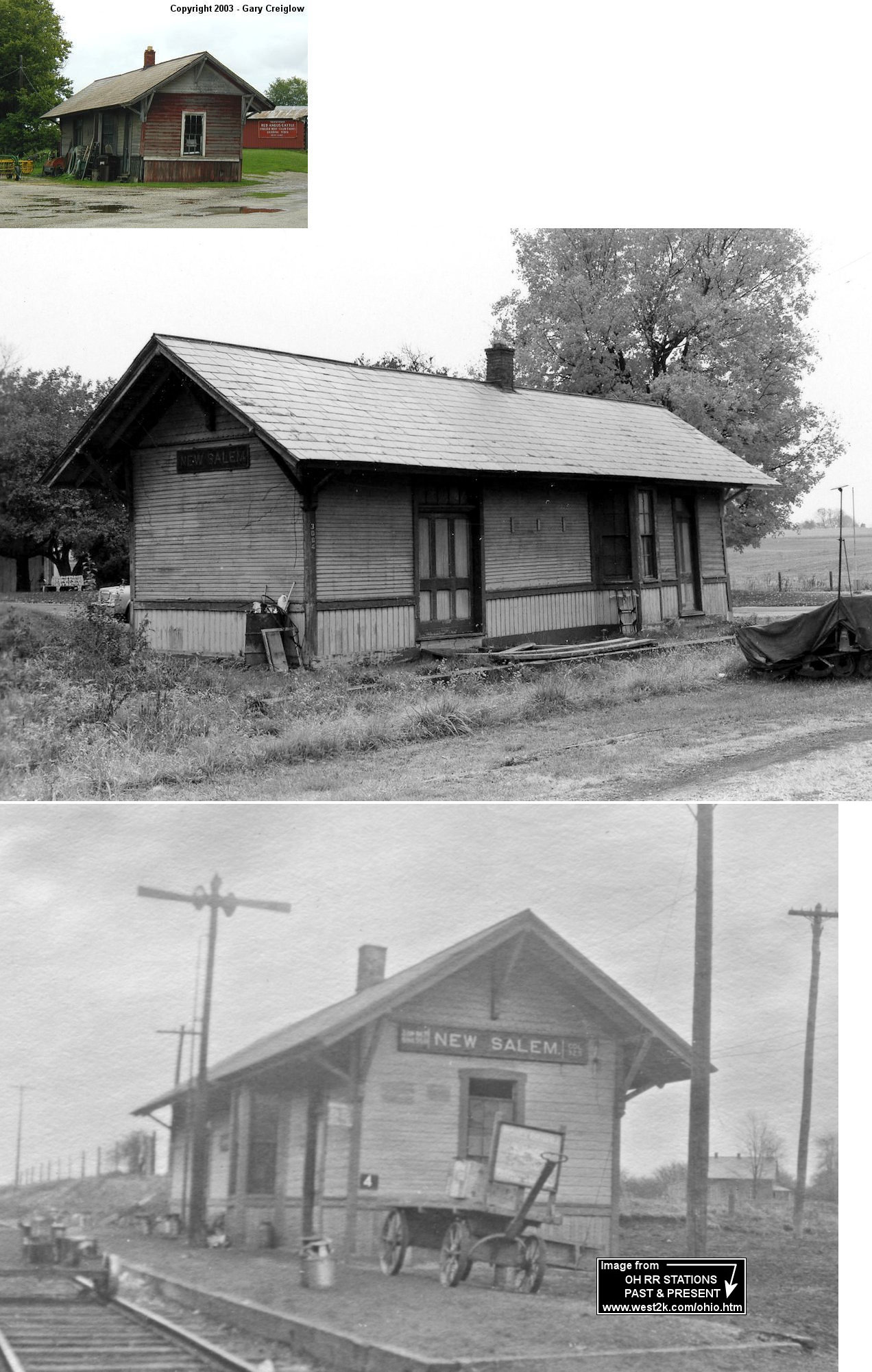
| New Salem |
 |
Canal Road & Elevator Road (GPS: 39.859033, -82.481574) |
P | Storage | 1882 | Gone | Wood |
|
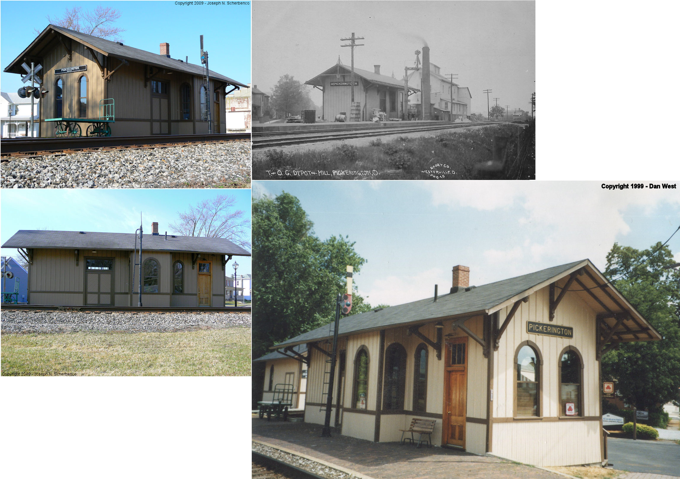
| Pickerington |
|
50 North Center Street (GPS: 39.885076, -82.753399) |
C | Business | 1880 | In Use | Wood |
|
| STATIONS OF THE PAST | ||||||||
| Station Name |
Original Railroad |
Notes | ||||||
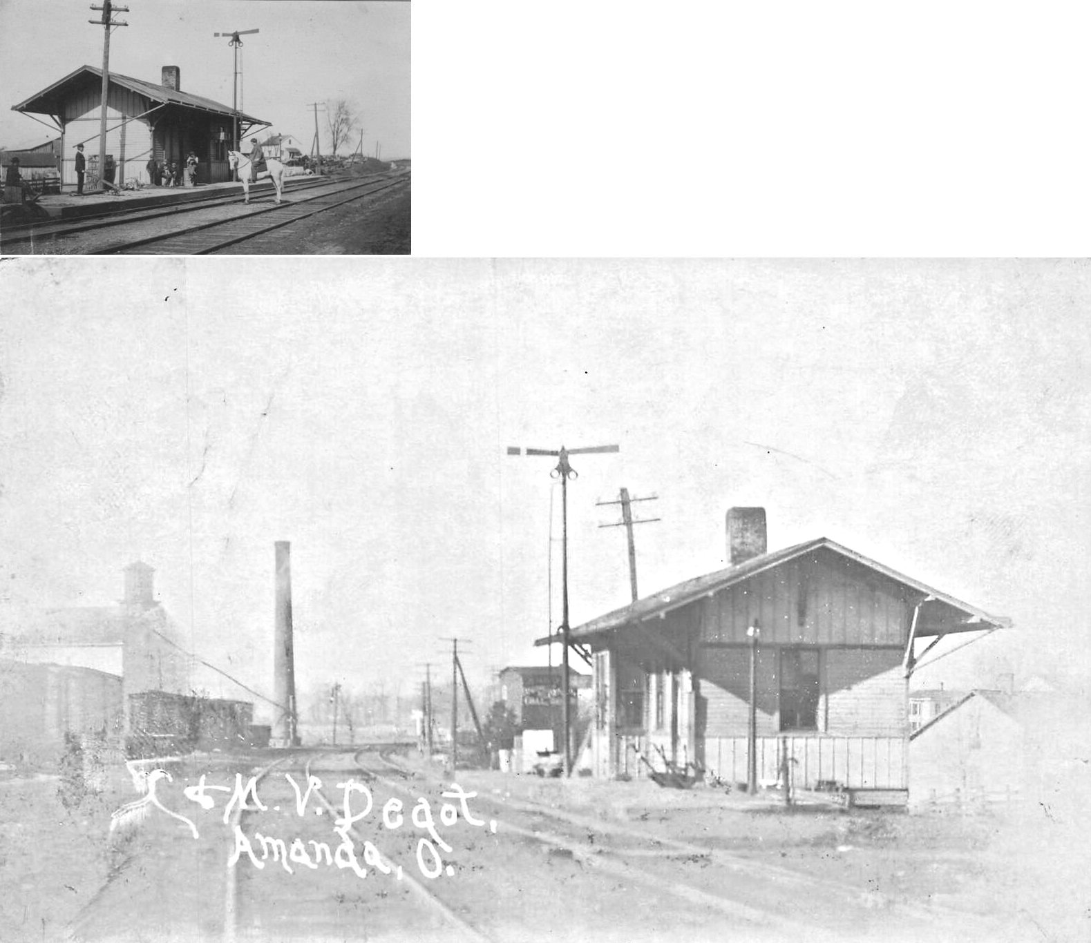
| Amanda |
 |
|||||||
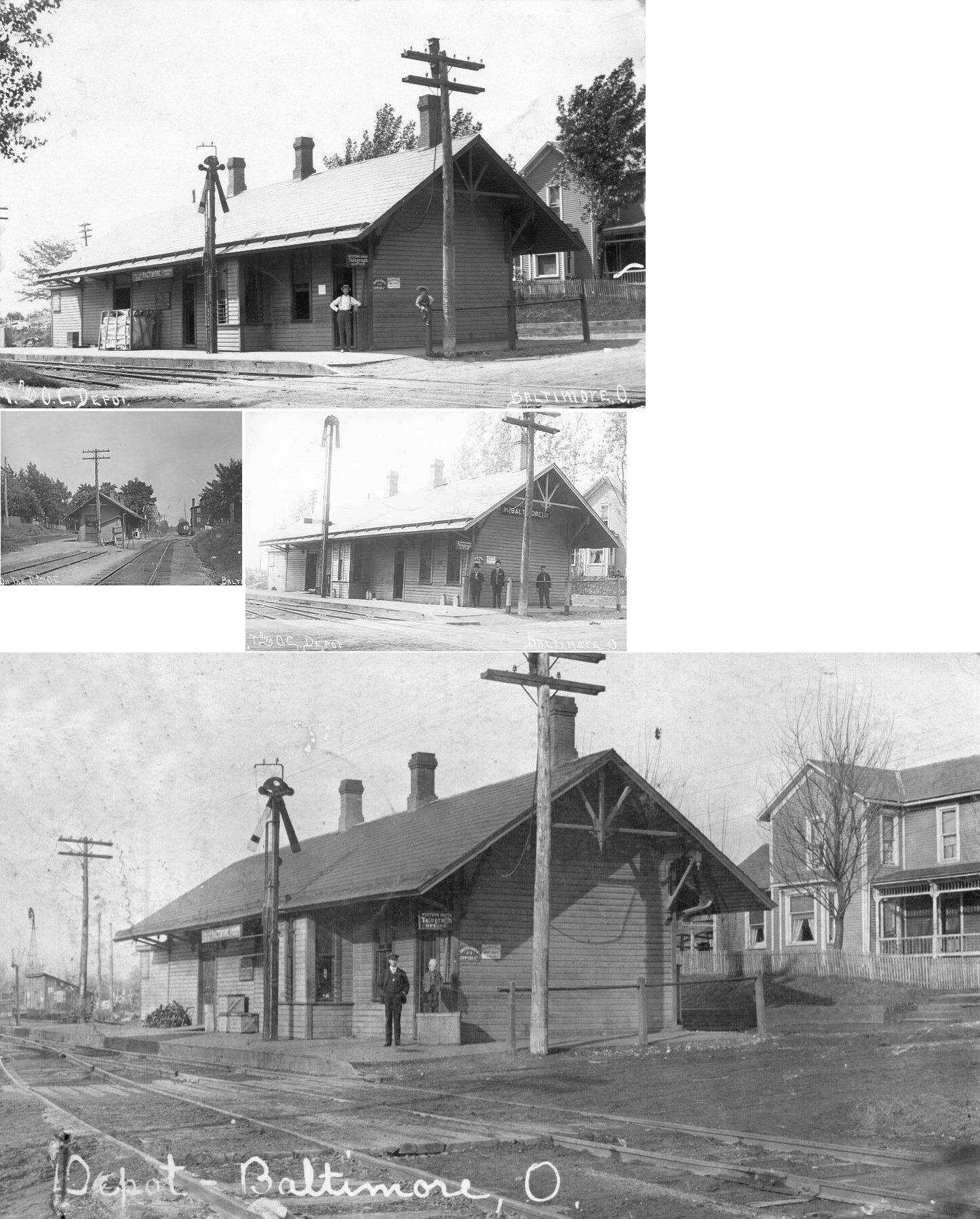
| Baltimore |
|
This combination station was on the west side of Main St. (SR 158) on the north side of the tracks. | ||||||
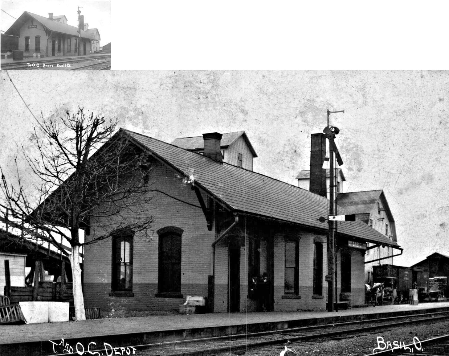
| Basil |
|
The first station here was a frame station built in 1880 on Oak Alley. It burned shortly thereafter and arson was suspected. The local rivalry between Basil and Baltimore (the station at Basil was one mile east of the station at Baltimore) led some to believe that the depot was burned as part of this feud. | ||||||
| Basil |
|
This station replaced the original station (listed above) and was the only brick station on the T&OC. It was built in 1880 and was closed by the NYC in 1948. When the station closed, it still was lit by gas lamps rather than electricity (Lancaster Eagle-Gazette, 7-10-1948). Basil and Baltimore were two separate towns up until around 1958, when they were combined together. | ||||||
| Bismark Park (Buckeye Park) |
|
|||||||
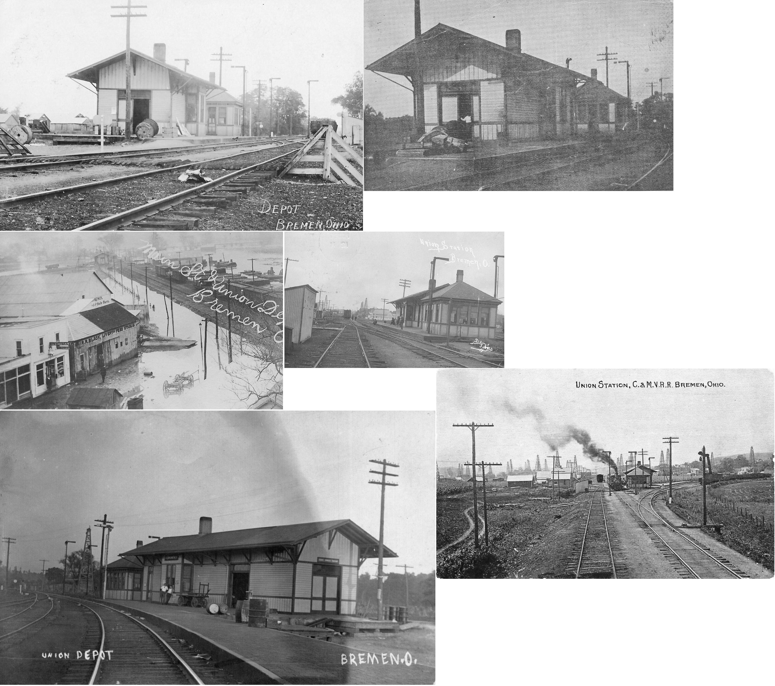
| Bremen |
AND |
This "union" station sat between the tracks of the railroads with the C&MV to the south of the station and the T&OC to the north at GPS: 39.703305, -82.423150. | ||||||
| Carroll |
|
The original depot here was built in 1868 and burned down in 1905. | ||||||
| Delmont |
|
|||||||
| Harley |
|
Was also known as "Yelrah" ("Harley" spelled backwards) by locals. The station was off Stoudertown Road NW in the vicinity of GPS: 39.853713, -82.689459. | ||||||
| Lakeside Park |
|
|||||||
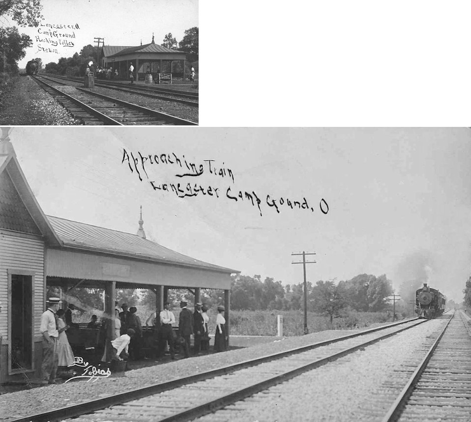
| Lancaster (Campground) |
|
This station was at the Lancaster United Methodist Church campground. It was located on the road that crosses present U.S. 33 at the Highway Patrol Post and Ohio Valley Trading, just north of Lancaster. | ||||||
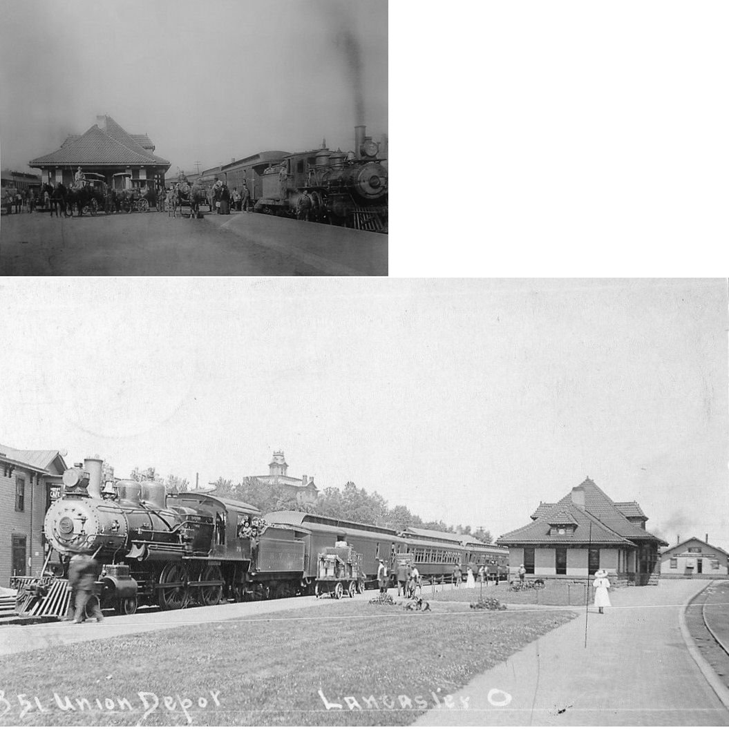
| Lancaster |
AND |
The Lancaster HV/C&MV (C&O/PRR) passenger station sat between S. High and S. Broad Streets. Built in 1899, it went out of service in 1960. Prior to 1899 there was another joint station here; a smaller frame depot that was just to the west. The 1899 Sanborn Fire Map shows both the "old" and "new" stations standing at that time. | ||||||
| Lancaster |
|
This freight station was on the east side of South High Street just south of Locust St. Photo from David Dupler's site. | ||||||
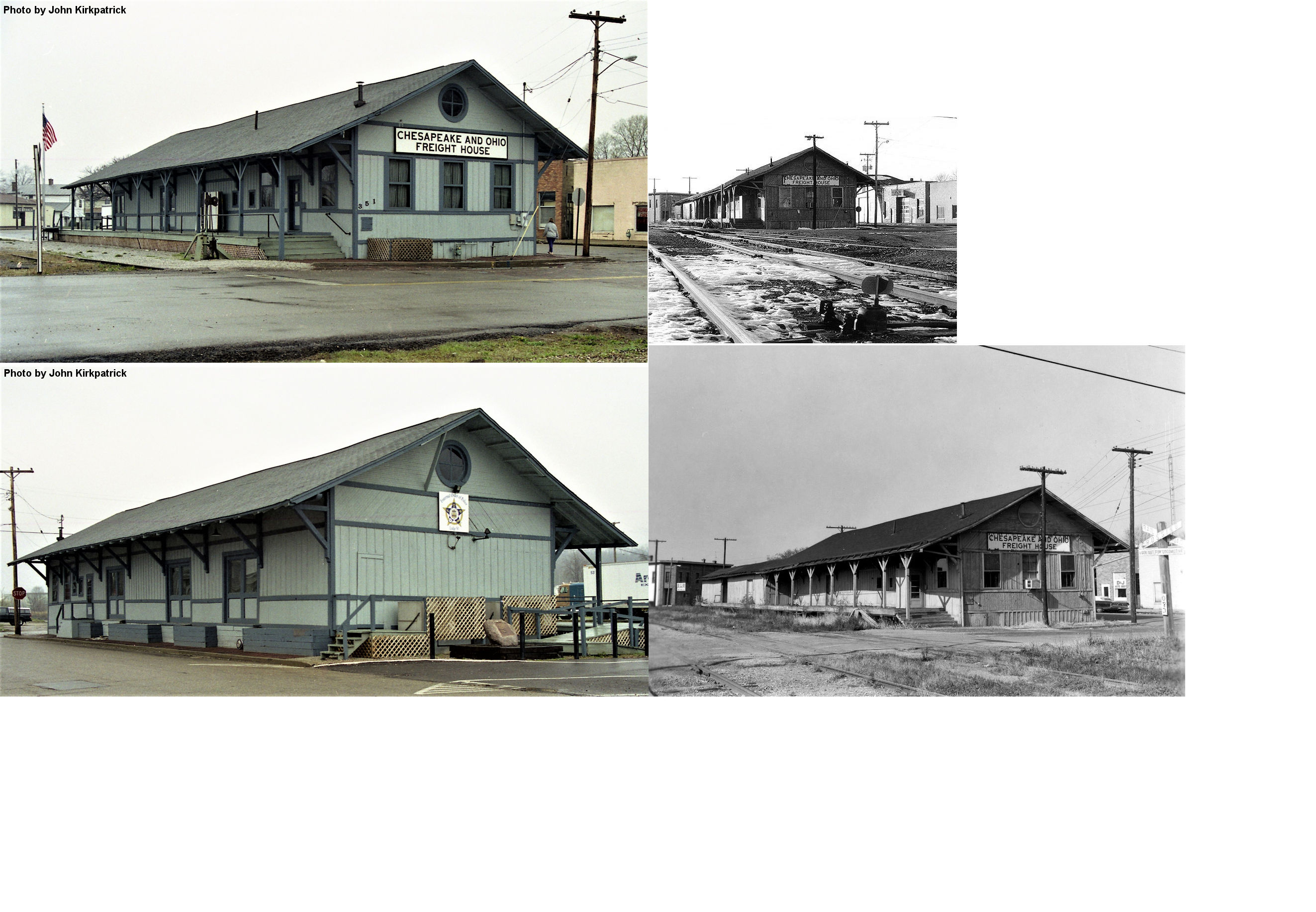
| Lancaster |
|
This freight station was at 351 South High Street (GPS: 39.709516, -82.599746). It was set on fire in 2021 (arson) and 2024 (suspected arson) and subsequently torn down. It served as an FOP hall in modern times. | ||||||
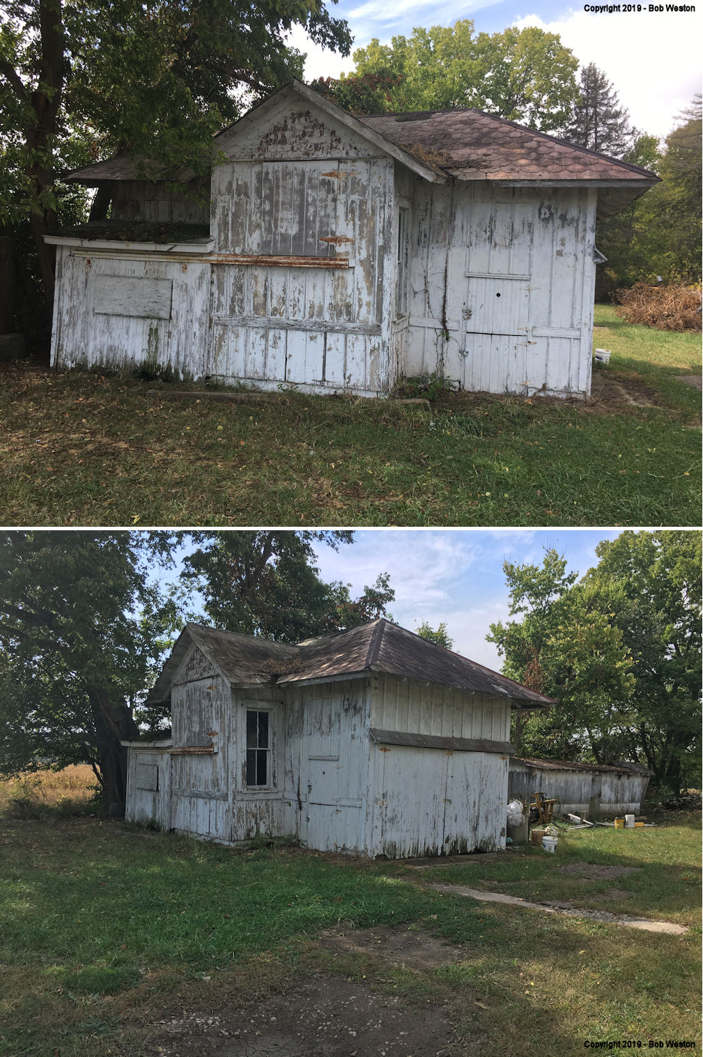
| Lockville |
|
There was a station here prior to the 1905 station listed below. | ||||||
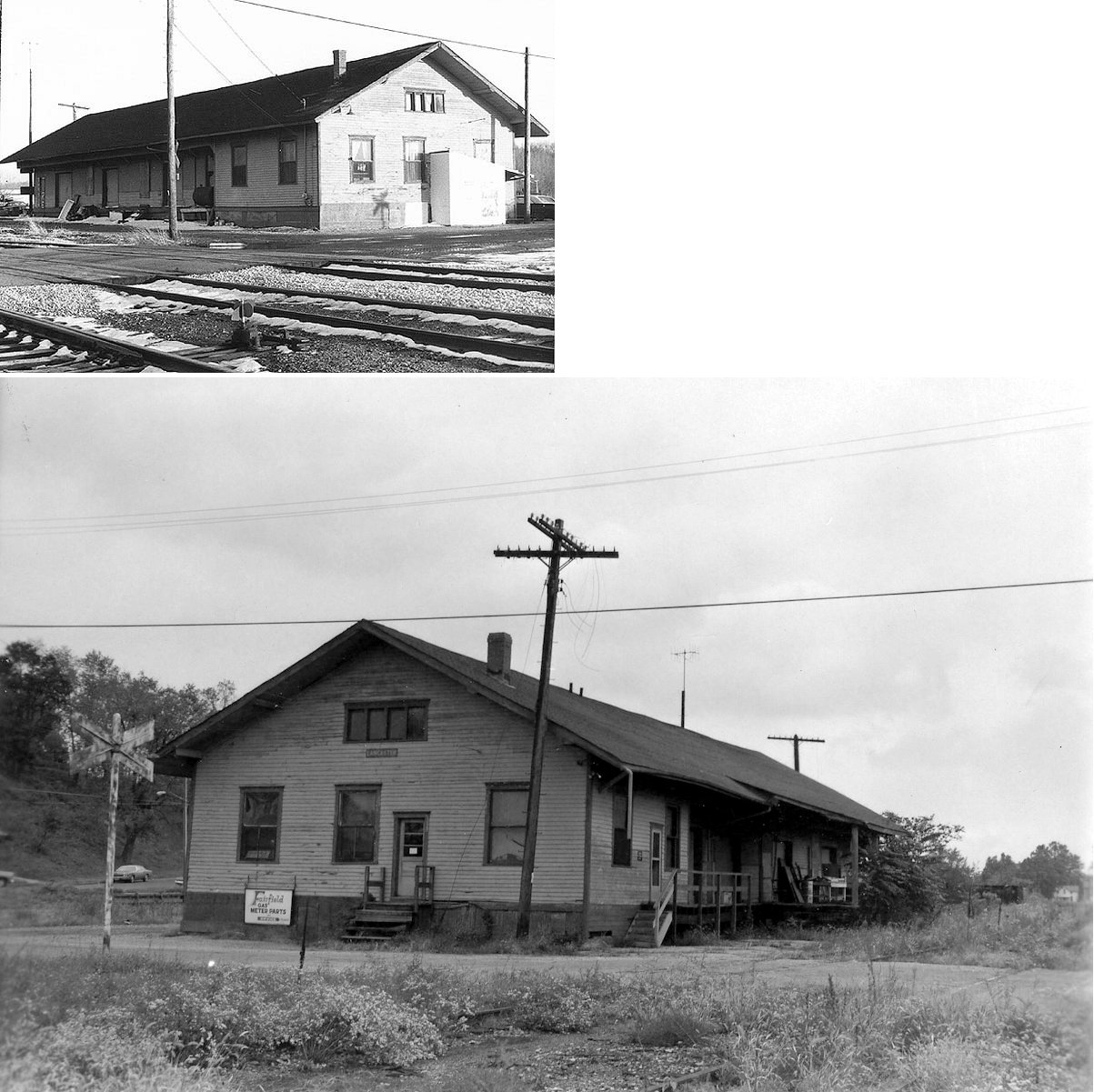
| Lockville |
|
This station was built in 1905 and sold by the C&O in 1930s. It was then soved about 400 feet south of the tracks on the west side of Pickerington Road NW just south of US 33 at GPS: 39.832583, -82.744619. It was privately owned and was partially modified with all sorts of doors. It was being used as a shed, but as of 2019 the property appeared abandoned/vacant. It was finally torn down in the summer of 2025 for a road improvement project. | ||||||
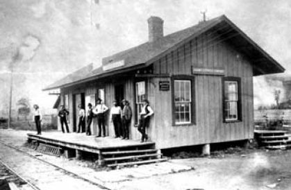
| North Berne |
|
According to the November 19, 1936 edition of the Lancaster Eagle-Gazette, John Eversole, Sherman Weidner, William E. Friesner, and Walter A. Shaw served as agents over the life of the station. During peak traffic, the station saw eight passenger trains per day. Passenger service ended in 1926 and around 1936 the station was purchased by Edward Burnsworth who reclaimed the lumber to build a house on Bremen Pike. | ||||||
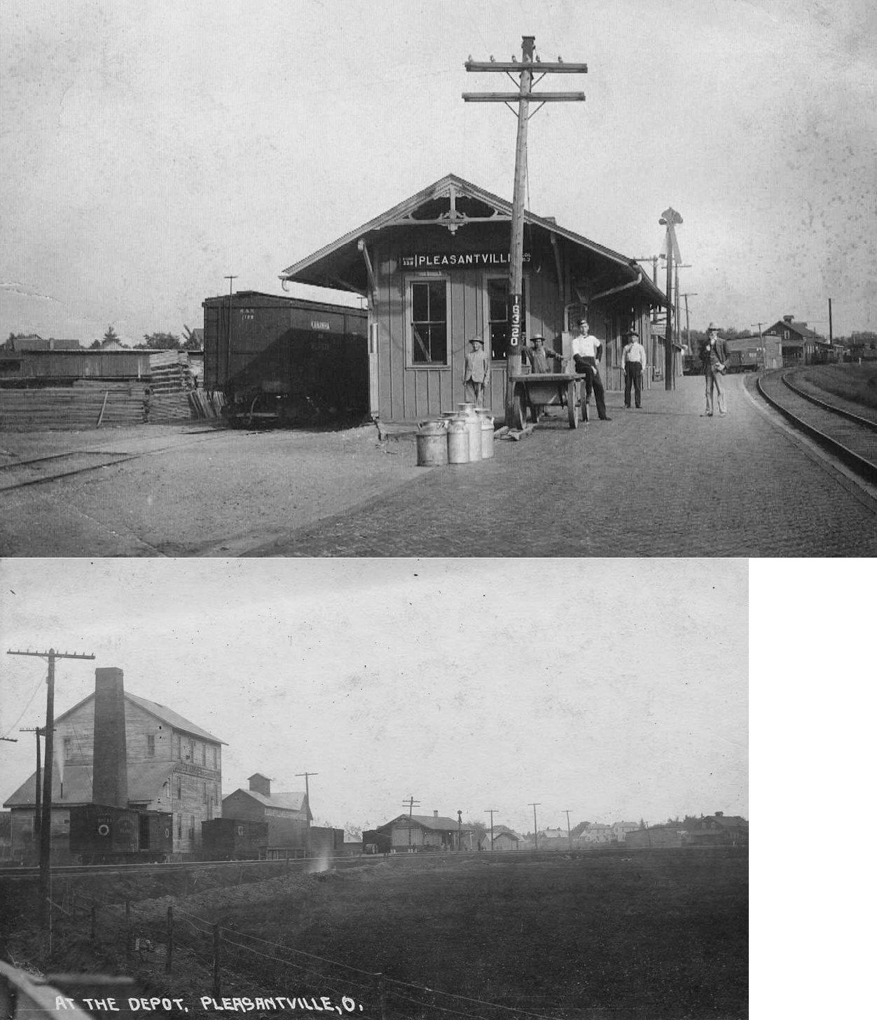
| Pleasantville |
|
|||||||
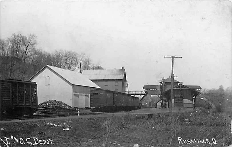
| Rushville |
|
|||||||
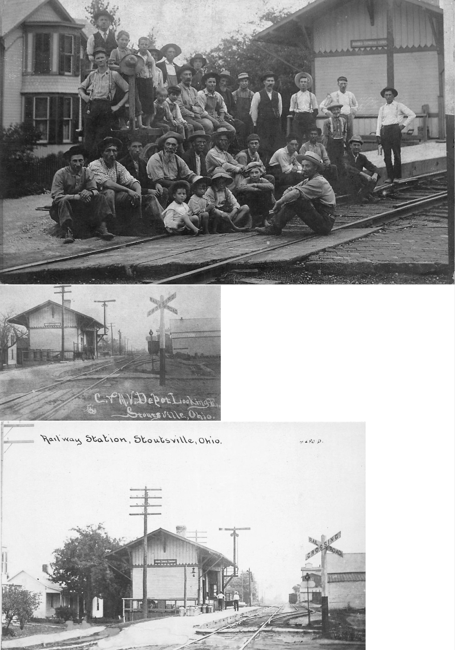
| Stoutsville |
|
|||||||
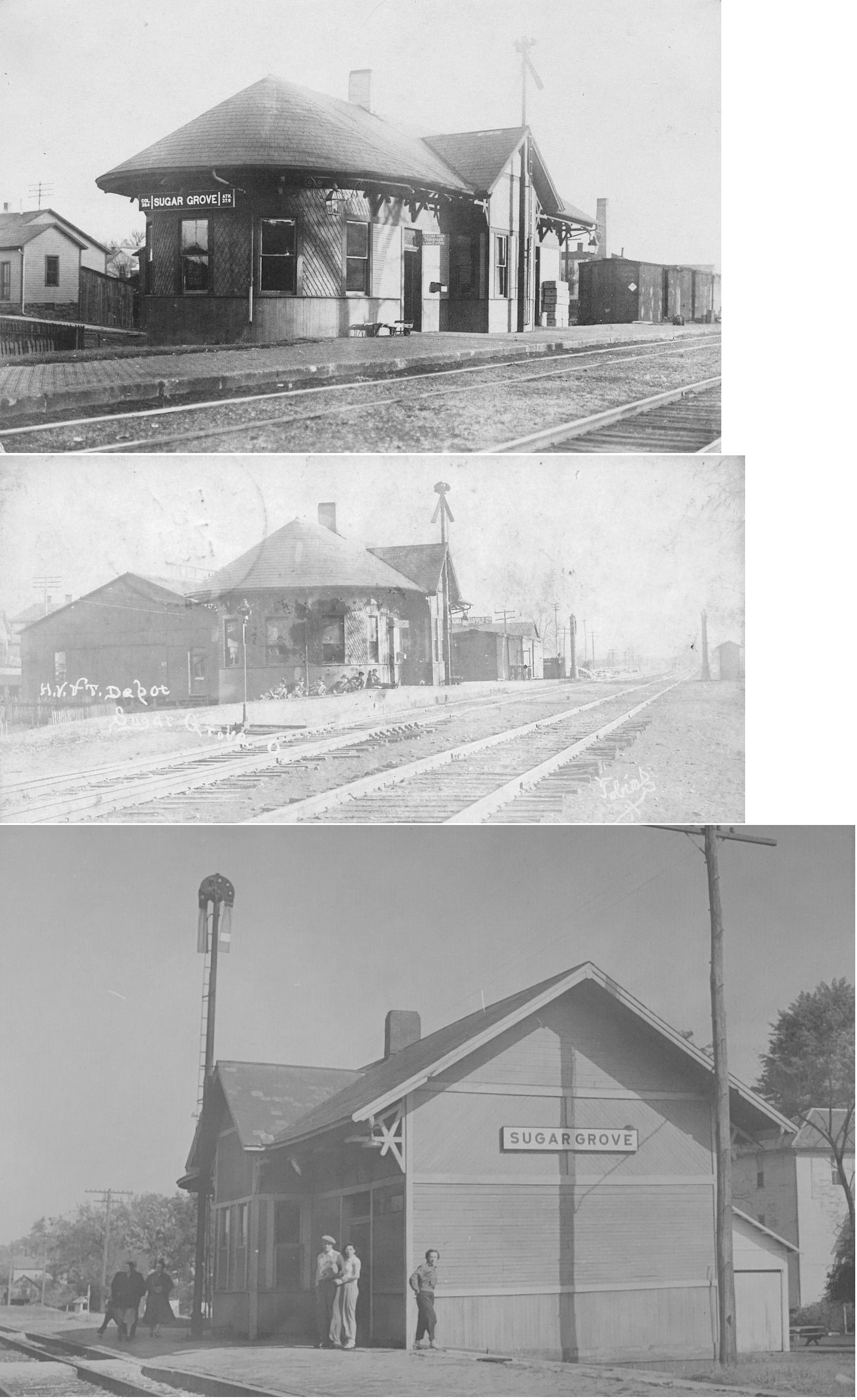
| Sugar Grove |
|
This station was built in 1902 and replaced an earlier depot here. It was almost identical to the depot at Prospect. | ||||||
|
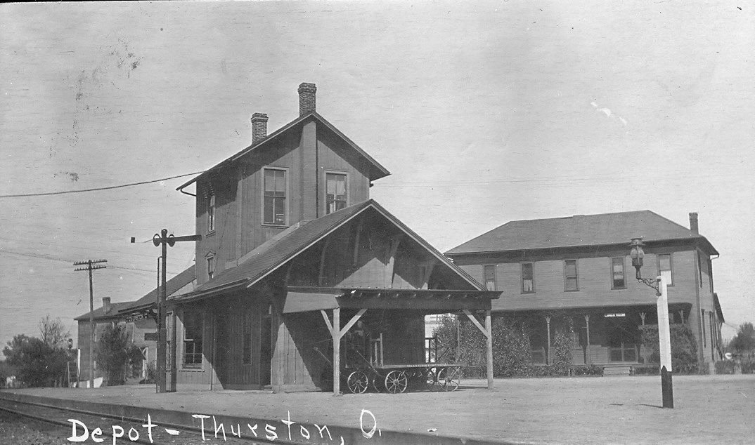
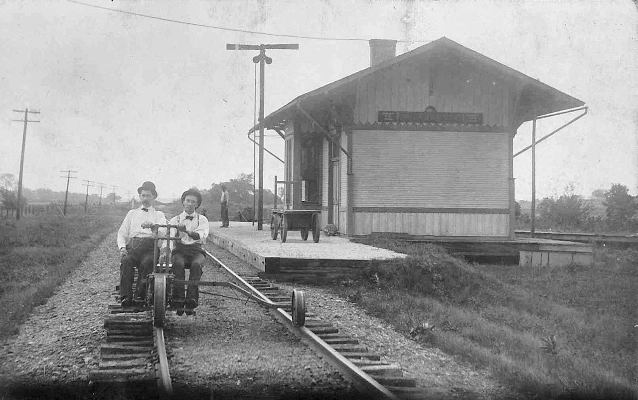
Thurston (Bush's Station) |
 AND |
This station was on the east side of High Street on the NE side of the tracks at GPS: 39.843381, -82.546518. The house/hotel in the background of the photo is still standing as of 2026. It was likely built by the Z&W/CS&H and served the T&OC as well. For some reason the station was moved across the track from its original location in 1894. During the move, the depot staff operated from the hotel (The Bucyrus Evening Telegraph, 10-2-1894). In early years the station was briefly known as Hadley Junction. | ||||||
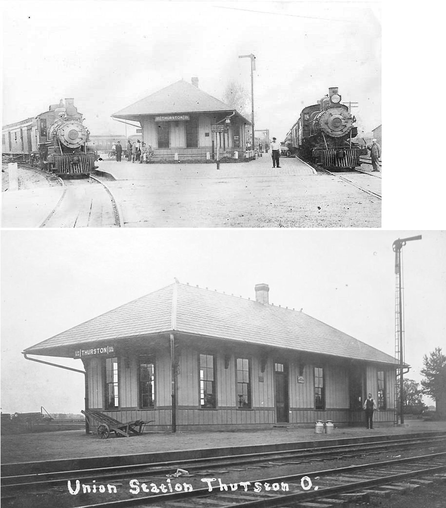
| Thurston |
AND |
This station, which may still be standing as a residence, was built by the T&OC. Can anyone confirm whether it is still standing? It was still standing as of 1979. It was likely at the same site as the station listed above. | ||||||
| Wyandotte (Clear Creek) |
AND Columbus & SOUTHERN |
This station was on Wyandotte Road. It is where the Lancaster & Hamden RR (Columbus & Southern) junctioned with the C&MV. The back of the photo read "2 miles east of Stoutsville where the 'Old Rosie' met the C&MV railroad. The Old Rosie went to Tarllton, Laurelville and South Bloomingville." A 1918 article in the Lancaster Eagle-Gazette (5-18-1918) reported that the station was dismantled with the intent that it would be reassembled and used by the railroad in Zanesville. The article also confirmed that the station was in fact a union station used previously by the C&MV and Columbus & Southern RR. | ||||||
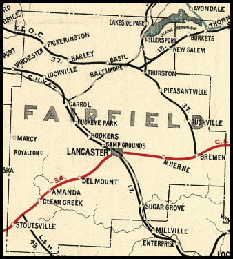
| 1898 FAIRFIELD COUNTY RAILROAD MAP | ||||||||
 |
||||||||
|
Notes About Existing Stations... Carroll (CHV&T) - The station was originally located on the north side of Mill Street in Carroll. Hooker (CHV&T) - Moved from original location. It almost unrecognizable as a depot, having been heavily remodeled. It is easier to tell it was a station by looking at the rear of the house. Millersport (T&OC) - The station was originally moved approximately 400 feet and turned 90 degrees from its original location in Millersport and was at Refugee Road (SR 204) & Railroad Street. Around 2003 that this station was purchased and moved to private property at 3670 Havensport Road near Carroll at GPS: 39.780510, -82.650594. In 2024 the station was moved again to Guysville where it serves as a rental cabin along with several cabooses on the property. See https://hideawayonthehocking.com/ for details. New Salem (Z&W) - The Columbus, Sandusky, and Hocking Railway must have had trackage rights over the T&OC Ry from Columbus to Thurston. The extension was built from Thurston to Darlington connecting with the Cincinnati & Muskingum Valley. Coal branch lines extended south of Fultonham into the counties of Perry, Morgan and Athens. The Zanesville & Western must have been formed by 1900 or 1901. I have an Ohio Railway Map dated 1898 as my source for this information. At Fultonham, the scale house and other small buildings still existed as of a couple of years ago. --Ron Weaver Pickerington (T&OC) - Insurance Agency. T&OC section house next door. This station is restored and is in excellent condition. It's now a State Farm insurance office. The adjoining Section House #44 (also beautifully restored) is now home to Focus Photography. Station is on National Register of Historic Places. |
||||||||