 COUNTY COUNTY
|
|
||||||||
| EXISTING STATIONS | ||||||||
|---|---|---|---|---|---|---|---|---|
| Station Name |
Original Railroad | Current Location |
Type | Current Use |
Date Built |
Track Status |
Building Material |
More Info |
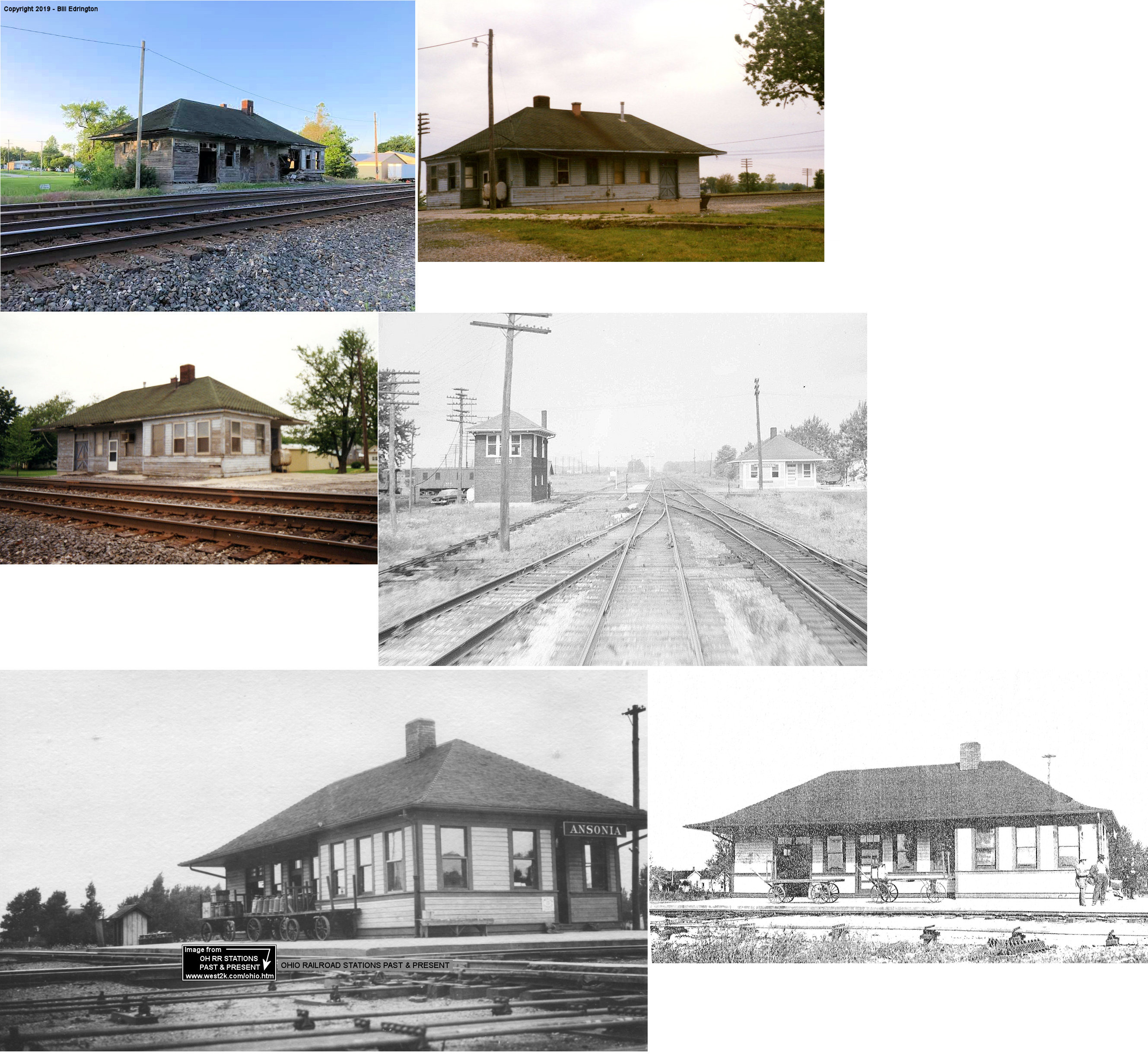
| Ansonia |  AND  |
South of the intersection of Michigan and High Streets (GPS: 40.211884,-84.640651) |
C | Railroad | ???? | In Use | Wood | |
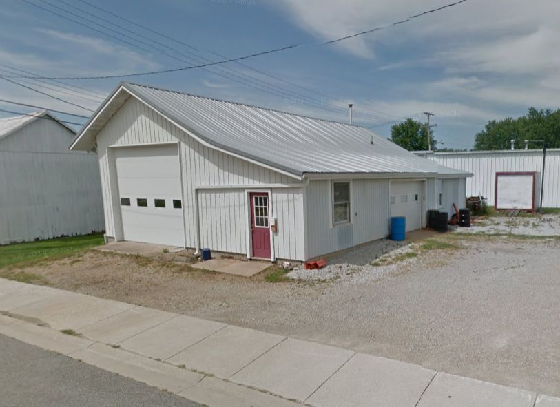
| Greenville |
|
610 West 3rd Street west of Chestnut Street. (GPS: 40.098805,-84.638758) |
C | Business | 1904 | In Use | Wood |
|
| Union City |  |
West side of Howard Street. (GPS: 40.197814,-84.810365) |
P | Museum | 1893 | In Use | Brick |
|
Versailles |  |
532 Chestnut Street (40.227750, -84.487285) |
P | Business | 1881 | None | Wood |
|
| STATIONS OF THE PAST | ||||||||
| Station Name |
Original Railroad |
Notes | ||||||
| Ansonia | |
The original passenger and freight stations here were on the east side of Main Street on the north side of the tracks at GPS: 40.212184, -84.636619. These stations were gone by 1915. | ||||||
| Ansonia | AND |
The freight station sat about 100 yards to the southeast of the existing passenger station on the transfer track between the CN and CCC&St.L at GPS: 40.211372, -84.639869. | ||||||
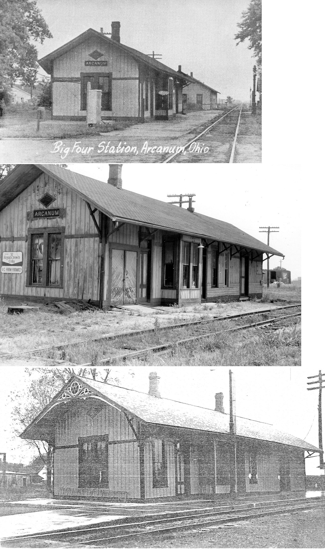
| Arcanum | |
The passenger and freight station in the photo sat on the east side Main Street between Miller and Second Streets. It was diagonally northeast of the Arcanum Milling Co. and south of the Kaylor Furniture Factory. (GPS: 39.987733,-84.552712) | ||||||
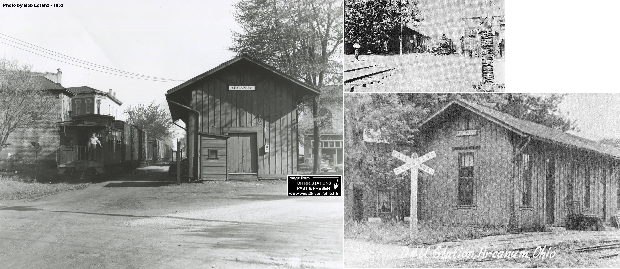
| Arcanum |
 |
The D&U passenger station sat on the north side of George Street between Sycamore and High Streets (GPS: 39.991288,-84.555148). It was directly across the street from the Commercial Hotel. | ||||||
| Arcanum |
|
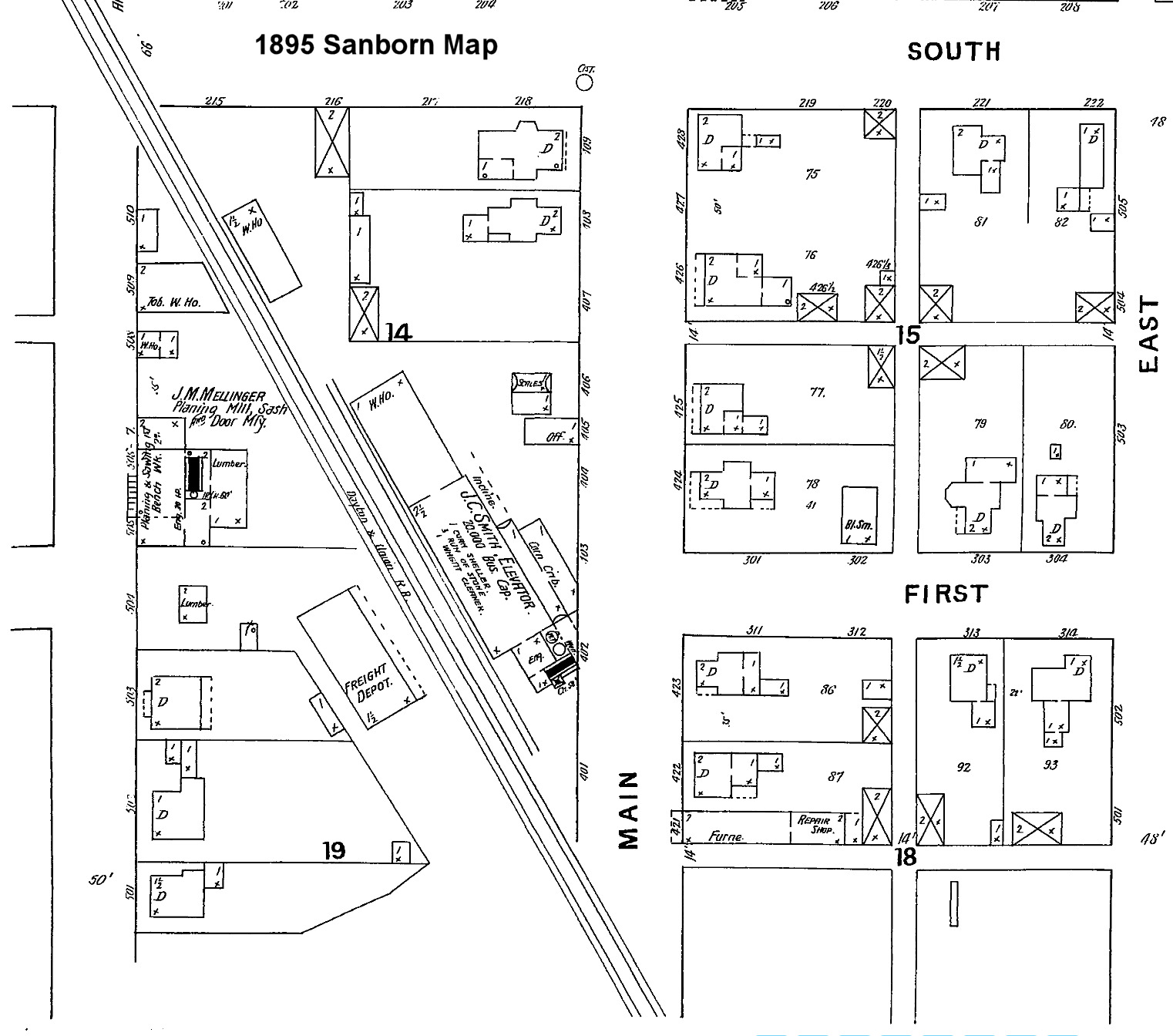
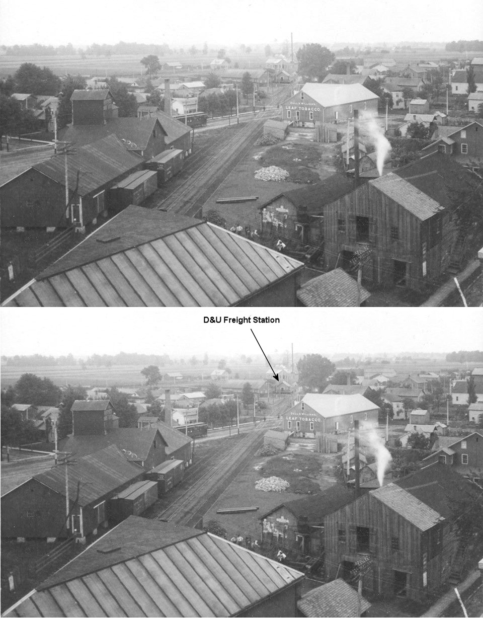
The first D&U freight station was near where the line crossed Main Street and was situated across the tracks from te J.C. Smith Grain Elevator (later H.J. Niswonger Elevator, later Miami Valley Tobacco Co. Warehouse). It was at GPS: 39.989251, -84.553635. It was gone by 1901. | ||||||
| Arcanum |
|
The second D&U freight station sat in the southeast quadrant of the crossing with the CCC&St.L at GPS: 39.987701, -84.552250. It was likely built around 1900 to replace the one listed above. There were platforms on two sides to facilitate freight transfers between the D&U and the Big 4. | ||||||
|
Castine (NEW CASTINE) |
|
Formerly called New Castine. The station was on the north side of West Elm Street on the east side of the tracks (GPS: 39.931463,-84.625615). According to NYC valuation records, it was built in 1886. | ||||||
| Clark (Noggle) |
|
|||||||
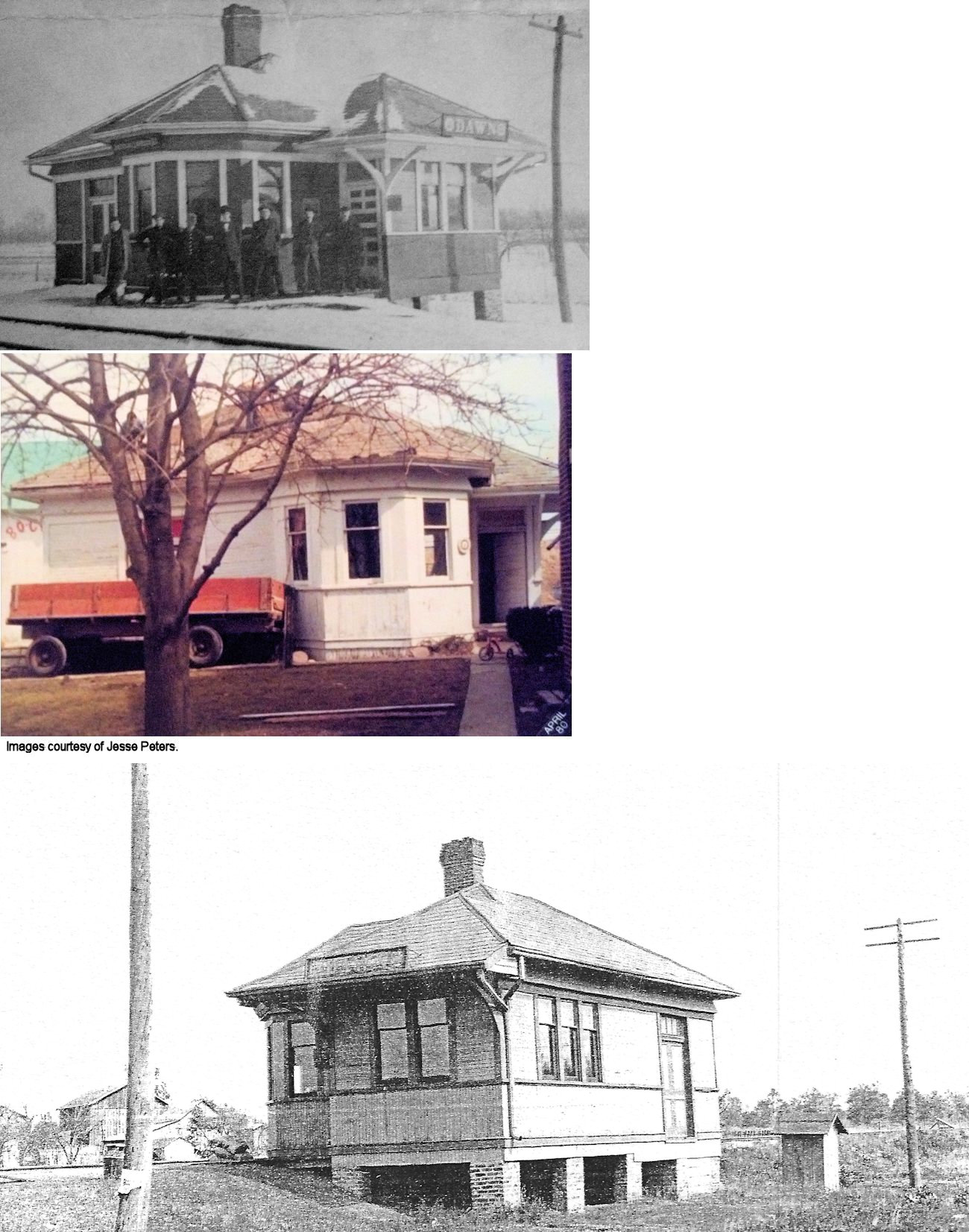
| Dawn Station (Nevada) |
|
This station was on the east side of Main Street (now CR-14/CR-98), on the south side of the tracks (GPS: 40.21623,-84.578381). The station was moved from its service location about 1000 feet away in the early 1940s to 10313 Greenville/St. Mary's Road. It was used as a storage barn until a fire damaged part of it in 1979 and then it was subsequently torn down in 1980. | ||||||
| Delisle |
|
|||||||
| Elroy |
|
|||||||
| Fort Jefferson Station |
|
This was just west of Fort Jefferson, most likely on CR-271 (Weavers-Ft. Jefferson Road). There were a number of spurs here off the main line that served the nearby gravel pits. In 1919 the only thing here was a freight station that was built in 1889. | ||||||
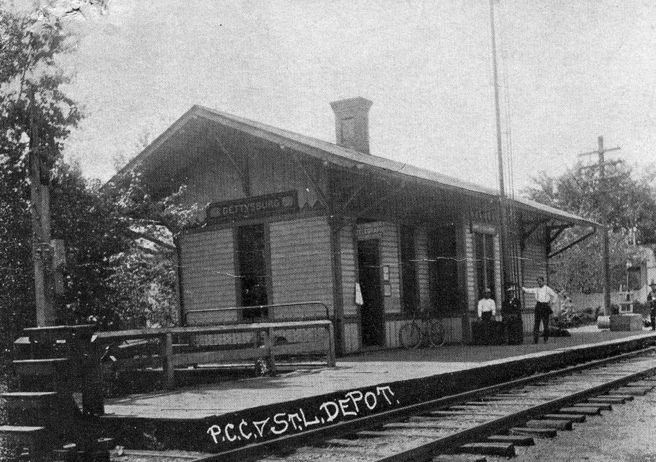
| Gettysburg | |
This station was on the north end of Dorwin street on the south side of the tracks at GPS: 40.114085,-84.496193. It was built in 1881. | ||||||
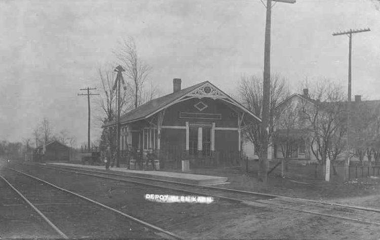
| Glen Karn | |
The station was on the east side of Main Street (CR-46) on the SW side of the tracks. (GPS: 40.008318,-84.793575) | ||||||
| Gordon |
|
|||||||
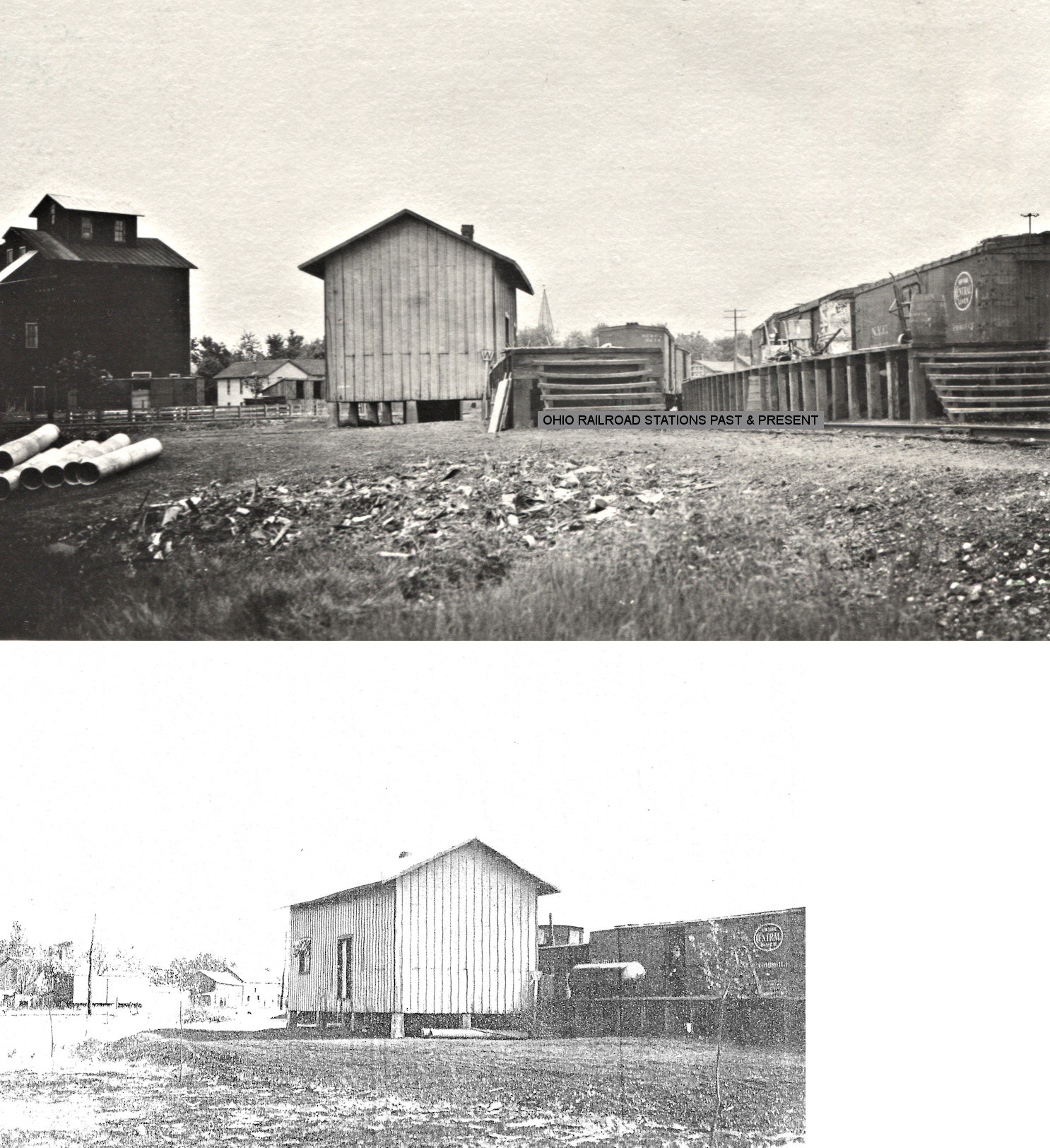
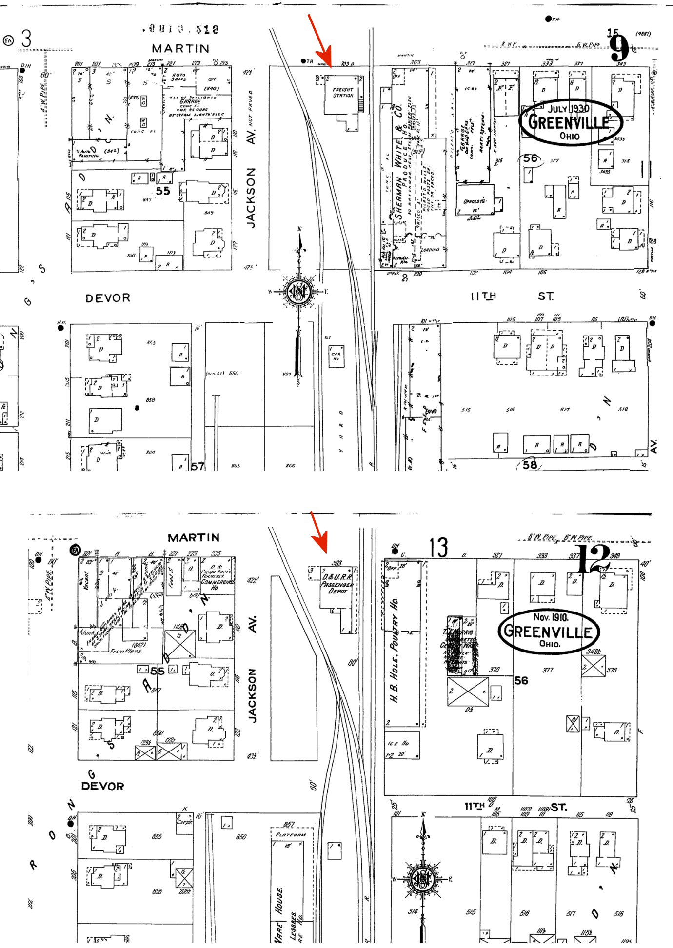
| Greenville |
|
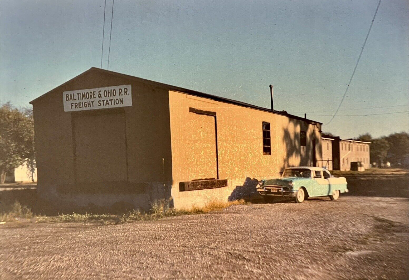
The passenger station was on Martin Street on the south side of the intersection with Montgomery and Walnut Streets (GPS: 40.099252, -84.627655). It was built in 1893 and was likely the second station here (the first train was in 1850 so there was likely an earlier station). After the station went out of service for passengers in 1931, it was used as the B&O freight station. The station was torn down in 1951 and replaced with the metal station listed below (Dayton Daily News, 9-25-1951). | ||||||
| Greenville |
 |
This modern metal freight station was built in 1951 to replace the station listed above at essentially the same location on the south side of Martin Street at GPS: 40.099150, -84.627672. It was torn down in the late 1980s/1990s. | ||||||
| Greenville | |
The original PCC&St.L depot sat at the diamond with the D&U at the intersection of Front Street and Hamilton Street. | ||||||
| Greenville | |
The second PCC&St.L station was constructed in 1890 a short distance to the west of the original station on Front Street directly across from the intersection with Gray Avenue (GPS: 40.095461,-84.628834). This new location was the site of the original small PCC&St.L freight station. | ||||||
| Greenville | |
When the new passenger station was built, a new freight station was built on the west side of Washington Avenue between Front and Walker Streets. (GPS: 40.095547,-84.63025) | ||||||
|
Greenville (D&U Crossing) |
|
The CN has a small depot at the crossing with the Dayton & Union. This station was called "D&U Crossing." It was on the west side of Wayne Street south of Meeker Avenue (GPS: 40.107951,-84.639788). It is listed on timetables as a station, but was primarily an interlocking tower. | ||||||
| Hill Grove |
|
The depot was on the north side of Liberty Street between Main and Cherry Streets. It was on the west side of the tracks. (GPS: 40.177869,-84.767708) | ||||||
| Horatio | |
The station was on the east side of main street on the north side of the tracks. (GPS: 40.14882,-84.524699) | ||||||
| Jaysville |
|
The station here may have been the post office/general store building. | ||||||
|
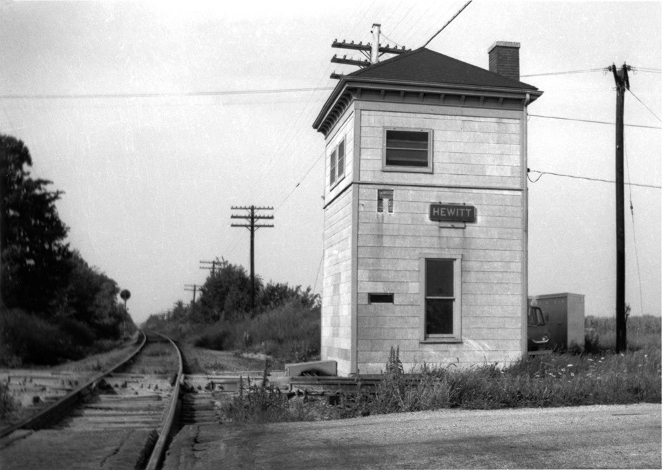
Junction (Hewitt) |
AND |
The tower here also served as a flag stop station. Tt was joint with the PRR/PCC&STL, but Big Four built the tower. | ||||||
|
Meeker Station |
AND |
This station was in the NE quadrant of the diamond. This location is inaccessible by road now and is in the middle of a field. It is west of SR-118 between Hunter Road and Hillgrove-Woodington Road. (GPS: 40.171094,-84.646676) | ||||||
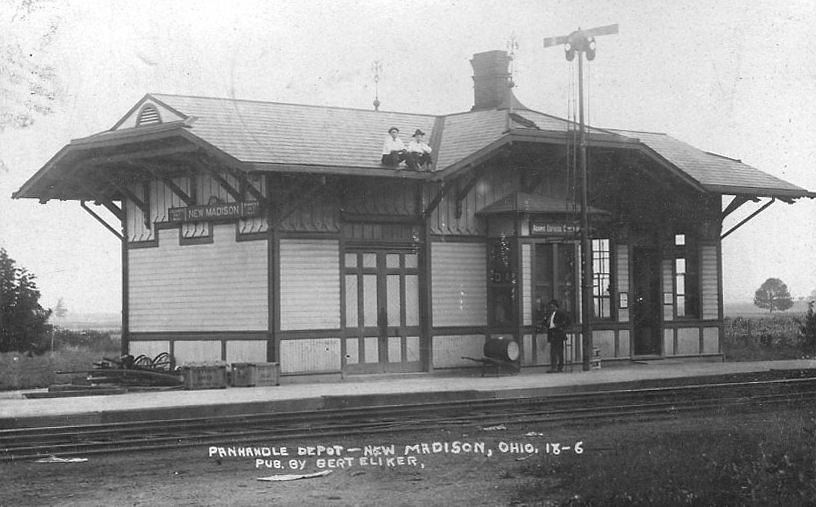
| New Madison | |
This station was on the north side of Washington street on the NW side of the tracks. (GPS: 39.969137,-84.711424) | ||||||
| New Weston |
|
The station was on the north side of Main Street, on the west side of the tracks. | ||||||
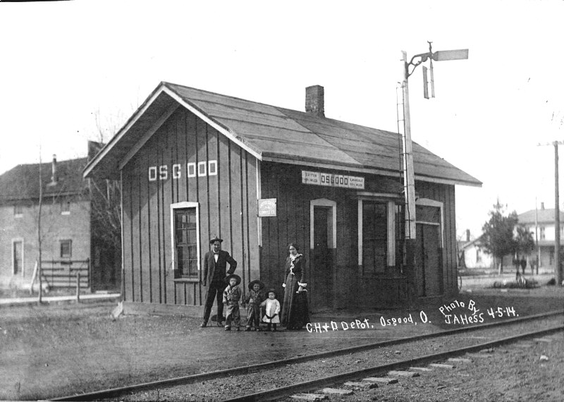
| Osgood |  |
The Dayton, Ft. Wayne & Chicago was a forerunner of the CH&D. This station was on North Street between Main and Washington Streets on the west side of the tracks. (GPS: 40.340064,-84.49526) | ||||||
| Pikeville | |
The station was on the east side of CR-98 on the north side of the tracks. (GPS: 40.163473,-84.604951) | ||||||
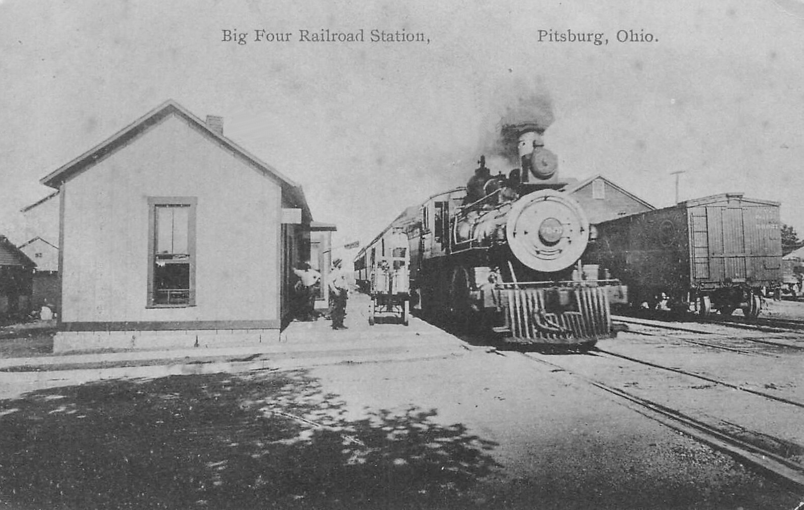
| Pitsburg (Arnettsville) |
|
The station was on the east side of Jefferson Street, on the north side of the tracks. (GPS: 39.988255,-84.487347) | ||||||
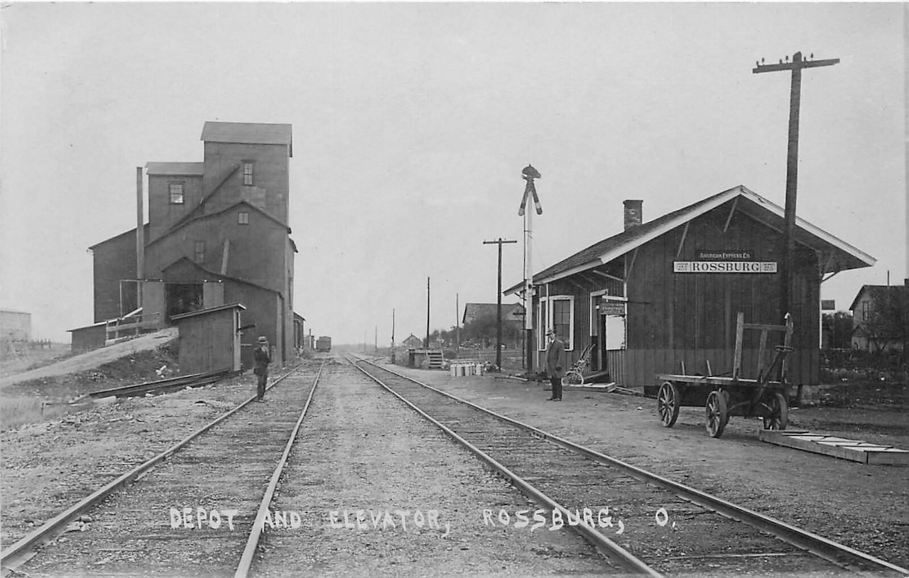
| Rossburg |
|
This station was on the north side of Main Street, on the east side of the tracks. (GPS: 40.279485,-84.639691) | ||||||
| Rush Station (Mt. heron) |
|
This station was on the east side of TWP-150, on the north side of the tracks. (GPS: 40.135267,-84.689323) | ||||||
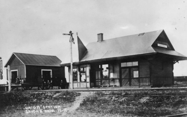
| Savona (Tecumseh) |
AND |
The 1910 map shows four buildings near the diamond. One, in the NW quadrant, is labeled as a depot. It was shared by the CCC&St.L and CN and was located at GPS: 39.986615,-84.662565. | ||||||
| Savona (Tecumseh) |
AND |
This was the freight transfer station. It was in the SW corner of the diamond. | ||||||
| Stelvideo | |
This station was on the east side of CR-34, on the north side of the tracks. (GPS: 40.153773,-84.551838) | ||||||
| Union City | |
This station was on the Indiana side of the city just across the state line between North Columbia Street and State Line Road. There was a freight station just east of the state line in Ohio. | ||||||
| Union City | |
A new passenger station was built here in 1891. | ||||||
| Union City | |
There was a freight station on a siding track, just west of the passenger station. | ||||||
| Union City |
|
This station was in the area of South State Line Road. | ||||||
| Versailles | |
This station was built prior to 1893 as it appears on Sanborn Fire Insurance maps from that year. The station was modified in the 1950s by the NYC and was moved in the 1970s. Its original location was on West Water Street just east of North West Street. It sat on the north side of the tracks. It was part of the Versailles Feed Mill, 242 North West Street (GPS: 40.224591, -84.488204) after it was moved. As of 2024 it appeared that the station was demolished or moved. | ||||||
| Versailles | |
Built in 1881. The TD&B eventually became part of the CH&D. This station was moved distance from its original site. The station had been a transmission repair shop and sat along an alley often mistaken for the right-of-way for the narrow gauge railroad. but the station has not served a railroad since 1923. Its original location was on the south side of Main Street on the west side of the tracks. Reportedly the station was carefully dismantled board by board in the late 2000s, so it may reappear someday or may have had its materials repurposed. | ||||||
|
Weaver Station |
|
The station was on CR-271 (Weavers-Ft. Jefferson Road) (GPS: 40.026419,-84.676904). | ||||||
| Woodington |
|
This station was on the east side of SR-49 on the south side of the tracks (GPS: 40.176422,-84.676791). It was built in 1889. | ||||||
| Yorkshire |
|
This station was on the north side of Main Street at East Street, on the west side of the tracks. The station was practically in the middle of East Street. (GPS: 40.325449,-84.495356) | ||||||
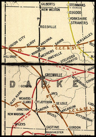
| 1898 DARKE COUNTY RAILROAD MAP | ||||||||
 |
||||||||
|
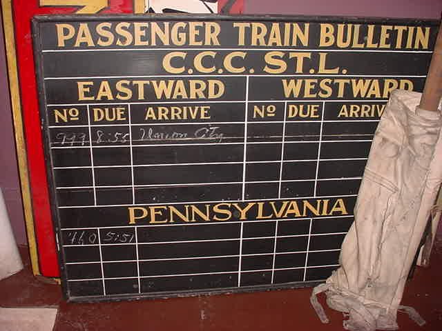
Notes About Existing Stations... Greenville (CN) - This property was purchased by Lew Crowell on March 18, 2011. The depot is in good condition and is being improved. The depot is half passenger and half freight. Half of the building (610 West Third Street, Suite B) is currently being leased by The Little Showcase Factory, LLC, which manufactures hardwood showcases for model trains and other collectibles. The other half (Suite A) serves as residence for the owner. The siding tracks have been disconnected from the main rails which are still in use. According to the 1919 Cincinatti Northern valuation records, the station was built in 1904. Union City (PCC&St.L) - Station is on the Indiana side of Union City. The station was originally built in 1893 at Piqua, Ohio, for the PCC&StL Ry. It was moved in 1912 to Union City, Indiana. Brick was added to the exterior after the station was moved, it is actually a frame station with a brick veneer. In later years, this station may have been used by the CCC&St.L as well as noted below. More on Union City from David Allen: I used to live in Darke County and railfanned and photographed in Union City OH/IN. In 1974, I became acquainted with Joe Fahnestock, who published a booklet titled, Dateline Stateline, Williams, Arcanum, OH, 1974. In it, and in discussions we had, he named the three railroads serving Union City at one time. I recall that, due to the interesting feature of Union City sitting squarely on the state line, this affected the railroad charters and operations. I don't recall the details, except that I am pretty certain he said either the interurban or the D&U was not chartered in Indiana, and their tracks stopped short of there. Finally, as to the depot itself, notice that in the photo of the schedule board of the station, there is a train marked up on the Big Four side. There is a photo in Joe Fahnestock's book of him in front of the same train board while it was still hanging in the depot. It clearly shows four trains on the Big Four side and none on the PRR. The caption indicates: "Last regularly scheduled passenger train out of Union City..." Finally, it should be noted that there was never grass and trees between the depot and the tracks while it was in use. The platform was brick, and later repaired/filled-in/extended with concrete. Versailles (TD&B) - The TD&B eventually became part of the CH&D. This station was moved distance from its original site. The station is a transmission repair shop and sits along an alley often mistaken for the right-of-way for the narrow gauge railroad, but the station has not served a railroad since 1923. Its original location was on the south side of Main Street on the west side of the tracks. |
||||||||