 COUNTY COUNTY
|
|
||||||||
| EXISTING STATIONS | ||||||||
|---|---|---|---|---|---|---|---|---|
| Station Name |
Original Railroad | Current Location |
Type | Current Use |
Date Built |
Track Status |
Building Material |
More Info |
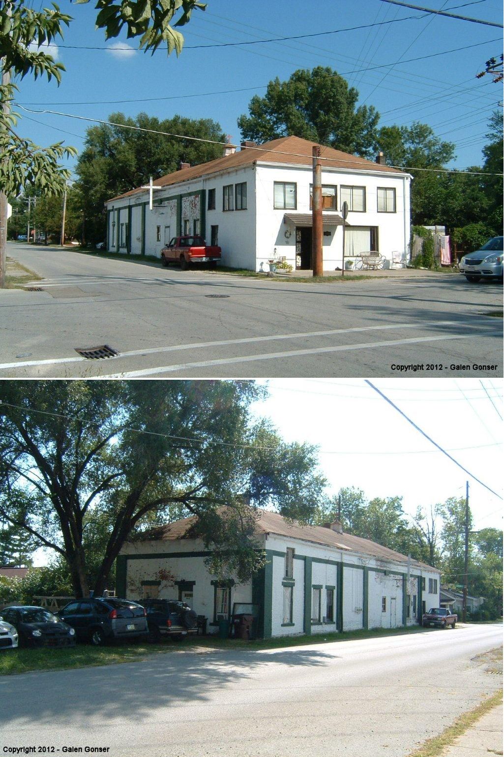
| Amelia |
 |
86 West Main Street (across from Tire Discounters). (GPS: 39.031749,-84.2236) |
P | Museum | 1878 | None | Wood |
|
| Amelia |
|
86 West Main Street (at SE side of property). (GPS: 39.031059, -84.223278) |
F | Private | 1878 | None | Wood | |
| Bethel |
|
SE corner of South and Union Streets (GPS: 38.958486, -84.080126) |
C | Residence | 1901 | Gone | Brick |
|
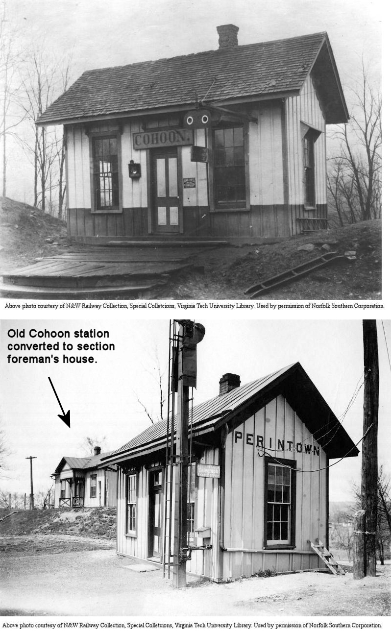
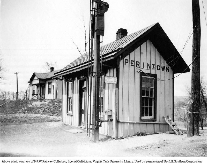
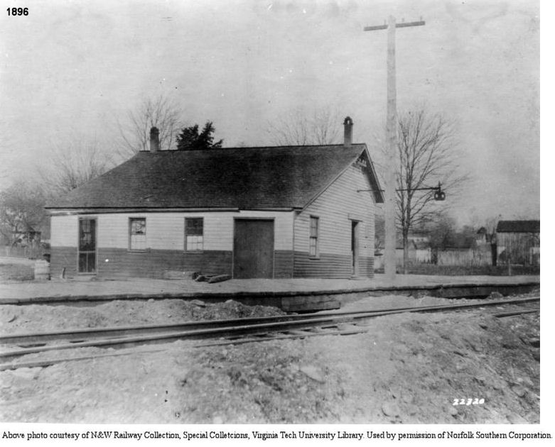
| Cohoon (Perintown) |
 |
Off Round Bottom Road south of Binning Road (GPS: 39.136339, -84.239203) |
P | ???? | ???? | In Use | Wood |
|
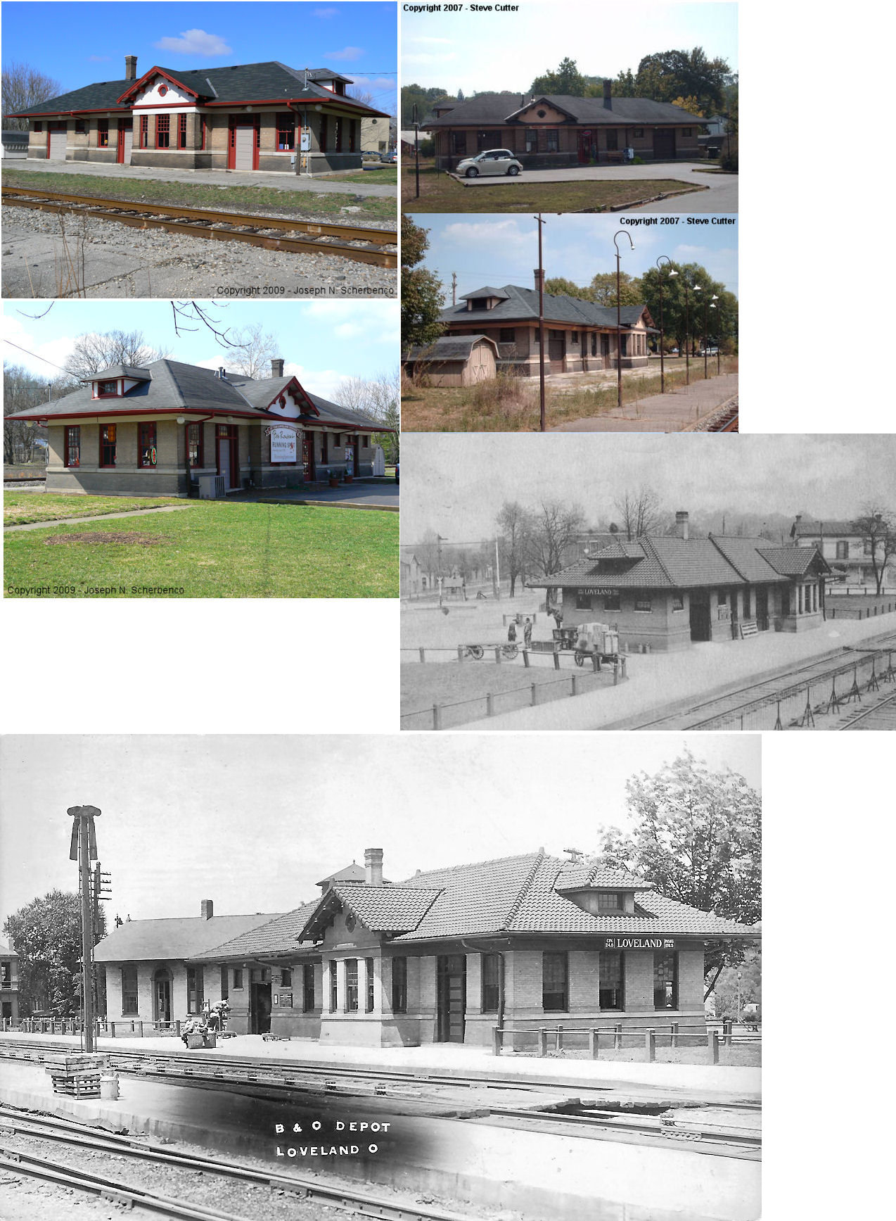
| Loveland |
 |
127 West Loveland Avenue (GPS: 39.267466, -84.258329) |
P | Business | 1907 | In Use | Brick |
|
| STATIONS OF THE PAST | ||||||||
| Station Name |
Original Railroad |
Notes | ||||||
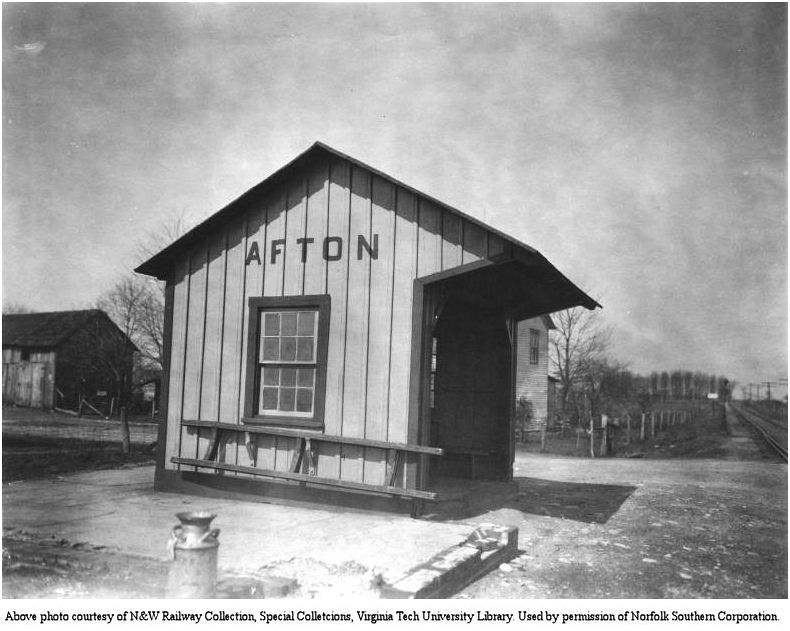
| Afton |
 |
According to N&W valuation records, this station was built in 1911. Formerly known as California, this was an early station on the CP&V. An earlier shelter shed here was moved to Chattaroy, WV. | ||||||
| Baldwin |
|
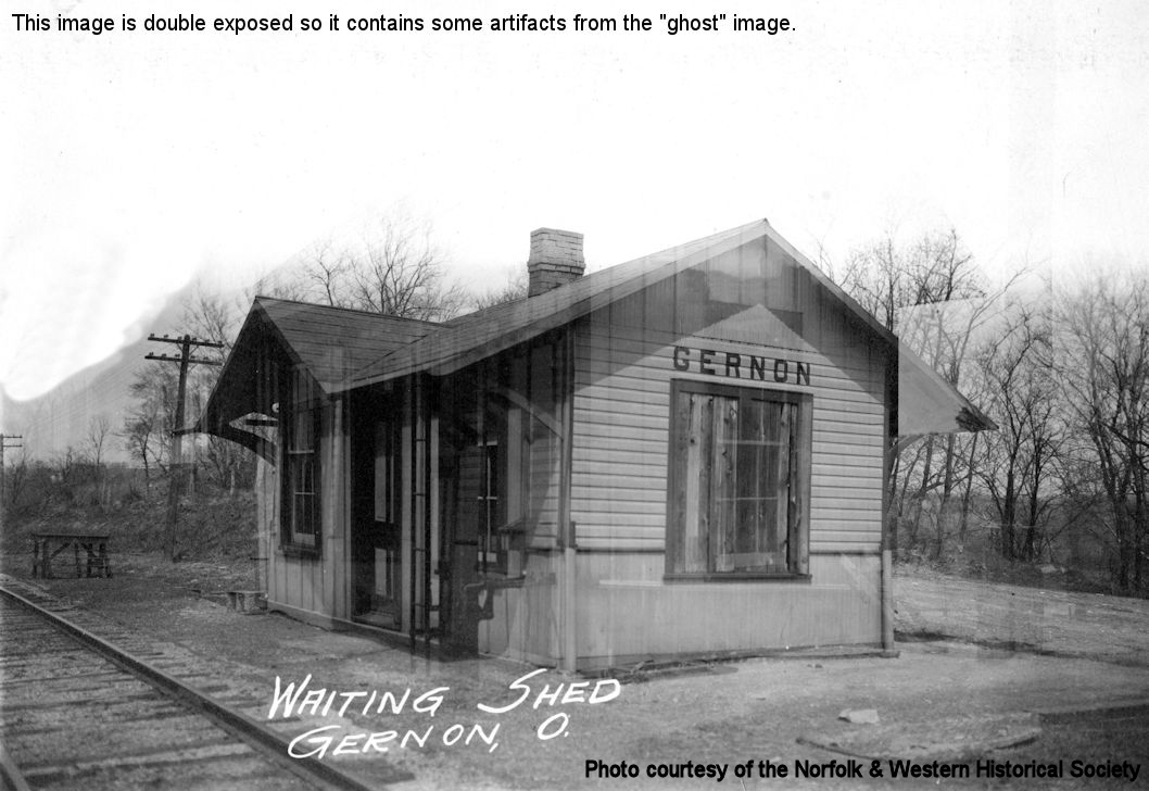
See entry below for Gernon. | ||||||
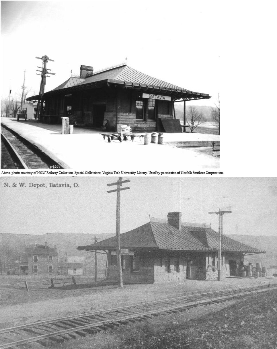
| Batavia |
|
According to N&W valuation records, the earlier station here was built in 1891. | ||||||
| Batavia |
|
This station sat on the south side of Main Street. It was on the east side of the tracks. | ||||||
| Beechwood |
|
Also known as Elston/Elstens Station, there was an early station here in the days of the Cincinatti & Eastern (pre-N&W). | ||||||
| Branch hill |
 |
The station in 1891 was located at the corner of Front and Bridge Streets. It was on the east side of the tracks. | ||||||
| Brazier |
|
|||||||
| Clifton |
 |
C&E = Cincinnati & Eastern. The station here was still standing in 1891 after this section of the C&E RR was sold/reorganized as the Cincinnati, New Richmond & Ohio River RR. That RR ceased operations in 1889 and was torn up by 1898. Clifton is now the southern part of New Richmond. | ||||||
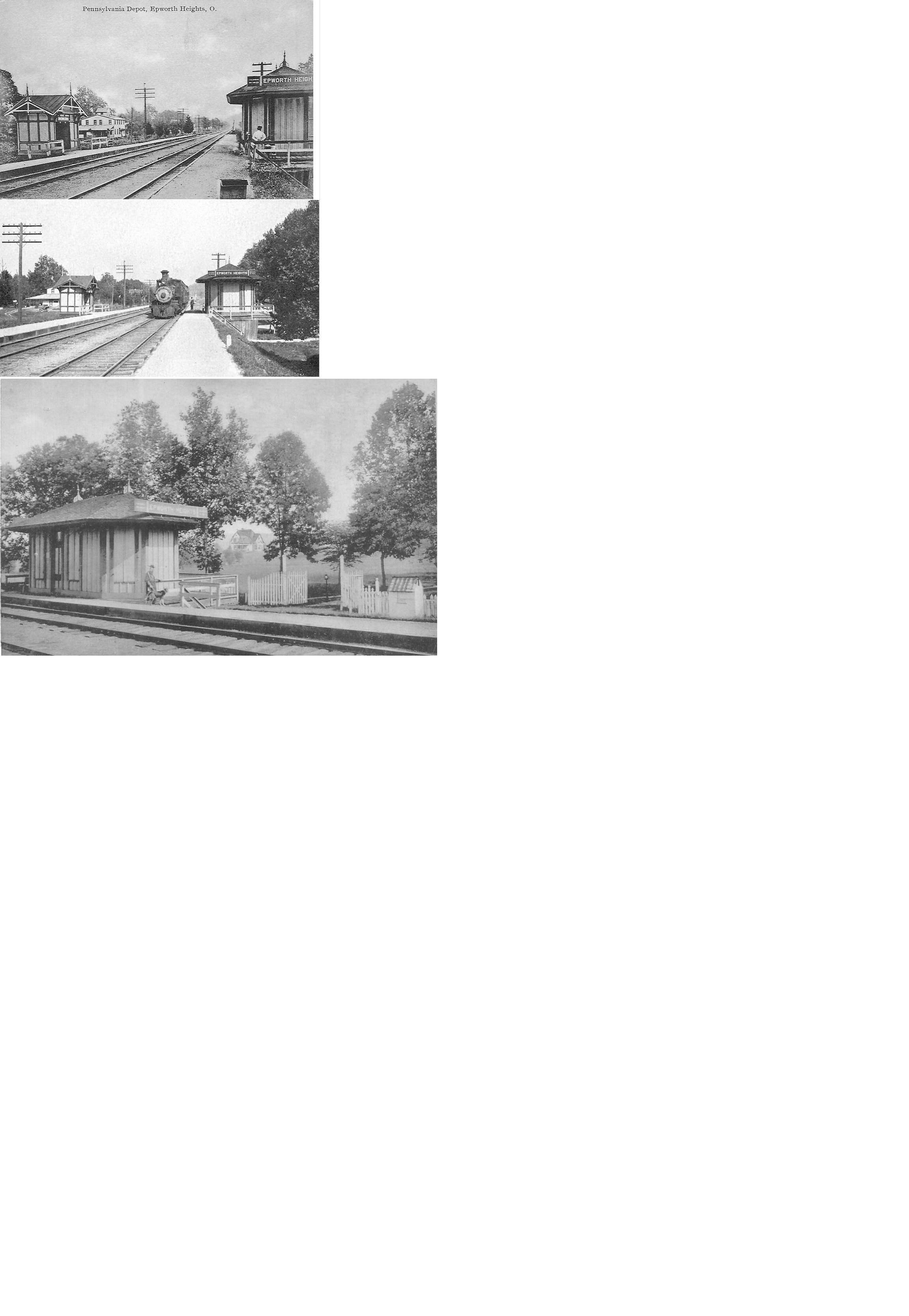
| Epworth Heights |
 |
|||||||
| Fair Oak |
|
This station was on the west side of Lindale–Mt. Holly Road. | ||||||
| Gernon (Baldwin) (East Liberty) |
|
According to N&W valuation records, a new station was built here in 1901. The station was on Baldwin Road. | ||||||
| Glen Este |
|
|||||||
| Gravel Pit |
|
According to N&W valuation records, the station was built in 1906. | ||||||
| Hamlet |
|
|||||||
| Hills |
|
|||||||
| Hulington |
|
|||||||
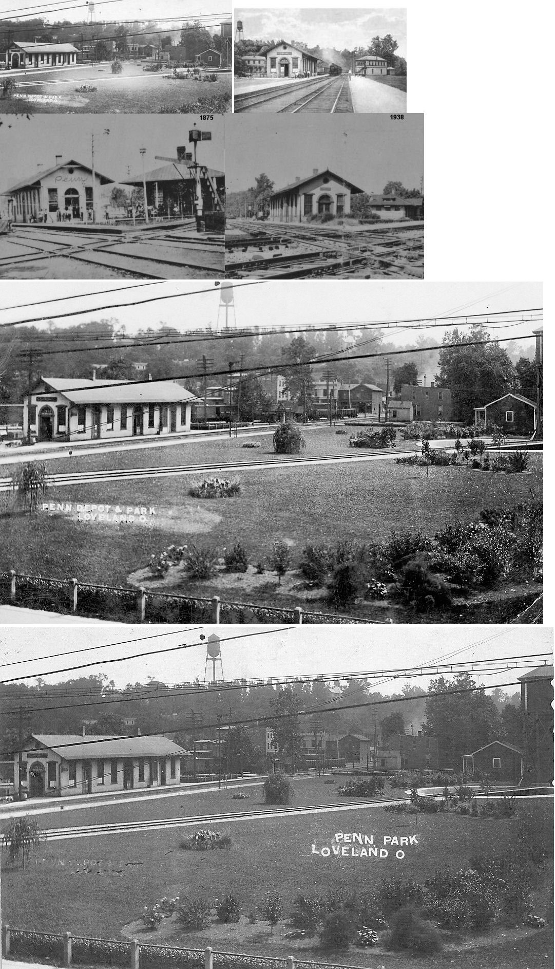
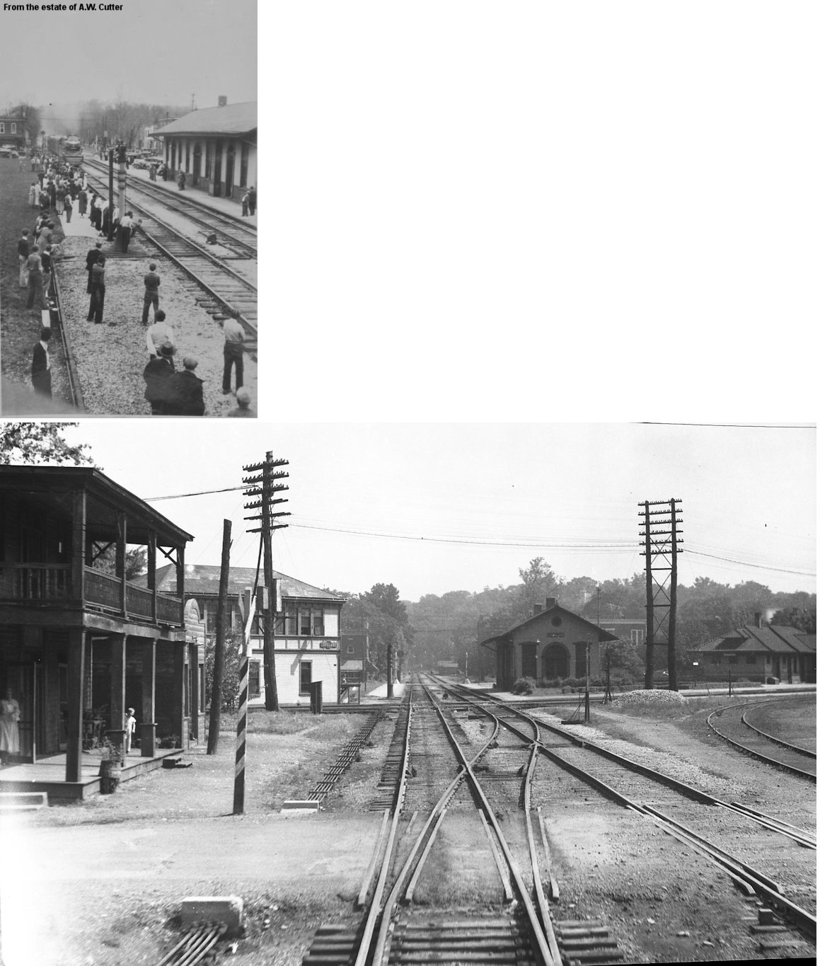
| Loveland |
|
A new station was built here in 1859. | ||||||
| Loveland |
|
This station was located near the intersection of what is currently West Loveland and Railroad Avenues. Here are some more photos including one showing a Pacific K-4 Streamlined 4-6-4 pulling into the station. Both the PRR and B&O stations occupied the northeast corner of the diamond, with the tower in the northwest quadrant. Across the tracks from the PRR station was a "railroad park" that at one time contained a turntable and water tower. The PRR tracks were removed by Conrail around 1976. | ||||||
| Loveland |
|
These photos show the original frame B&O passenger station and its brick replacement which was built in 1907. | ||||||
| Maywood |
|
This town was platted in 1877 and had a station on the CP&V. | ||||||
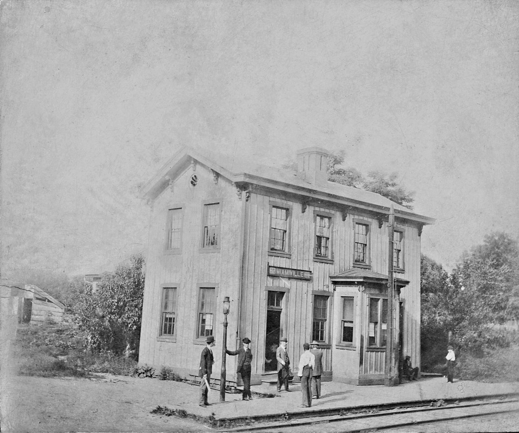
| Miamiville |
|
In 1891 the Little Miami RR station agent here was Smith Ware. The station was on the west side of Second Street on the south side of the tracks. | ||||||
| Mt. Carmel |
|
|||||||
| New Richmond |
|
C&E = Cincinnati & Eastern. The station here was still standing in 1891 after this section of the C&E RR was sold/reorganized as the Cincinnati, New Richmond & Ohio River RR. That RR ceased operations in 1889 and was torn up by 1898. | ||||||
| Ninevah (Pleasant Valley) |
|
|||||||
| O'Bannon |
|
|||||||
| Olive Branch |
|
|||||||
| Palestine |
|
|||||||
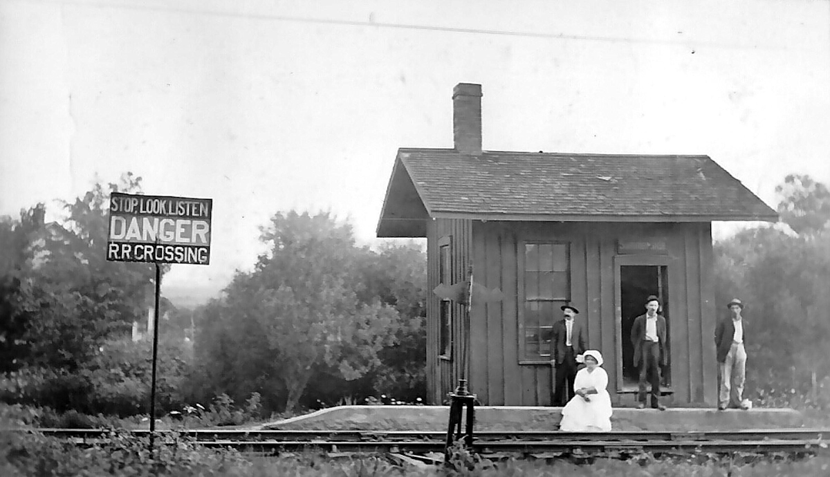
| Perintown (Cohoon) |
|
Although the station is gone, the old station (still standing) which was converted into a section foreman's house is shown in the background of this photo. | ||||||
| Rocky Ford Stock Farm |
|
According to the 1891 map of the county, there was a station at the Rocky Ford Farm. This was located at GPS coordinates 39.104732,-84.19575 in Batavia Township. | ||||||
| Silver Hook |
|
|||||||
| South Bantam |
|
|||||||
| South Milford |
|
|||||||
| Swing's Station |
|
|||||||
| Summerside |
|
This station was on Aicholtz Road. | ||||||
| Summit Station |
|
This old station was in Batavia Township on Herold Road. The tracks through here was rerouted to the south and the town no longer exists. | ||||||
| Tobasco |
|
|||||||
| Walker's Mills |
|
This station was just SE of Bethel near where Patterson Road curves from SE to due south. | ||||||
| Williamsburg |
|
|||||||
| Williamsburg |
|
This station was on the NW side of 3rd Street on the SW side of the tracks (GPS: 39.056988,-84.051542). According to N&W valuation records, it was built in 1901. | ||||||
| Willowville |
|
|||||||
| Wiltse |
|
|||||||
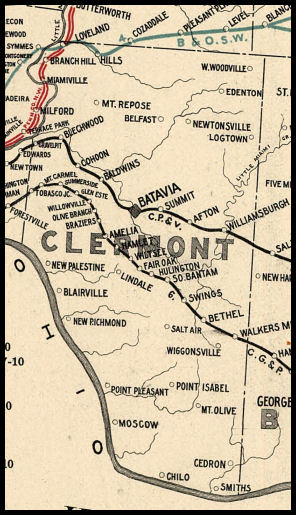
| 1898 CLERMONT COUNTY RAILROAD MAP | ||||||||
 |
||||||||
|
Notes About Existing Stations... Amelia (CG&P) - The station is nearing the end of a long restoration. The restoration has been a major rebuild that is historically correct. The plan is to use it as a museum displaying CG&P & Black Line artifacts. Please contact David Pommert (513-236-2160) to see the building or to loan pictures or artifacts of the CG&P or Black Line to display. Bethel (CG&P) - Part of the building is a chapel and part is a residence. It was the first electrified building in Bethel. As with the Mt. Washington station (Hamilton Co.), the station was passenger/freight, and also housed the electric generating equipment (sub stations) for the electric cars, and freight locos. There was a third sub station on the east side of White Oak creek in Brown county. It has been long gone, but the foundation is still in place, and in very good condition. Several railroad artifacts have been found in the area. The railroad electrified the route in 1902. Steam and electrics used the line together until 1915. After a wreck east of Amelia, steam was not allowed on the route any more. It remained electric until the line's demise in 1936. Cohoon (CP&V) - he name of this town was changed to Perintown. This is the original station. It was later converted into a section foreman's house and a new station was built. Loveland (B&O) - Now houses the "Runner's Depot" that sells shoes and running gear. Along ex-PRR bike trail. |
||||||||