 COUNTY COUNTY
|
|
||||||||
| EXISTING STATIONS | ||||||||
|---|---|---|---|---|---|---|---|---|
| Station Name |
Original Railroad | Current Location |
Type | Current Use |
Date Built |
Track Status |
Building Material |
More Info |
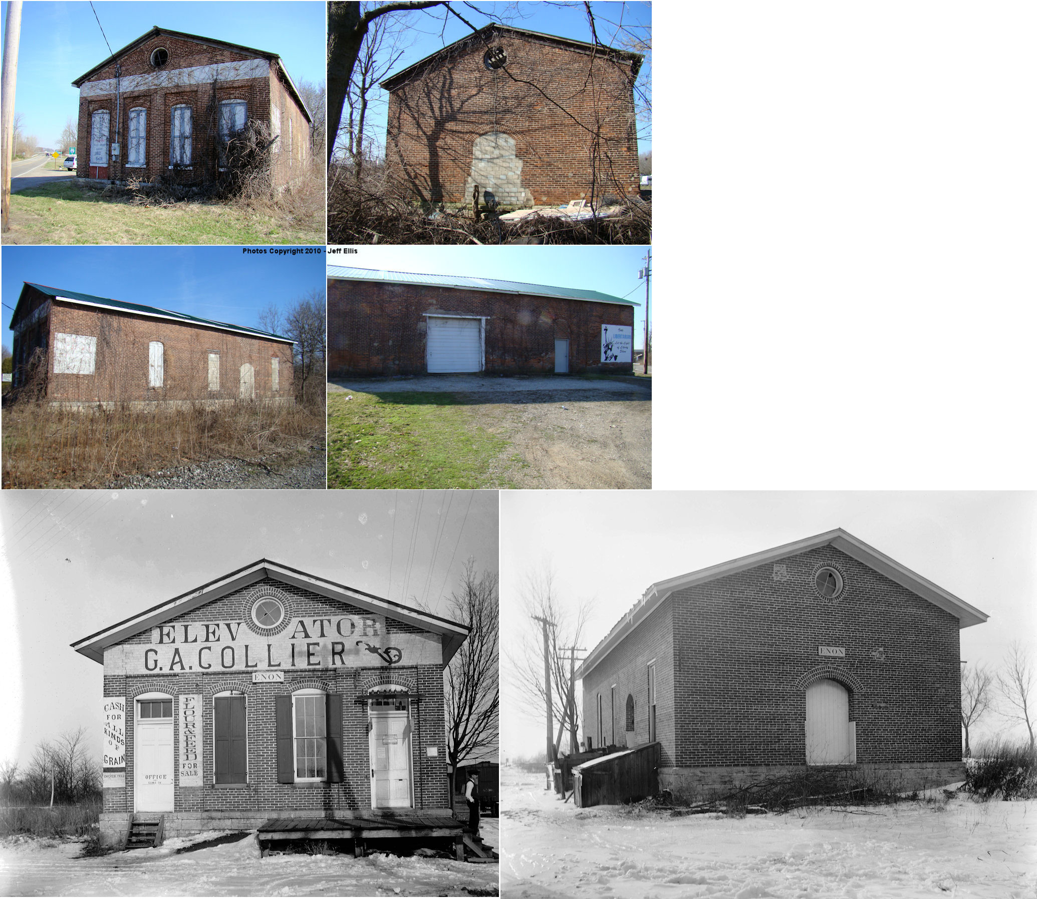
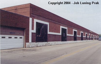
| Enon |
 AND  |
2340 Enon Road (GPS: 39.889779, -83.935529) |
C | Storage | ???? | In Use | Brick |
|
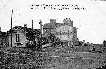
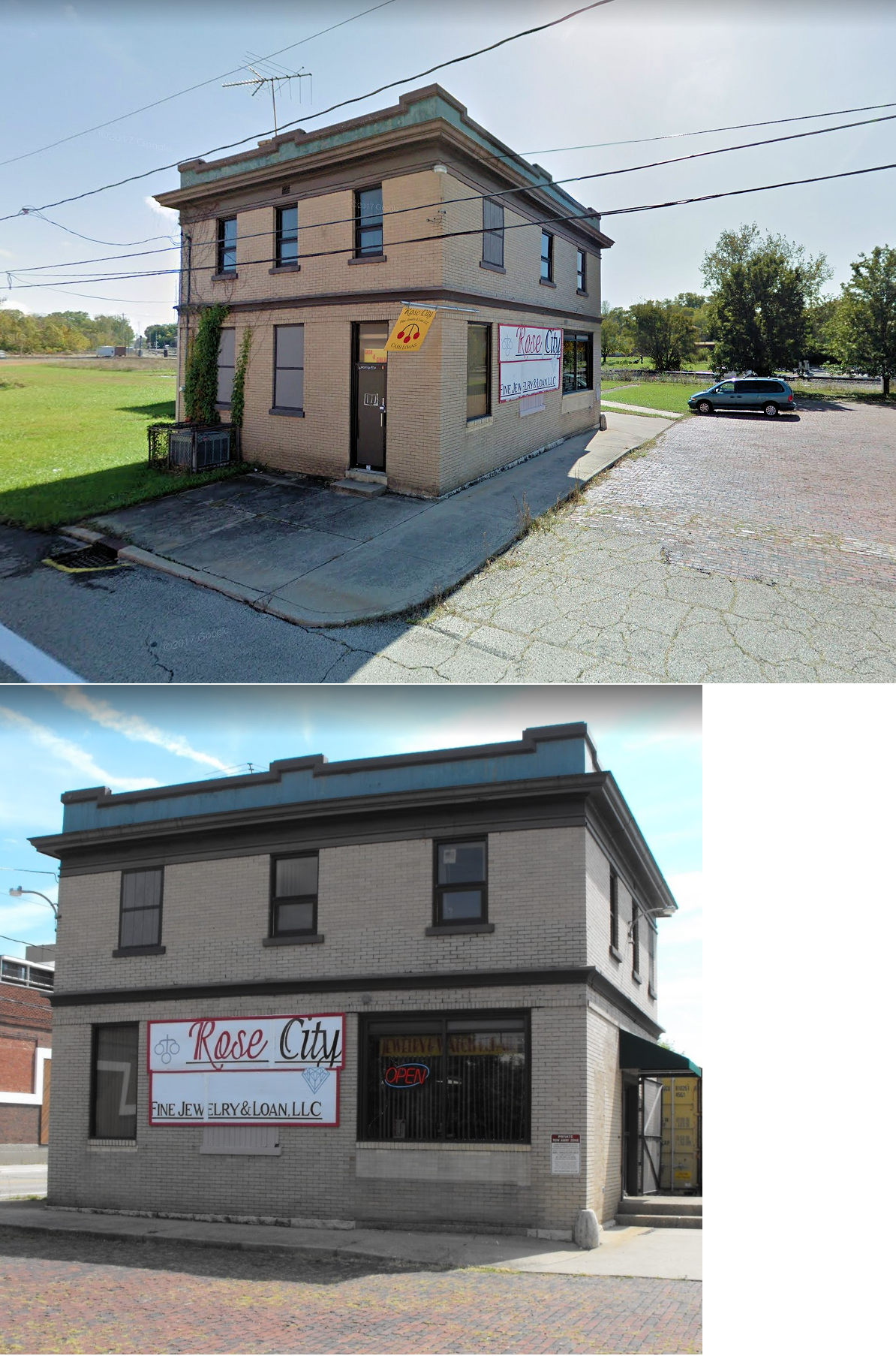
| Jackson Center |
 |
3390 Baker Road south of St. Paris Pike in Springfield (GPS: 39.97571,-83.845704). |
C | Private | 1893 | None | Wood |
|
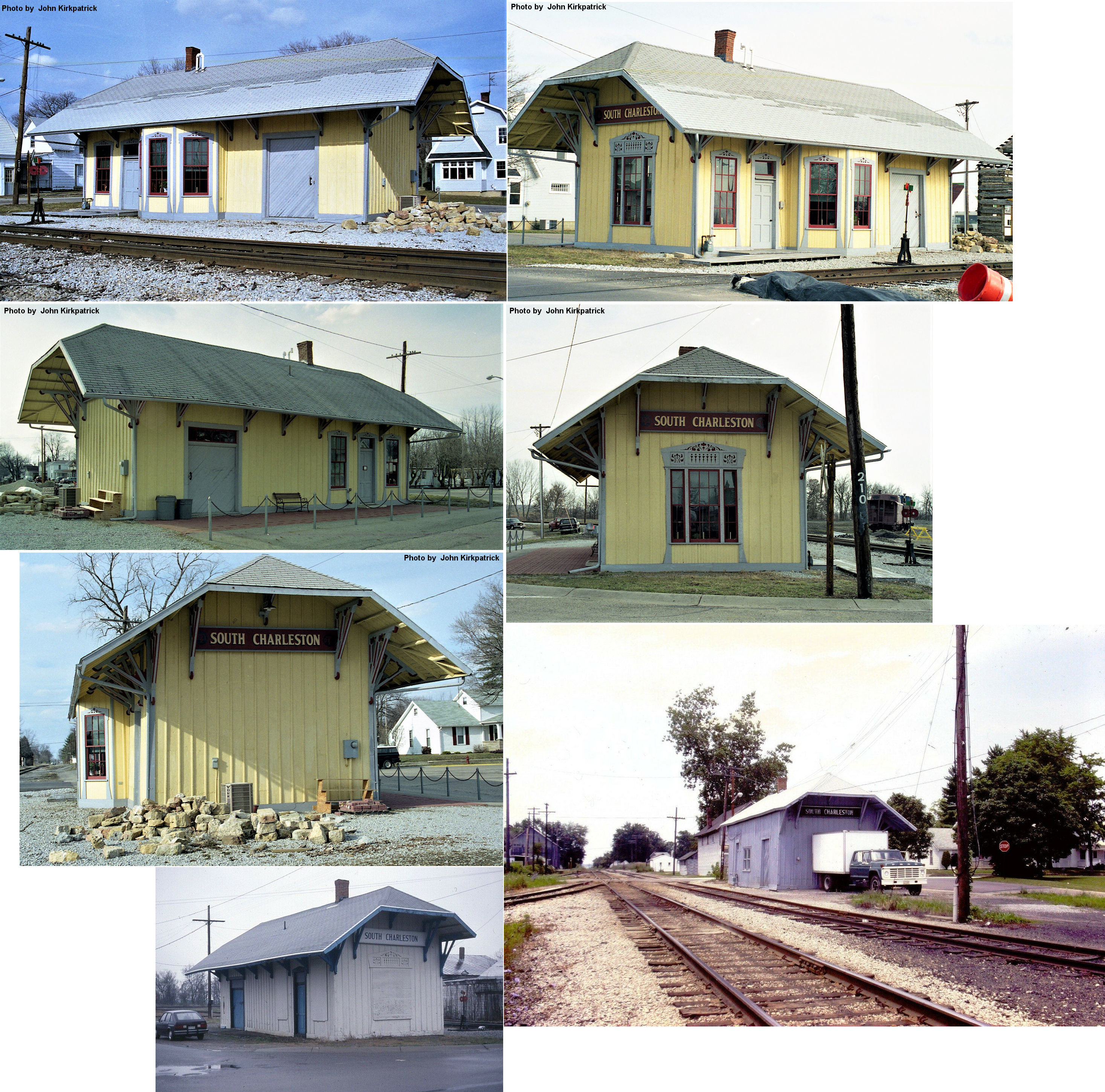
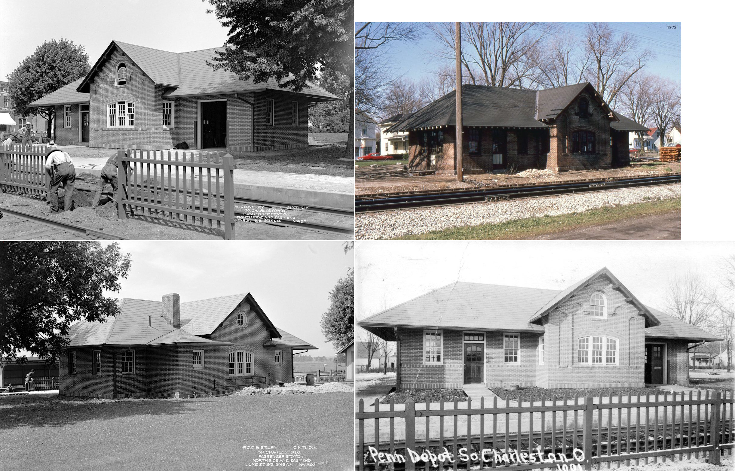
| South Charleston |
|
Corner of West Mound and High Streets (GPS: 39.821499, -83.637548) |
P | Museum | ???? | In Use | Wood |
|
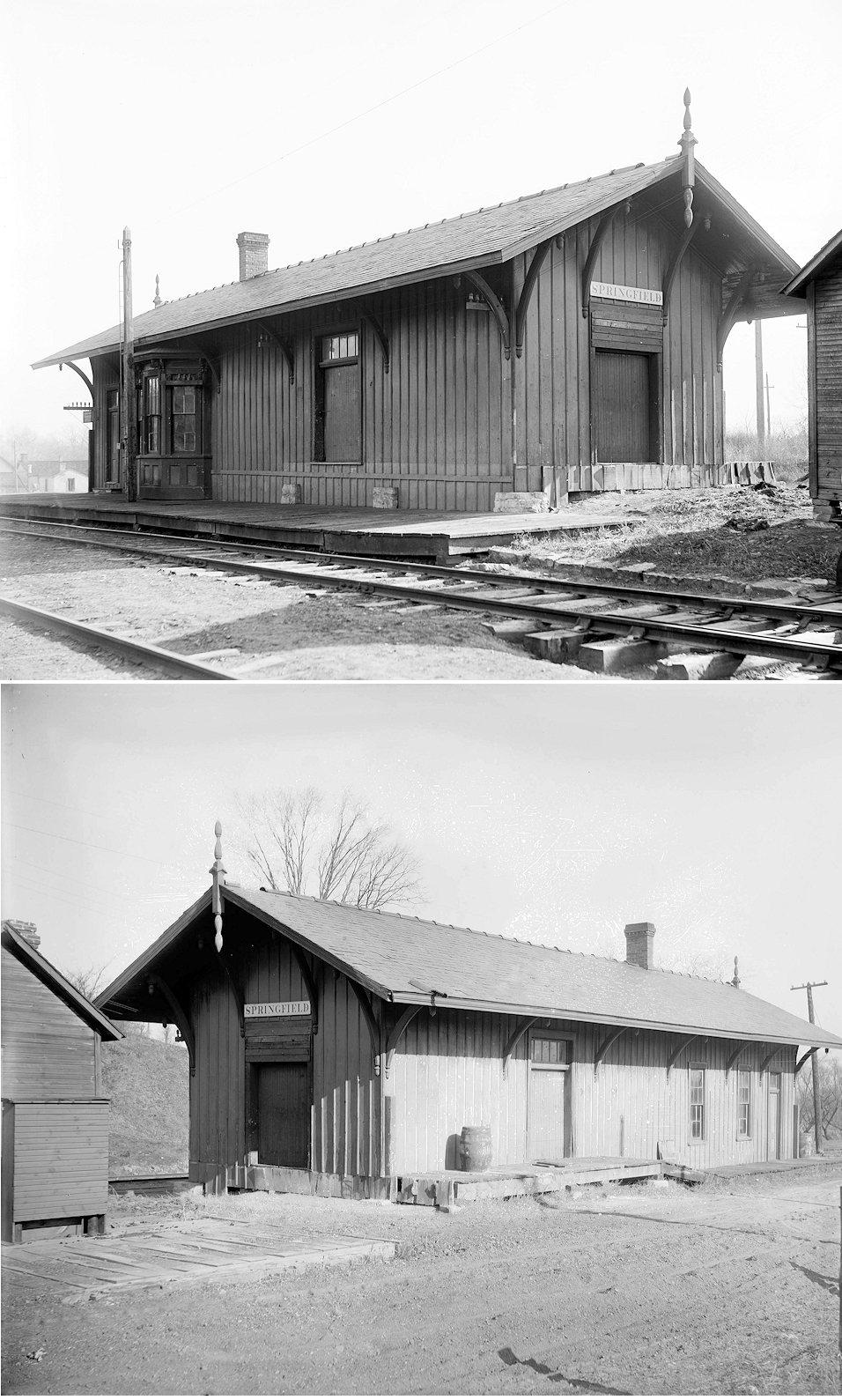
| Springfield | |
202 Washington Street at Spring Street (GPS: 39.922026,-83.805859) |
F | Unknown | 1910 | Gone | Brick | |
| Springfield |
 |
201 East Washington Street (GPS: 39.921801, -83.806121) |
P | Business | ???? | Gone | Brick |
|
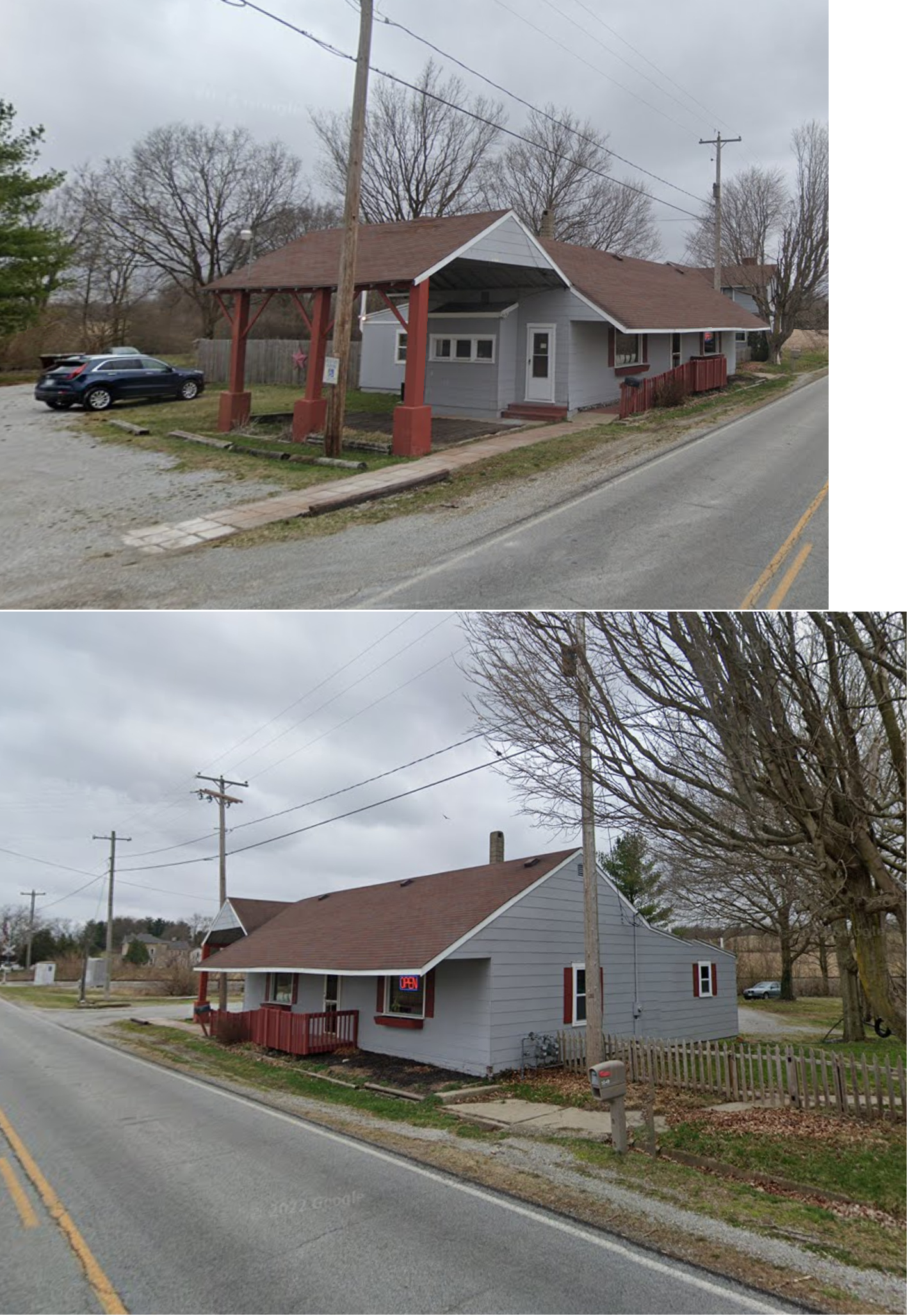
| Tremont City |
 |
5549 Upper Valley Pike (GPS: 40.007276, -83.835265) |
C | Business | 1942 | In Use | Wood | |
| STATIONS OF THE PAST | ||||||||
| Station Name |
Original Railroad |
Notes | ||||||
| Bowlusville | |
|||||||
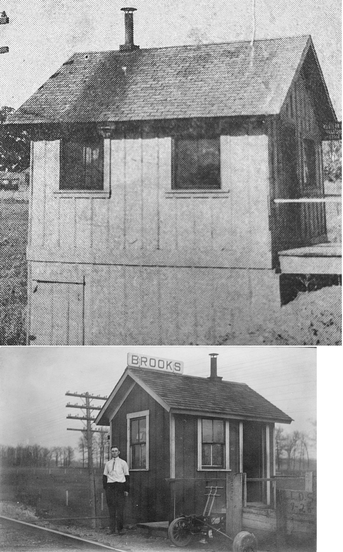
| Brooks | |
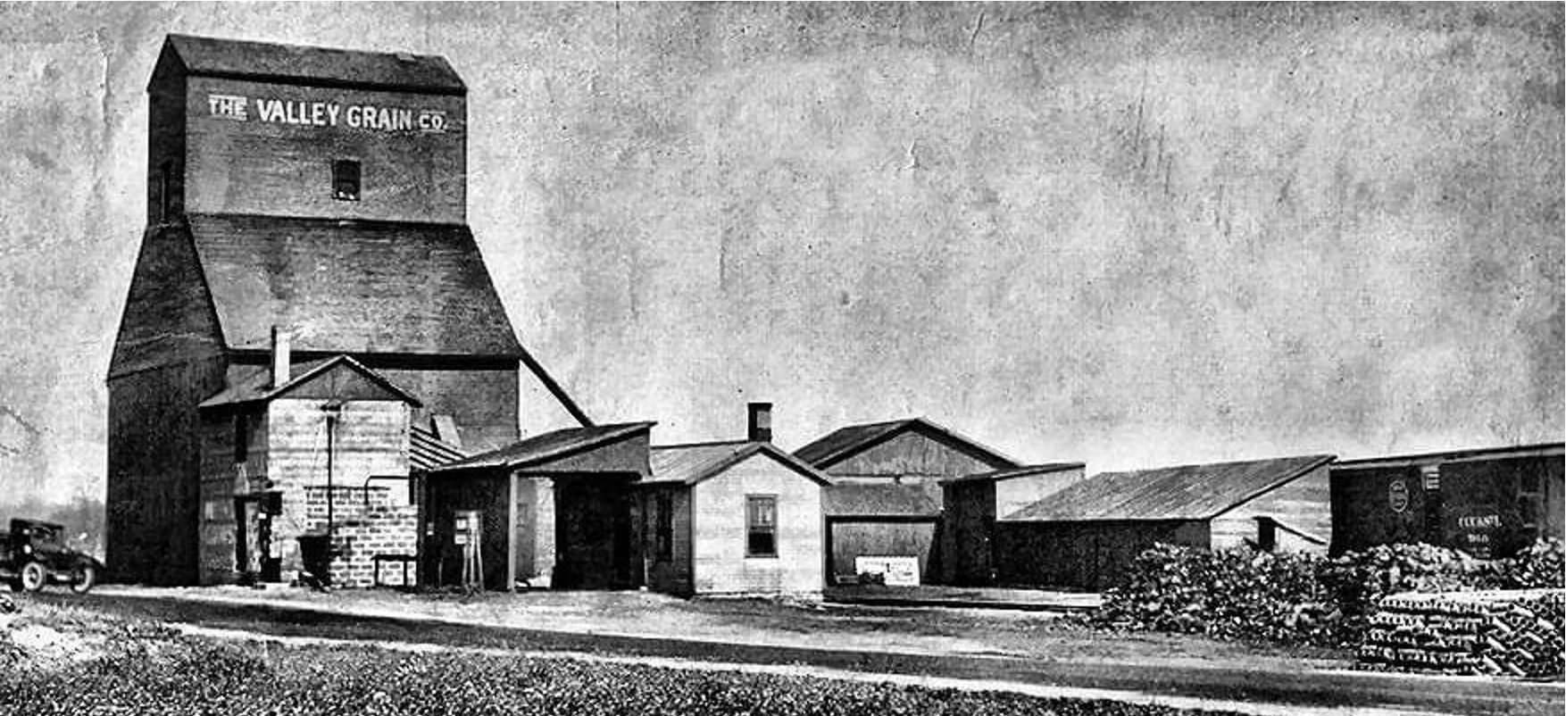
This station was where Newlove Road crosses the tracks in the vicinity of GPS: 39.900331, -83.676334. This was a combination station/telegraph office. After it went out of service it was used as toolshed. The founders of Brooks were Andrew Nathan Brooks (1835-1904) and Mary Ann (Foreman) Brooks (1837-1886). They married in 1855, had 7 children, and owned a 140-acre farm on in the southeast lot of the GPS coordinates where they made a good living in the cattle and grain industries. A grain elevator in the northwest corner of the Brooks fed cars on the Springfield & Columbus Railroad, later bought by the Big Four (Cleveland, Cincinnati, Chicago, & St. Louis Railroad). There was also a town hall on the west side of Newlove Road across from the elevator. | ||||||
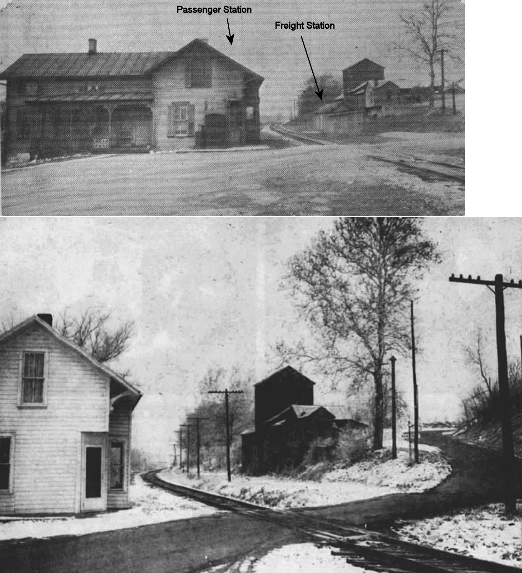
| Browns (Rex) |
|
Valuation maps show that the small building near the grain elevator across the tracks from the passenger station was a freight station. | ||||||
| Bryar |
|
|||||||
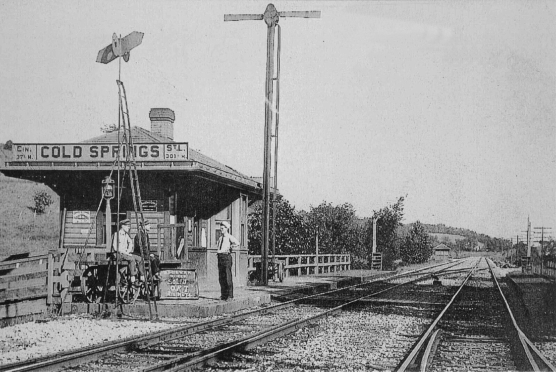
| Cold Springs | |
|||||||
| Donnellsville Station |
|
This station was on the north side of Lower Valley Pike just west of Snider Road at GPS: 39.8987529, -83.9656835. | ||||||
| Donnellsville Station |
|
There was a freight station here next to the mill. | ||||||
| Durbin | AND |
The Big 4 and Erie shared a station here. Up until 1914 passengers bound for Springfield on the Erie would disembark here and take a five-mile trolley ride the rest of the way. The Erie opened Springfield station in 1914 which was closer to town with the last 2.5 miles on the Springfield, Troy & Piqua trolley line (Richwood Gazette, 4-2-1914). | ||||||
| Emery Chapel (Beatty) |
 |
This station was on the SE side of South Yellow Springs Street on the west side of the tracks at approximately GPS: 39.879421, -83.840623. The depot survived as a non-agency, carload-only freight station up until at least the late 1960s when the PRR applied to have it governed by the Xenia agency rather than the Springfield freight station which was slated to close (Springfield News Sun 10-18-1967). | ||||||
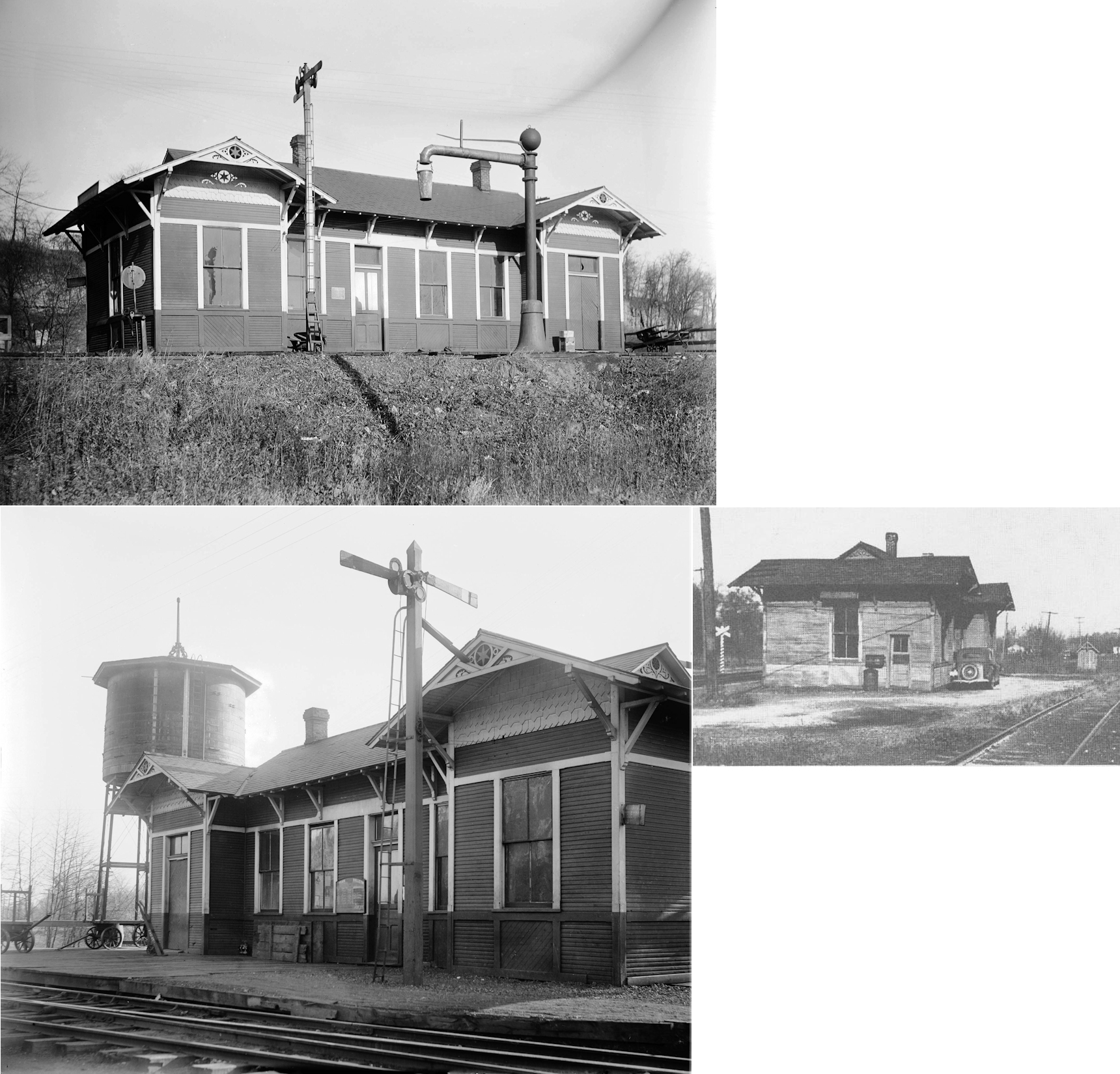
| Enon |
|
This station was on the west side of Enon Road, on the north side of the tracks. | ||||||
| Enon Crossing |
|
See listing below for Oakview. | ||||||
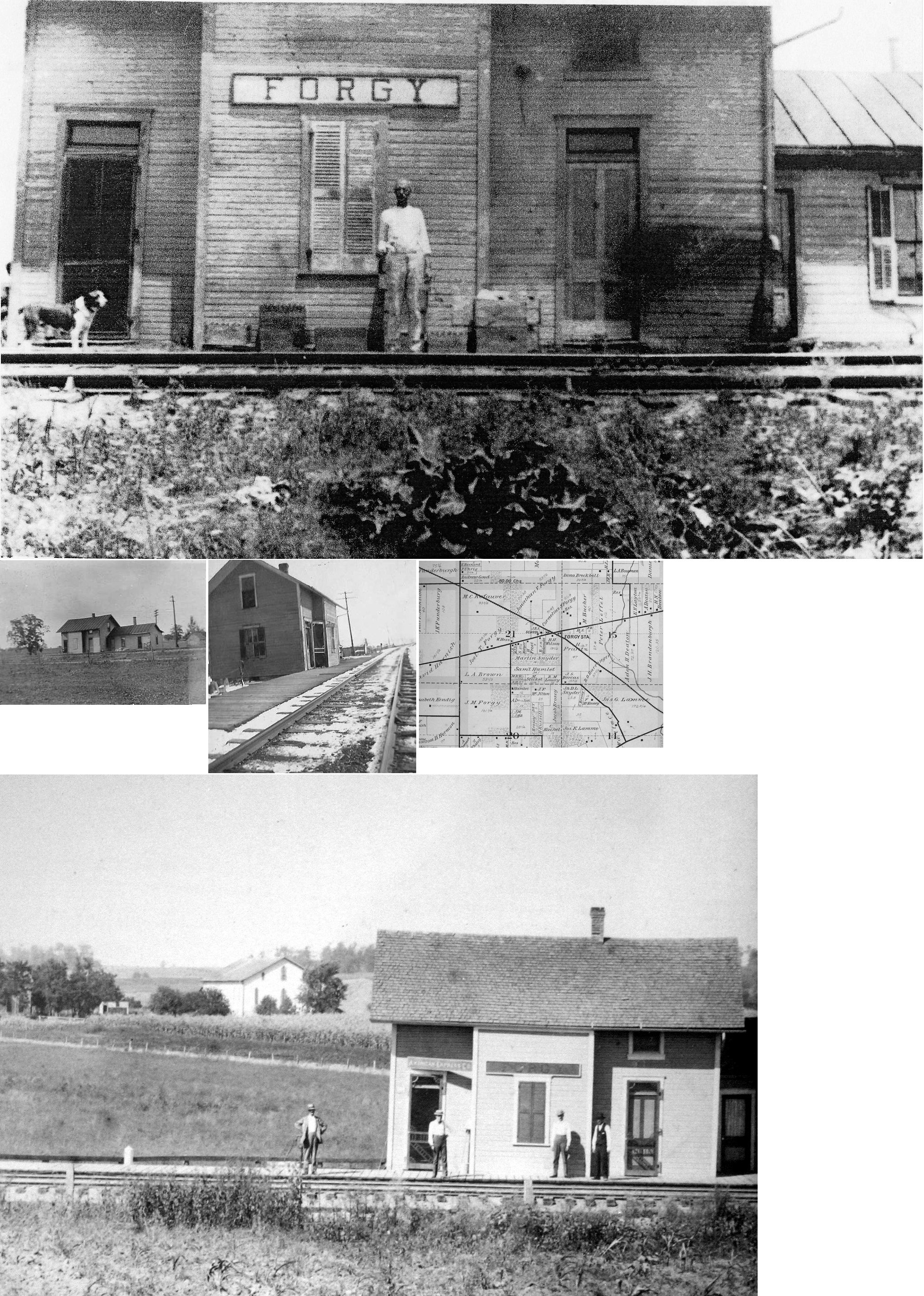
| Forgy |
|
This station was on the old Peoria & Eastern line where the grade crossed US-40 at approximately GPS: 39.913213, -83.991385. The station appears to be named after the family that owned the land around the station, however, according to the book "Ohio Town Names" (1958), the station was named after C.S. Forgy an employee of the Big 4 Railroad. | ||||||
| Hennesee (Hennessy) |
|
|||||||
| Hustead |
|
According to the 1916 valuation records, there was only a platform and station sign here. It was on the north side of Hustead Road on the NW side of the tracks at GPS: 39.8401959, -83.8710414. | ||||||
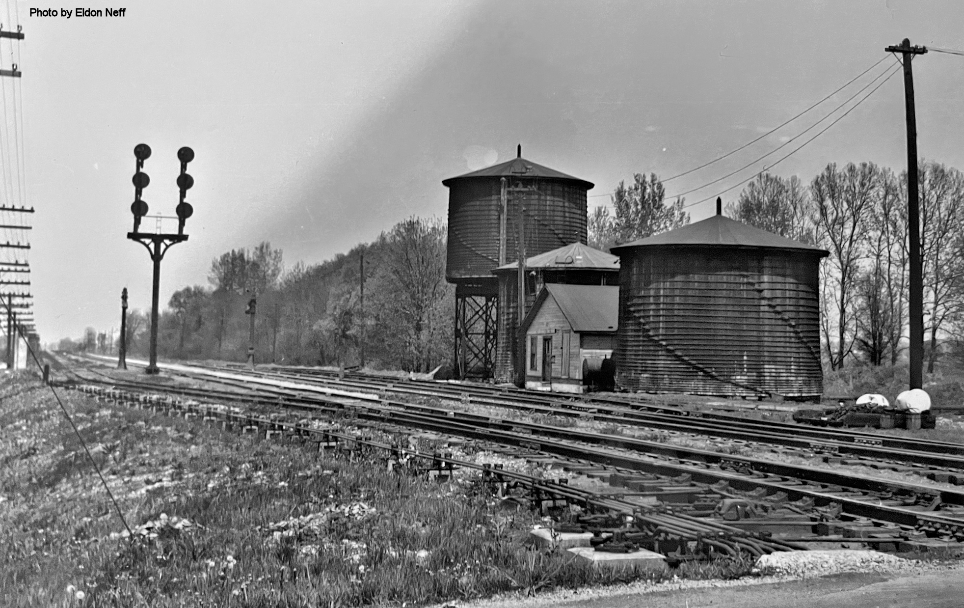
| Lagonda |
|
This station was somewhere in the yard and also served as the yard office. | ||||||
| Limestone City (Moores) |
|
This station was located near the crossing at Old Mill Road. Listed as "Moores" on the Big Four Valuation map from 1915. This station was built for to serve the village and the Moores Lime Company Quarry | ||||||
| Locust Grove |
|
|||||||
| Maitland |
|
There was a small passenger station here just to the NW of the diamond on a stub track. This station is shown on the 1928-1950 Sanborn Fire Insurance Map. It was at GPS: 39.935710, -83.846790. | ||||||
| Maitland |
|
The freight station here was a boxcar on a platform. It was along the Erie tracks on the NE side of the diamond at GPS: 39.935657, -83.846677. This freight station is also is shown on the 1928-1950 Sanborn Fire Insurance Map. | ||||||
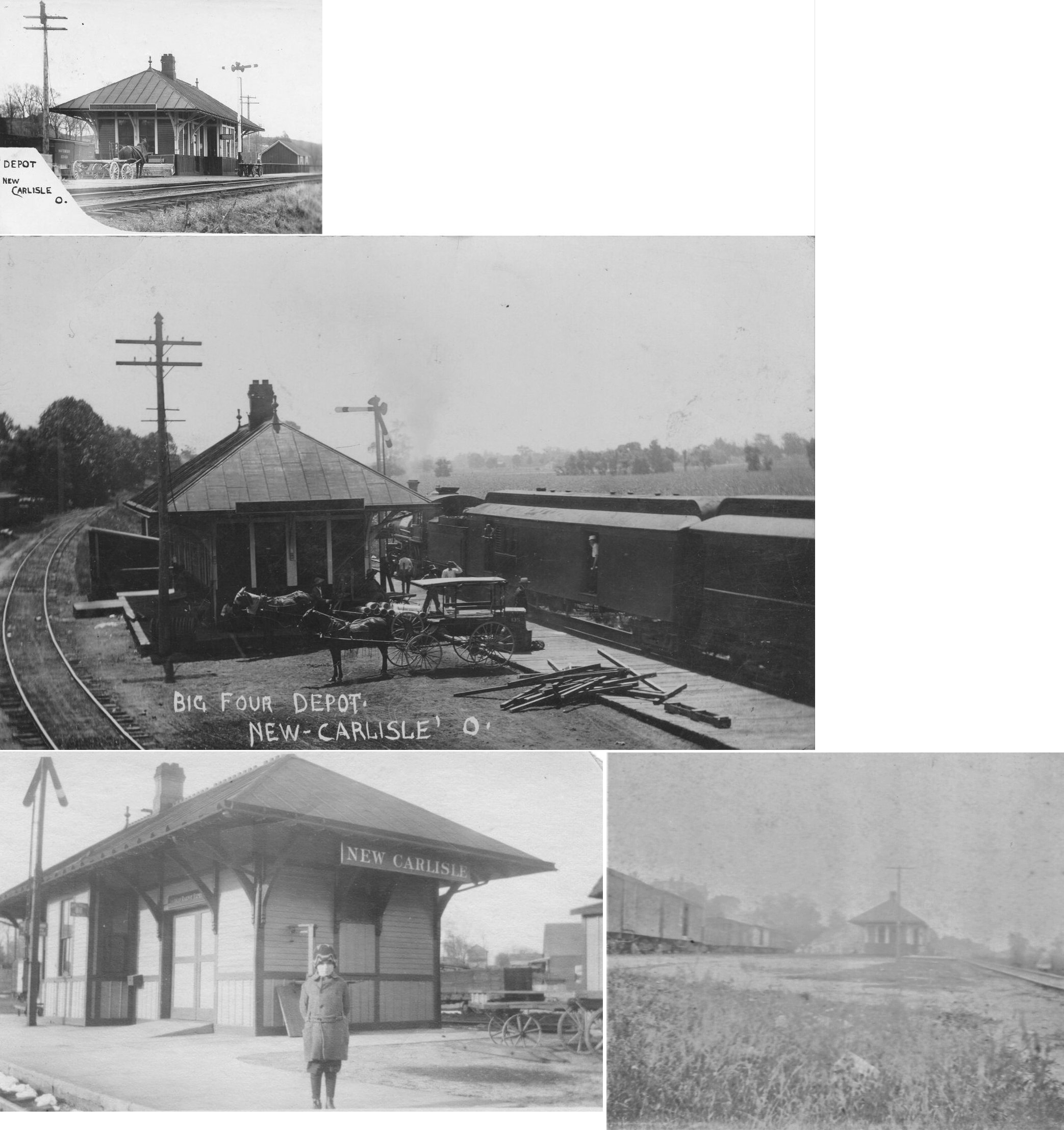
| New Carlisle | |
This station was off Ohio Street just south of Davis Street (when Ohio Street continued through to the tracks). It fell into disrepair and was torn down in the summer of 1965. | ||||||
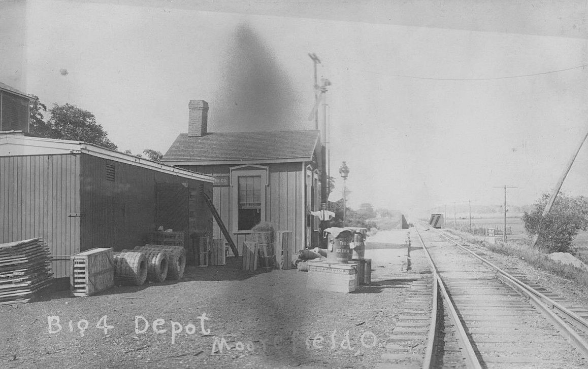
| New Moorefield | |
This station was at GPS: 39.988400, -83.716201 prior to the track realignment for the reservoir. There was also a freight station here made of a converted boxcar. New Moorefield was first built up in the 1840s when a sawmill and gristmill were started there. A post office called New Moorefield was established in 1866, and remained in operation until 1926. | ||||||
| Oakview (Enon Crossing) |
|
This station was located at Collier Road formerly Oakview Avenue. | ||||||
| Oxtoby | |
Henry Oxtoby, the founder of Oxtoby, donated the land in 1875 to the Springfield & Columbus Railroad which was later bought by the IB&W and then Big Four. The town and depot faded into oblivion in the early 1900s. The station was in the vicinity of GPS: 39.901931, -83.695180 where Fletcher Pike crosses the tracks. | ||||||
| Plattsburg |
|
This station was on the east side of North Urbana Lisbon Road on the north side of the tracks at GPS: 39.895526, -83.611264. In 1853 the first station here was built by Andrew Nichelson. There was also a Railway Express Agency here. After service it was sold to a nearby farmer. The nearby grain elevator burned down in 1971 and the station was torn down in the mid/late 1990s. | ||||||
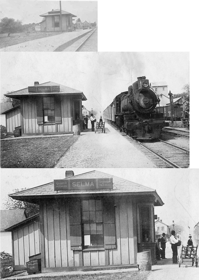
| Selma |  |
|||||||
| South Charleston |
|
This station was located on the south side of Woodward Street just east of Chillicothe Street. A freight station with stock pens and a ramp to the tracks was just to the east of the passenger station. | ||||||
| South Charleston | |
"Newer" brick station built in 1906 at same site as the above station. | ||||||
| Snyder | |
|||||||
| Snyder |
 |
|||||||
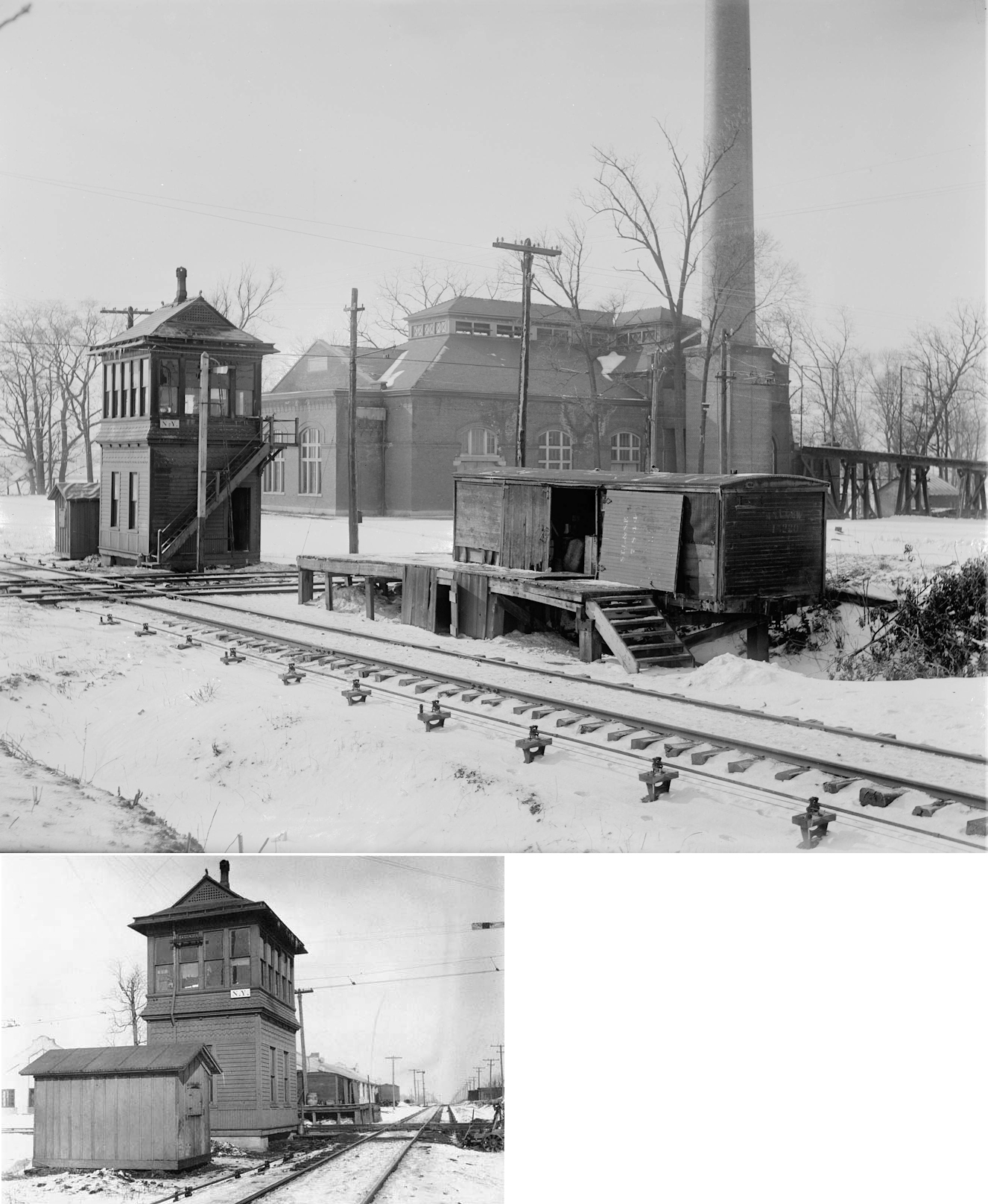
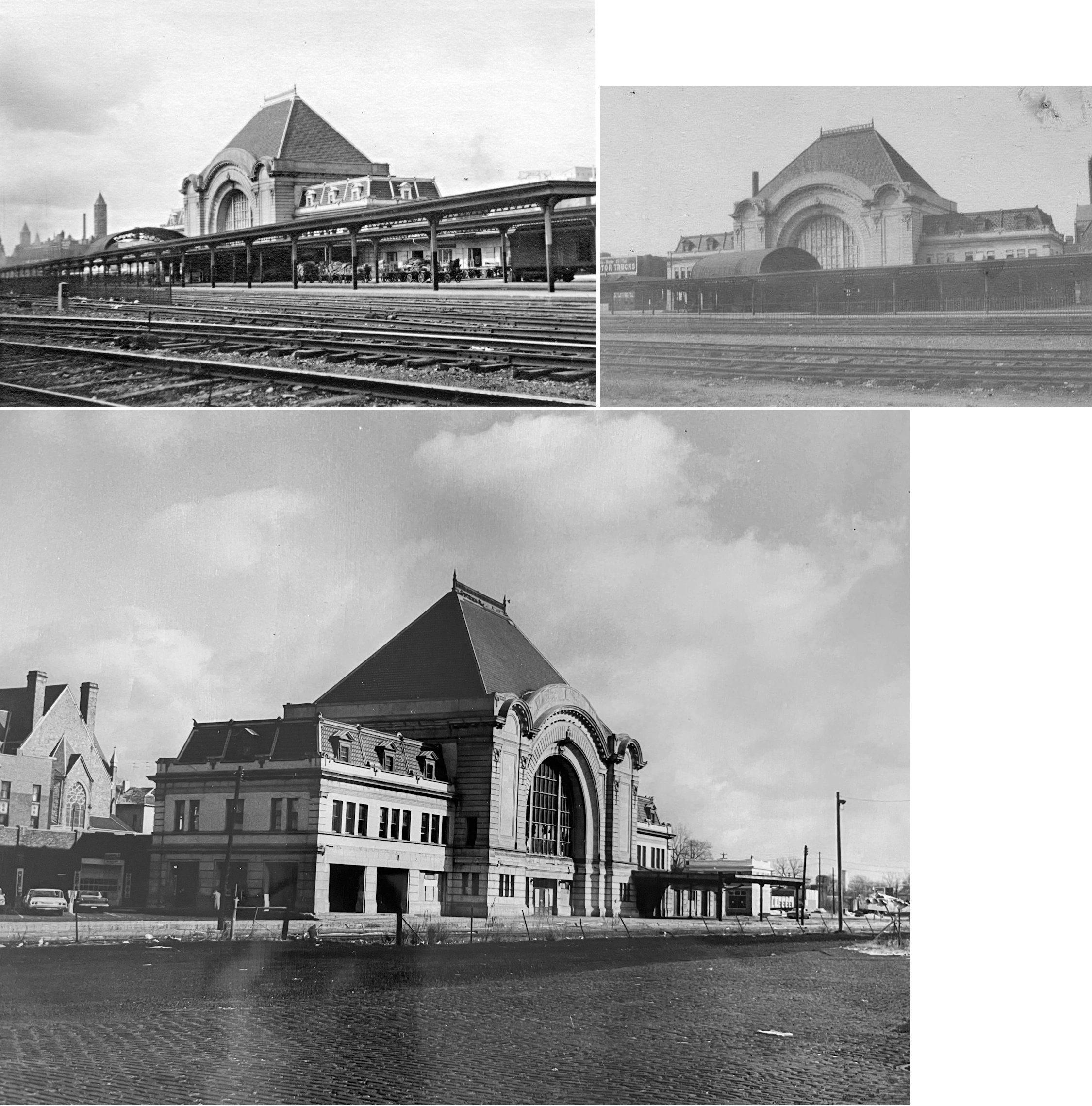
| Springfield |
|
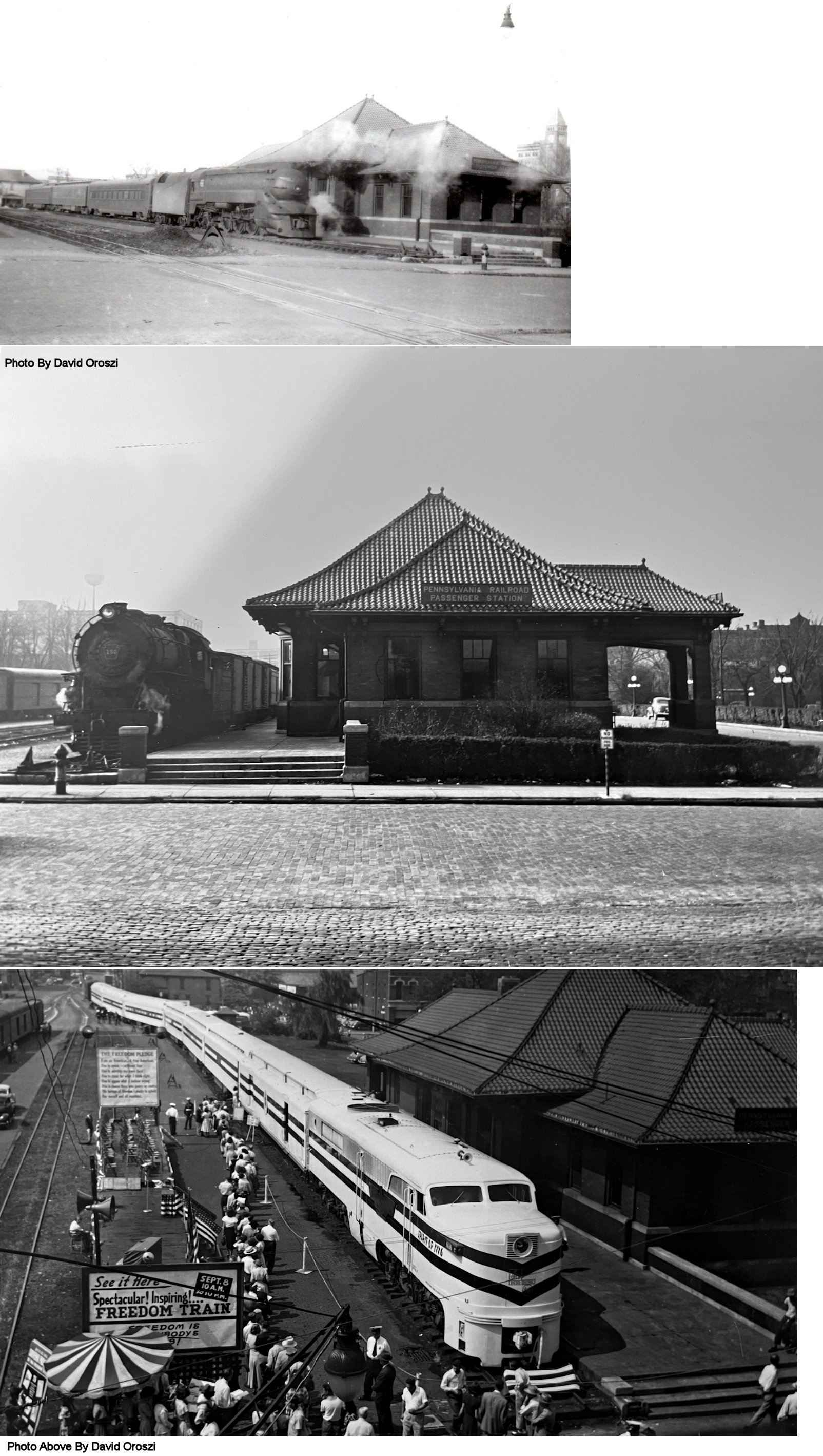
This is the newer "union
station" built in 1910. Although referred to as a "union station" in
newspapers when it opened, it only ever served the Big 4 RR. It was on Washington Street at Spring Street
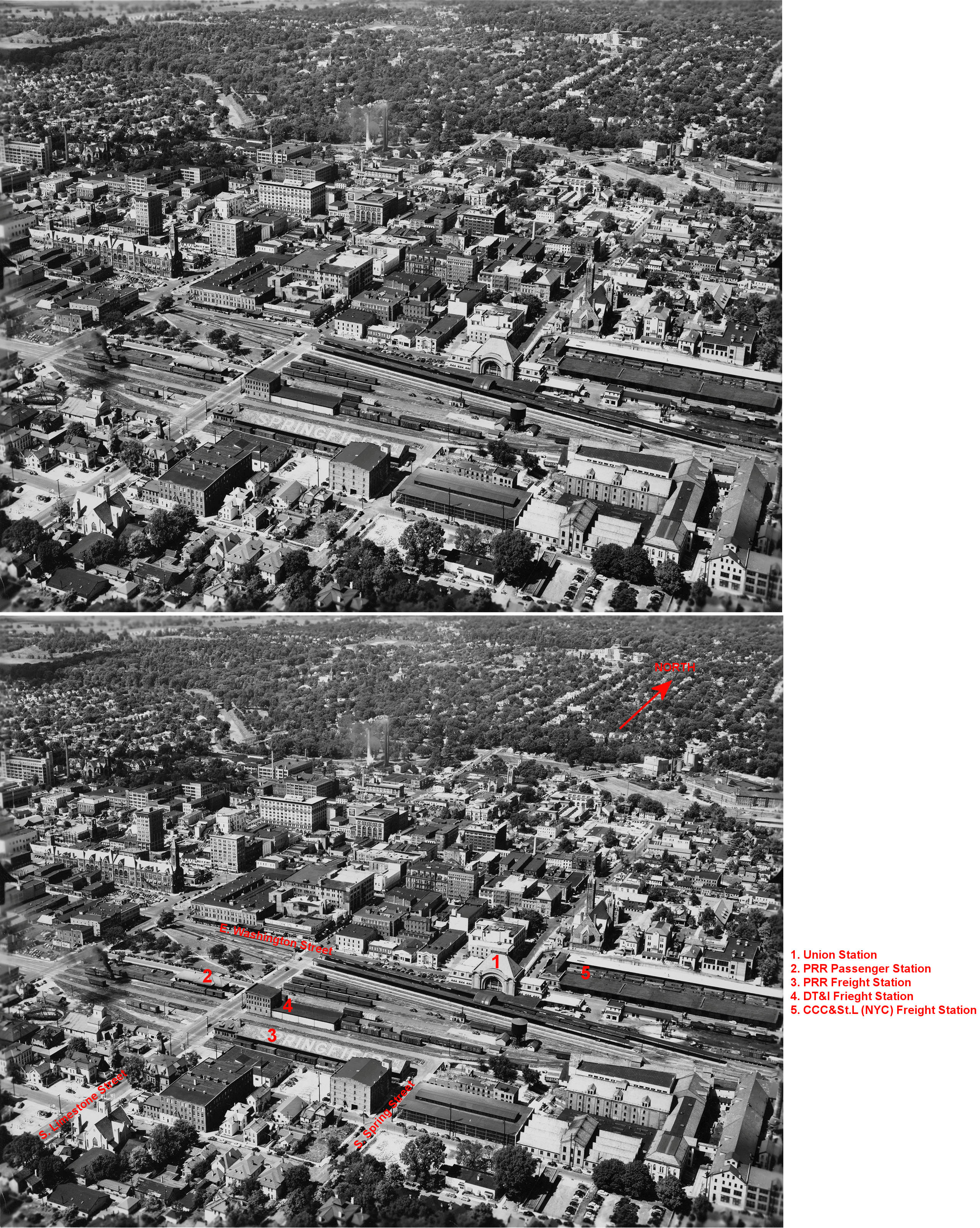
(GPS: 39.921812,-83.806959). It was demolished in 1969 to make way for the new Spring Street bridge. Spring Street was cut off in 1909, so this bridge was a restoration of Spring as a through street. The passenger station site itself is now a parking lot for Clark State Community College. Most of the Springfield freight and passenger facilities met their end in the late 1960s and early 1970s when the transportation hub area surrounding the NYC passenger station were demolished in an urban renewal project. --Scott Trostel Here is an aerial view of the Union Station area circa 1948. |
||||||
| Springfield |
|
This is the old Big 4 station. It sat on the SW corner of Washington Street and South Limestone Street (GPS: 39.922014,-83.808984). It was demolished in 1910 and the location became known as Big 4 Park. | ||||||
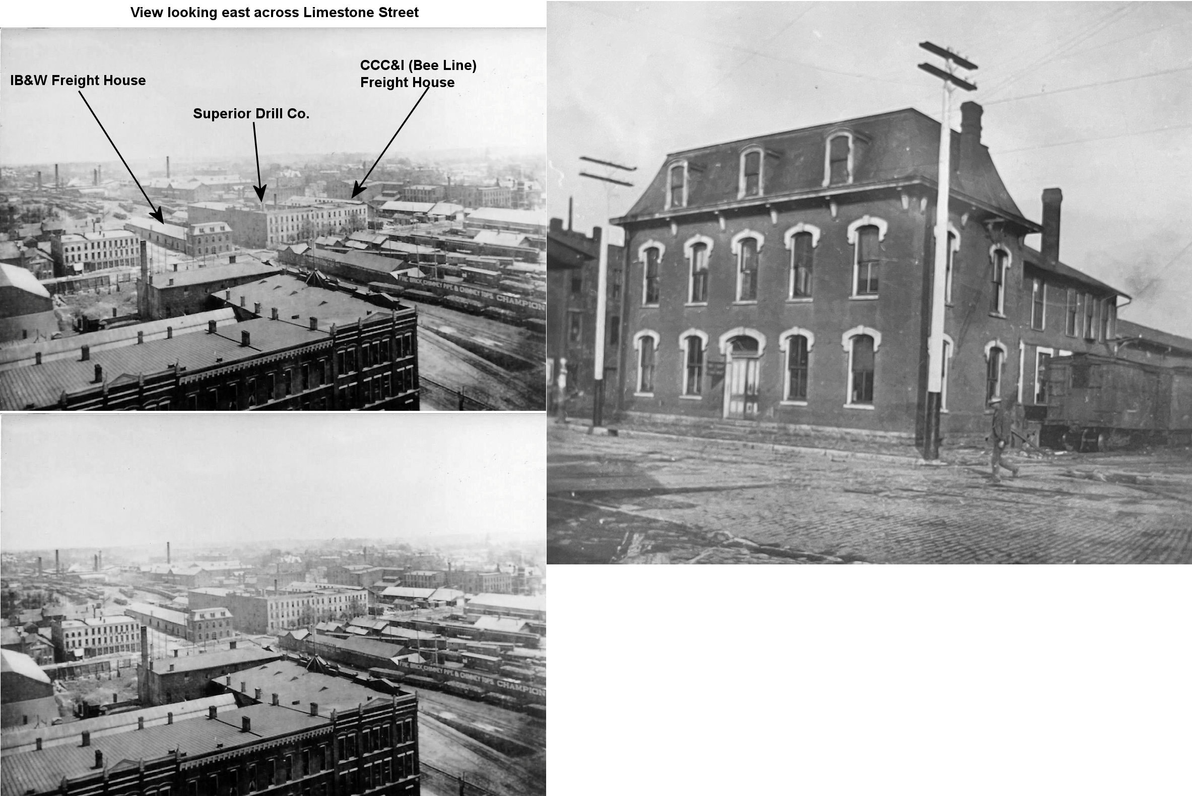
| Springfield |
 |
The IB&W frieght station was on the SE corner of Washington and South Limestone Streets (GPS: 39.921981,-83.808488). This station was gone by 1910. | ||||||
| Springfield |
 |
The CCC&I freight station was between South Limestone and Spring Streets at approximatley GPS: 39.920837,-83.808024. This station was gone by 1910. | ||||||
|
Springfield (East Street) |
|
The 1889 Official Guide To Railways lists a station on East Street. The station would have been in the vicinity of GPS: 39.917255, -83.794523. | ||||||
|
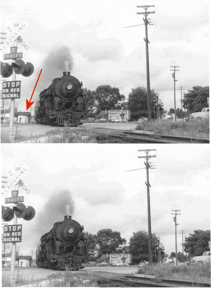
Springfield (West End) |
|
The 1893 Official Guide to Railways lists a West Springfield station at mile marker 77.9 which would put its location 1.8 miles from the old main Springfield station at Washington & Limestone Streets (MP 79.7). That would put the station at the Snyder Street crossing or the crossing on West Main near the intersection with South Walter Street. This was also known as the "West End" station. The photo is from 1957 after that station building had been downgraded to a toolhouse. |
||||||
|
Springfield (Masonic Home) |
|
I have seen references to a stop at the Masonic Home. It is unclear whether there was an actual station building there. The most likely place, if there was a station, would have been in the vicinity of where the tracks parallel Lodge Road. | ||||||
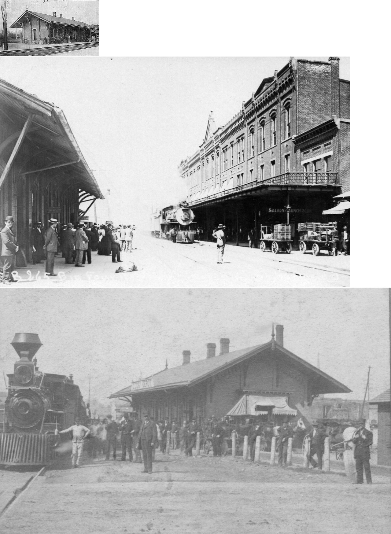
| Springfield |
 |
The passenger station was on the west side of South Limestone Street between Monroe and Washington Streets (GPS: 39.921244,-83.809325). It was replaced by a newer PCC&St.L station in 1910. | ||||||
| Springfield |
|
The Little Miami freight station was on the west side of South Limestone just north of Monroe Street (GPS: 39.921244,-83.809325). It was torn down around 1910. | ||||||
| Springfield |
|
A new brick passenger station was built in 1910. Here is an aerial view of the city circa 1948 showing Union Station, the PRR station and freight houses for the three RRs. | ||||||
| Springfield |
|
A new PCCC&St.L freight house was built around 1910 on the former site of the original CCC&I freight station. It was between South Limestone and Spring Streets at approximatley GPS: 39.920837,-83.808024. | ||||||
| Springfield |
|
|||||||
| Springfield |
|
A new, larger freight station was built around 1910 just
west of the old Ohio Southern freight station on the east side of
Limestone Street (GPS: 39.921102,-83.808627). The DT&I had two passenger stations in town at different times. Until 1897 it used the old "Union Passenger Station," then moved into its own station on North Limestone on the Springfield belt line of the Ohio Southern, a forerunner of the DT&I. It was closed in 1932 and all DT&I trains went to the PRR station. In 1937 they moved across the street into the DT&I's South Limestone Street freight house. It was then used as a joint freight and passenger station for the DT&I's mixed train until May 8, 1954, when the DT&I ended all passenger service. - Scott Trostel |
||||||
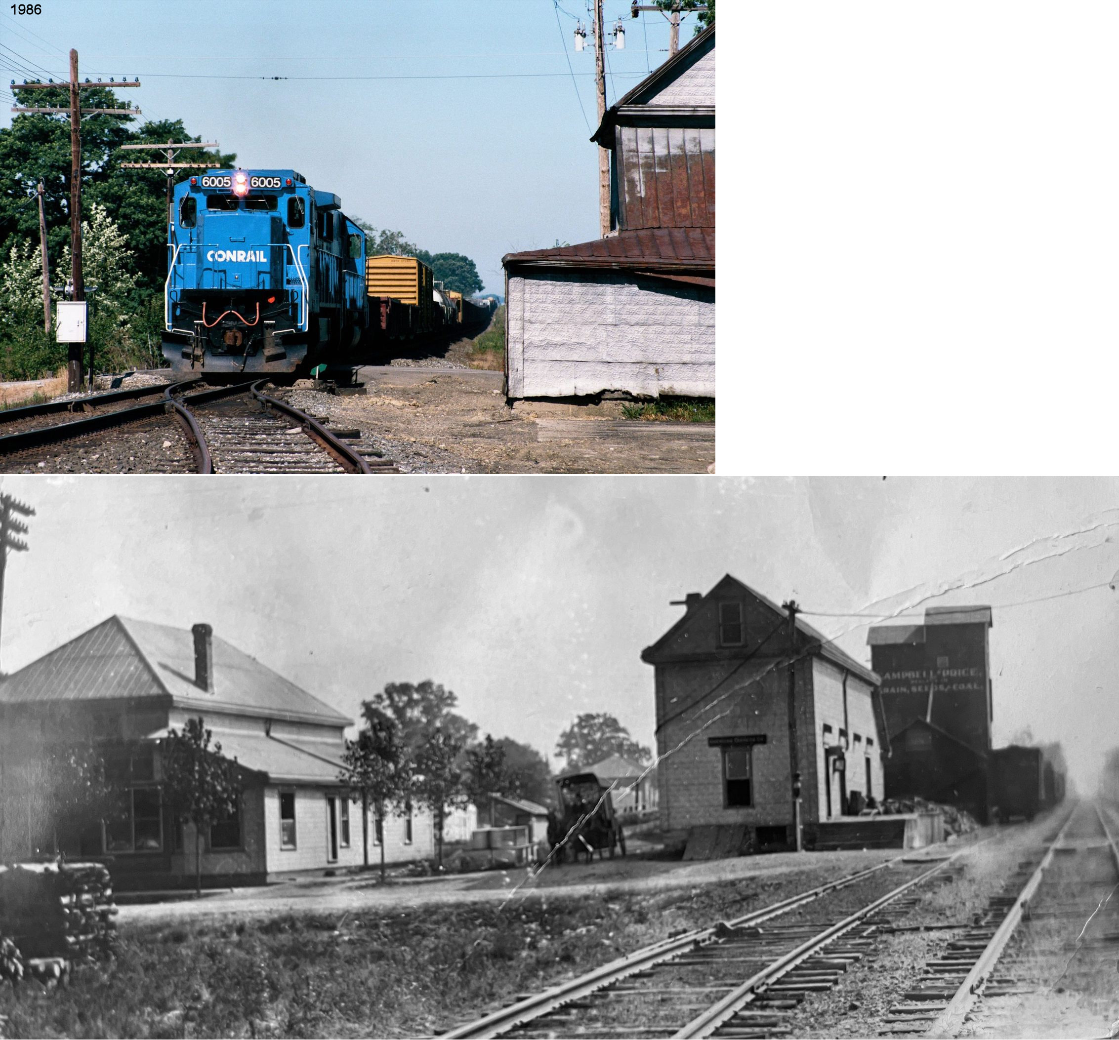
| Springfield | |
There was a freight station near the NW end of Cliff Street (GPS: 39.929373,-83.81511). It is the smaller building in the foreground of the photo. The larger building in the background was the old Springfield Electric Railway car shop. The frieght station may have also served the trolley line originally, but it is labeled as the Erie frieght depot on the Sanborn map from 1955. This station was not located on the Erie line as Springfield suburban railroad handled the cars from Maitland to the freight house. It was torn down sometime between 2008-2010. | ||||||
|
Springfield Station (Maitland) |
|
Up until 1914 passengers bound for Springfield on the Erie would disembark at Durbin and take a five-mile trolley ride on The Ohio Electric the rest of the way. The Erie opened Springfield Station in 1914 which was closer to town with the last 2.5 miles of the journey into Springfield proper on the Springfield, Troy & Piqua trolley line (Richwood Gazette, 4-2-1914) The station here was formerly known as Maitland. The station was at approximately GPS: 39.9280627, -83.8602603. | ||||||
| Sugar Grove |
|
|||||||
| Thorps |
|
|||||||
|
Tremont (Glen Echo) |
AND |
|||||||
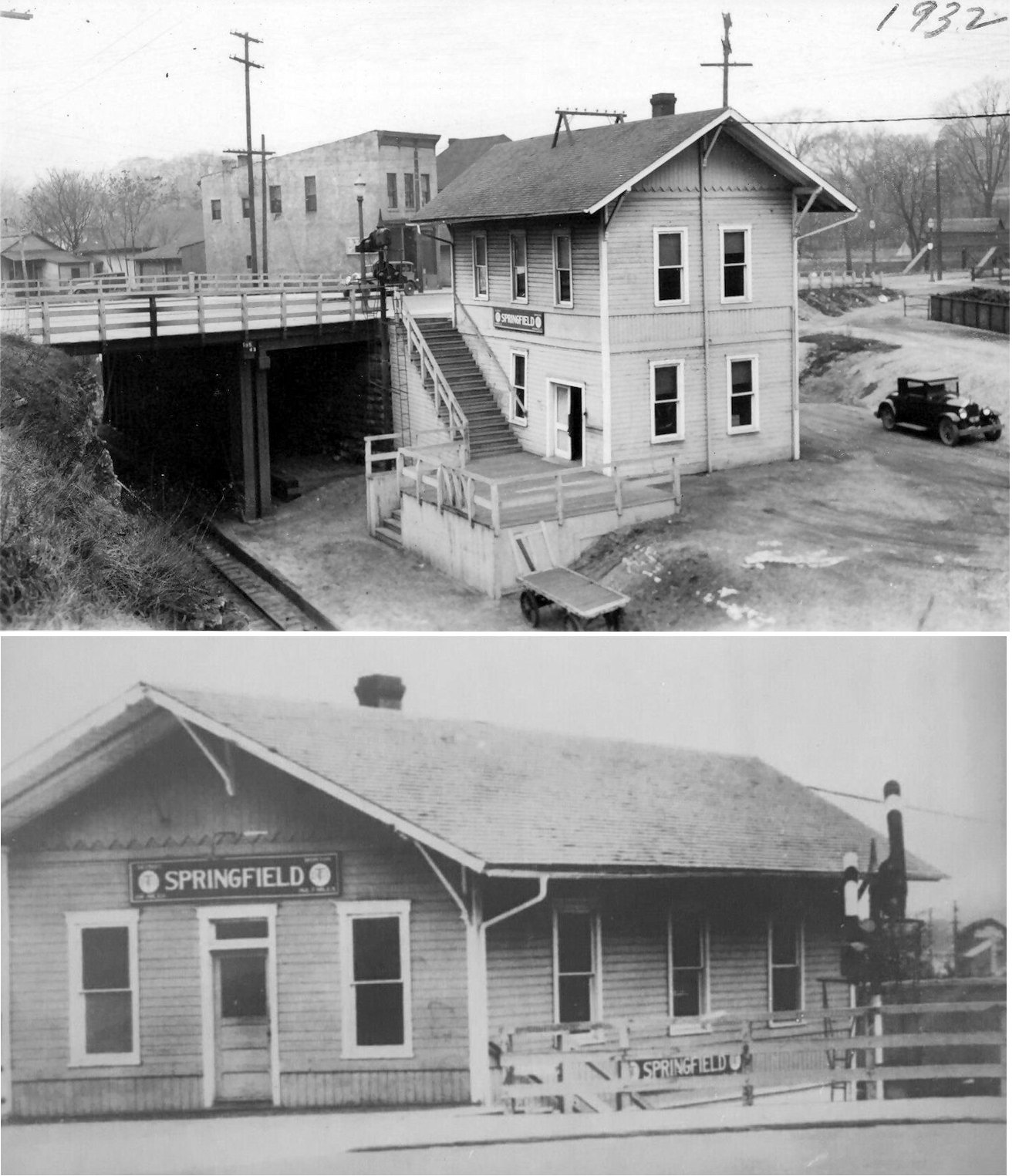
| Tremont City |
|
This station was on the east side of Upper Valley Pike. It was on the south side of the tracks. The station burned after WWII and the DT&I built a new station (which is still standing). | ||||||
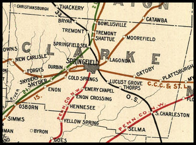
| 1898 CLARK COUNTY RAILROAD MAP | ||||||||
 |
||||||||
|
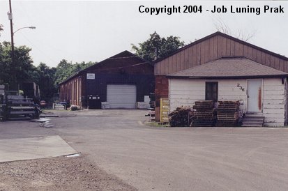
Notes About Existing Stations... Enon (Erie) - This station was built sometime prior to 1886. The building also served as a grain store in the old days. Jackson Center (Ohio Southern) - This station was moved from Jackson Center, in Shelby County, by a private individual in the 1970s. It was restored and maintained in near original condition some 40 miles from its prior location. It features the distinctive 1920 style of Henry Ford when he owned the D T & I railroad and selected gray as the station color and with large signs. A very good example of Ford influence on the railroads under his ownership in that era. - Scott Trostel South Charleston (DT&I) - The bay window and roof overhang on the track side of the building had been removed by the DT&I many years ago, but were reinstalled during the restoration. Springfield (NYC) - After the 1910 Union Station was torn down in 1969, this building served as the last passenger station in Springfield until the end of passenger service there. The building previously housed The Mills Brothers Building Supply Company (as shown on the 1928 Sanborn maps) and was built somtime between 1911-1928. |
||||||||