 COUNTY COUNTY
|
|
||||||||
| EXISTING STATIONS | ||||||||
|---|---|---|---|---|---|---|---|---|
| Station Name |
Original Railroad | Current Location |
Type | Current Use |
Date Built | Track Status |
Building Material |
More Info |
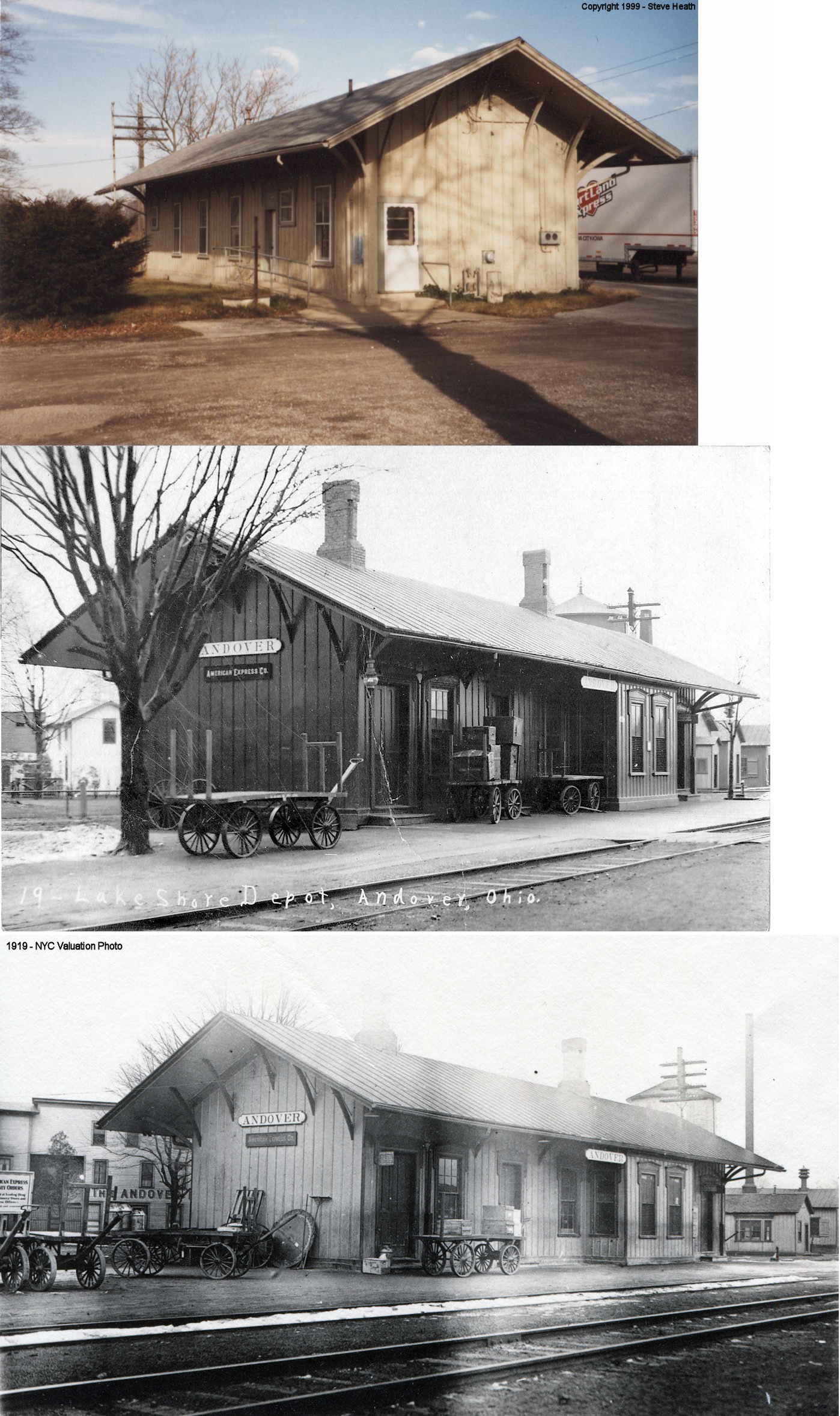
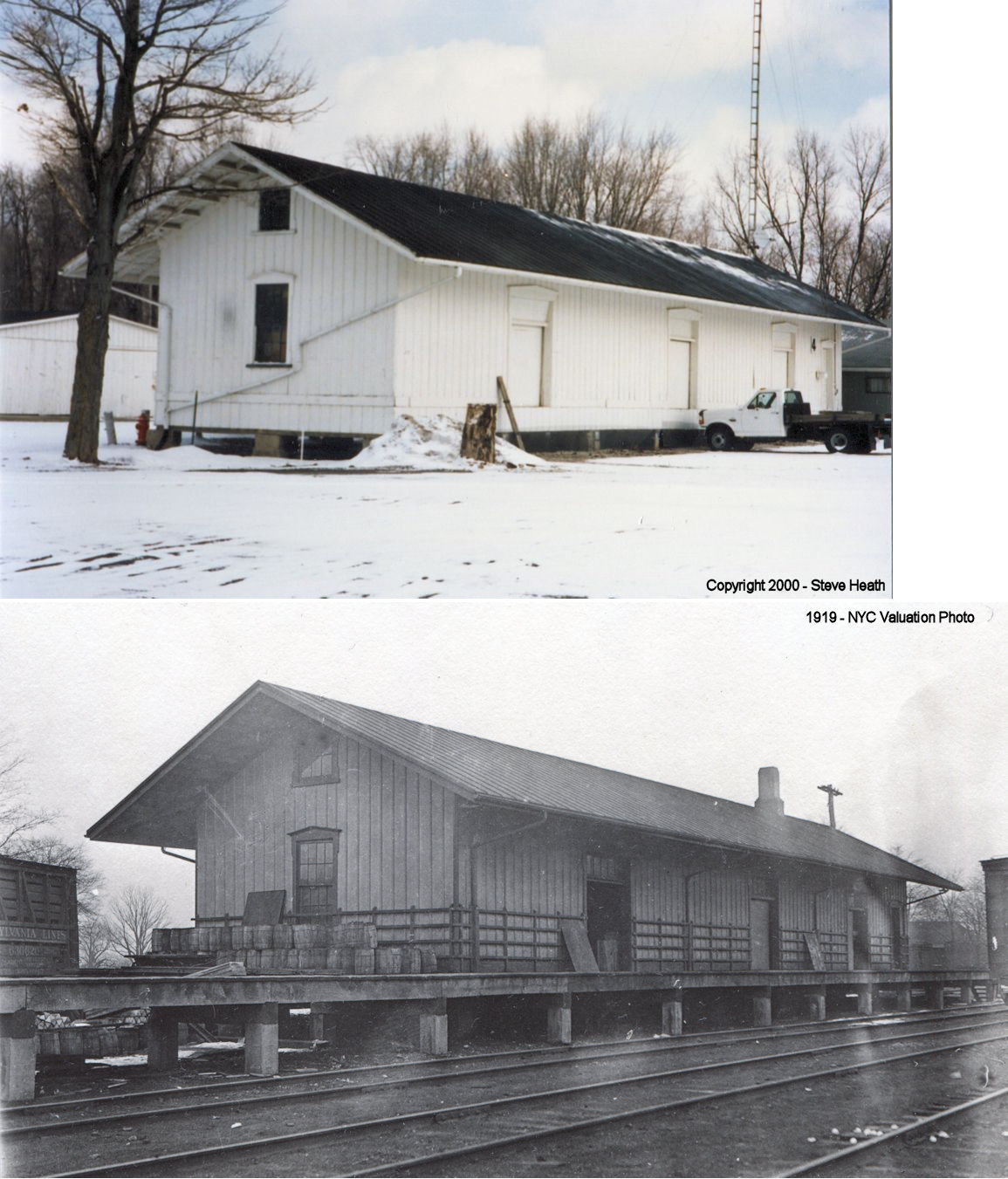
| Andover |
 |
Antique Engine Club Show Grounds on US-322 just east of Wick (GPS: 41.532304, -80.641367) |
P | Club | 1872 | None | Wood |
|
| Andover |
|
Antique Engine Club Show Grounds on US-322 just east of Wick (GPS: 41.532304, -80.641367) |
F | Club | 1872 | None | Wood |
|
| Ashtabula |
 |
West 30th Street (41.874686,-80.797499) |
P | ???? | ???? | In Use | Wood |
|
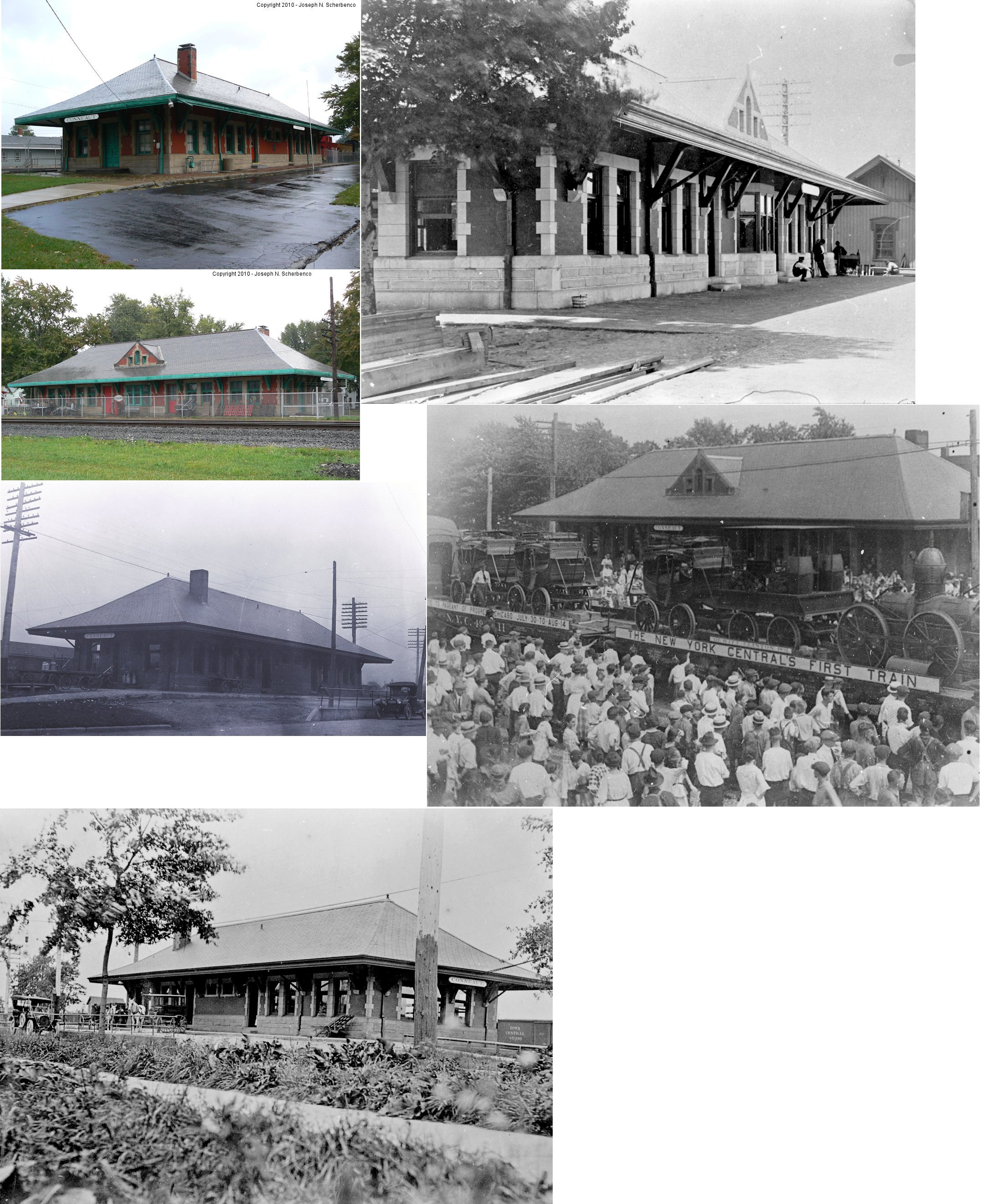
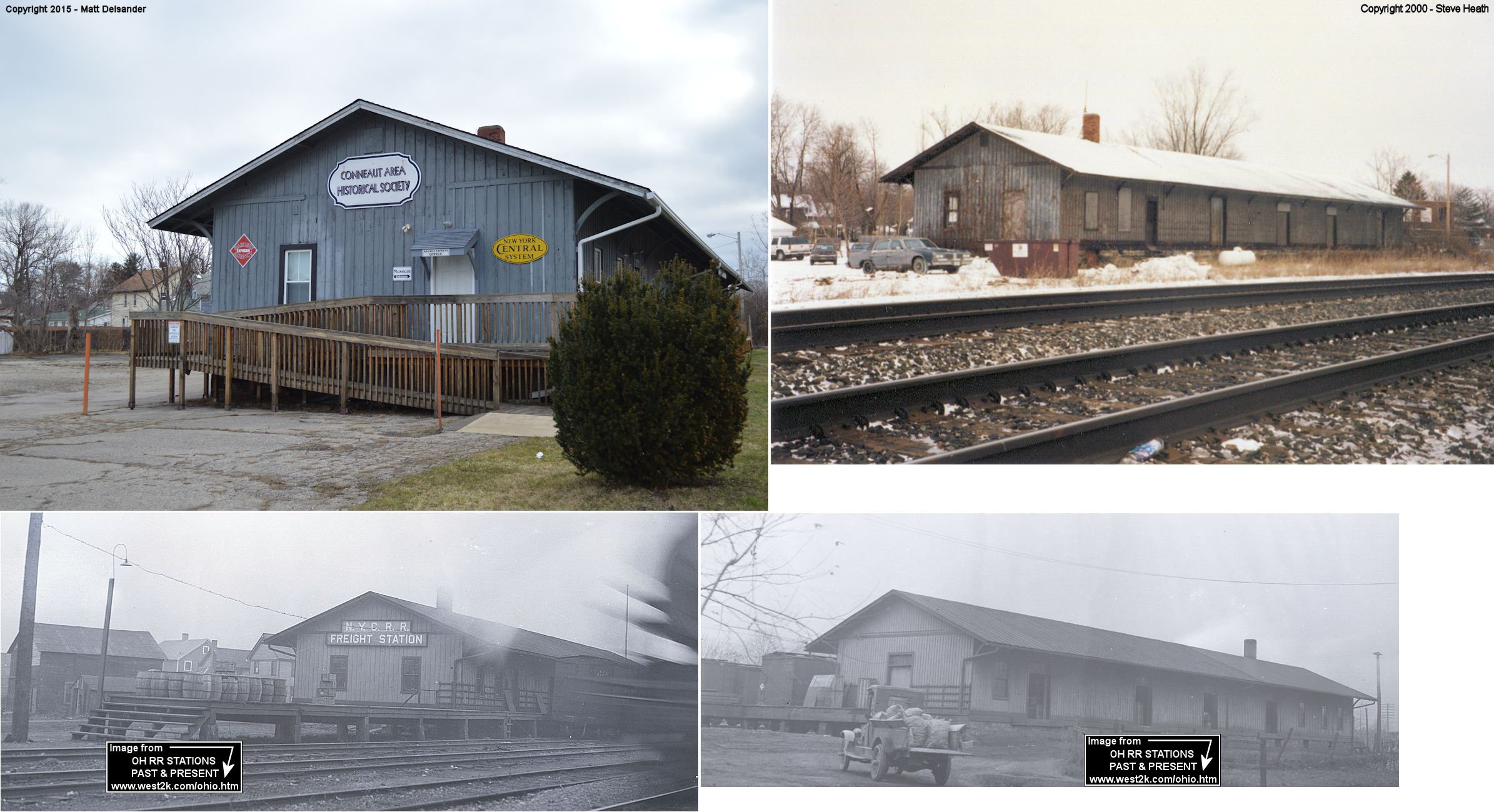
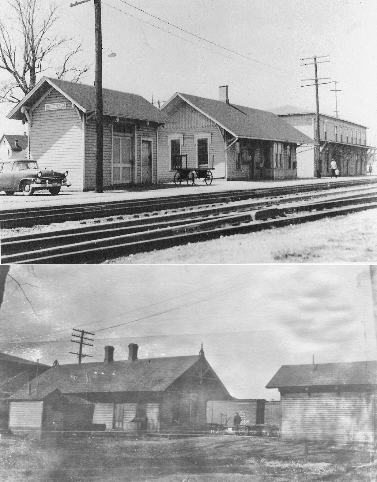
| Conneaut |
 |
Depot Street at Sandusky Street (GPS: 41.949756,-80.558683) |
P | Museum | 1900 | In Use | Brick |
|
| Conneaut |
|
East Side of Mill Street across tracks from passenger station. (GPS: 41.950219,-80.558512) |
F | Museum | 1851 | In Use | Wood |
|
| Geneva |
|
99 Woodlawn Street (GPS: 41.807432, -80.945270) |
P | Private | 1886 | In Use | Wood |
|
| Griggs |
|
Griggs Road (GPS: 41.785641,-80.748482) |
P | Home | ???? | In Use | Wood |
|
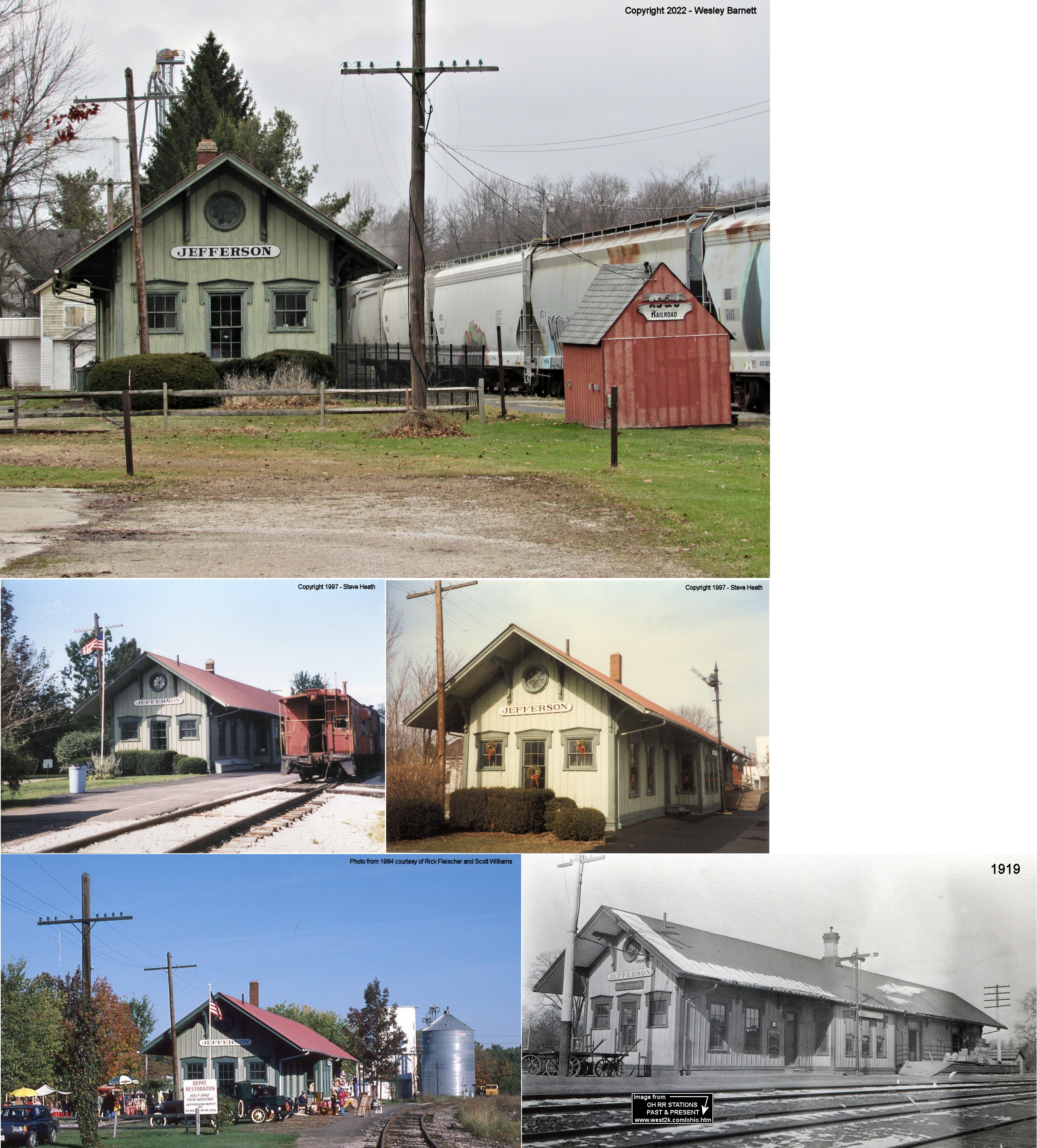
| Jefferson |
|
147 East Jefferson Street (GPS: 41.739374, -80.761860) |
P | Museum | 1872 | In Use | Wood |
|
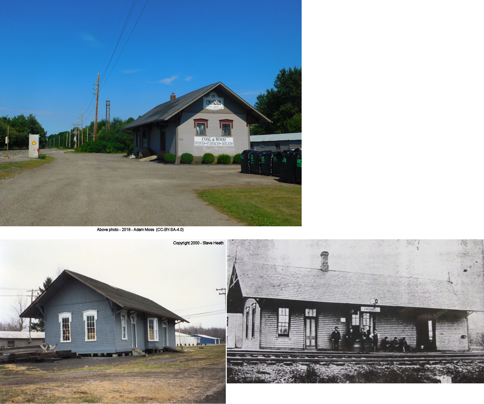
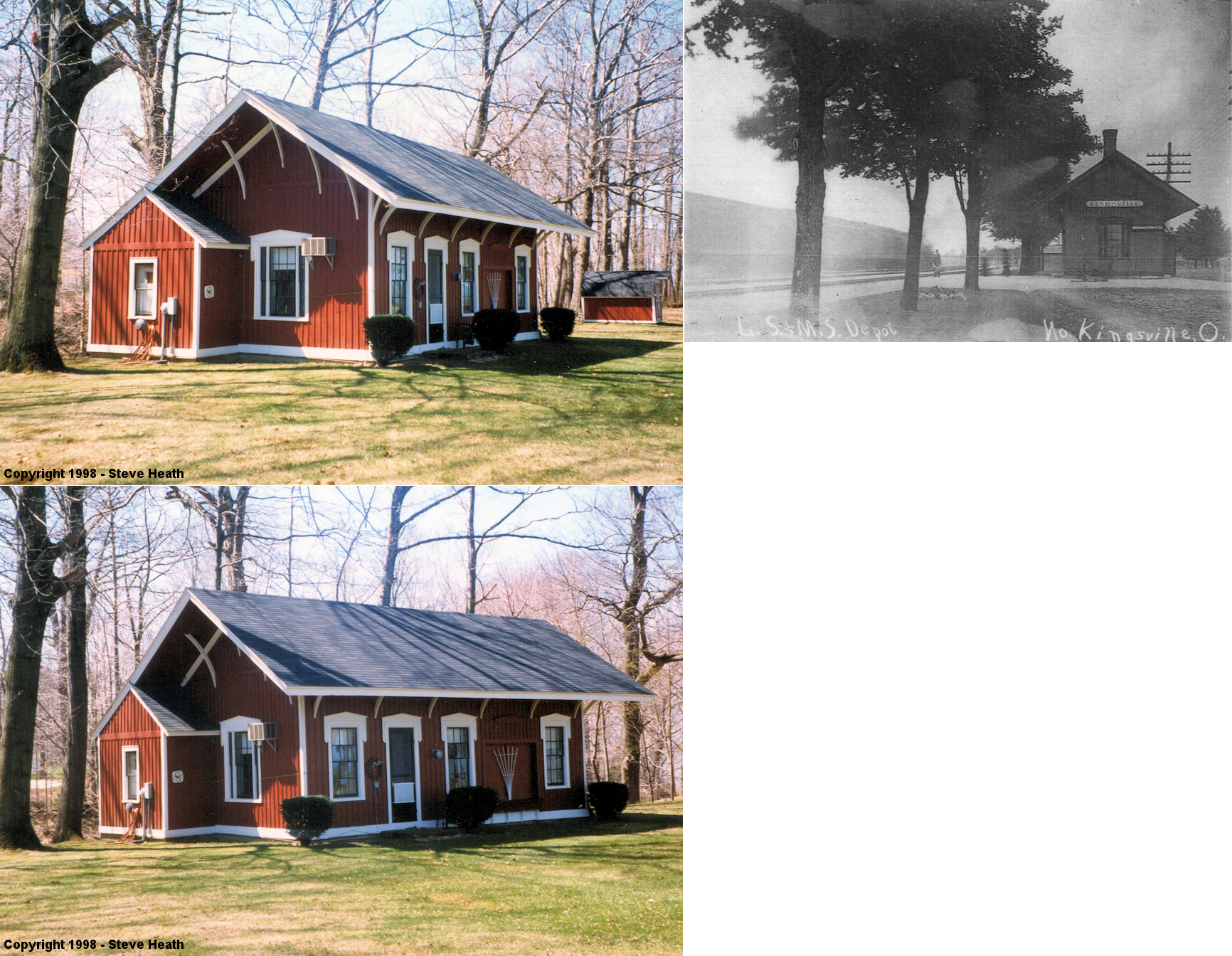
| Kingsville |
 |
6226 Lake Street (SR-193) (GPS: 41.896759, -80.682438) |
P | Business | ???? | In Use | Wood | |
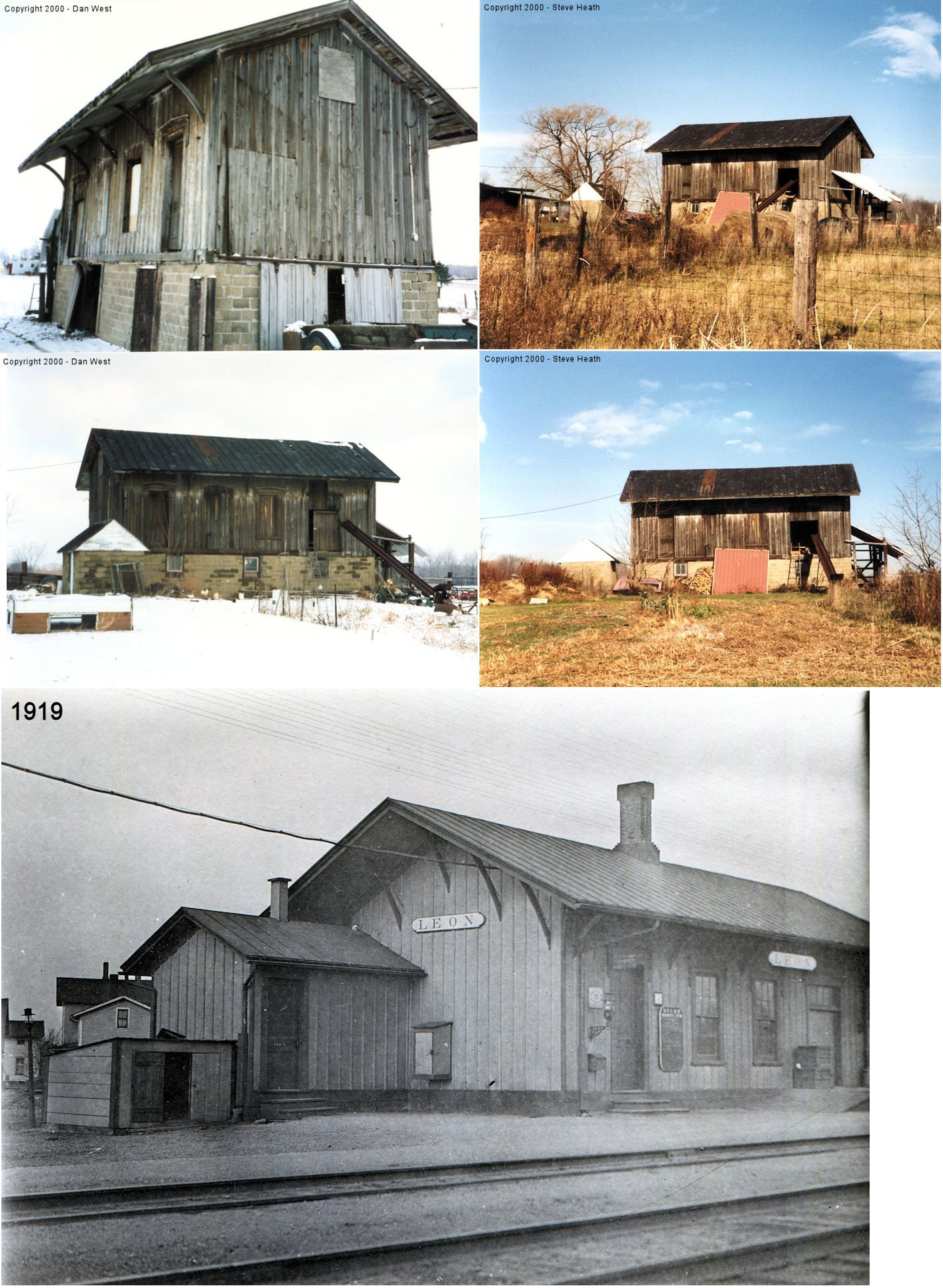
| Leon |
|
North side of Leon Road just east of Stanhope-Kellogsville Road (GPS: 41.654157, -80.610772) |
P | Private | 1872 | Gone | Wood |
|
| North Kingsville |
|
North of Lake Road about
1/2 mile west of Burrington Heights between North Kingsville and Conneaut |
P | Private | ???? | None | Wood |
|
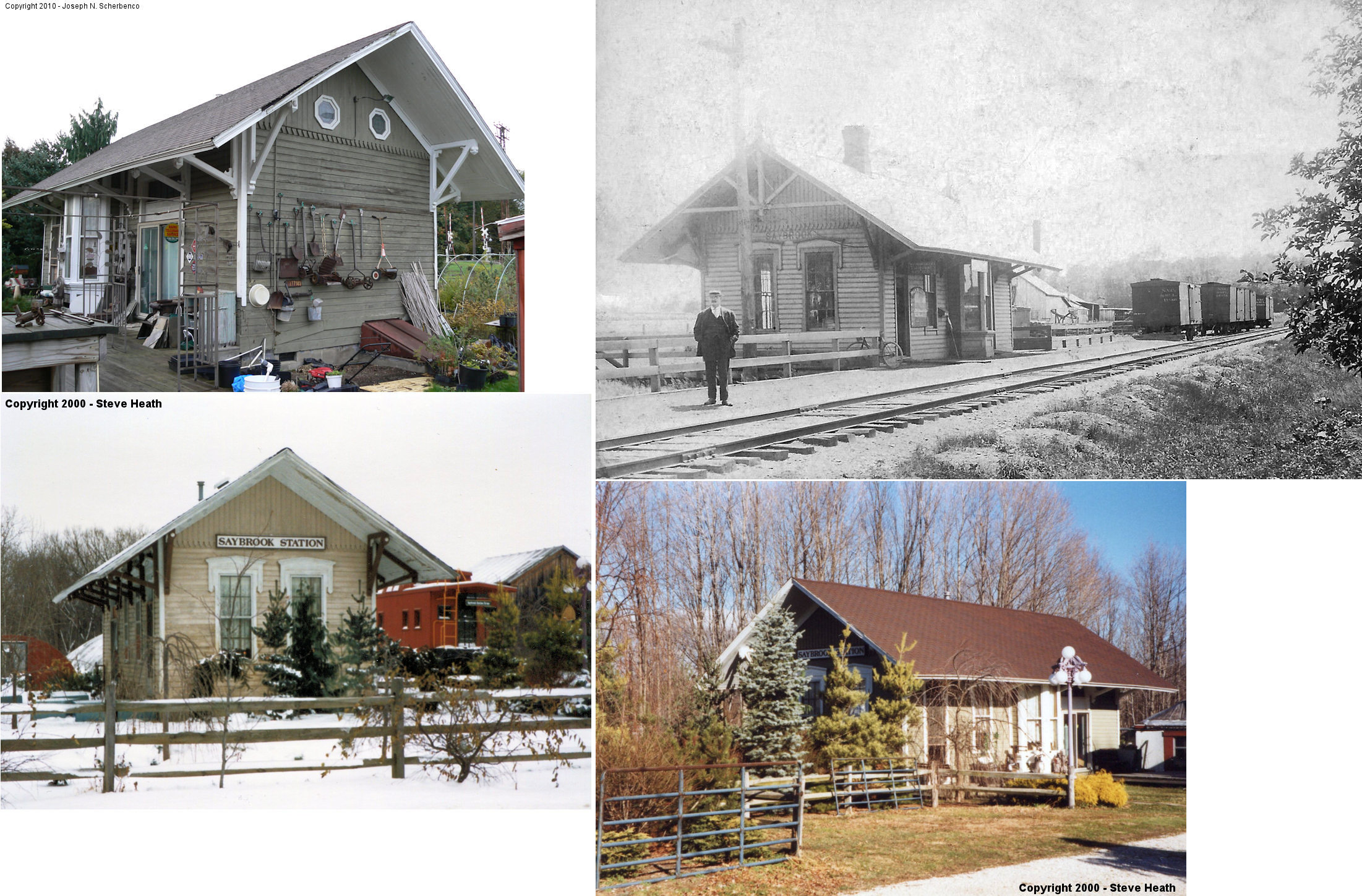
| Saybrook |
|
8050 Depot Road (GPS: 41.823831, -80.869193) |
P | Private | 1882 | In Use | Wood |
|
| STATIONS OF THE PAST | ||||||||
| Station Name |
Original Railroad |
Notes | ||||||
| Amboy (North) |
|
According to the 1894 map, this station was on the southeast side of the tracks on the north side of Gore Road. It was on the property of H. H. Hopkins. It was gone by 1916 as the NYC valuation records don't list a station here at that time. The records do list a number of other buildings though including two bunk houses, a farm, interlocking tower, and oil house. | ||||||
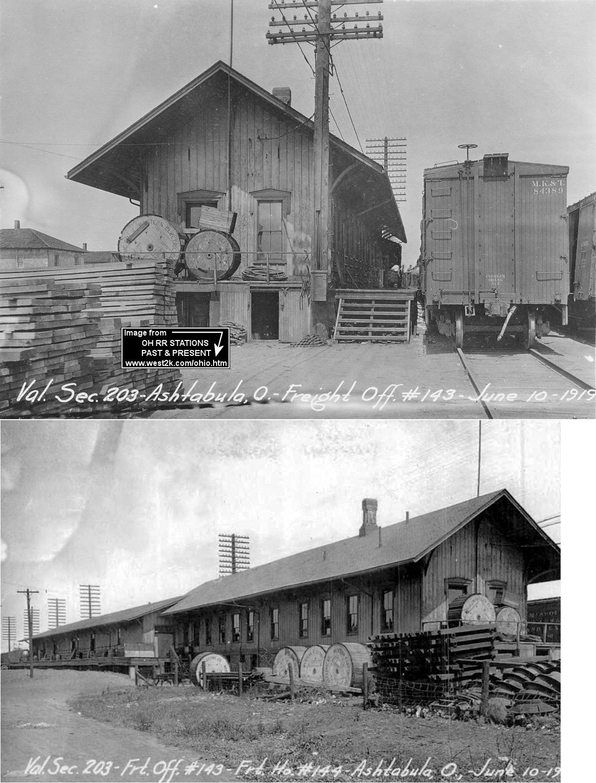
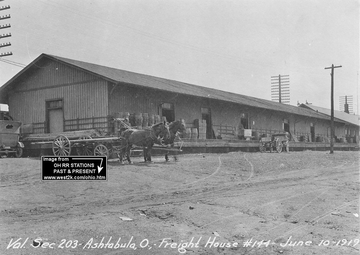
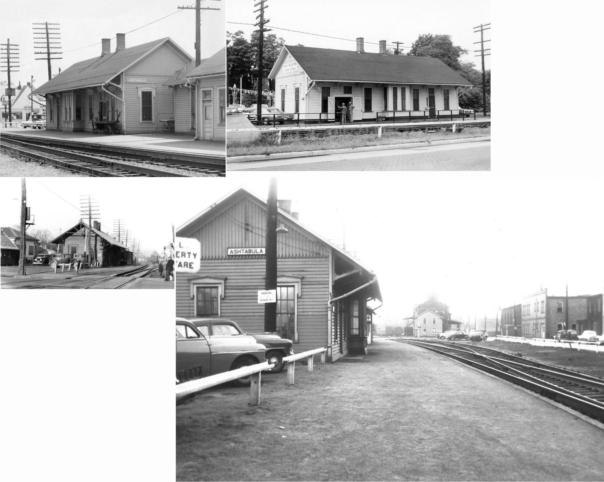
| Ashtabula |
|
Located on West 31st Street, this was the original 1852 LS&MS passenger/freight station in Ashtabula. After the brick depot was constructed across the tracks, this station was moved and served as the freight office from 1901 on into NYC days. | ||||||
| Ashtabula |
|
This freight station was built in 1893. In 1901 the original station (listed above) was moved next to it. | ||||||
| Ashtabula |
|
This station, built in 1901, was on West 32nd Street between Lake Avenue and Station Avenue at GPS: 41.875952,-80.792617. The old freight house used to sit directly across the tracks. There may have been another passenger station at this site as maps from 1893 also show a station here. The building was used as storage for CSX before being demolished on May 31, 2018. |
||||||
| Ashtabula |
|
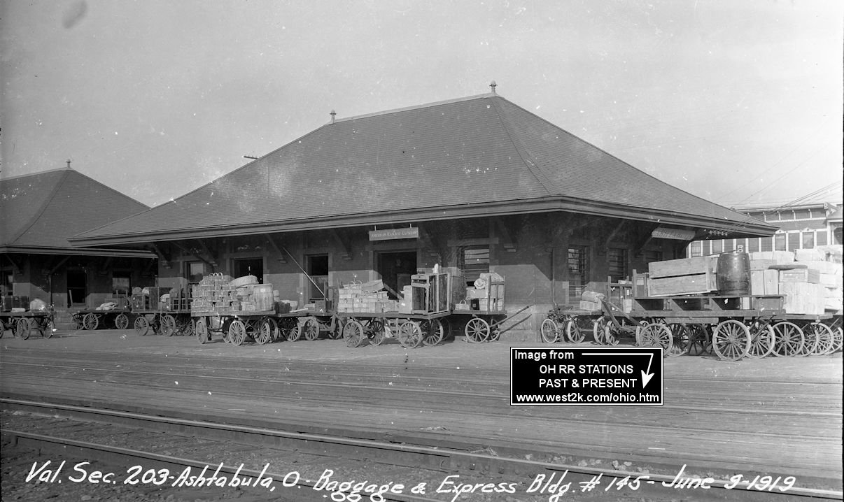
This baggage and freight station was also built in 1901 and was demolished on May 31, 2018. | ||||||
| Ashtabula |
|
There was a freight office on what is now called Port Avenue (formerly Coal Street) between East 8th (formerly Manning Street) and East 9th (formerly Belknap) Streets at GPS: 41.898738, -80.790812. The freight office sat about 60' from the tracks. There was also a repair shop and lighting station just to the south of the freight office. These building can be seen on the 1893 Sanborn map. | ||||||
| Ashtabula |
 |
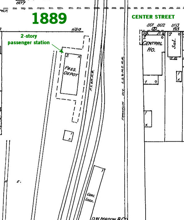
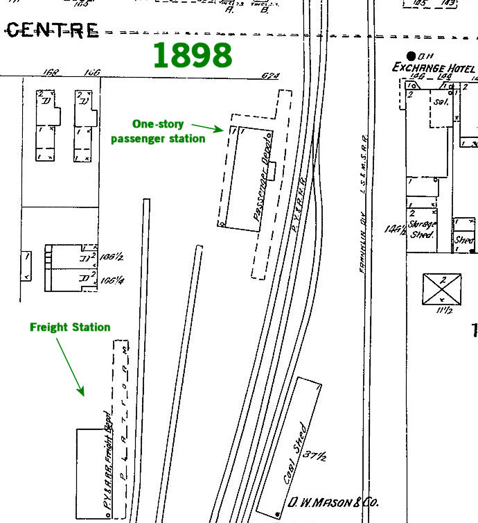
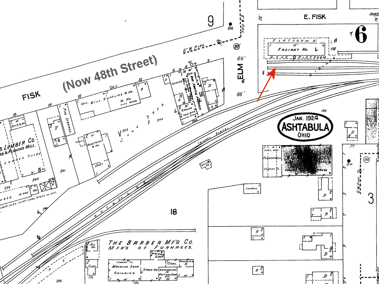
The original PY&A station here was a two-story building with division
offices on the top. According to Sanborn maps, the PY&A had a 2-story station here until around 1896 when the maps show a 1-story station in exactly the same location. See this 1889 map and this 1898 map of that location. A freight station was built in 1898 here on a spur to the southwest of where the passenger station was. That freight station would have had frontage on Fisk Avenue (now W. 48th Street). |
||||||
| Ashtabula |
|
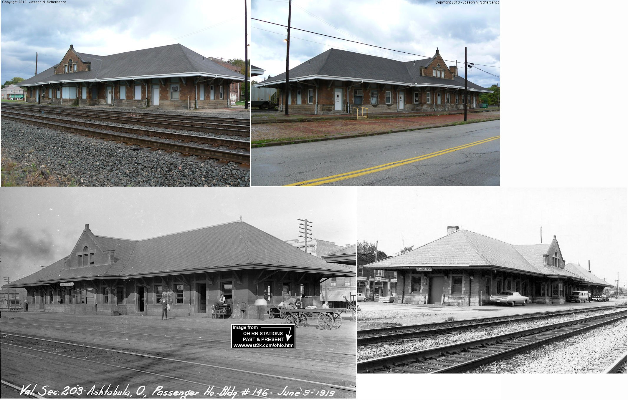
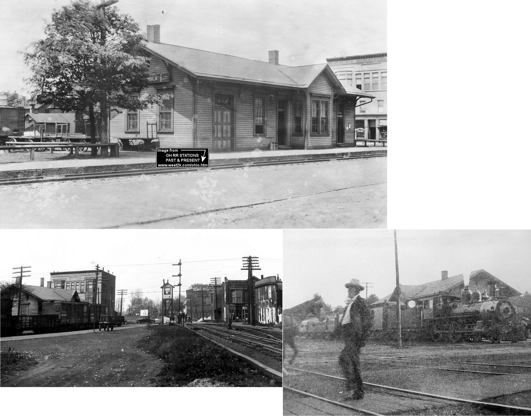
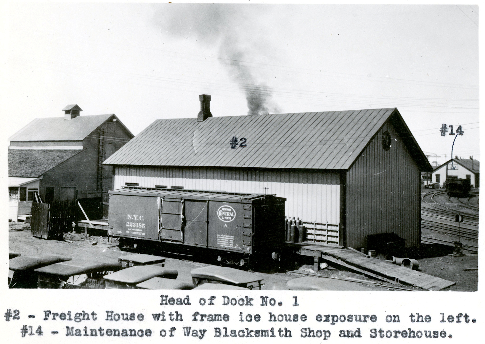
This station was built in 1896. Although the address of this station was 753 West 48th Street, it was known as the Center Street PRR station. Both the PRR and LS&MS crossed Center St. at this location. Some LS&MS passenger trains left from here going southbound as well. A wreck occurred here between a northbound LS&MS train and a trolley car killing eight on Dec. 16, 1912 at 7:50 p.m. A subway was constructed in 1926 and passengers could access the PRR station via a stairway from below the tracks. The freight office and supervisor's office were both listed for this location in the 1931 city directory. In 1931 the Freight Agent was John Clark and Supervisor was Todd Hofmeister. Top photo is from 1917, bottom left photo is from 1924. | ||||||
| Ashtabula |
|
This station was on the west side of Main Avenue. It was torn down in 1978. | ||||||
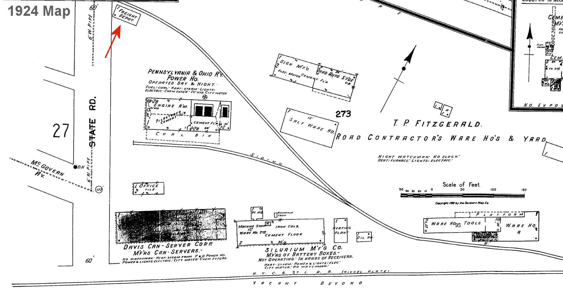
| Ashtabula |
|
The main NKP freight house was on the north side of the tracks on the east side of Elm Street near the intersection with 48th Street (GPS: 41.863850, -80.786208). There is a vacant lot there now (2009). | ||||||
| Ashtabula |
|
There was a wooden freight station on the east side of State Road between 46th and 47th Streets at GPS: 41.863942, -80.771790. | ||||||
| Ashtabula Harbor |
|
County maps from 1874 show a station here located on the north side of the river between Second and Third Streets. Today, this location would be on the south side of SR 531 between Ferry Drive and East 4th Street. The station was probably gone by the late 1800s. | ||||||
| Ashtabula Harbor |
|
There was a freight station on the east side of 4th Street north of SR 531 at GPS: 41.901046, -80.795035. Photo is from 1924. This freight station was built in 1893 according to NYC valuation records from the 1920s. This station can also be seen on the Sanborn map from 1931. | ||||||
| Ashtabula Harbor |
|
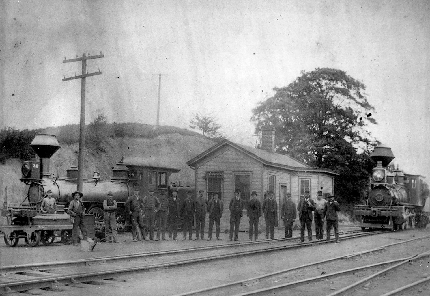
County maps from 1874 show a station here located due south of the west end of the drawbridge at the intersection of Railroad, Arch and Water Streets. The station was on the west side of the tracks. Today, this location would be near the intersection of Henry Street (West 6th) and Marina Drive (Morton) in the vicinity of GPS: 41.899547, -80.797590. The station was gone by the late 1800s. The Ashtabula & Pittsburgh Railway extended its passenger service two miles from Ashtabula to this station for passenger service in 1878. The last passenger run from the Ashtabula station to the Harbor station was on August 19, 1900. The photo linked here may or may not be that station, but it was found with a group of photos from the Harbor area and seems to show a depot there. | ||||||
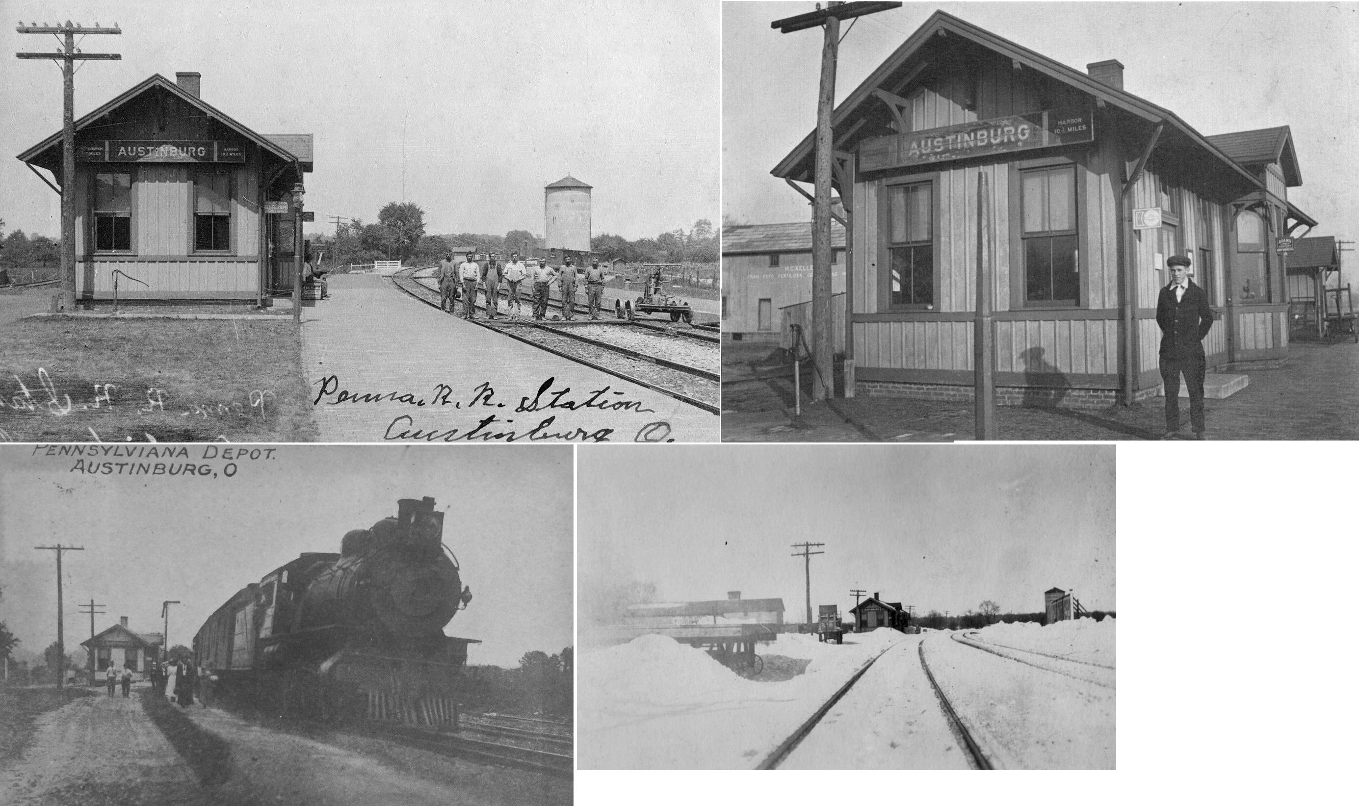
| Austinburg |
|
This station was on the north side of SR-45 (Jefferson Street) behind the mill on the west side of the tracks at GPS: 41.773413, -80.851909. | ||||||
| Carson |
|
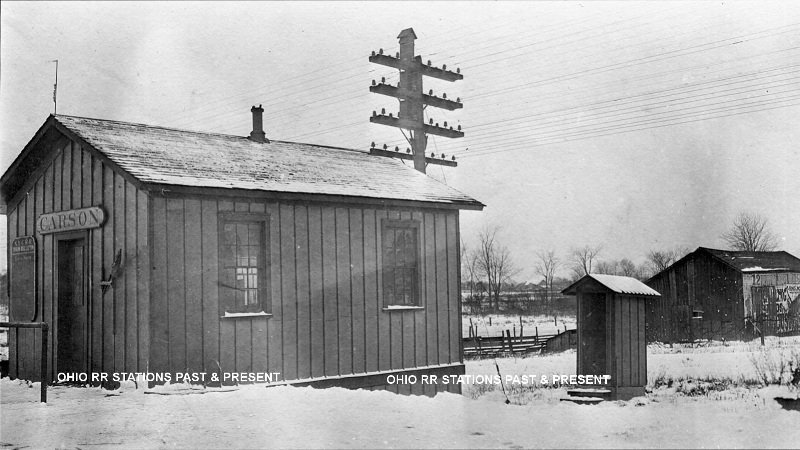
According to NYC valuation records, this station was built in 1879. Photo is from 1919. The station measured 14'x20'. It was on the south side of Carson Road on the south side of the tracks at approximately GPS: 41.825495, -80.748535 (Star-Beacon, 2-6-1971). | ||||||
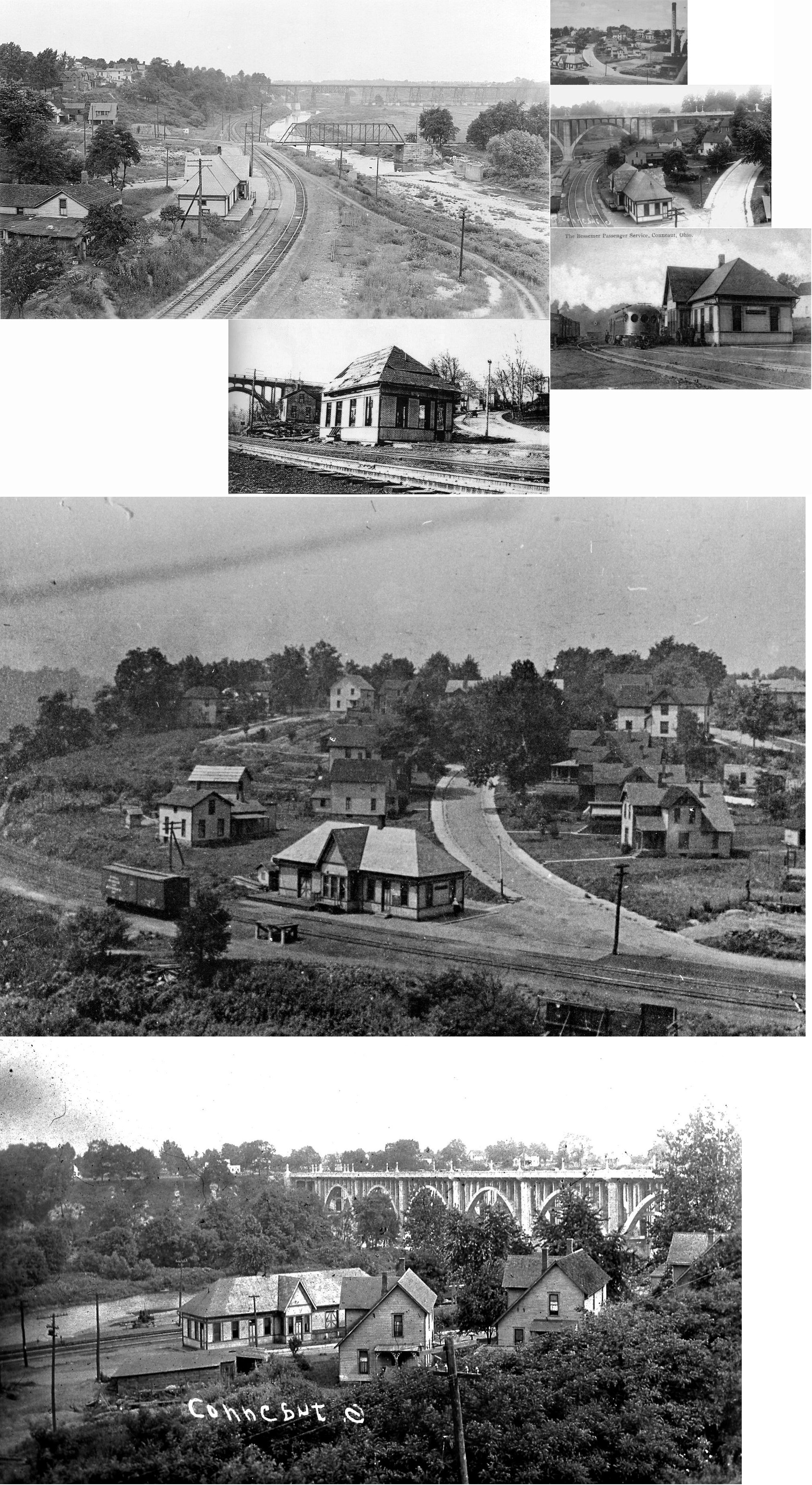
| Conneaut |
|
The original LS&MS depot here was destroyed by a cyclone on October 28, 1891 (Salem Daily News, 10-28-1891). | ||||||
| Conneaut |
 |
This station was on Liberty Street at the bottom of the hill at GPS: 41.943282, -80.551324. It was torn down in March, 1935. | ||||||
| Conneaut Harbor |
|
The September 19, 1895 edition of the Conneautville Courier reported that, "A force of carpenters commenced work Thursday on a new passenger depot to be built at Conneaut Harbor for the use of the Shenango Railroad and the car ferry line." I'm not sure if that actually came to fruition in the harbor proper or if this just referred to the station on Liberty Street. | ||||||
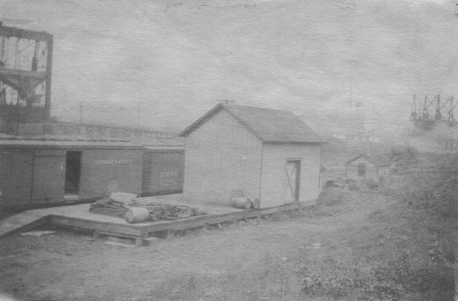
| Conneaut Harbor |
|
This small freight station was in the harbor. It was extended sometime around 1920 after the photo was taken. | ||||||
| Conneaut |
|
The passenger station, which was built in 1882, was on the north side of Jefferson Street between Mill and Sandusky Streets. It was on the south side of the tracks (GPS: 41.945918,-80.55945). Early maps show there was an adjacent hotel with a dining room and saloon on the west side of the depot called the "Nickel Plate Dining Station." Later maps don't show a hotel at the location, but still show the dining room and saloon. The station was torn down on August 1, 1966. | ||||||
| Conneaut |
|
The freight station was on the west side of Mill Street north of the tracks (GPS: 41.94603,-80.560609). Across the tracks to the south was a two story trainmaster/dispatcher's office. This station was also torn down with the passenger depot on August 1, 1966. | ||||||
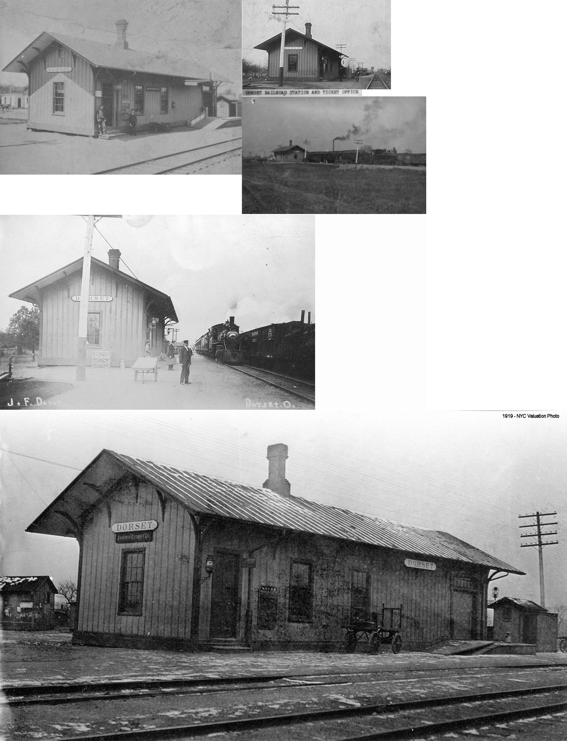
| Dorset |
|
This station was located on Depot Street. According to NYC RR valuation records, it was built in 1876. The NYC petitioned to close this station for all but less-than-car-load freight in 1957. | ||||||
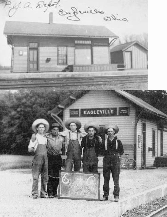
| Eagleville |
|
This Pittsburgh, Youngstown & Ashtabula (later PRR) station was off Eagleville Road. According to the Ashtabula Weekly Telegraph (2-14-1874), the first station here was a shed borrowed from Eagleville resident Eben Tuttle fitted with a stove provided by the RR. In the late 1870s there was talk of putting in a shortline railroad from Jefferson to Eagleville to connect the PY&A and the LS&MS, but this never came to fruition. | ||||||
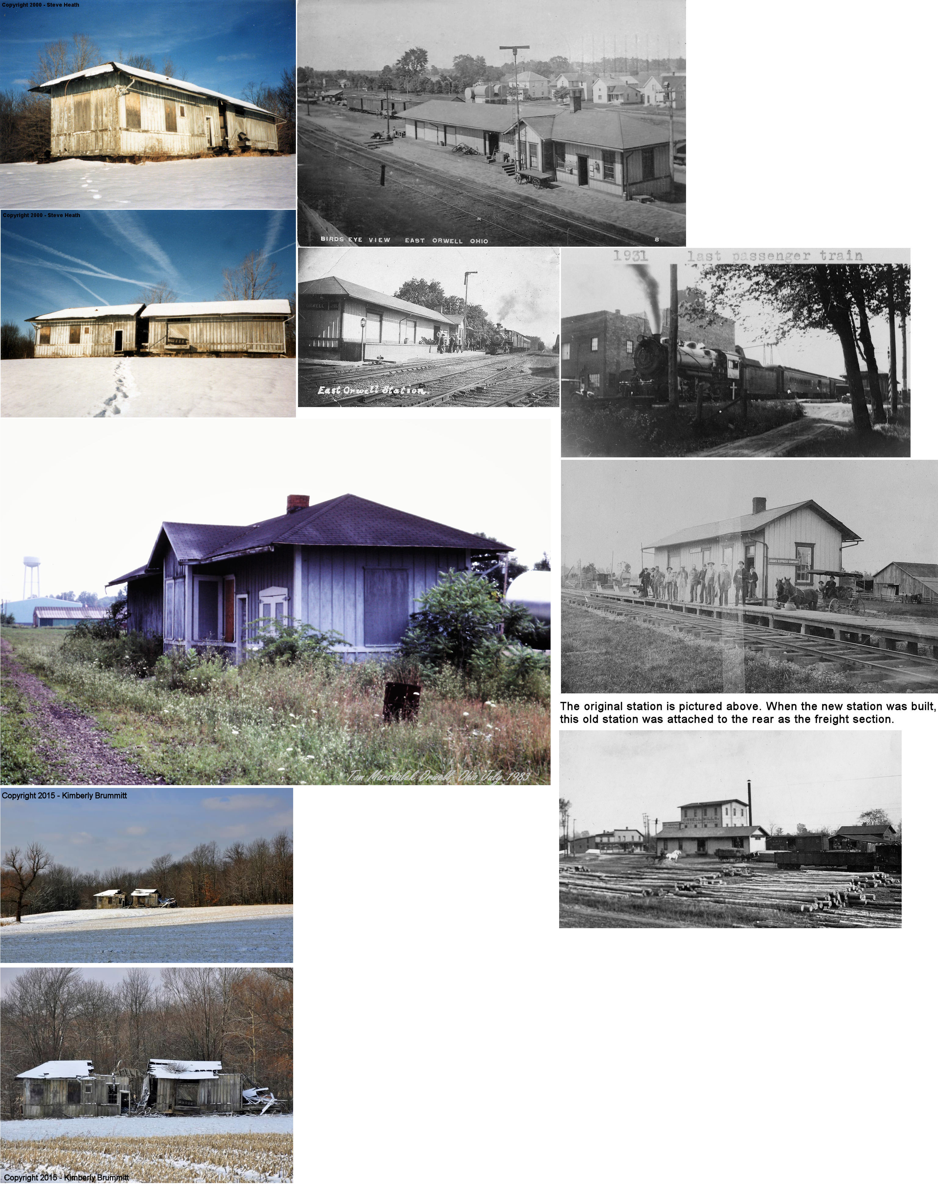
| East
Orwell (Inland) |
|
The original station was built by the PY&A in 1874 before it became part of the PRR. When a new station was built (I believe around 1909) the original station was attached to the rear and served as the freight section. The original location was the west side of the tracks south of US 322 at GPS: 41.534636, -80.848370. Originally called "East Orwell," the name was changed to "Inland" in 1878 to avoid confusion with the similar "Orrville" which was also part of the PRR system. At some point the station reverted back to the name "East Orwell." The last passenger train was in 1931 and the station closed in 1962. It was moved to a farm field on SR-46 about 1 mile south of US-6 in the 1990s and by around 2020 it had fully collapsed. | ||||||
| Geneva |
|
This station was built in 1901 and demolished in 1967. It sat on Depot Street west of North Broadway on the south side of the tracks at GPS: 41.806160, -80.948178. | ||||||
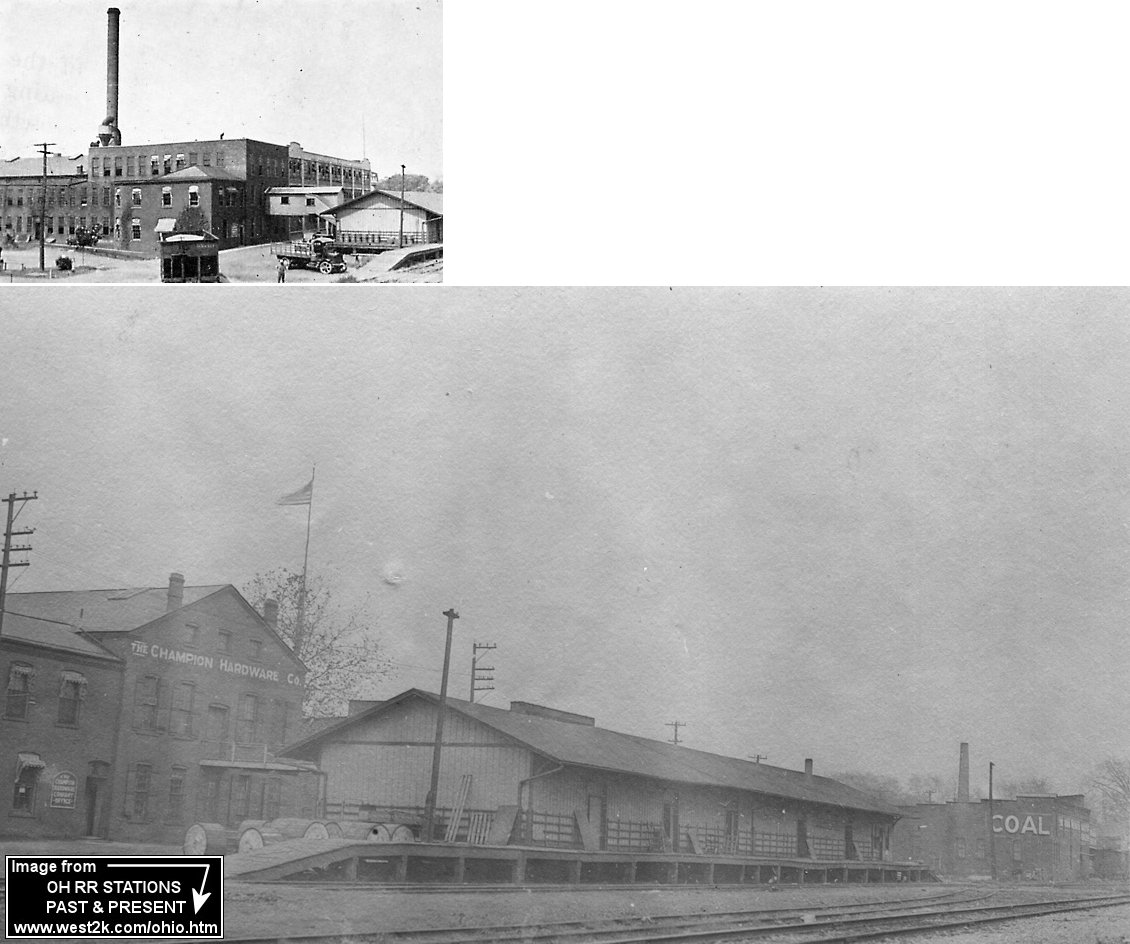
| Geneva |
|
There was a freight station on the north side of the tracks west of the North Broadway crossing at GPS: 41.806575, -80.948406. A bridge connected the freight station with the Champion Hardware Company to the north. It was likely built in the 1850s and, according to NYC valuation records, extended by 50' in 1896. An office section was added to the building in 1912. | ||||||
| Geneva |
|
The passenger station was on the east side of South Broadway near the intersection of Liberty St. There was an NKP freight station on the north side of Leslie between Sherman and Broadway. | ||||||
| Mann |
|
According to NYC valuation records from 1919, there was a 8'x12' passenger shelter here. Mann was on the low grade line southeast of Cherry Valley on Mann Road. | ||||||
| Munson Hill |
|
A station is shown here on early maps, but there isn't one listed on the 1923 PRR List of Stations & Sidings. | ||||||
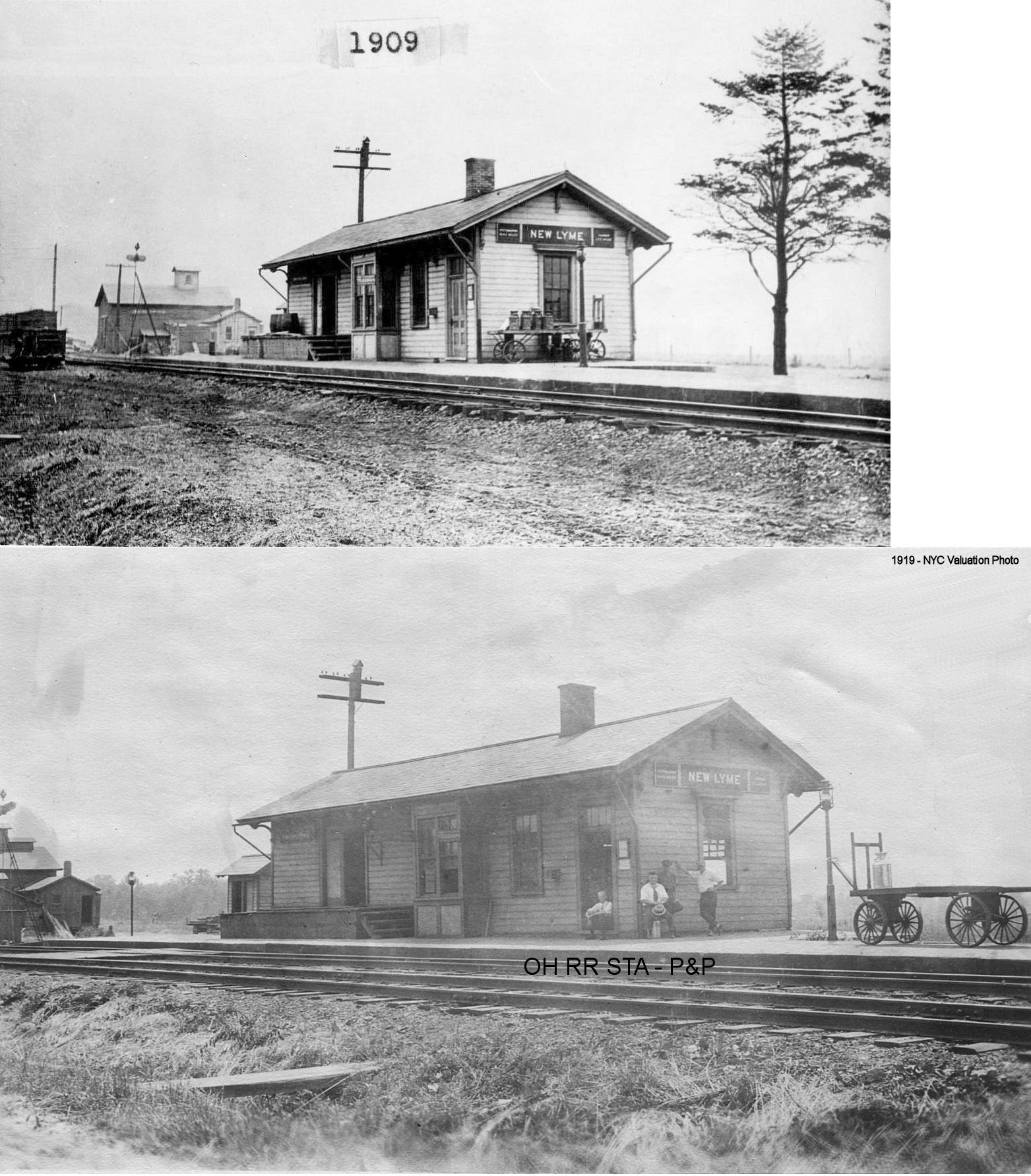
| New Lyme Station |
|
This station, built in 1874 (according to PRR valuation records) was on the south side of Dodgeville Road, on the west side of the tracks. | ||||||
| North Kingsville |
|
According to NYC valuation records, the freight house here was built in 1854. | ||||||
| Plymouth |
|
See listing above for Carson. | ||||||
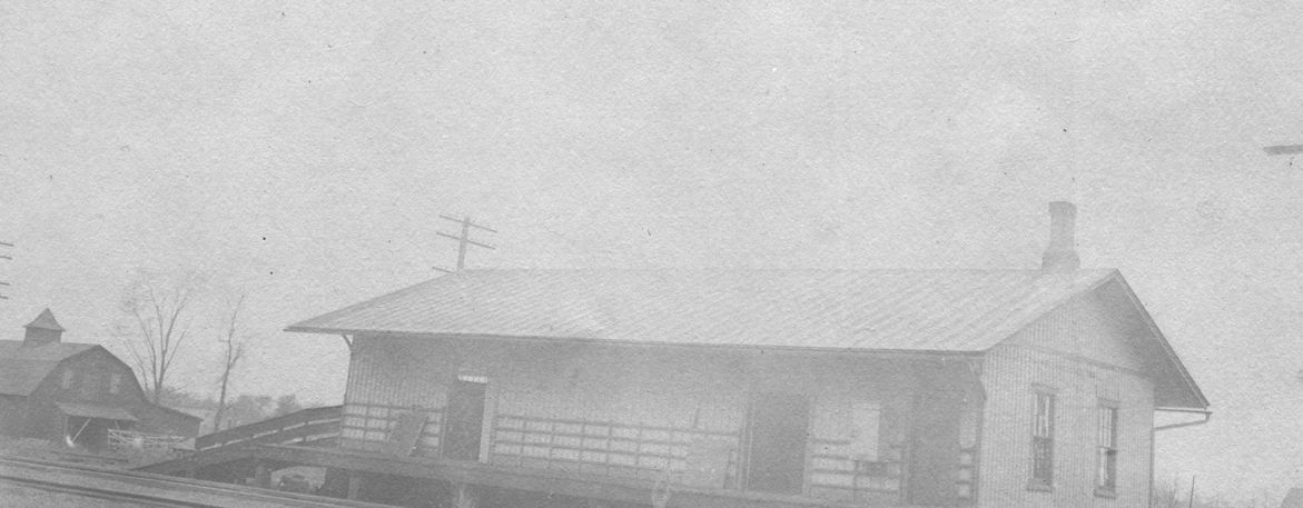
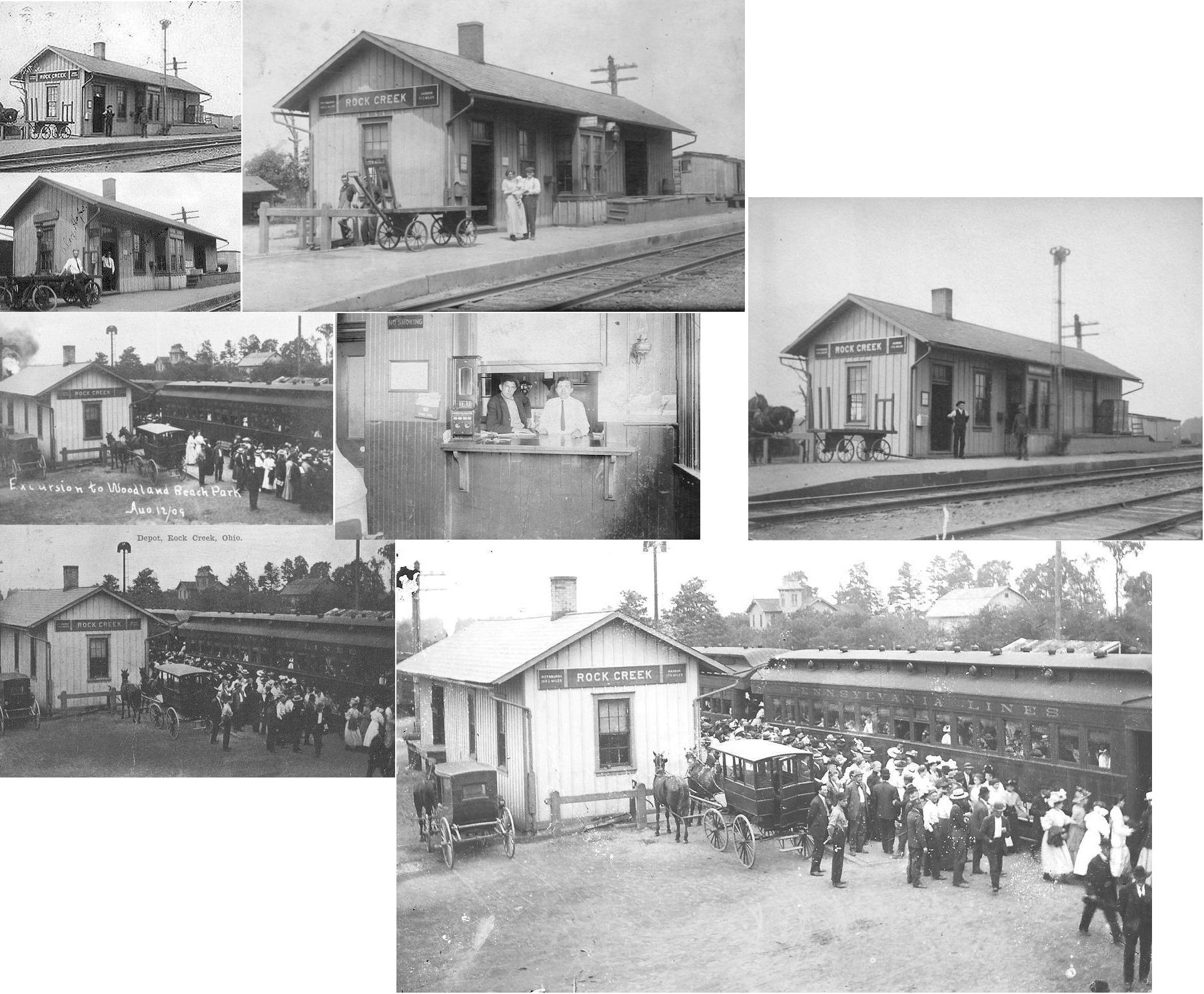
| Rock Creek |
|
The station was on the north side of Grove Street (later Station Street), on the west side of the tracks. There was a station here as early as 1874, perhaps earlier. | ||||||
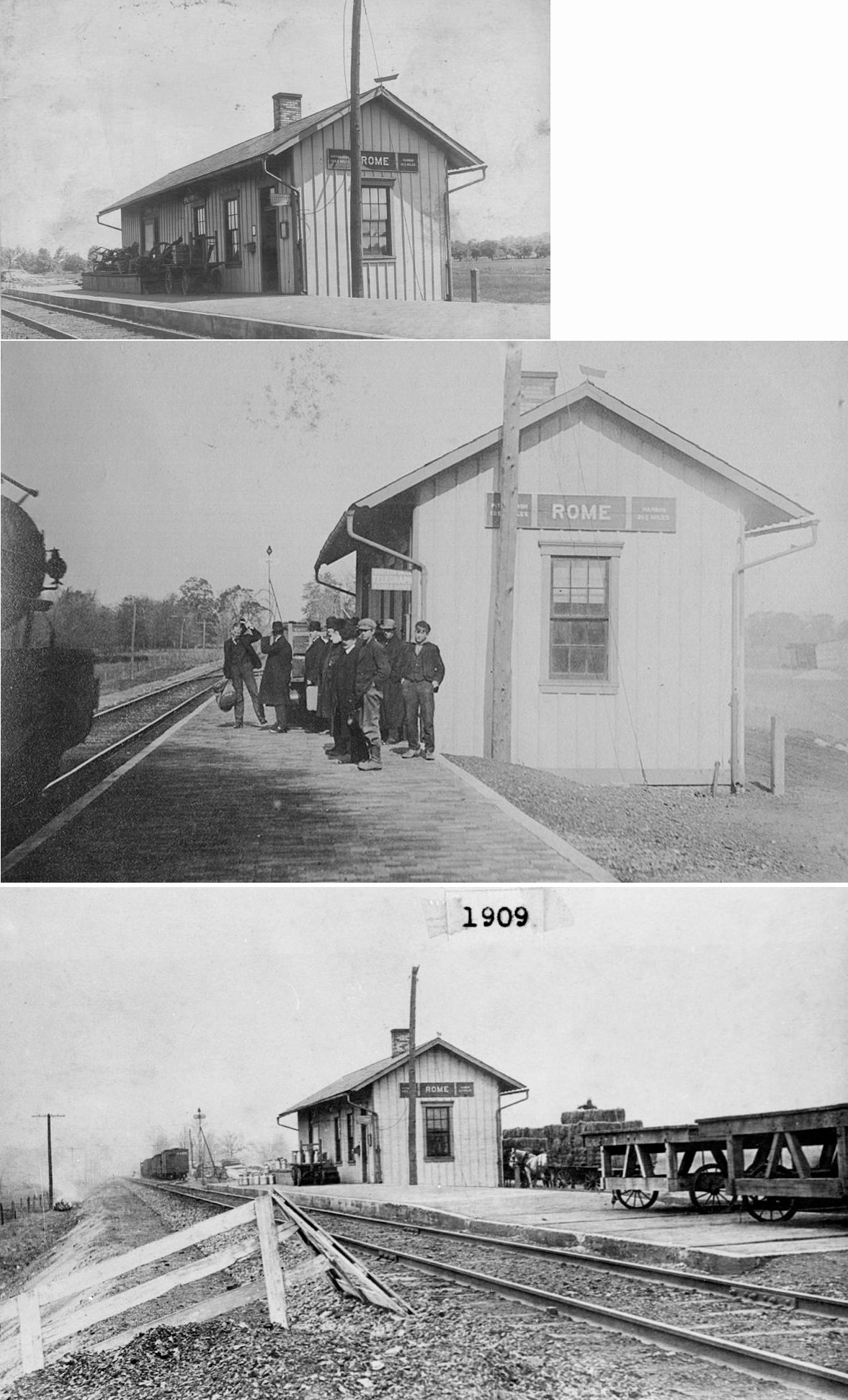
| Rome |
|
This station was on the north side of US 6, on the east side of the tracks. There was a station here as early as 1874, perhaps earlier. | ||||||
| Saybrook Station |
|
The first station here, according to 1874 maps was on the south side of the tracks at the intersection of Depot and New London Roads. According to NYC valuation records, this station was built in 1852 and raised higher in 1912. | ||||||
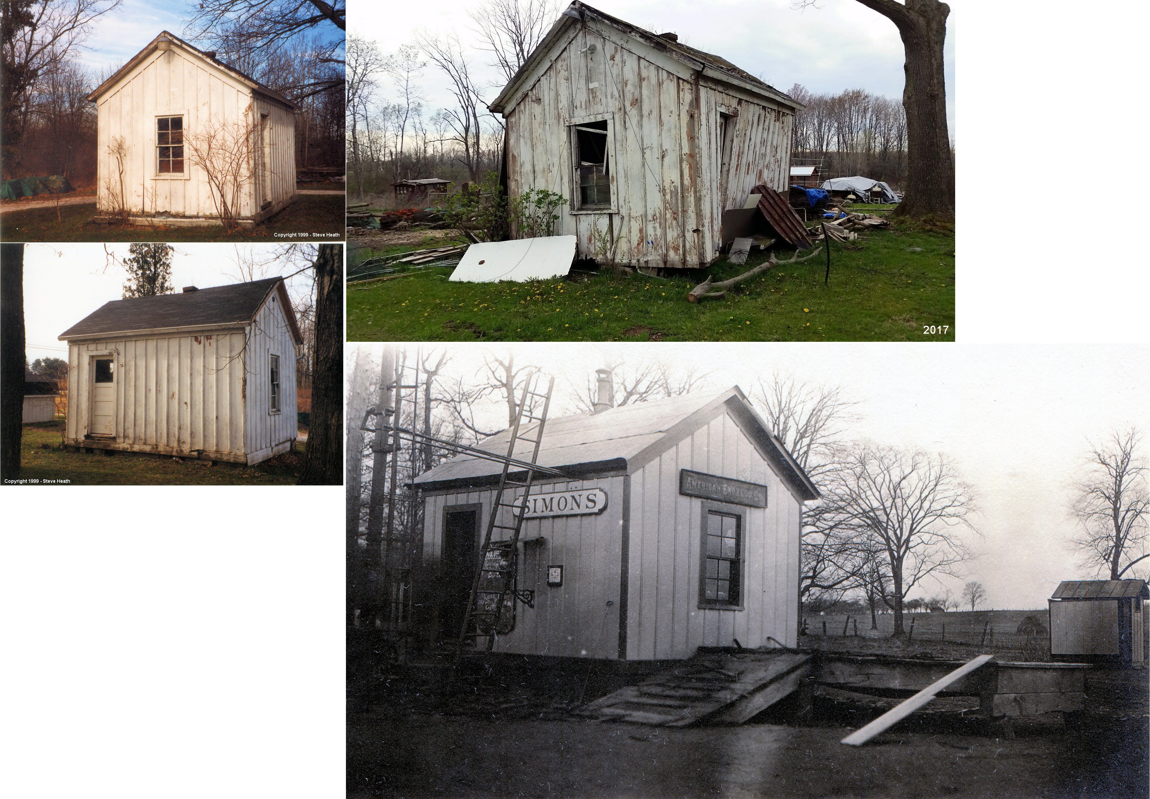
| Simons |
|
This station was built in 1899 and measured 12'x16'. The station was closed in the early 1930s and was subsequently moved from its original location to a residence at the NW corner of US-322 & Pymatuning Lake Road (GPS: 41.533469, -80.533640). The building sustained heavy damage in the 2017 Williamsfield tornado. After attempts to repair it and repurpose it, the station was torn down in 2019. | ||||||
| Simons |
|
An old 8'x27' boxcar body was placed here to serve as a freight station in 1902. Simons also had other railroad buildings including a coal house, bunk house, stock pen, handcar house, outhouse and telephone booth. | ||||||
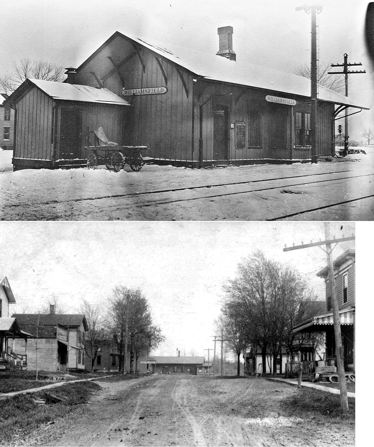
| Williamsfield (W. Williamsfield) |
|
According to NYC valuation records, this station was built in 1873 while this line was still called the Mahoning Coal Railroad. The RR line has been moved to the west, but Depot Street still exists here and the station was on the north side of the street on the west side of the tracks (which were just west of Mill Street). | ||||||
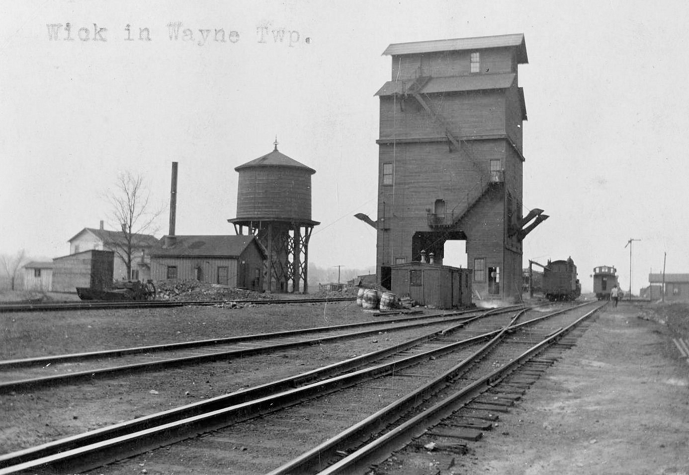
| Wick |
|
Wick is in Wayne Township. | ||||||
| 1898 ASHTABULA COUNTY RAILROAD MAP | ||||||||
 |
||||||||
|
Notes About Existing Stations... Andover (LS&MS Passenger) - The station measures 20'x71'. It was remodeled in 1913. Andover (LS&MS Freight) - This station was moved onto a new foundation in 1911 due to the addition of a new track. Ashtabula (PRR) - This building sits near the old PRR roundhouse and served the PY&A line that ran south out of Ashtabula Harbor and on to Youngstown. This station likely post-dates the main PRR depot which sat at Center Street (that station is now gone). The building has been resided with aluminum, but its general shape has not changed. The PRR "Ashtabula" station sign was attached to the chimney when the station was in service. The building served as a yard office in later years. Conneaut (NYC) - On National Register of Historic Places. This replaced an earlier wood depot. Conneaut (LS&MS Freight) - This station was built in 1851 and moved to a new foundation and extended 53' in 1906 according to NYC valuation records. Geneva (LS&MS) - This station was moved from trackside on Depot Street in 1901 to make room for a new brick LS&MS (NYC) station (which is now gone). Some sources say this was the first station in Geneva dating to around 1852, however, other sources indicate that it was built in 1886 which would make it the second station. Griggs (LS&MS) - On the NE corner of the crossing, this flagstop station is now part of a house. The station was the two story portion of the present look. The station agent lived upstairs and the first floor was the station office and waiting room. Jefferson (LS&MS) - On National Register of Historic Places. The last scheduled passenger train stopped here in late June 1956. The station was closed by the NYC in 1961. Several other historic buildings nearby. Was purchased from Conrail by the Jefferson Garden Club in 1978. Near the station during its active years were a 40'x102' stock pen, handcar house, coal house and tool house. The depot was built in 1872 by the Lake Shore & Michigan Southern RR (later merged into the NYCRR) and moved onto a new foundation in 1892. The original structure did not include a bay window. That was added in 1912 along with toilets and a 4,000-lb Buffalo scale in the freight room. Leon (LS&MS) - Moved and raised on a concrete foundation the station is now a barn. The original location of this building was on the SE corner of Leon Square on the east side of the tracks. It was moved 150' south onto a new timber foundation in 1910. Not sure when it was moved out to the farm. The 1875 LS&MS timetable lists the stop as "Barber's-Leon." North Kingsville (LS&MS) - This depot is considerably NE of original location. Moved around 1950. Now used as a cottage. Saybrook (NKP) - Moved from tracks in 1950, moved again in 1985. |
||||||||