 COUNTYCOUNTY
|
|
||||||||
|---|---|---|---|---|---|---|---|---|
| EXISTING STATIONS | ||||||||
| Station Name |
Original Railroad | Current Location |
Type | Date Built |
Current Use |
Track Status |
Building Material |
More Info |
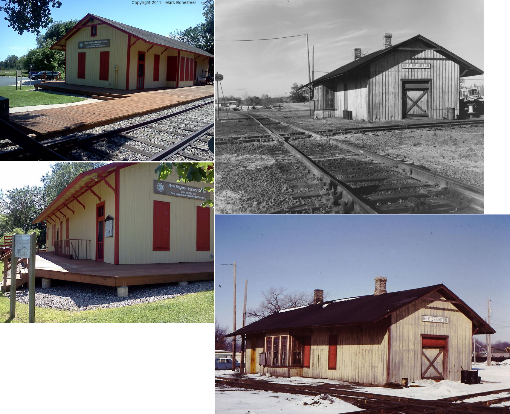
| new brighton (Bulwer JCT.) |
 |
Long Lake Park, New Brighton. About one mile in the park from entrance off Old US 8 (MN-77). | C | 1887 | Civic | None | Wood |
|
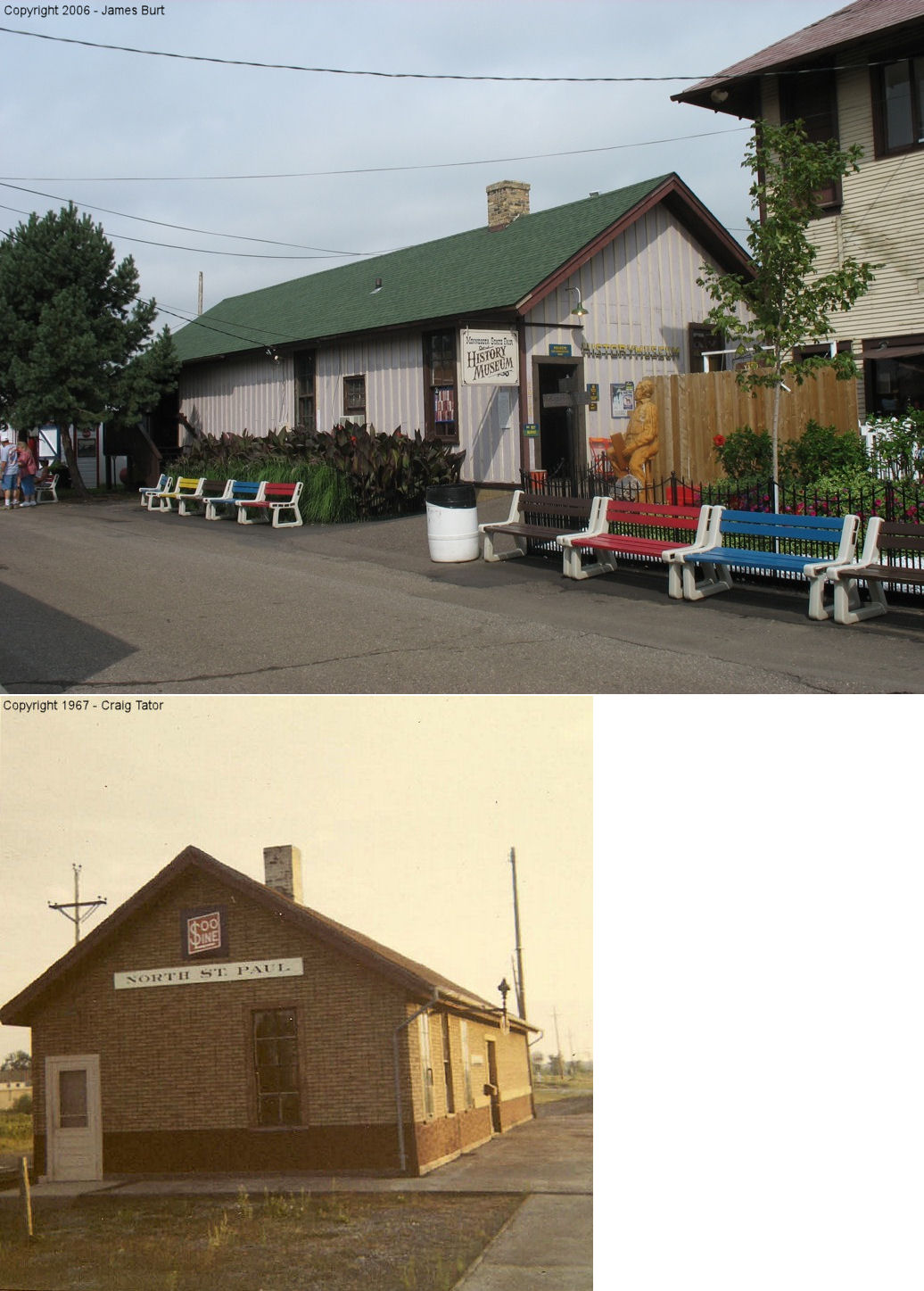
| north st. paul |
|
Now at Minnesota State Fairgrounds on the north side of Dan Patch Avenue (GPS: 44.981333,-93.17731). | C | 1911 | Museum | None | Wood | |
| rutledge |
 |
Minnesota Transportation Museum, 193 E. Pennsylvania Ave., St. Paul | C | ???? | Museum | None | Wood | |
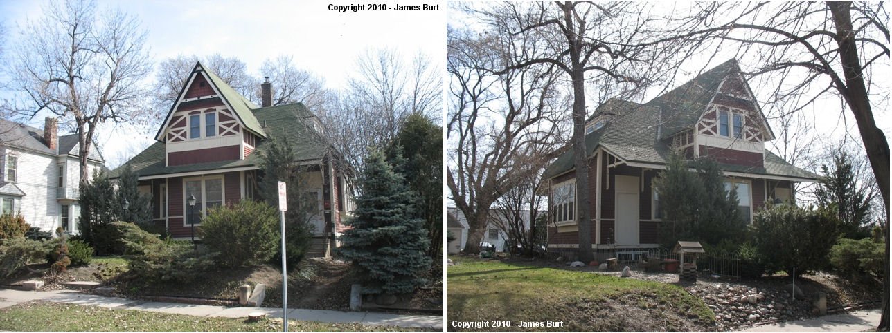
| St. Anthony Park |
|
2107 Commonwealth Avenue (GPS: 44.981058, -93.189360) |
C | 1885 | Residence | None | Wood | |
| St. Anthony Park |
 |
1048 Everett Ave just east of the Raymond Avenue Viaduct | C | 1888 | Residence | In Use | Wood | |
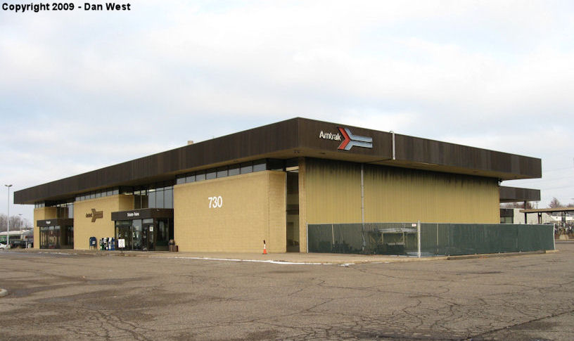
| st. paul |
 |
730 Transfer Road (GPS: 44.963075, -93.184636) |
P | 1978 | Railroad | In Use | Brick | |
| st. paul |
 |
240 East Kellogg Boulevard (GPS: 44.947683, -93.086225) |
P | 1920 | Business | In Use | Stone | |
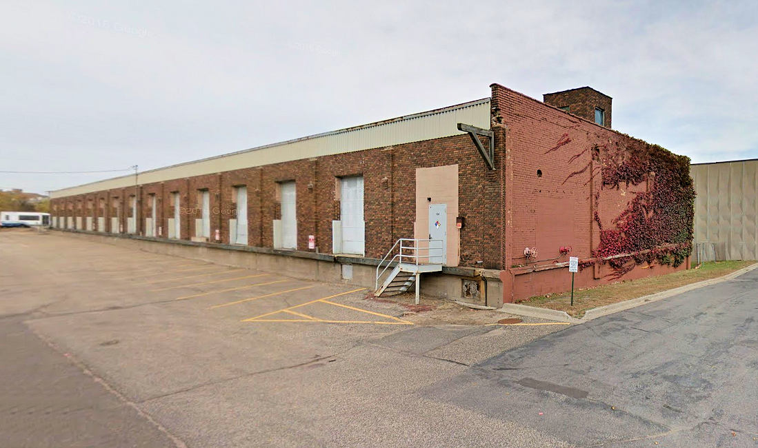
| St. Paul |
|
NE side of North Pine Street between Balsam and 10th
Streets (GPS: 44.954605, -93.087810) |
F | 1917 | Business | None | Brick |
|
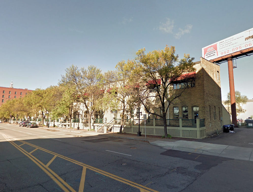
| st. paul |
 |
NW side of E. Kellogg Boulevard just west of the
Lafayette Bridge (GPS: 44.949634, -93.081930) |
F | 1900 | Business | None | Brick |
|
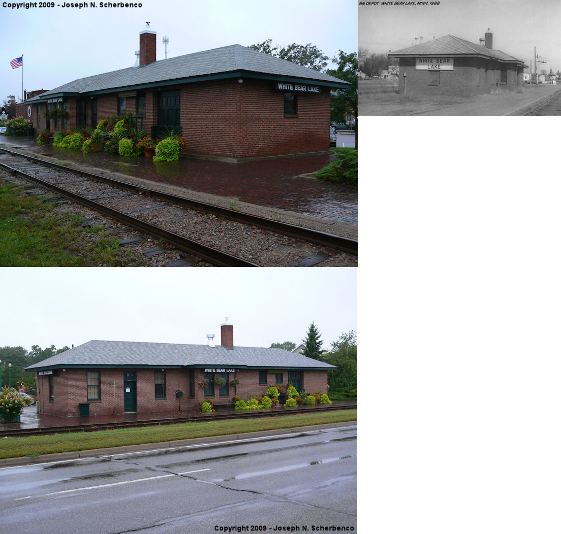
| White bear lake |
|
4751 US 61 at 4th Street (GPS: 45.084894, -93.010487) |
C | 1935 | Civic | In Use | Brick | |
| STATIONS OF THE PAST | ||||||||
| Station Name |
Original Railroad |
Notes | ||||||
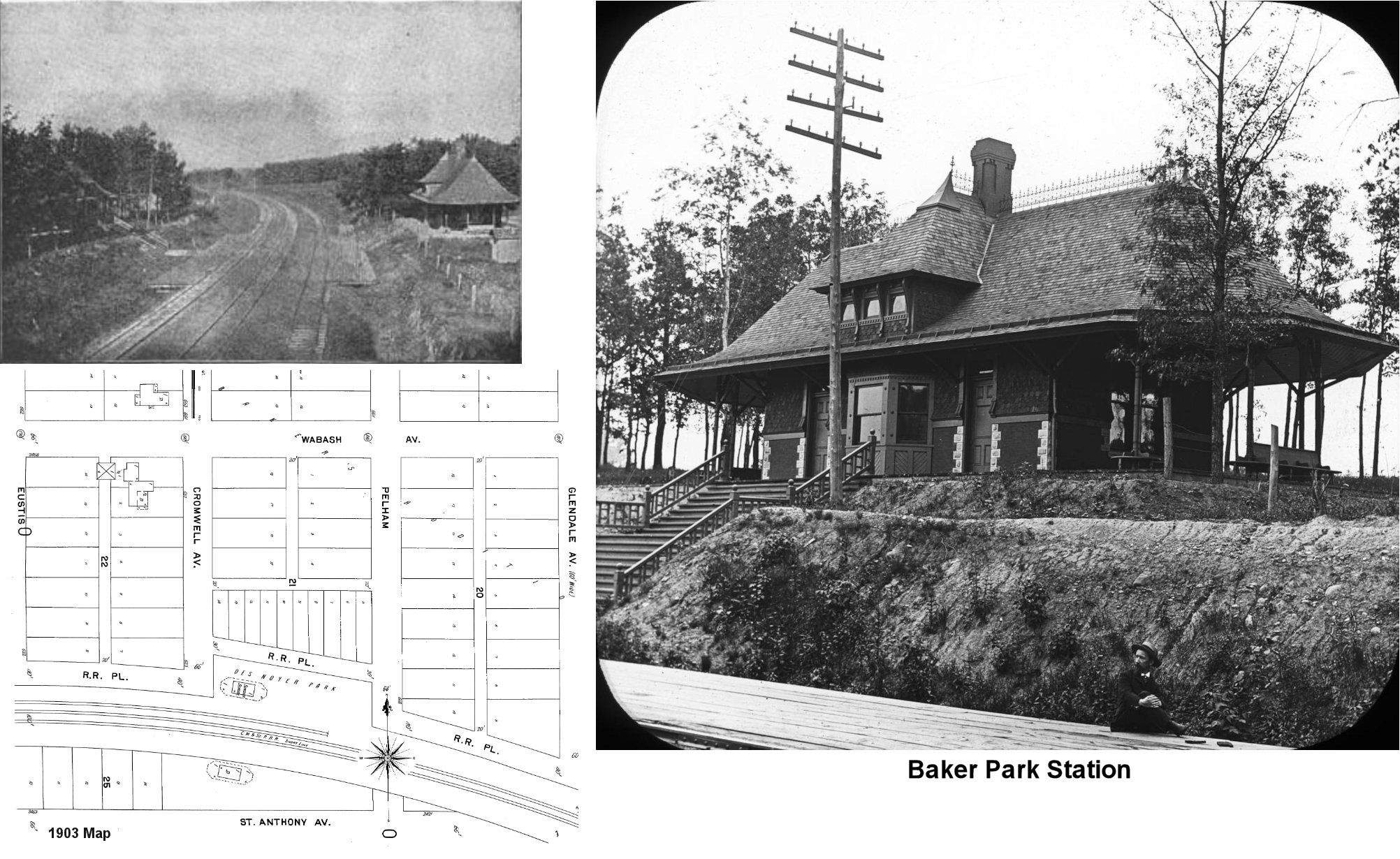
| Baker Park (Desnoyer Park) |
 |
The photo of both stations appeared in an 1893 book called "Buildings And Structures Of American Railroads: A Reference Book" by Walter Gilman Berg. The photo, which dates from 1891, shows two separate "twin" depots on each side of the tracks. Baker Park station was on the south side of the tracks (at GPS: 44.959199, -93.201316) and Desnoyer Park station was on the north side of the tracks (GPS: 44.959436, -93.201340). The stations appear on the 1903 Sanborn maps, but they were closed as railroad stations by then. On that map, the Desnoyer Park Station is labeled as a Sunday School and the Barker Park Station served as a dwelling. They were both gone by 1923. The northern part of this neighborhood is now gone due to the I-94 corridor. | ||||||
| Bald Eagle |
 AND |
According to the 1917 NP Valuation Records, there was a joint station (50/50 NP and Soo) here built in 1887 that was two stories on one end and one story on the other. The two-story section measured 20'x42' and the one-story section mesured 20'x40'. The NP also had a 16'x75' shelter shed and platform along its tracks. | ||||||
| cardigan junction |
|
This station sat within the triangle at the junction. This was located off Rustic Place which is west of Rice Street (CR 49). The depot was built in 1887 and included living quarters for the station master. | ||||||
| Como Station |
|
This station was on the north side of the tracks on the SW side of Como Avenue at GPS: 44.965501, -93.118373. | ||||||
| Cuenca |
|
This station was built in 1888. The RR brought it to Cardigan Junction as a Section House in 1917. Later, it was sold to a private party and moved east to Rustic Road where it was used as a house. It burned down in 2008. | ||||||
| Desnoyer Park |
|
See listing above for Baker Park for details. | ||||||
| Erick |
|
According to the 1917 NP Valuation Records, there was a shelter shed built here in 1917 that measured 8'x12'. This station was between Lake Shore and Gloster. | ||||||
| Gladstone (Gloster) |
AND |
This station, known as Gloster, was NE of the corner of Frost and English Streets at the diamond of the WC (later SOO) and NP. The station was manned by SOO operators in later years, but was owned by the NP. The bay window stuck out on the northwest corner of the building so trains could be observed on both railroads. The building was in the southeast quadrant of the diamond. | ||||||
| Gladstone |
|
The 1903 Sanborn map shows a depot on the north side of Frost Street at GPS: 44.999616, -93.044404. According to the 1917 NP Valuation Records, the station was built in 1897 and measured 16'x41'. | ||||||
| Gladstone |
 |
The original WC station was on the south side of the tracks just west of where Clarence Street crosses the grade today. It was at approximately GPS: 45.001171, -93.043461. This station is shown on the 1903 Sanborn map (St. Paul set - map 232). | ||||||
| Hazel Park |
 |
This station was four miles northeast of Union Station. | ||||||
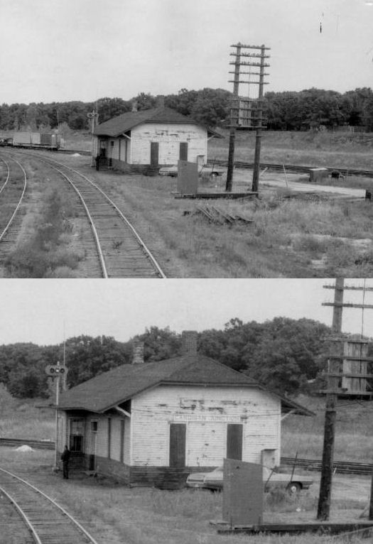
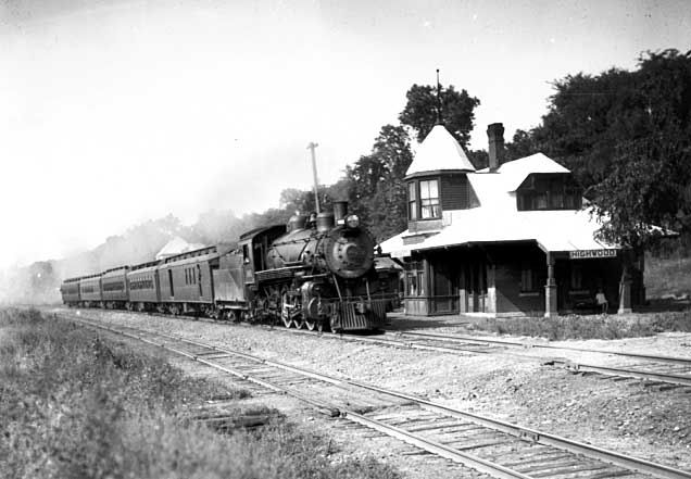
| Highwood |
 |
This station was on Newport Avenue (now Point Douglas Road) in St. Paul. | ||||||
| Inver Grove |
|
|||||||
| Merriam Park |
|
This station was on the south side of the tracks just west of Prior Avenue at GPS: 44.953964, -93.182870. It is shown on the 1903 Sanborn map. | ||||||
| North St. Paul |
|
This passenger station was on the north side of the tracks between Margaret Street and Charles Street at approximately GPS: 45.016373, -92.990381. The freight station was on the south side of the tracks closer to Margaret Street at GPS: 45.015651, -92.991352. The passenger station burned down in 1906. Both stations are shown on the 1888 and 1903 Sanborn maps. | ||||||
| St. Paul |
|
This freight station was on East 7th Street. | ||||||
| St. Paul |
|
There was a combination station west of Jackson Street and south of Arlington Ave East. It was located on the lower track. In 1960 it had no electricity except for telegraph and phone lines and had an outhouse even though it was in St. Paul city limits. --Gordon Schmidt | ||||||
| St. Paul |
|
There was a freight station on the SE side of 4th Street at GPS: 44.950890, -93.082441. This station appears on the 1904 Sanborn map. | ||||||
| St. Paul |
 |
There was a freight station on the riverbank between Minnesota and Robert Streets at GPS: 44.944470, -93.088683. This station is shown on the 1885 Sanborn Map. It was likely torn down when the Robert Street bridge was built. | ||||||
| St. paul |
|
There was a freight station on Robert Street that was built in 1891. On the 1903 Sanborn map the station is labeled as the "CMSt.P&O Western Division Freight House." It was north of where the previous freight station was closer to 2nd Street at approximately GPS: 44.944935, -93.089127. | ||||||
| St. Paul |
|
There was a freight station on Fillmore Avenue that was built in 1902. | ||||||
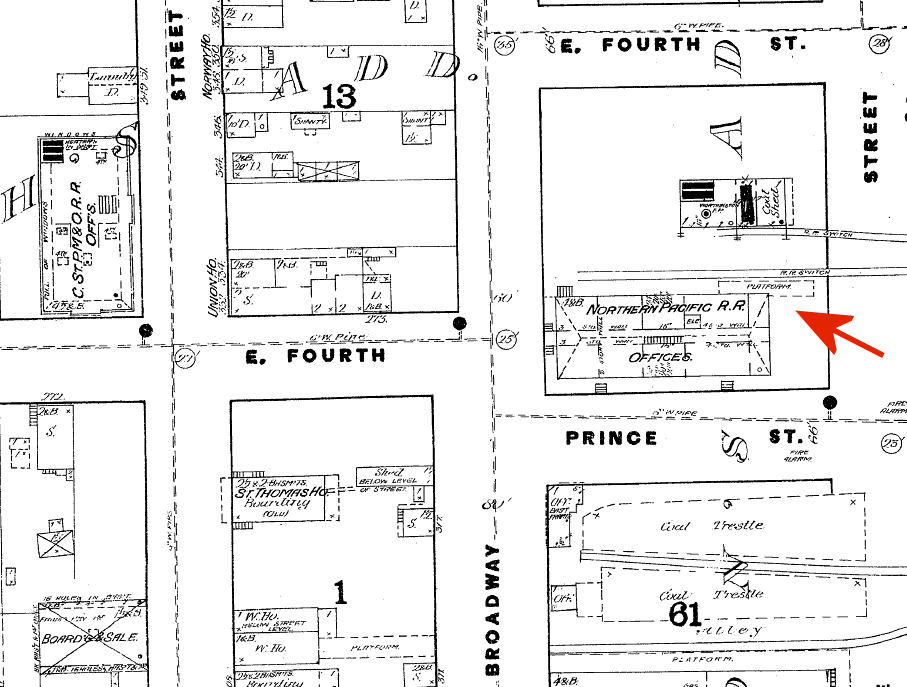
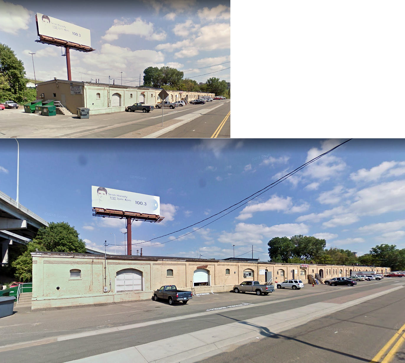
| St. Paul |
AND |
There were two long frieght stations on the south side of Prince Street east of Pine Street at GPS: 44.949831, -93.082657 and GPS: 44.950235, -93.081817. These stations are shown on the 1885 Sanborn map. On the 1904 Sanborn map, the freight station to the northeast was then occupied by the C&NW. | ||||||
| St. paul |
|
There were two freight stations on Prince Street. The first was built in 1897 and a second was added in 1902. There was an Omaha roundhouse to the NW across the tracks. | ||||||
| St. Paul (East St. Paul) |
|
The East St. Paul passneger station was on the west side of Payne Avenue on the south side of the tracks at GPS: 44.965152, -93.074000. This station is shown on the 1903 and 1926 Sanborn maps. | ||||||
| St. Paul (Western Avenue) |
|
This station was NE of where Western Avenue South used to cross the tracks in the CSt.PM&O yard. That station was at GPS: 44.932251, -93.114647. It is shown on the 1926 Sanborn map. | ||||||
| St. Paul |
|
Before Union Station was built in 1881, the NP served passengers from a platform at the back of its office building at 4th and Broadway Streets at GPS: 44.949640, -93.084355. This was according to a Star Tribune story from July 19, 1914. However NP valuation records show this building's construction date as 1883, so either on of those documents is incorrect or there was an earlier office building at this site. | ||||||
| sT. pAUL |
AND  |
There was a long NP freight house on the north side of Prince Street at GPS: 44.950075, -93.082887. This station is shown on the 1885 and 1904 Sanborn maps. On the 1904 and 1926 maps the building is labeled "Leased by M&St.L RR. Owned by NP RR." A newer station may have replaced the old station here at some point as the NP Vaulation Records list a build date of 1908 for the station that was there as of the 1917 survey. | ||||||
| St. Paul |
|
There were two St. Paul & Duluth (formerly Lake Superior & Mississippi RR) on the south side of Kellog Street (formerly East 3rd Street) at approximately GPS: 44.951734, -93.076606. These stations are shown on the 1885 Sanborn map. They were gone by 1904 as more tracks were laid in the area. | ||||||
| St. Paul |
|
Following the closure and removal of the two St.P&D freight houses listed above, a new NP freight house was built to the northest. It had a two-story head house that just bordered the Kellogg Boulevard overpass at GPS: 44.952081, -93.076004. According to NP Valuation Records, the station was built in 1903 with the two-story section mesuring 40'x65' and the one-story section measuring 40'x675'.This station is shown on the 1904 Sanborn map. | ||||||
| St. Paul |
|
This freight station was at 400 East 4th Street, next to the US 52 overpass at GPS: 44.952133, -93.080569. It was torn down sometime between 2010 and 2016. | ||||||
| St. Paul (E. 7th Street) |
AND |
Known as the East 7th Street Depot, this joint owned station was on the east side of Earl Street north of 7th Street at GPS: 44.967047, -93.055694. It was built in 1885 and sat between the tracks of the NP and Omaha with platforms of both sides. According to NP Valuation Records from 1917, the station measured 16'x34'. | ||||||
| St. Paul |
|
There were two side-by-side, terminal style, St. Paul, Minneapolis & Manitoba freight stations on the NE side of Broadway Street south of Kellogg Boulevard (formerly 3rd Street). The northernmost station stretched from Broadway Street, past Pine Street, to John Street with the middle of the station located at GPS: 44.948941, -93.082482. This station is shown on the 1885 Sanborn map. | ||||||
| St. Paul |
AND |
There were two side-by-side, terminal style, St. Paul, Minneapolis & Manitoba freight stations on the NE side of Broadway Street south of Kellogg Boulevard (formerly 3rd Street). The southernmost station stretched from Broadway Street, to just past Pine Street with the middle of the station located at GPS: 44.948577, -93.082616. This station is shown on the 1885 Sanborn map. On the 1904 map the station is still there and occupied by the CB&Q. | ||||||
| St. Paul |
|
By 1904 the northernmost St.PM&M freight station on the south side of Kellogg Boulevard was torn down and a larger GN station was built on the site. This new station stretched from Broadway Street, past Pine Street, to John Street with the middle of the station located at GPS: 44.948941, -93.082482. This station is shown on the 1904 Sanborn map. The addition of this larger GN freight station may have allowed the southernmost freight station to be sold to the CB&Q. | ||||||
| St. Paul |
|
By 1904 the northernmost St.PM&M freight house | ||||||
| St. Paul |
 |
The St. Paul, Stillwater and Taylor's Falls Railroad was built from St. Paul to Stillwater in 1872. The St. Paul station was on Westminster Road. The line became part of the St. Paul & Sioux City RR in 1880 and eventually became part of the C&NW. | ||||||
| St. Paul (Chestnut St.) |
|
The CM&St.P Chestnut Street Passenger Station was on the north side of the tracks near the intersection of what is now Eagle Parkway (this section formerly Chestnut Street) and Shepard Road at GPS: 44.940734, -93.100410. This station is shown on the 1903 Sanborn map. | ||||||
| St. Paul |
|
There was a freight house on the SE side of the tracks near the intersection of Eagle Parkway and Shepard Road at GPS:44.940525, -93.100375. This station is shown on the 1885 Sanborn map. On the 1903 map the building is no longer used by the railroad, but is owned by Stoddard & Allen Agricultural Implements. | ||||||
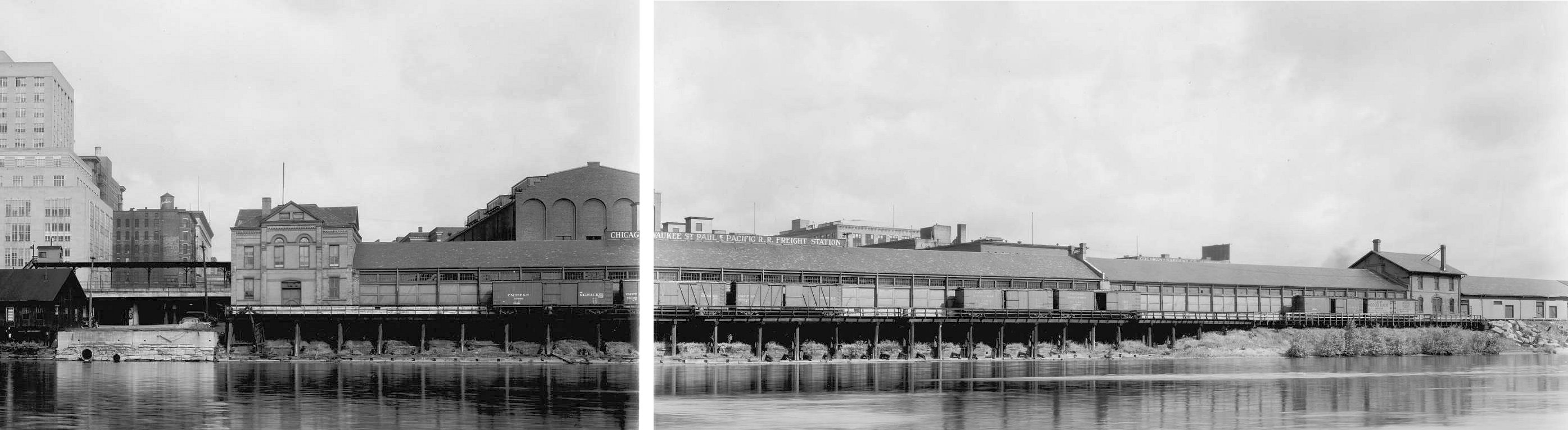
| St. Paul |
|
There were two large freight houses along the river on what used to be Second Street near Union Station. In the early years (1885) they were separated by a grain elevator. After that was torn down, the two freight houses were joined together so there was a head house on the west side at Sibley Street and then a head house seemingly in the middle of the building. The west freight house (inbound) was on the east side of Sibley Street at GPS: 44.946014, -93.084655. The east freight house (outbound) was at the foot of Broadway Street at GPS: 44.947037, -93.082229. These are shown as separate buildings on the 1885 Sanborn map, but on later maps they are joined together with a refrigerator section in the old two-story headhouse in the middle. | ||||||
| St. Paul |
|
There was a freight house on the NE side of Neill Street (now gone) which was between Willus and Kittson Streets north of East 7th Street. The head end office was on the corner of Neill and East 7th Streets. The freight station was at GPS: 44.954613, -93.081934. This area is now the Lafayette Park Parking Lot. | ||||||
| St. Paul |
|
There was a freight station on the east side of South Robert Street (formerly Ducas Street) SE of East Fairfield Avenue at what used to be Indiana Avenue (which no longer exists). It was at approximately GPS: 44.939806, -93.083370. This station is shown on the 1885 Sanborn map. | ||||||
| St. Paul (West St. Paul) |
MVRR | The West St. Paul depot was a train station for the Minnesota Valley RR (later known as St. Paul & Sioux City RR), but did not last long. Opening in 1866 on the West side across the Mississippi from Saint Paul only because a train bridge across the Mississippi to the south side from Saint Paul was prohibitive in cost at the time. The station was reached by foot or by Omnibus (horse drawn carriage) across the Wabasha bridge. The station and depot lasted until 1869 when The St. Paul and Sioux City RR railroad bridge was built across the Mississippi allowing their depot to be transferred to the St. Paul side of the river. The old depot at West Saint Paul was taken down and shipped to Lake Crystal (Blue Earth County) to be used as the depot there in late December 1869 (the same year that Lake Crystal was incorporated). | ||||||
| St. Paul (West St. paul) |
|
There was a Minnesota & North Western passenger station on the south side of East Fillmore Avenue on the west side of Concord Street (later called Starkey St., but now gone) at GPS: 44.939587, -93.087965. An 1884 newspaper article references the railroad intending to build its main station there and the station is shown on the 1885 Sanborn map. | ||||||
| St. Paul (West St. paul) |
|
A new CGW station was built here sometime in the late 1800s/early 1900s to replace the original M&NW station. It was on the south side of East Fillmore Avenue at GPS: 44.939803, -93.088166 and was known as the "West St. Paul Station." It was slightly more north than the original M&NW station that was here prior. It is shown on the 1903 Sanborn map. | ||||||
| St. Paul (State Street) |
|
The CGW "State Street Station" was at the eastern end of Delos Avenue at GPS: 44.933975, -93.076706. State Street used to cross over the tracks here via a bridge which is now gone. This station is shown on the 1903 Sanborn map. | ||||||
| St. Paul (Concord Street) |
|
The CGW "Concord Street Station" was on the SW side of the tracks on the east side of Concord Street near where Arthur Avenue used to cross the tracks at GPS: 44.924724, -93.064564. This station is shown on the 1903 Sanborn map, but it is marked as "vacant." | ||||||
| St. Paul (South Park) |
|
The CGW "South Park Station" was an 18'x20' depot that was at the east end of Mill Street (now gone) on the west side of the tracks at GPS: 44.906845, -93.046781. This location is off Concrod Avenue just north of Bryant Avenue. This station is shown on the 1903 Sanborn map. | ||||||
| St. Paul (South St. Paul) |
|
This station was on the SW corner of Grand Avenue West and Concord Street North across Grand Avenue from the Concord Exchange Building at GPS: 44.892856, -93.034396. The CGW tracks here used to run where Concord Street is now. There was also a freight station to the south and an engine house across the tracks to the east. These stations are shown on the 1903 Sanborn Map, but are not shown on the 1939 revision (see below). | ||||||
| St. Paul (South St. paul) |
|
Sometime between 1903 and 1939 a new South St. Paul station was built to replace the one listed above. This new station was just north of the post office at GPS: 44.894639, -93.035624 along what is now Concord Street (which used to be railroad right-of-way). | ||||||
| St. Paul |
|
There was a Minnesota and North Western (absorbed later by the CGW) freight station on the east side of South Robert Street just north of Plato Avenue at GPS: 44.938948, -93.082628. This station is shown on the 1888 and 1903 Sanborn maps. The CGW later added an ice house on the east side of the building. | ||||||
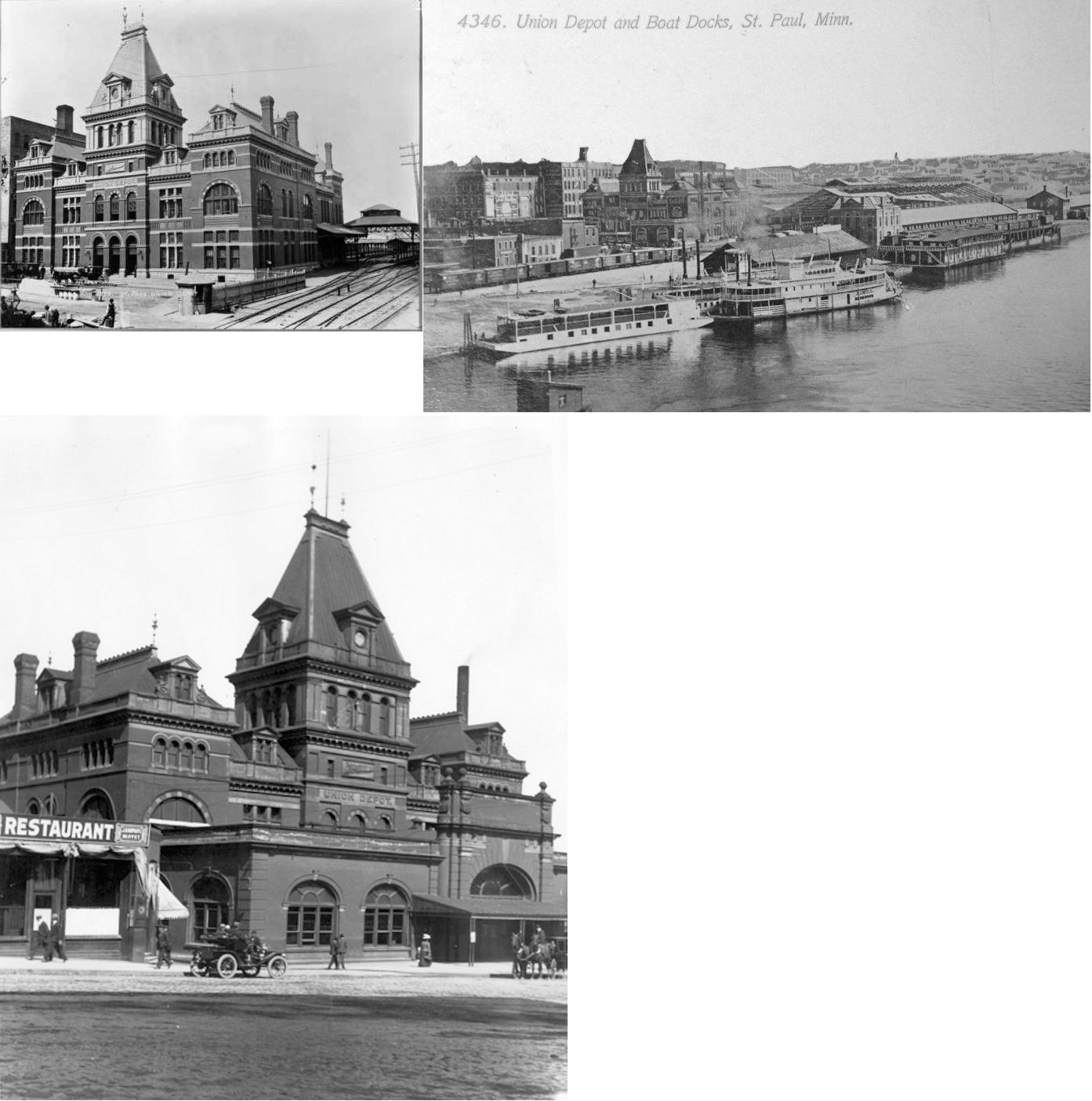
| St. Paul |
|
The first Union Station here opened in August 1881, but was destroyed by fire on June 11, 1884. It was located south of Kellog Boulevard between Sibley and Wacouta Streets at GPS: 44.946948, -93.085333. After it was destroyed, the second union station (see below) was rebuilt on the same site using some of the exterior walls of the original. Passenger traffic contnued to be handled from temporary quarters in the ruins during the rebuilding of the station. | ||||||
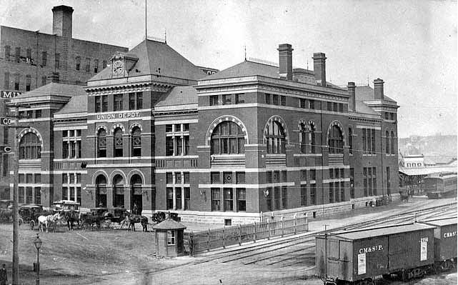
| St. Paul |
|
This station, opened in 1884, was south of Kellog Boulevard between Sibley and Wacouta Streets at GPS: 44.946948, -93.085333. It looked almost identical to the original union station, but the rebuild included higher roof peaks and a new tower. Although it had the same exterior width and length as the original station, the new version was able to handle more passengers due to baggage operations being moved out of the station to a new baggage building (St. Paul Globe, Dec. 13, 1884). This second union station was remodeled in 1901 and burned down in December 1913. | ||||||
| St. Paul |
 |
There was a large freight house on the north side of Fillmore Street north ofthe intersection of Eva Street at GPS: 44.942826, -93.082884. The tracks came in from the NE to the freight house. This now the site of River Park Plaza. This station is shown on the 1903 Sanborn map. | ||||||
| St. Paul |
|
There was a Wisconsin Central freight house on the north side of Kellogg Street (formerly 3rd Street) east of John Street (now gone) at GPS: 44.950100, -93.080939. This station is shown on the 1885 and 1904 Sanborn maps. | ||||||
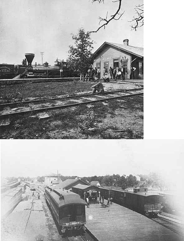
| White Bear Lake |
|
The first station here was built in the early 1870s. | ||||||
| White Bear lake |
|
According to the 1917 NP Valuation Records, the second generation station was built in 1895 and measured 24'x93'. It was on the south side of 4th Street at GPS: 45.085220, -93.009873. | ||||||
| White Bear Lake |
|
According to the 1917 NP Valuation Records, there was a freight house here that was built in 1887 and measured 20'x40'. It was between 6th and 7th Streets at GPS: 45.087954, -93.008236. | ||||||
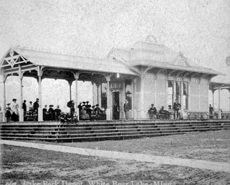
| White Bear
Lake (LAke Shore) |
|
This station was on the SE side of the tracks on South Lake Avenue (now US-61) at approximately GPS: 45.076890, -93.017619. According to the 1917 NP Valuation Records, it was built in 1887 and measured 20'x30'. | ||||||
| White Bear Beach |
|
According to the 1917 NP Valuation Records, there was a 10'x36' passenger shelter here that was built in 1916. | ||||||
| White Spur |
|
According to the 1917 NP Valuation Records, there was a 10'x24' waiting shed here that was built in 1897. This station was somewhere between the White Bear Beach station and the main station in White Bear Lake. | ||||||
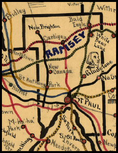
| 1898 RAMSEY COUNTY RAILROAD MAP | ||||||||
 |
||||||||
|
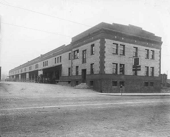
Notes About Existing Stations... New Brighton (Soo Line) - This station was also known as Bulwer Junction. Station was moved to Long Lake Park in 1990 and now houses the New Brighton History Center. St. Paul (GN Freight) - This building is shown as a GN freight house on the 1926 Sanborn map and property records list a build date of 1917. There were once 14 tracks and two covered platforms on the NE side of this building. St. Paul (CGW Freight) - Rail operations ended at the station in 1973. It was converted to a mixed use building (office and residential condominiums) in 1982. |
||||||||