 COUNTYCOUNTY
|
|
||||||||
| EXISTING STATIONS | ||||||||
|---|---|---|---|---|---|---|---|---|
| Station Name |
Original Railroad | Current Location |
Type | Date Built |
Current Use |
Track Status |
Building Material |
More Info |
| grand falls |
 |
???? | C | ???? | Residence | In Use | Wood | |
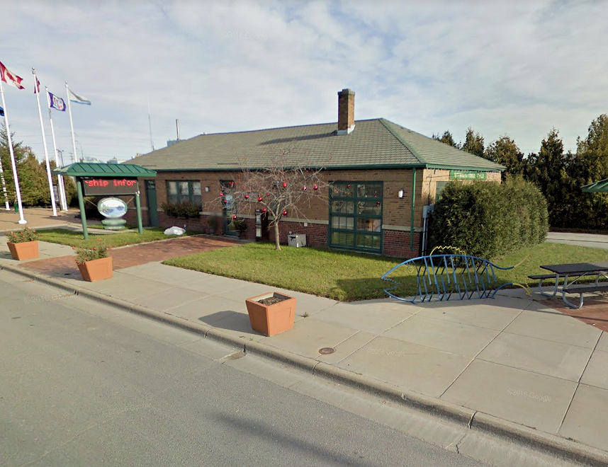
| international falls |
|
301 Second Avenue (GPS: 48.602516, -93.401898) |
C | 1947 | Civic | In Use | Brick |
|
| Little Fork |
|
Relocated to a farm north of Little Fork at the dead end of UT 249, #5375 (the driveway going NW) (GPS: 48.42136, -93.55371) |
C | 1907 | Private | None | Wood |
|
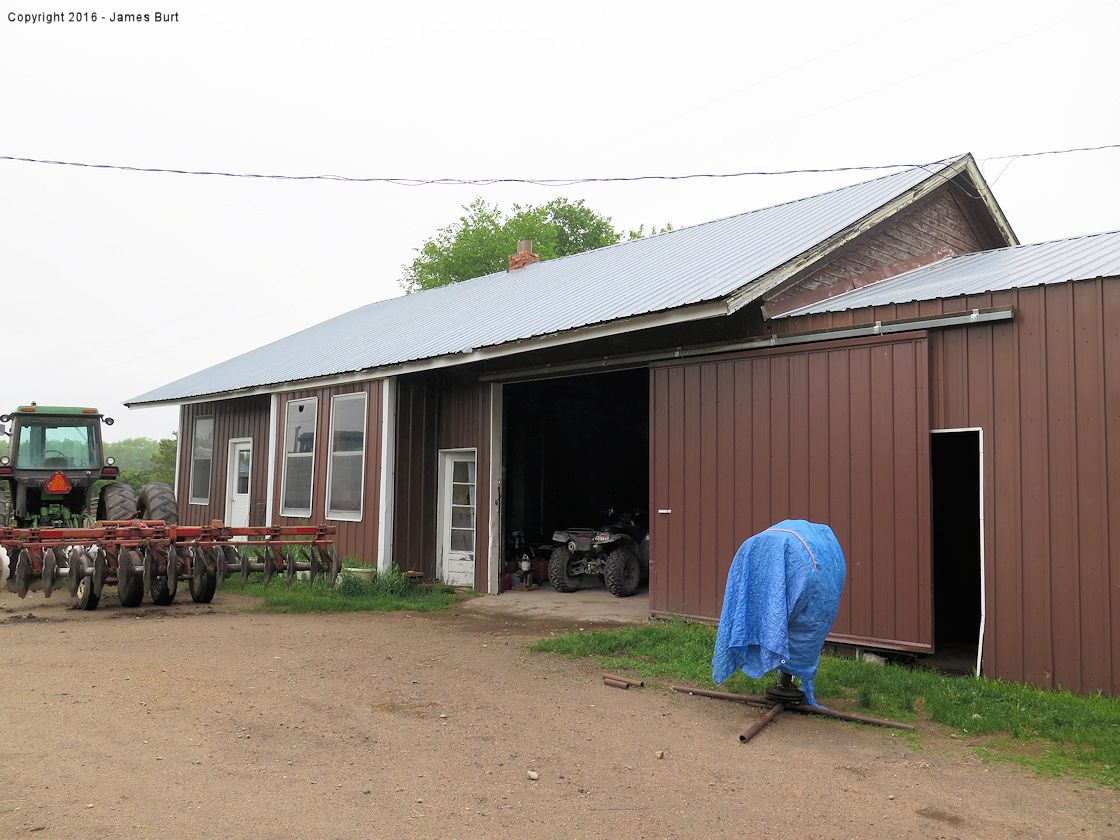
| Margie |
|
Deer Road | C | 1960 | Hunting Cabin |
None | Metal | |
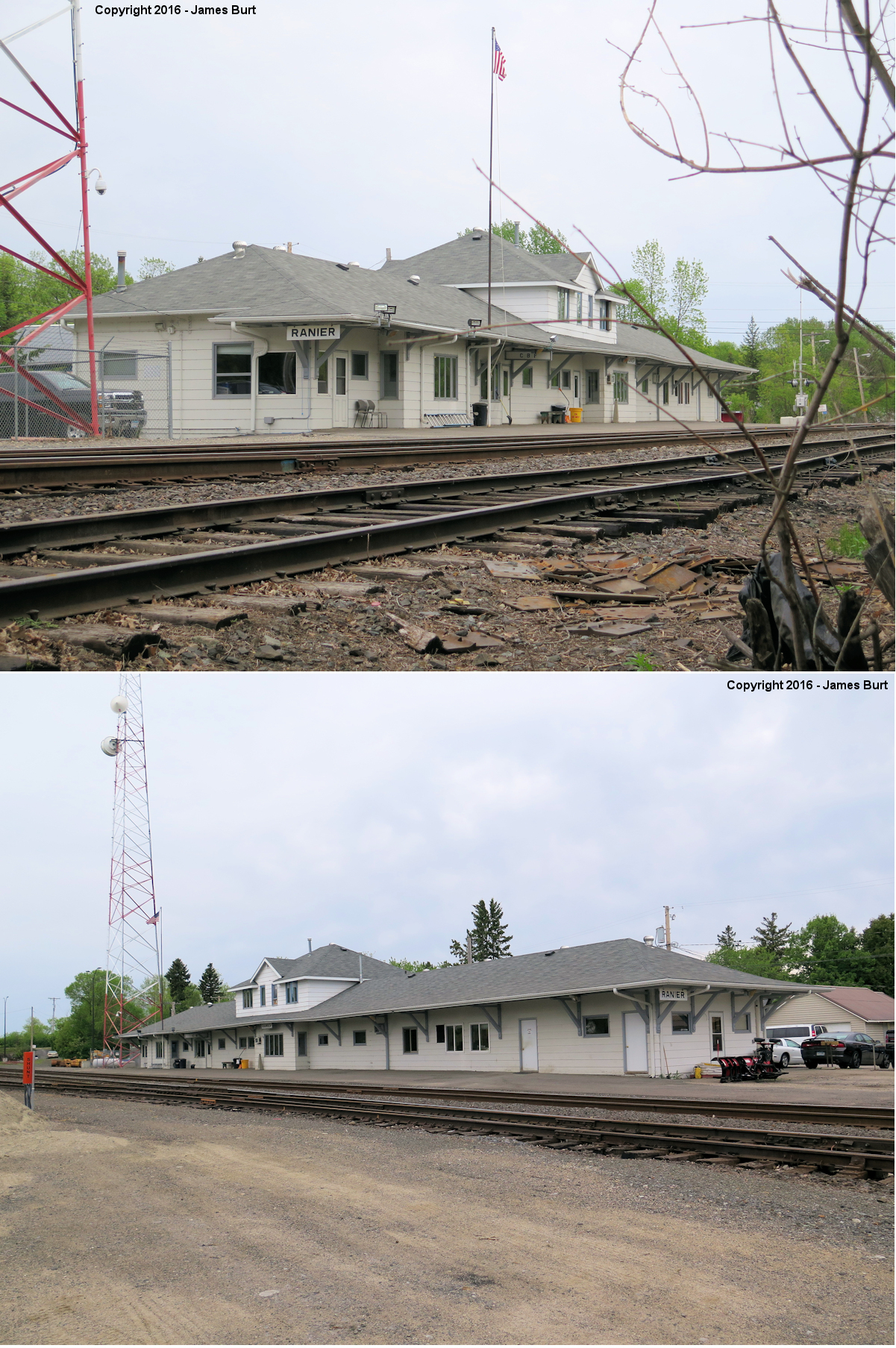
| Ranier |
 |
Main Street at Spruce Street (GPS: 48.614767, -93.349267) |
C | ???? | Railraod | In Use | Wood | |
| STATIONS OF THE PAST | ||||||||
| Station Name |
Original Railroad |
Notes | ||||||
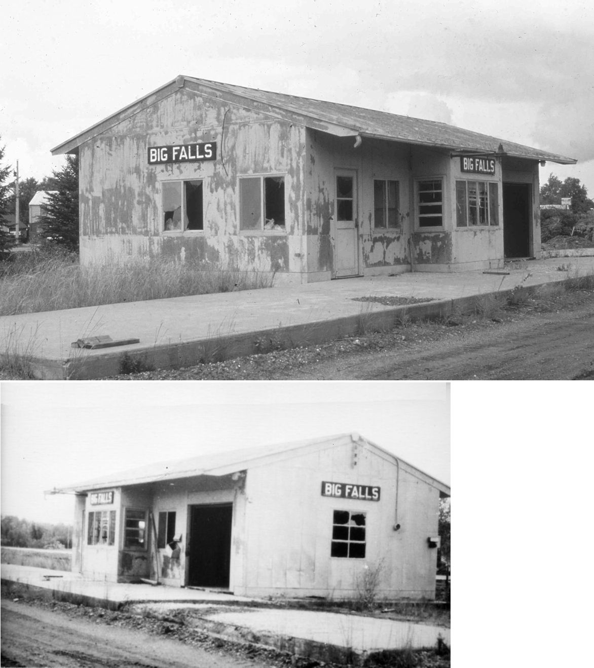
| Big Falls (Ripple) |
 |
This was the original depot in Big Falls, which was originally built by the Minnesota and International, but ownership was changed to the Northern Pacific, when they bought this line outright in 1941. According to the NP Valuation Records from 1917, a combination station was built here in 1905 and measured 21'x75'. This station was either originally called "Ripple," or that was a seperate station. | ||||||
| Big Falls |
|
A later-generation station. | ||||||
| Big Falls |
Toomey Williams RR |
The Toomey-Williams line was a local logging railroad that operated from Big Falls, and went west into the Pine Island Forest. It then crossed the Sturgeon river and also did interchange service with the Minnesota and International Railway. It was thirty-three miles long and started in 1923. It was considered a Red River logging railroad, because it went west toward the Red River Valley towards North Dakota. This line operated two 2-8-0 Consolidation steam locomotives, and a 10-ton capacity Plymouth internal combustion gasoline engine industrial switching locomotive the line got in 1928. Some flat cars were supplied by the Minnesota and International Railway. The logging camp buildings for this line were made to fit onto flat cars, which made the camp mobile, along with the operation. This was unique for a Minnesota logging railroad. There may have been a permanent station in Big Falls, but this line had servicing up and down the line, using facility maintenance cars. This line stopped operations and rail was taken up in 1935. --Note by Howard Glockzin | ||||||
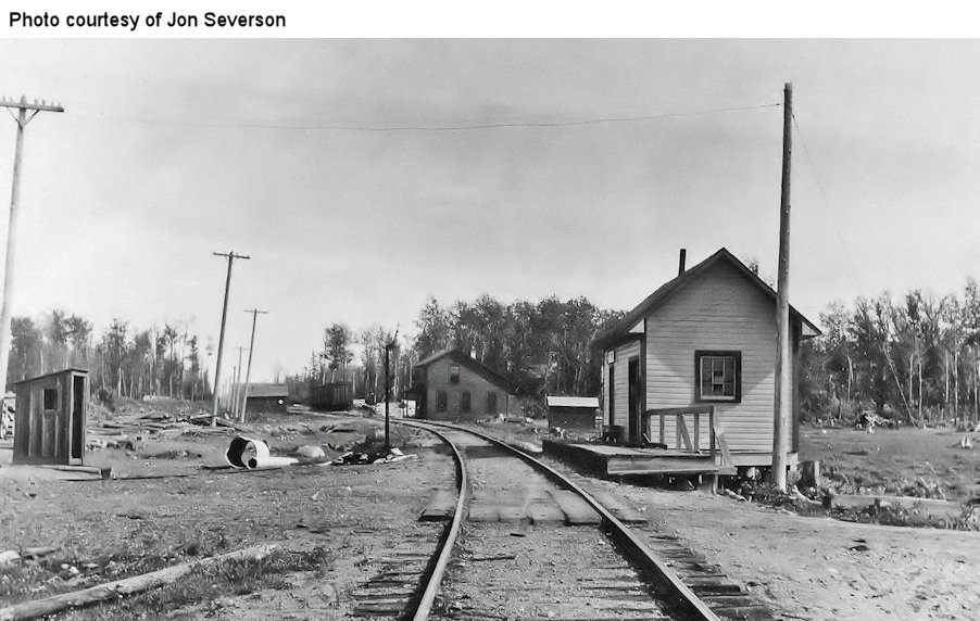
| Craig |
 |
This station was on the north bank of the Big Fork River. It serviced a logging camp known as Camp 29, and Craig was the town that serviced that camp. Craig was also the terminus of the MD&W's Deer River Line, which ran between Littlefork and Craig, about 30 miles. The other part of Craig was south of the Big Fork River and served by the Minneapolis & Rainy River Railway. There was to be a wooden trestle built across the Big Fork River connecting the two rail lines. However, the building materials for the trestle were delivered to the south bank of the Big Fork River and it was never built (the materials subsequently sat there and rotted). So the two parts of Craig remained seperated by rail. | ||||||
| Craig |
 |
The town of Craig was in Koochiching County and the village was on
both sides of the Big Fork River. About a half mile south of the
river is the county line between Koochiching and Itasca. On the
Itasca side of the line was a general store, MacAffee's, and a few
residences. This area was known as Craigville (or Craigsville). The
M&RR did make at stop at MacAffee's in Craigville when they first
extended the line north and had a wye there, but there was no
stand-alone station there. They soon extended all of the way to the
river at Craig in anticipation of connecting with the Backus Line,
and built a depot at Craig. Around the 1930s, Craigville kind of
disappeared as the few folks there moved away. Craig still had some
activity until about the mid 1970s when the last two saloons closed
and the few remaining residents moved away. The few remaining
buildings were mysteriously burned around 1980 and there is no
visible clue today that there was once a thriving town there. Today
the area locals use the terms Craig and Craigville interchangeably
to refer to the townsite on the river in Koochiching County and most
are not aware that Craigville was actually a separate settlement
just a bit south of Craig.
|
||||||
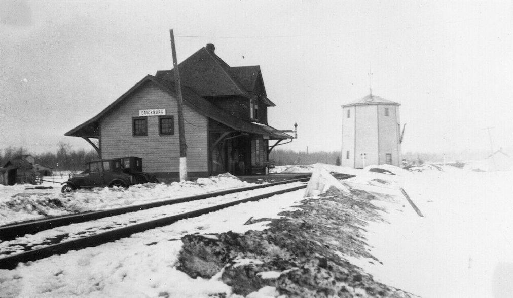
| Ericsburg |
|
An early station. | ||||||
| Ericsburg |
|
A later station. | ||||||
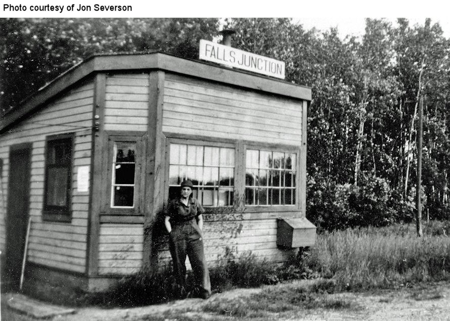
| Falls Junction |
|
|||||||
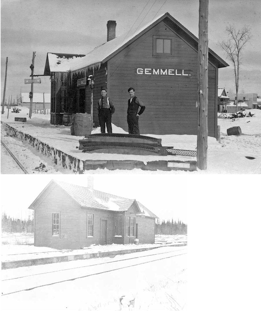
| Gemmell (Stoner) |
|
According to the NP Valuation Records from 1917, a combination station was built here in 1907 and measured 16'x48'. | ||||||
| Happyland |
|
According to the NP Valuation Records from 1917, a 12'x16' passenger shelter was built here in 1907. Happyland was SW of Littlefork in the vicinity of GPS: 48.359947, -93.617758. "Happyland was a temporary railroad work camp constructed by the Minnesota and International Railroad for the workers and their families, while the line was being built. It also made cross ties for the railroad. This place was only around until possibly the 1920s. The actual name "Happyland" came from a discarded sugar barrel top that a worker found and nailed to a tree stump. The Northern Pacific bought the Minnesota and International outright in April, 1941, by which time, the actual camp was completely gone having since served its intended purpose to house railroad construction workers." --Howard D. Glockzin | ||||||
|
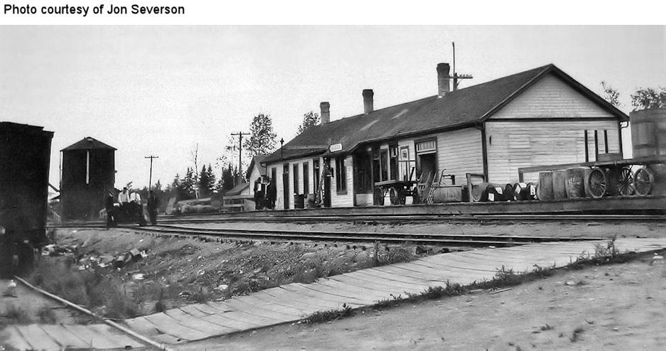
International Falls |
|
According to the NP Valuation Records from 1917, the station was built in 1907 and measured 32'x50'. It was on the NE corner of 2nd Avenue and 4th Street at GPS: 48.601893, -93.401899. | ||||||
| International Falls |
|
According to the NP Valuation Records from 1917, a freight station was built in 1909 and measured 28'x143'. It was on the SE corner of 2nd Avenue and 4th Street at GPS: 48.601469, -93.401889 | ||||||
| International Falls |
|
This was used along with the Minnesota and International station in town, but had it's own roundhouse, and yard facilities as well. This was the main station for all operations pertaining to the Minnesota Dakota and Western Railroad. --Howard Glockzin | ||||||
| International Falls |
V&RL | The Virginia and Rainy Lake was a 150-mile long logging railroad that started in International Falls at around 1900 that served both Koochiching and St. Louis counties until October 1929. They had a large sawmill in Virginia, as well as a loading dock in Duluth for loading wood products onto ships. This line largely followed the Right of Way of the Duluth Winnipeg and Pacific. Along with being a logging railroad, it also hauled general freight to supply its operation, and may have carried passengers on a limited basis for an extra form of revenue. --Howard Glockzin | ||||||
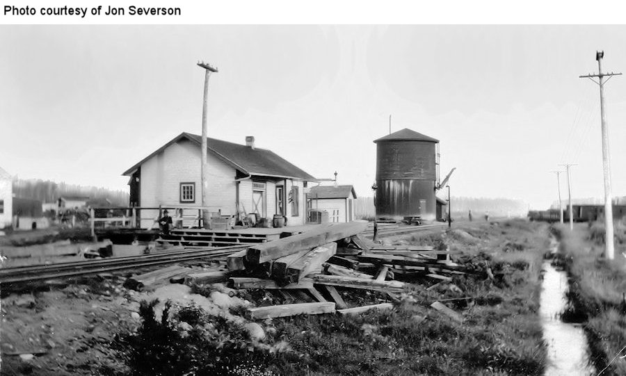
| Little Fork |
|
According to a local source, this station was moved and used as a house for an elderly couple on property owned by a timber company. After the couple passed away, the company demolished the building. | ||||||
| Little Fork |
|
Littlefork was the point which the Minnesota Dakota and Western went off of the Minnesota and International right of way, then commenced onto its Deer River Line to Craig at the north bank of the Bigfork River. It might make sense that MD&W may have operated a station in Littlefork to handle the interchange. --Howard Glockzin | ||||||
| Loman |
|
Loman was the starting point for which the MD&W had grand plans to extend into North Dakota for its vast crops of wheat. There was to be a large flour mill to be built in International Falls, which never came to fruition, so the terminaus westward for the MD&W ended up being at Loman. | ||||||
| Margie |
|
According to the NP Valuation Records from 1917, a combination station was built here in 1907 and measured 16'x48'. This was the same station plan as Gemmell. This station was replaced by the small metal station (still standing) in 1959. | ||||||
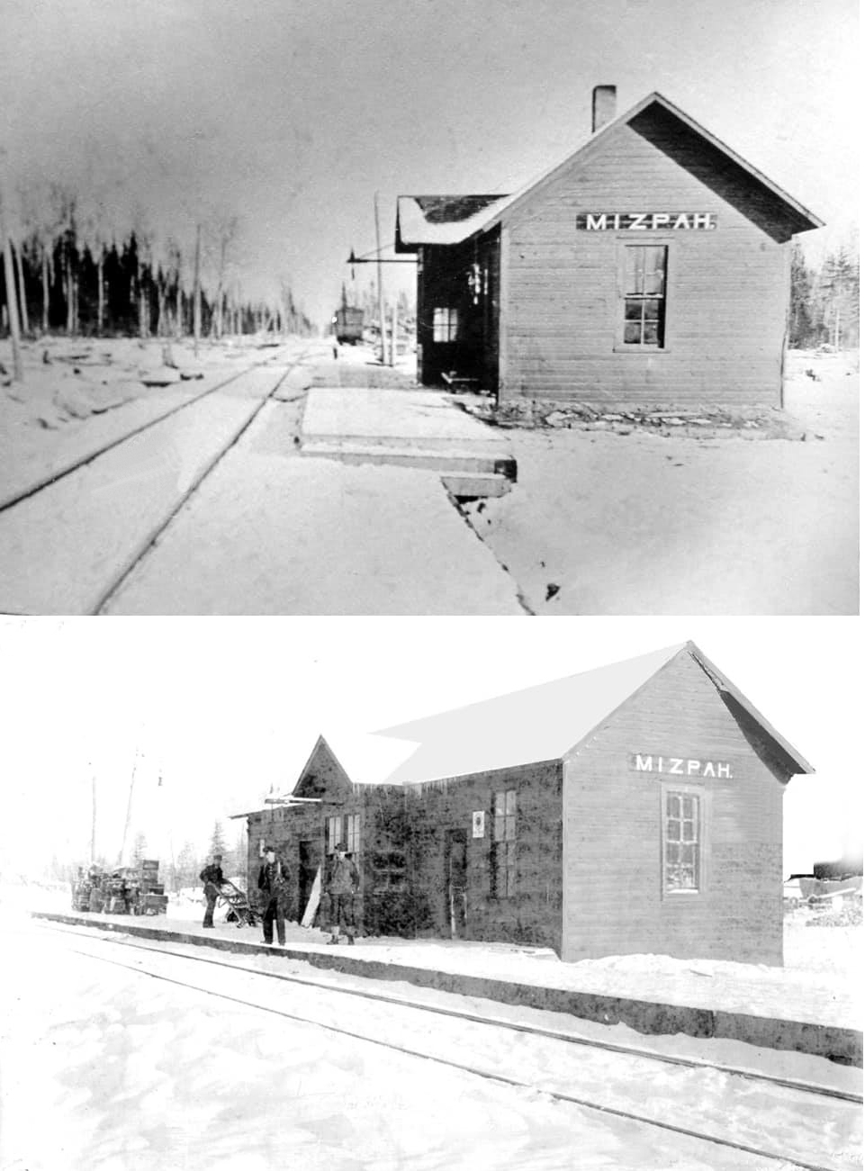
| Mizpah |
|
According to the NP Valuation Records from 1917, a combination station was built here in 1907 and measured 16'x47'. | ||||||
| Nakota |
|
According to the NP Valuation Records from 1917, there was only a gravel platform and station sign here as of that year. | ||||||
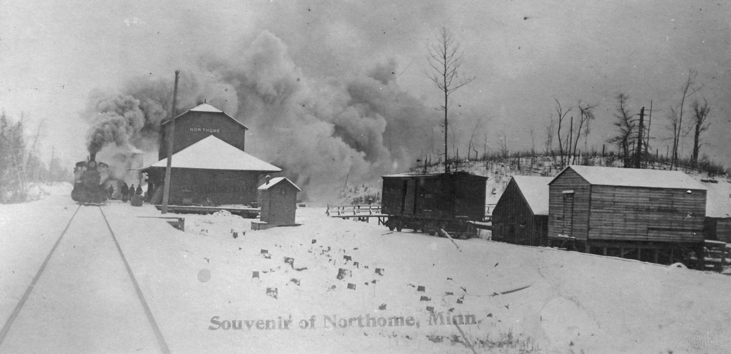
| Northome |
|
This original Northome depot was "located next to the railroad tracks on the west end of Main Street. It was a red, two-story, wooden structure. Ed Dalton was then the depot agent, and he and his wife resided in the upstairs living quarters of the depot" (P. Pat McCarvill, in History of Koochiching County, 1983). | ||||||
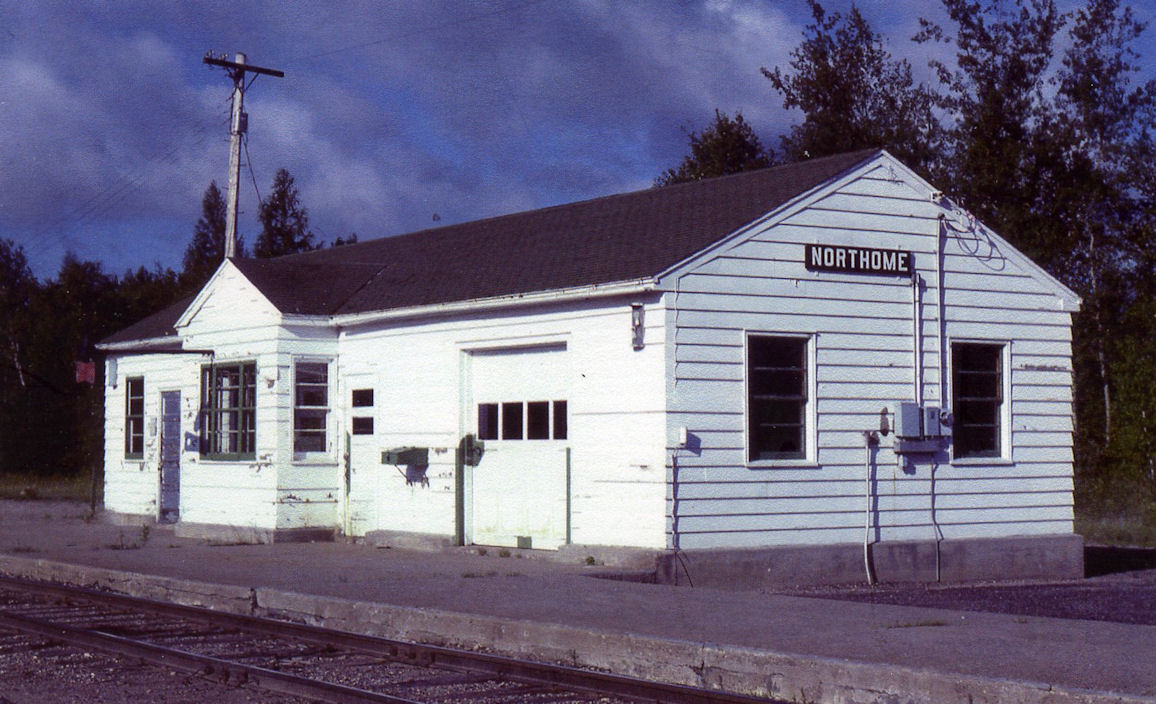
| Northome |
|
This station replaced the one listed above and was about one block north of where the original station stood. Passenger service ended in 1968 and the tracks were removed in 1985. | ||||||
| Ranier |
|
|||||||
| ranier |
|
|||||||
| Ray |
|
|||||||
| Ray |
|
This appears to be a newer station than the one listed above. | ||||||
| Ridge (Gemmell Pit) |
|
The name of this station was changed to Ridge in 1939. | ||||||
| Rockton (Rockton Spur) |
|
This town and station were about the mid-point along the Deer River Line between Littlefork and Craig. When the MD&W stopped its linehaul logging operations in 1947, and the rail was taken up, Rockton Spur was where the flat cars carrying the rail, along with other MD&W equipment, were parked and left. The Iron Horse Central Rail Museum has found MD&W caboose #207 parked in that area, and is currently in the process of restoring it. | ||||||
| Waukauha |
|
According to the NP Valuation Records from 1917, a 10'x14' passenger shelter was built here in 1911. | ||||||
| Wisner |
|
According to the NP Valuation Records from 1917, there was only a gravel platform and station sign here as of that year. | ||||||
| 1898 KOOCHICHING COUNTY RAILROAD MAP | ||||||||
KOOCHICHING COUNTY WAS PART OF ITASCA COUNTY UNTIL 1906.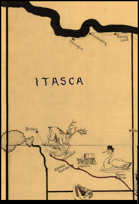 |
||||||||
|
Notes About Existing Stations... International Falls (NP) - Houses the International Falls Chamber of Commerce. Little Fork (M&I) - The station was built in 1907 after the NP passed through town. It was sold in 1972 by BN to Frank Porkony and moved to his farm. According to the NP Valuation Records from 1917, the station was built in 1907 and measured 32'x50'. Margie (NP) - This station replaced the former depot, which closed in April 1959, and was located on the south edge of town just north of Dinner Creek. This depot was along the tracks north/northeast of Margie. |
||||||||