 COUNTYCOUNTY
|
|
||||||||
| EXISTING STATIONS | ||||||||
|---|---|---|---|---|---|---|---|---|
| Station Name |
Original Railroad | Current Location |
Type | Date Built |
Current Use |
Track Status |
Building Material |
More Info |
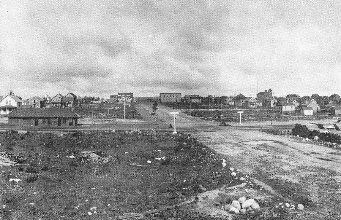
| calumet |
 AND  |
Hill Annex Mine State Park, 890 Gary Street | C | 1909 | Museum | None | Wood | |
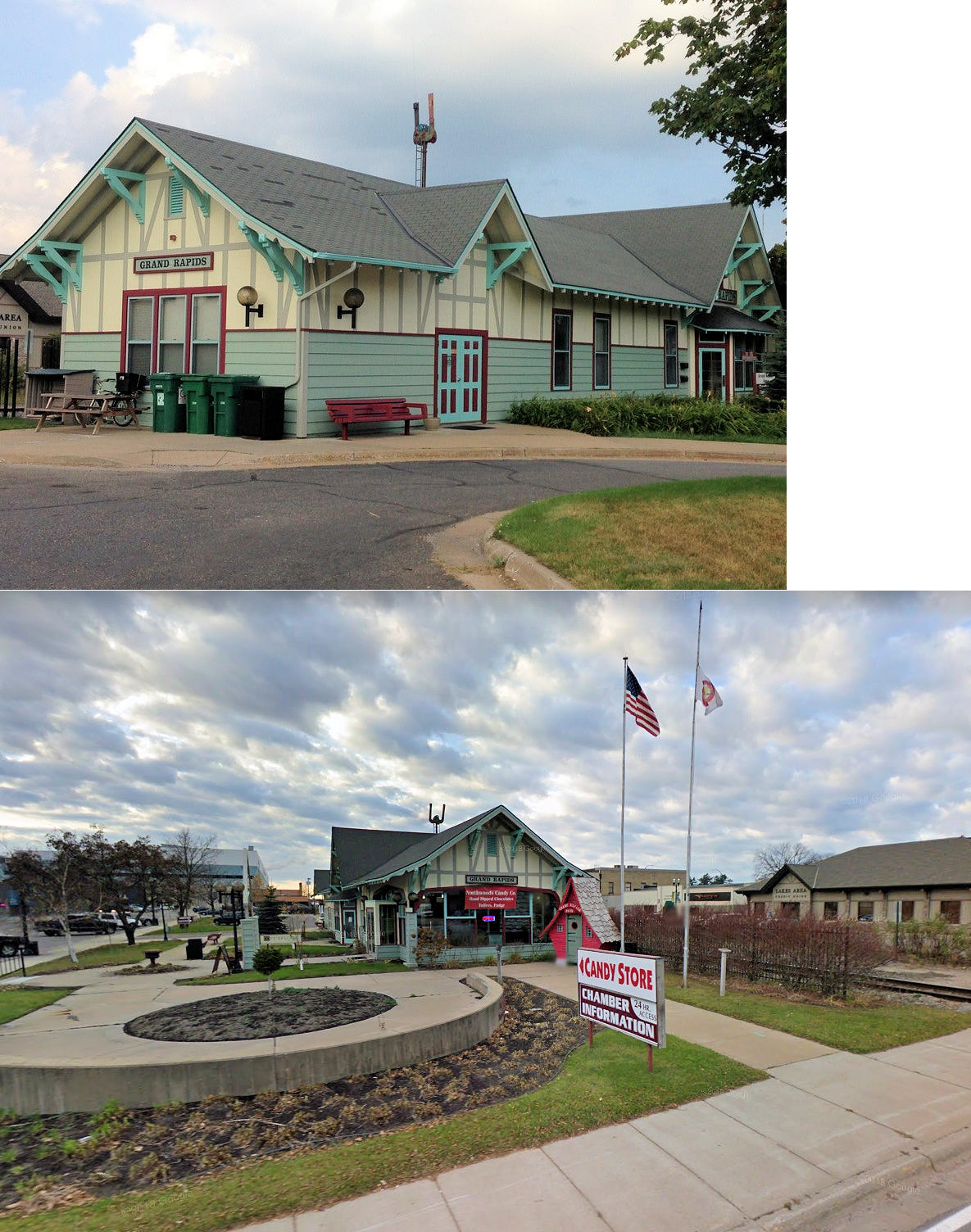
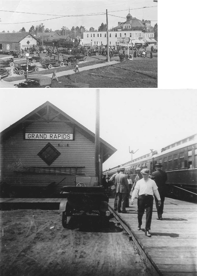
| grand rapids |
|
1 NW 3rd Street (GPS: 47.235203, -93.528910) |
C | 1903 | Civic | In Use | Wood |
|
| STATIONS OF THE PAST | ||||||||
| Station Name |
Original Railroad |
Notes | ||||||
| Acropolis |
|
According to the 1915 GN Valuations Records, there was only a station sign at this location as of that year. This station was between Bengal lake and Goodland. | ||||||
| Alder |
 |
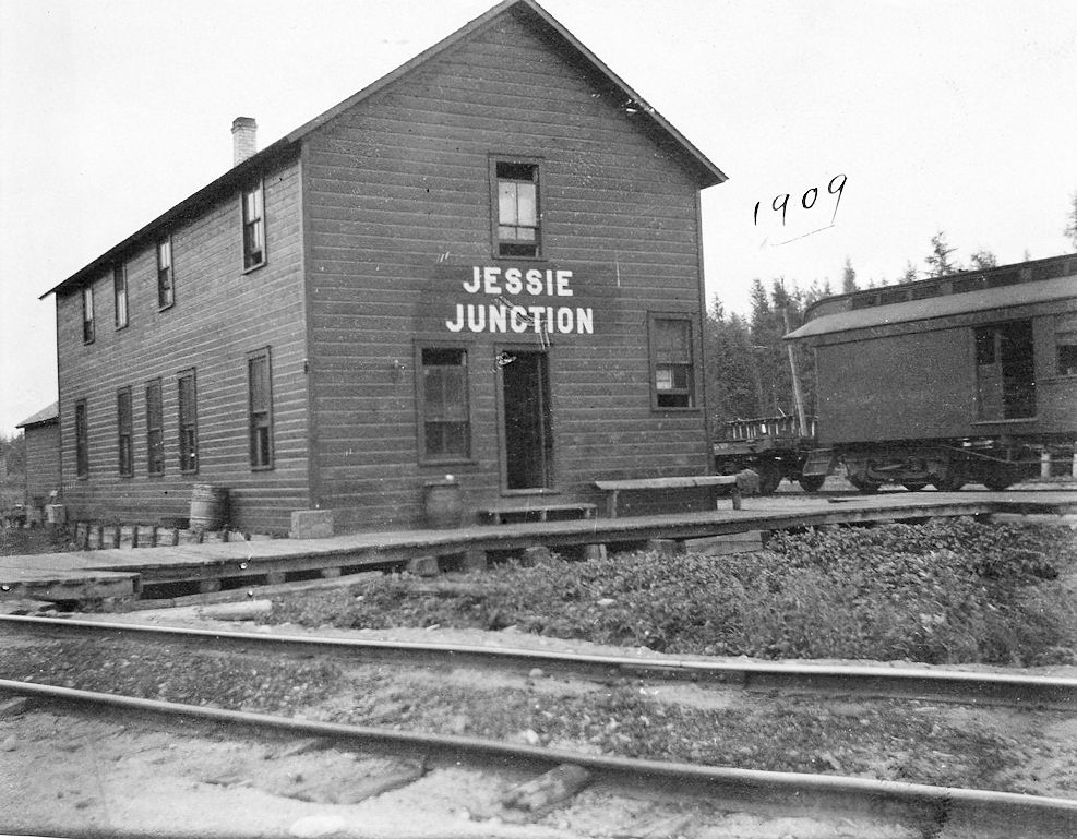
Minneapolis & Rainy River Railway. See "Jessie Junction" listing below. | ||||||
| Ball Club |
|
According to the 1915 GN Valuation Records, an old railroad car that measured 8'x34' served as the depot here as of that year. | ||||||
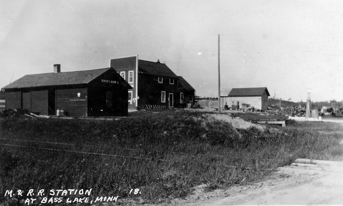
| Bass Lake |
|
|||||||
| BigFork |
|
This was the first station at Bigfork. | ||||||
| BigFork |
|
This was the second station at Bigfork. | ||||||
| Blackberry |
|
According to the 1915 GN Valuations Records, there was only a cinder platform and station sign at this location as of that year. | ||||||
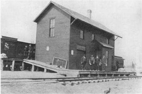
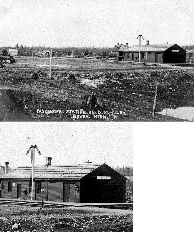
| Bovey |
|
|||||||
| Bovey-Coleraine |
|
The station was torn down in order to salvage the lumber. This station, originally known only as "Bovey" had its name change to "Bovey-Coleraine" by the GN in 1955. According to the 1915 GN Valuations Records, the station here was built in 1909 and measured 30'x76'. The GN records also list a station for Coleraine with the same build date and dimensions, so there may have been twin stations at these locations before consolidation. | ||||||
| Bruce |
|
According to the 1915 GN Valuations Records, there was only a 5'x'28 platform and station sign at this location as of that year. | ||||||
| Clarks |
|
|||||||
| Cohasset |
|
According to the 1915 GN Valuations Records, this station was built in 1902 and remodeled in 1911. It measured 24'x72'. | ||||||
| Coleraine |
|
This was the first depot in Coleraine. | ||||||
| Coleraine |
|
According to the 1915 GN Valuations Records, the station here was built in 1909 and measured 30'x48'. | ||||||
| Collins |
|
|||||||
| Cooley |
|
|||||||
| Cort |
|
|||||||
| Coutny Road |
|
This station was 4.4 miles north of Deer River. | ||||||
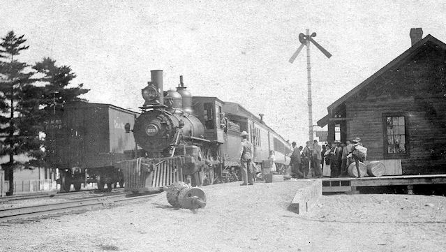
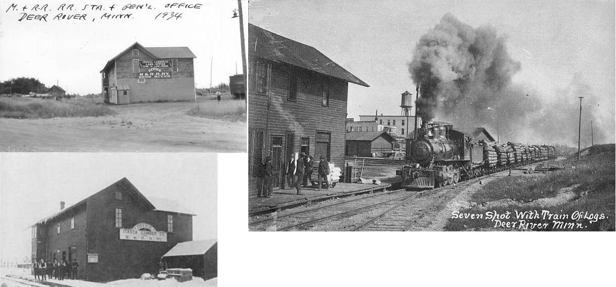
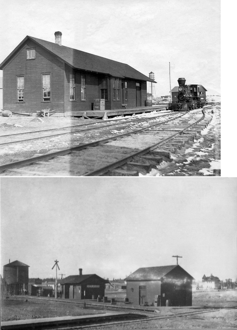
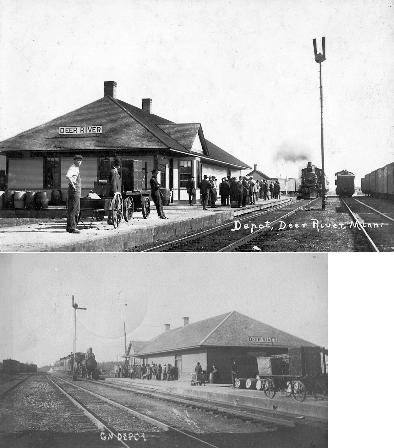
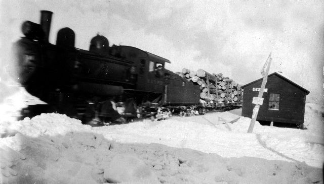
| Deer River |
|
Begun as the Itasca Lumber Company RR, it became the M&RR RY in 1904 and closed in 1932. This station/office building was east of 2nd Street SE at GPS: 47.330913, -93.790685. It was in the SW corner of the GN/M&RR diamond. | ||||||
| Deer River |
|
The original Duluth, Superior & Westen station was at the south end of 1st Street NW (formerly Homer Street). This is shown on the 1897 Sanborn map of Deer River (part of the map of Grand Rapids, MN). | ||||||
| Deer River |
|
The second generation passenger and freight stations we SE of 2nd Street SE at GPS: 47.331560, -93.790945. Although they had been replaced by the new GN station to the NW in 1903, both the passenger and freight stations were still standing as of 1908. They were both gone by 1913 (according to Sanborn maps from those years). | ||||||
| Deer River |
|
According to the 1915 GN Valuations Records, this station was built in 1903 and measured 30'x104'. It was at the corner of Main Avenue and 1st Street SE at GPS: 47.332616, -93.793269. | ||||||
| Dumas |
|
According to the 1915 GN Valuation Records, there was a 12'x74' platform that was built in 1903 and a station sign here for that year. Dumas was the stop between Ball Club and Deer River. | ||||||
| Effie |
|
|||||||
| Fox Lake Junction |
|
|||||||
| Goodland |
|
According to the 1915 GN Valuations Records, a station was built here in 1911 that measured 12'x34'. | ||||||
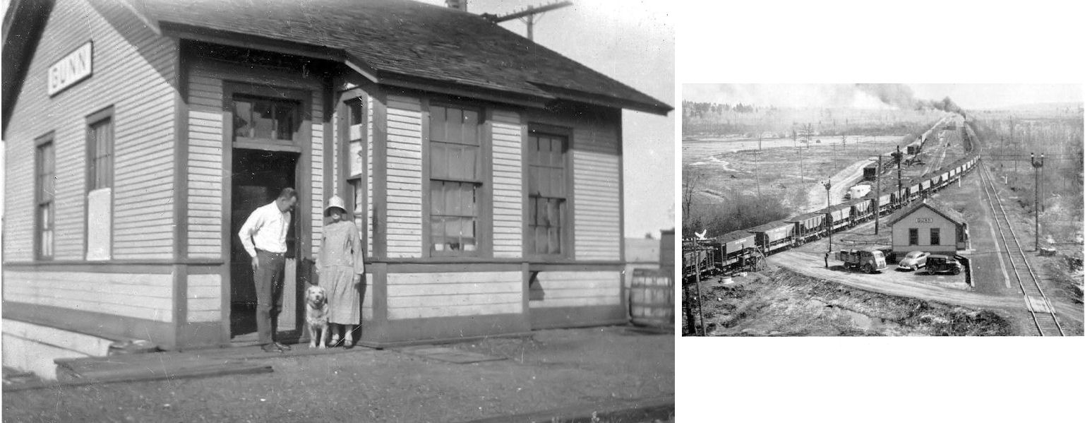
| Gunn |
|
According to the 1915 GN Valuations Records, the station here measured 24'x24'. | ||||||
| Grand Rapids |
|
This first generation Duluth, Superior & Western (later GN) station was approximately at the same location (but with a smaller footprint) as the newer GN station that is still standing. | ||||||
| HArrison Spur |
|
According to the 1915 GN Valuations Records, there was only a station sign at this location as of that year. | ||||||
| Hill Annex |
|
According to the 1915 GN Valuations Records, there was only a station sign at this location as of that year. | ||||||
| Holman Junction |
|
According to the 1915 GN Valuations Records, the station here was built in 1909 and measured 30'x60'. | ||||||
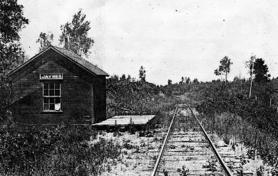
| Jaynes |
|
|||||||
| Jessie Lake |
|
|||||||
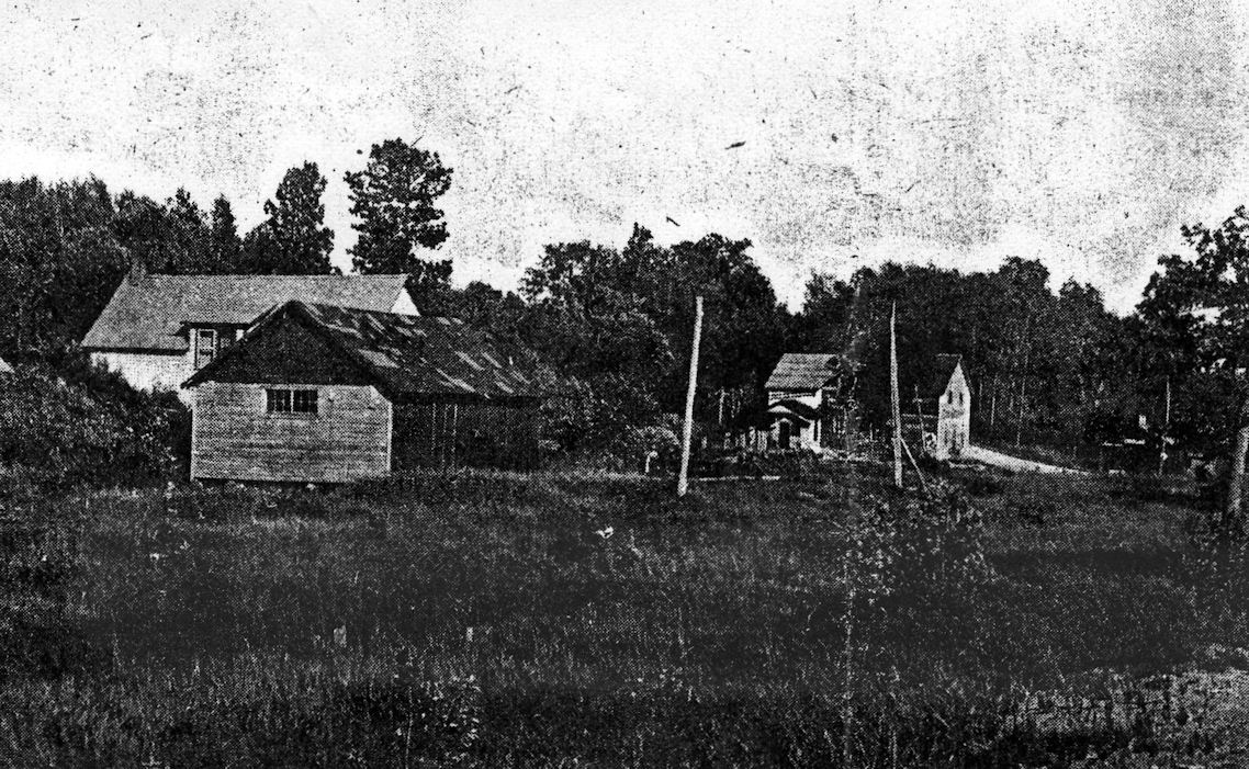
| Jessie
Junction (Alder) |
|
|||||||
| Jurgenson |
|
|||||||
| Keewatin |
|
This station may have been reloacted to a lake for use as a cabin. Does anyone know for sure? According to the 1915 GN Valuations Records, the station was built in 1911 that measured 30'x76'. | ||||||
| Kenny |
|
|||||||
| Kevin |
|
|||||||
| LA Prairie |
|
According to the 1915 GN Valuations Records, the station here was built in 1899 and measured 12'x33'. | ||||||
| Leipold |
|
According to the 1915 GN Valuations Records, there was only a station sign at this location as of that year, so there was likely never an actual station building here. This station was on a branch that was built in 1906 primarily for logging. The tracks were removed in 1935. | ||||||
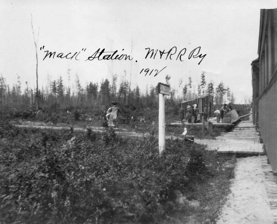
| Mack |
|
|||||||
| Marble |
|
According to the 1915 GN Valuations Records, the station here was built in 1909 and measured 30'x48'. | ||||||
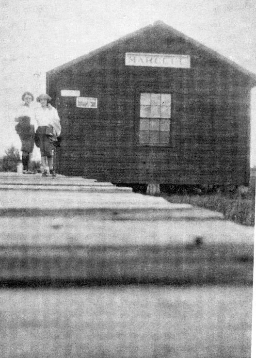
| Marcell |
|
|||||||
| McCartys |
|
According to the 1915 GN Valuations Records, there was only a station sign at this location as of that year. | ||||||
| McVeighs |
|
|||||||
| Mine Spur |
|
According to the 1915 GN Valuations Records, there was only a station sign at this location as of that year. | ||||||
| Moore |
|
According to the 1915 GN Valuations Records, there was only a station sign at this location then. | ||||||
| Nashwauk |
|
According to the 1915 GN Valuations Records, a station was built here in 1903 that measured 30'x46'. | ||||||
| Noyes |
|
|||||||
| Orth |
|
|||||||
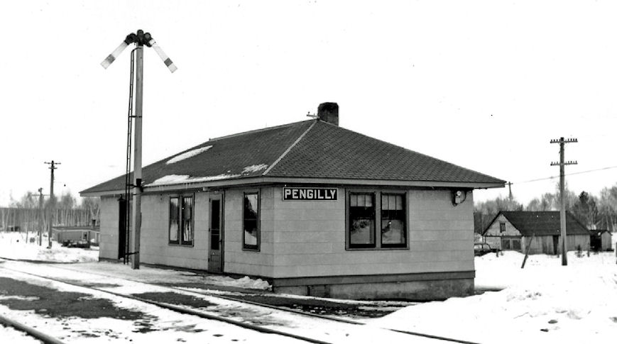
| Pengilly |
|
|||||||
| Pengilly |
|
|||||||
| Philbin |
|
|||||||
| Pines |
|
This station was two miles north of Marcell and did not last long as it was originally a flag stop. | ||||||
| Quinn |
|
According to the 1915 GN Valuations Records, there was only a station sign at this location as of that year. | ||||||
| Round Lake |
 |
|||||||
| Silverwood |
|
|||||||
| Soumi (Albo) |
|
|||||||
| Spring Lake |
|
|||||||
| Summit |
|
|||||||
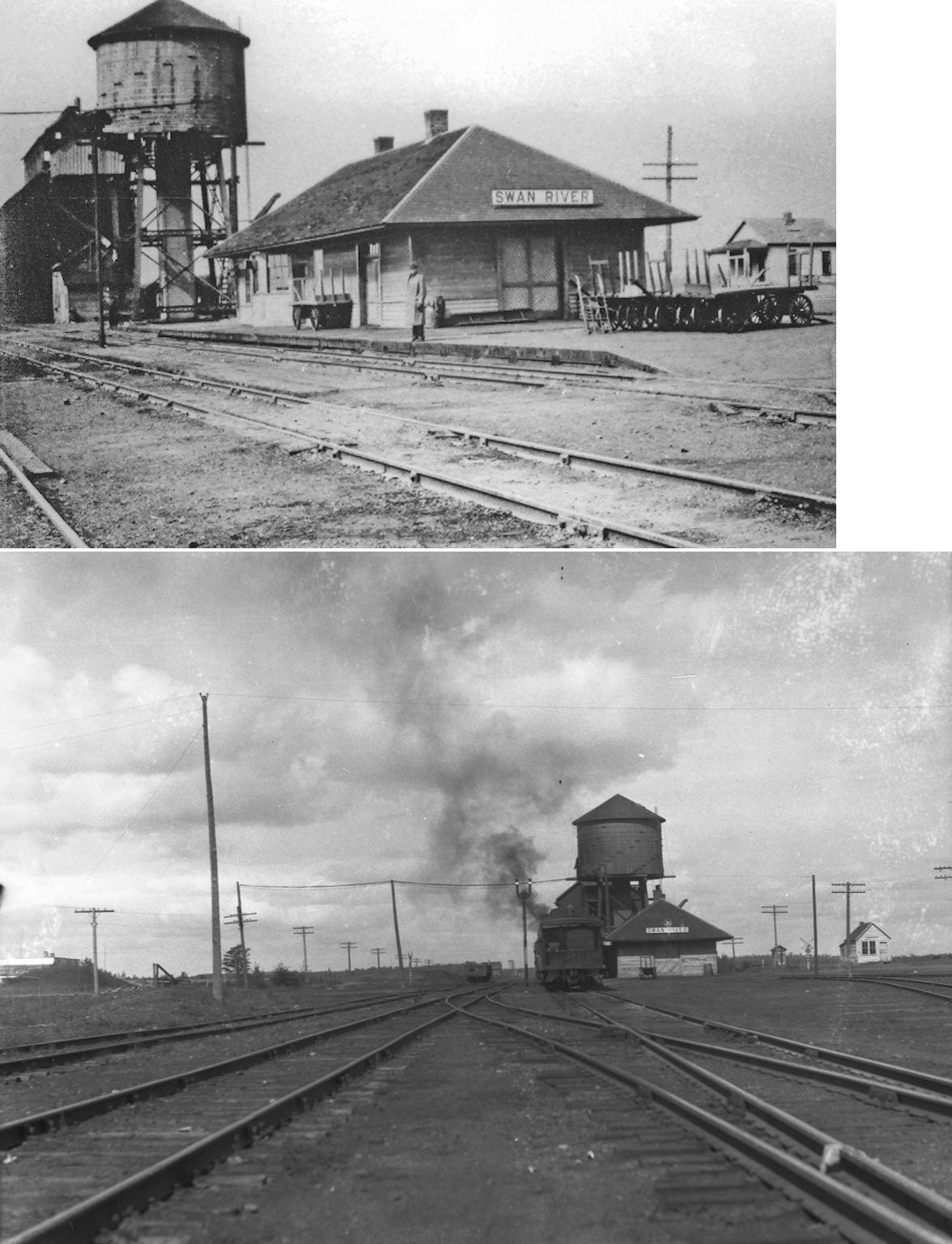
| Swan River |
|
According to the 1915 GN Valuations Records, a new station was built here in 1907 that measured 24'x67'. | ||||||
| Swan River |
DMR&N AND D&W |
This station was shared by the Duluth, Mississippi & Northern RR and the Duluth & Winnipeg RR. | ||||||
| Taconite |
|
|||||||
| Taconite |
|
|||||||
| Turtle Junction |
|
|||||||
| Warba |
|
According to the 1915 GN Valuations Records, a new station was built here in 1913 that measured 30'x48'. | ||||||
| Wawina |
|
According to the 1915 GN Valuations Records, a new station was built here in 1910 that measured 12.5'x12.5'. | ||||||
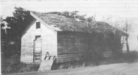
| Wirt (Stanley) |
|
Town originally called Stanley later changed to Wirt. | ||||||
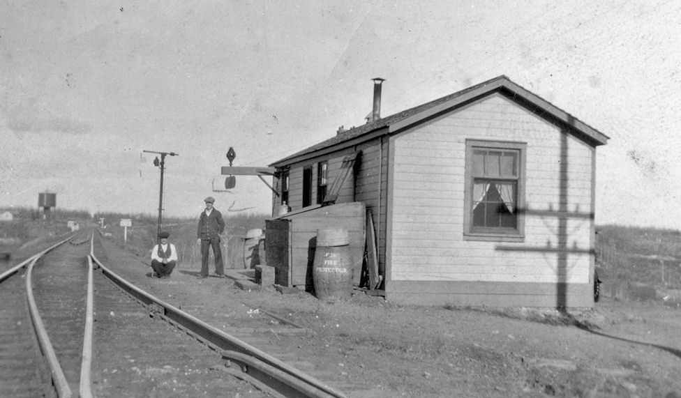
| Weller's Spur |
|
This was five miles SE of Deer River. According to the 1915 GN Valuations Records, there was only a 8'x100' platform and station sign at this location, but it burned sometime prior to 1915. | ||||||
| Zemple |
|
|||||||
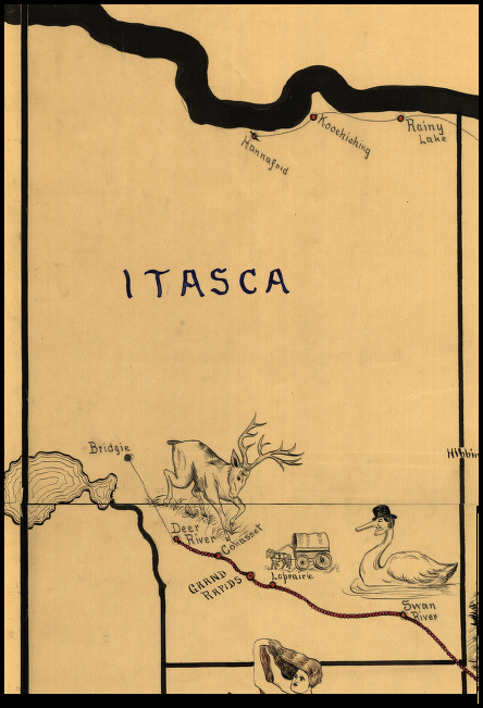
| 1898 ITASCA COUNTY RAILROAD MAP | ||||||||
 |
||||||||
|
Calumet (GN/DM&IR) - The original location of this depot was on 4th Avenue between Gary and Morgan Streets. In a 1941 state guide it was listed as serving both the GN and DM&IR RRs. Did the DM&IR have its own station at sometime prior? Grand Rapids (GN) - According to the 1915 GN Valuations
Records, the new station was built here in 1903 and measured 24'x148'. |
||||||||