 COUNTYCOUNTY
|
|
||||||||
| EXISTING STATIONS | ||||||||
|---|---|---|---|---|---|---|---|---|
| Station Name |
Original Railroad | Current Location |
Type | Date Built |
Current Use |
Track Status |
Building Material |
More Info |
| Brownsville |
 |
306 Clay Street (GPS: 43.6934 -91.2759) |
C | 1908 | Residence | None | Wod |
|
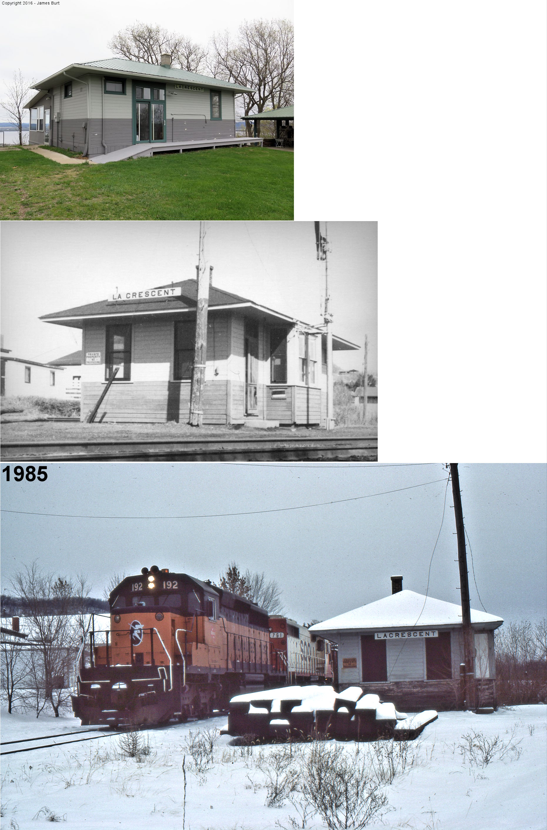
| LA Crescent |
|
North of town on a bluff overlooking the river at 31994 County 1 on
driveway going to radio tower. (GPS: 43.87890, -91.33130) |
C | 1939 | Civic | None | Wood | |
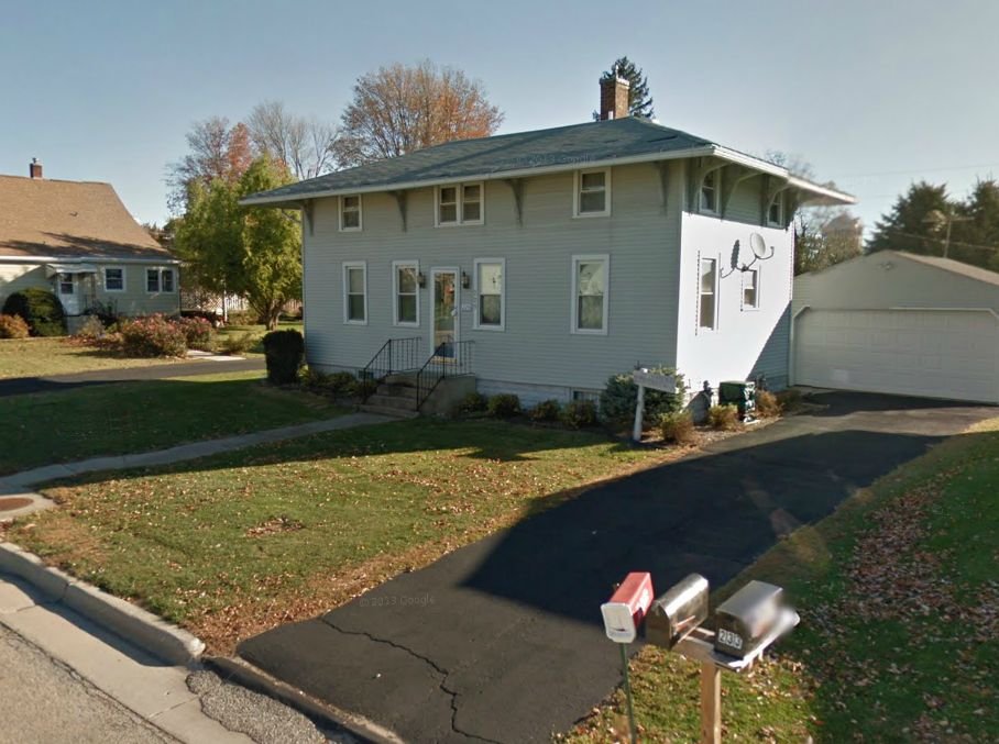
| NewHouse |
| 229 3rd Ave SE, Spring Grove | C | 1879 | Residence | None | Wood |
|
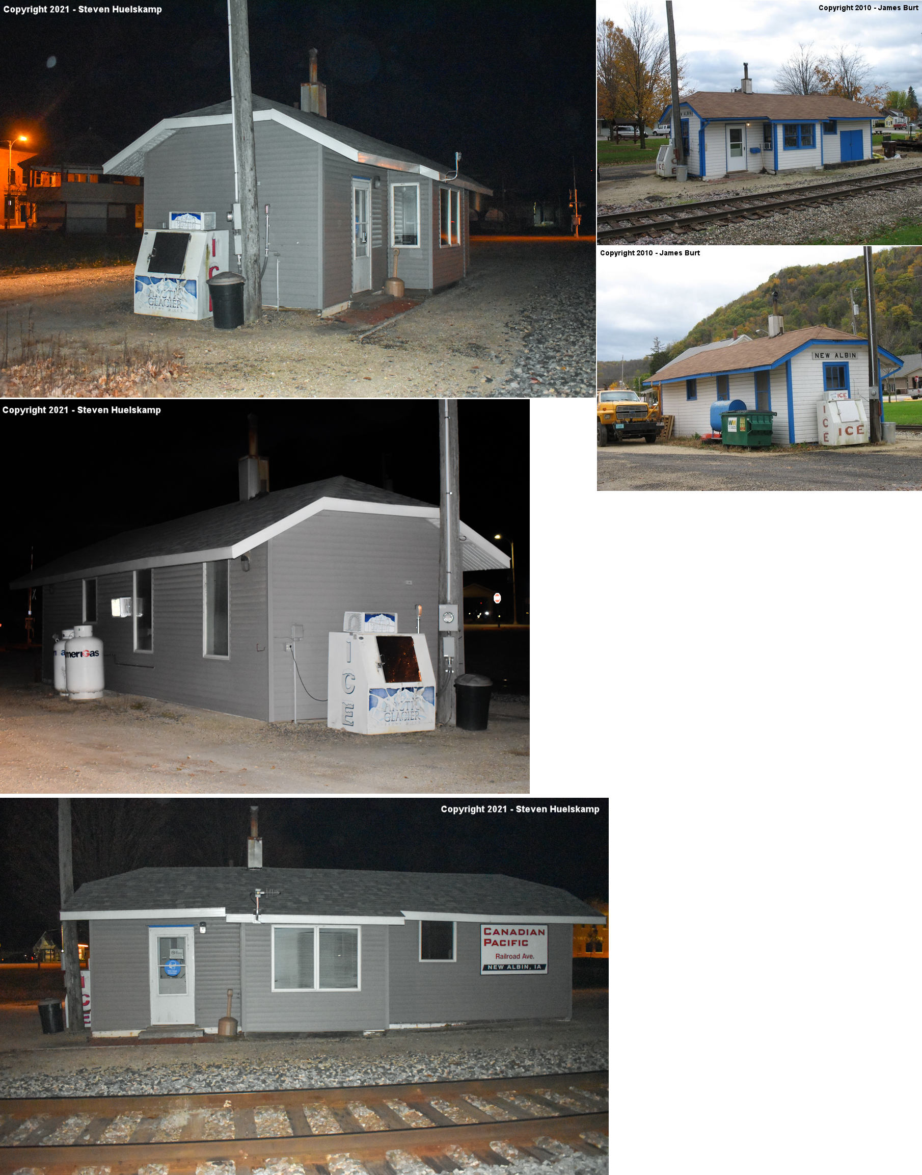
| RENO |
|
SW side of Oak Street between Main Street and IA-26 in New Albin, IA. (GPS: 43.497099,-91.288657) |
C | ???? | Railroad | In Use | Wood |
|
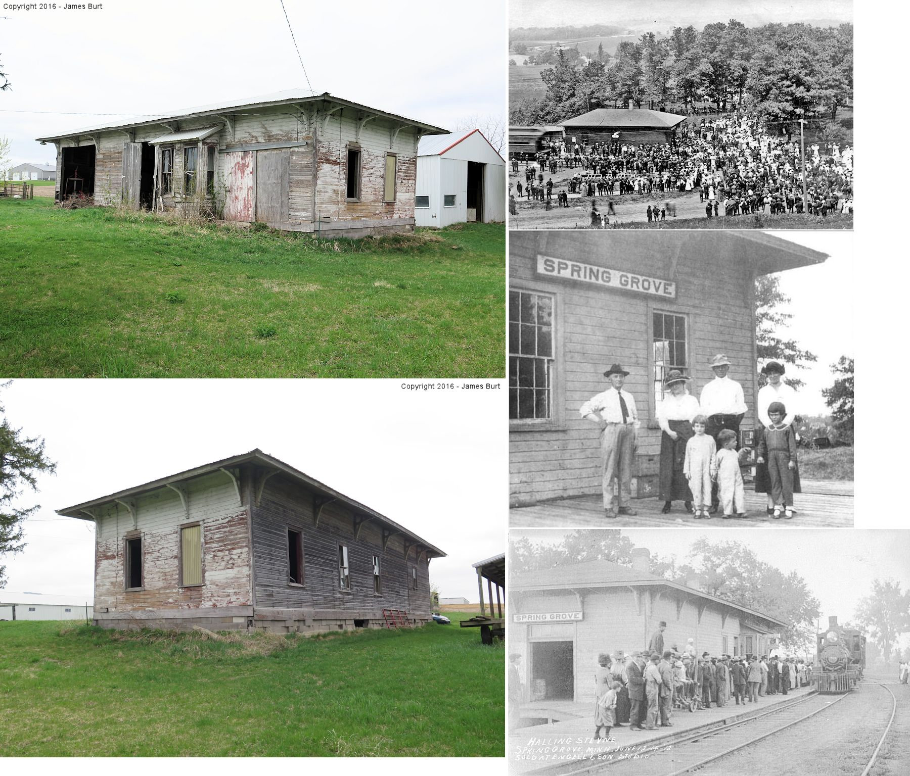
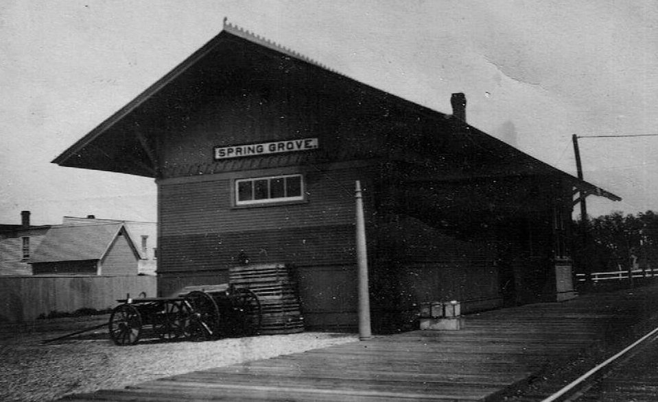
| Spring Grove |
|
On private property on the north side of MN-44 just east of Nine Oaks
Road (T-60). It is about 300 yards north of MN-44 on a private
drive/unmarked road. (GPS: 43.56853, -91.61712) |
C | 1879 | Storage | None | Wood |
|
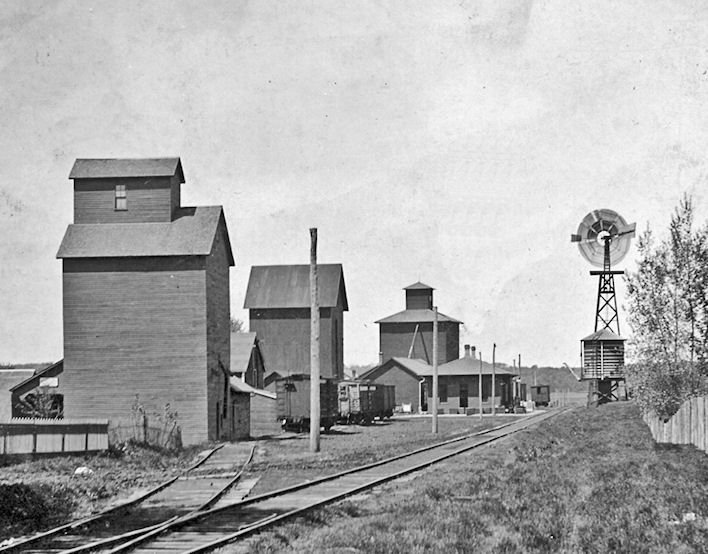
| STATIONS OF THE PAST | ||||||||
| Station Name |
Original Railroad |
Notes | ||||||
| Brownsville |
|
This station was at the river end of Rice Street (no longer exists). | ||||||
| Caledonia |
|
This station was on the west side of North Ramsey Street. There is a storage facility at this site as of 2009. Although some locals tried to save it, the station was torn down by order of the village. | ||||||
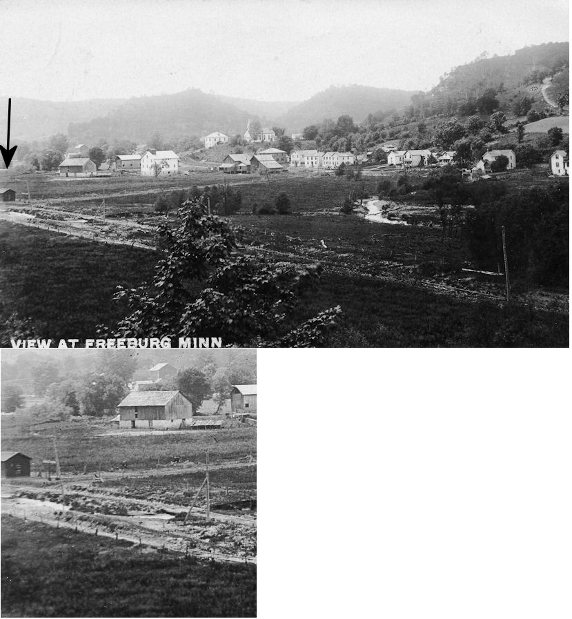
| Freeburg |
|
|||||||
| Hokah |
|
This depot was in the area of where MN 16 crosses the Root River on the NE side of town and intersects with CR 7. The station was on the east bank of Thompson's Creek, on the south side of the tracks. | ||||||
| Houston |
|
The depot was on the south side of the tracks between Grant and Sherman Streets. | ||||||
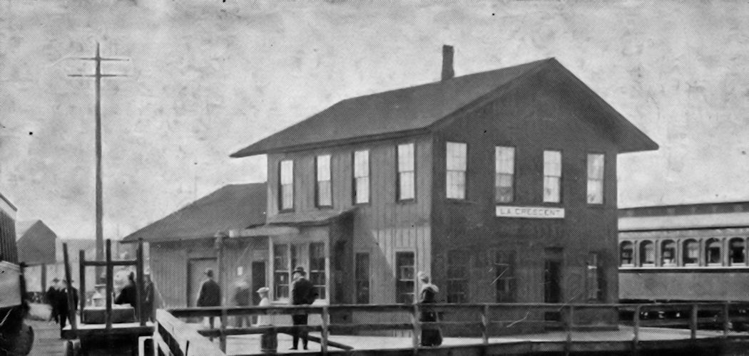
| La Crescent |
|
The depot was located near the corner of Sycamore and North 1st Streets wedged between the north/south line and the wye to Wisconsin. This station was replaced by the smaller station that is still standing. | ||||||
| Spring Grove |
|
Not sure if this was a predacessor station or the same station as above before a remodel. Does anyone know? | ||||||
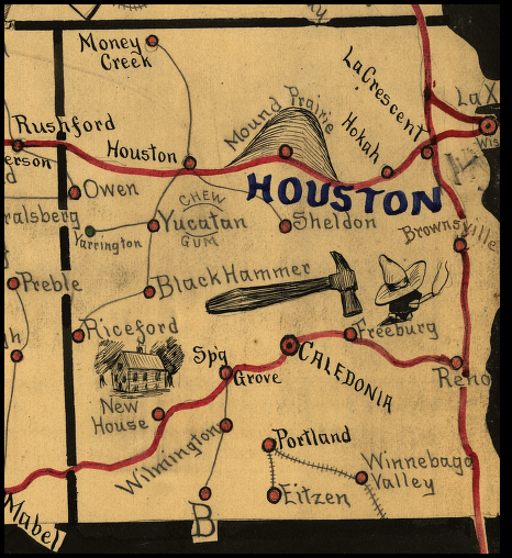
| 1898 HOUSTON COUNTY RAILROAD MAP | ||||||||
 |
||||||||
|
Notes About Existing Stations...
Brownsville (CM&St.P) - This station was originally at the river end of Rice Street (no longer exists). It was sold by the railroad about 1940 and moved to its present location as an offfice for a lumber yard. When the lumber yard closed around 1975 is was converted into a house. Newhouse (CM&St.P) - According to the book "Dreams, Disasters and Demise: The Milwaukee Road in Minnesota" by John C. Luecke (1988) the Newhouse station was moved to Spring Grove. Reno (CM&St.P) - According to a retired section worker from Reno this station was moved from Reno to New Albin for MOW use. Before that it was from some other town on the Milwaukee Road either from IA or MN. Now used by IC&E for MOW use. Spring Grove (CM&St.P) - The station was on the west side of Maple Drive where the tracks used to cross there. |
||||||||